Top 8 Natural Monuments around Wimborne St. Giles
Best natural monuments around Wimborne St. Giles are situated within a landscape characterized by rolling chalk downland, ancient woodlands, and tranquil river valleys, including the River Allen. The area lies on the southern edge of the Cranborne Chase Area of Outstanding Natural Beauty, known for its diverse ecosystems and archaeological remains. This region offers a blend of natural beauty and historical significance, with features ranging from elevated viewpoints to ancient earthworks and riverine environments.
Best natural monuments around Wimborne St.…
Last updated: May 19, 2026
Win Green Summit
Highlight • Historical Site
Tip by

Bokerley Dyke
Highlight • Trail
Tip by

Sign up now to discover places like this
Get recommendations on the best single tracks, peaks, & plenty of other exciting outdoor places.
Sign up for free
Ibsley Common Triangulation Point
Highlight • Viewpoint
Tip by

White Deer in New Forest National Park
Highlight • Natural Monument
Tip by

Knowle Hill
Highlight (Segment) • Natural Monument
Tip by

Sign up for free to discover even more natural monuments around Wimborne St. Giles.
Sign up for free
Already have an account?
Start today with a free account
Your next adventure awaits.
Login or Signup

Tips from the Community

Bokerley Dyke is a substantial linear earthwork, approximately 5.75 kilometers (3.6 miles) long, located on Cranborne Chase. It runs along part of the border between Dorset and Hampshire, specifically between Woodyates and Martin. It is part of a larger Scheduled Monument that also includes Grim's Ditch and other earthworks. The dyke has a multi-period history. It is believed to have originated in the Bronze Age or Early Iron Age as an important political and cultural boundary. In the 1st century, it was cut through by a Roman road, Ackling Dyke, which ran between Old Sarum and Badbury Rings. In the 4th century, the dyke was remodeled and brought back into use. During this period, the Roman road was blocked. A coin of Valens found during excavations dates this activity to shortly after 364 AD, with some sources suggesting it was built between 367-368 AD. This remodeling may have been a defensive measure against attacks on Britain by Picts, Scots, and Saxons. The Roman road was eventually reopened, but the dyke may have continued to be used as a boundary after the Roman administration ended. Today, it still forms part of the border between the counties of Dorset and Hampshire.
0
0

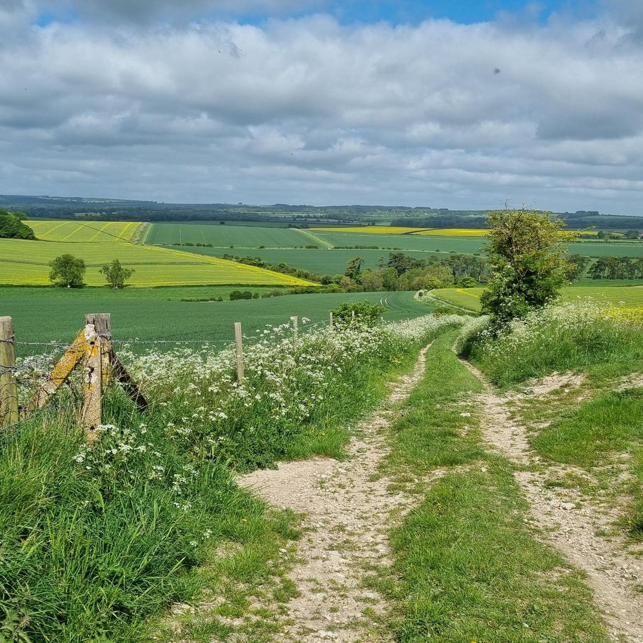
One of the most beautiful places in the south of England 🏴 and amazing views of Wiltshire and Dorset 🤩
0
0

The white-coated Ibsley Common triangulation point is easy to see from a distance, sitting right next to the Whitefield Plantation. It's at 77m, surrounded by beautiful moorland and offering gorgeous far-reaching views of the area.
0
0
Everywhere I looked on this section were wild deer. The only time I've ever seen a white deer. it looked so majestic amongst the other deer.
2
0

Win Green at 277 m is the highest point on Cranbourne Chase. The tree topped summit also has a Bronze Age hill barrow, topography stone and trig point. Lots of great running loops from here as well as easy parking close by.
0
0
Win Green hill at 277m is the highest point on Cranborne Chase. The trig point affords panoramic views apart from the bit blocked by the little clump of trees on the summit. The beech trees are growing on a Bronze Age bowl barrow. It's managed by the National Trust and is often busy because it's close to a car park. Still very nice though!
0
0

Bokerley Dyke may have originated in the Bronze Age or Early Iron Age and formed a political and cultural boundary. It was cut through by a Roman Road (Ackling Dyke running between Old Sarum and Badbury Rings) in the 1st century.
0
0

This is a great 6 mile 2 hour walk running through the glorious Rushmore Estate. Not a road to cross or walk on except those in the estate. Nice for dogs but they need to be kept on a lead for part of the walk due to animals.
2
0
Frequently Asked Questions
What are some of the most popular natural monuments around Wimborne St. Giles?
Visitors frequently enjoy Win Green Summit, which is the highest point in the Cranborne Chase and offers panoramic views. Another popular spot is Ibsley Common Triangulation Point, known for its far-reaching views over moorland. The ancient Bokerley Dyke, a substantial linear earthwork with a rich history, is also highly appreciated by the komoot community.
Are there family-friendly natural monuments to visit near Wimborne St. Giles?
Yes, several natural monuments are suitable for families. Win Green Summit and Ibsley Common Triangulation Point are both tagged as family-friendly, offering open spaces and views. Additionally, the extensive parkland of St Giles House, with its serpentine lake and avenues of trees, provides a beautiful setting for family walks, and the unique grotto can be an intriguing feature for children.
What kind of historical or archaeological natural features can I explore in the area?
The region is rich in historical natural features. You can explore the ancient Bokerley Dyke, a prehistoric boundary ditch with a multi-period history. The summit of Win Green Summit is crowned by a Bronze Age bowl barrow. Further north of St Giles Park, you can find several bowl barrows dating from the Late Neolithic to the Late Bronze Age. Knowlton Church and Earthworks also offer a compelling combination of natural landscape and ancient human endeavor, with the church uniquely set within an ancient henge.
What outdoor activities can I do near the natural monuments around Wimborne St. Giles?
The area offers various outdoor activities. You can find numerous routes for road cycling, mountain biking, and touring cycling. For example, there are moderate road cycling loops like the 'View of Godshill – Telegraph Hill loop from Verwood' and MTB trails such as the 'Sixpenny Handley & Pentridge Hill loop from Cranborne'. You can explore more options on the dedicated komoot guides for Road Cycling Routes, MTB Trails, and Cycling around Wimborne St. Giles.
Are there any natural monuments that offer expansive views?
Yes, the region is known for its viewpoints. Win Green Summit provides breathtaking panoramic views over Blackmore Vale and Salisbury Plain, extending to the Isle of Wight on clear days. Ibsley Common Triangulation Point also offers gorgeous far-reaching views of the surrounding moorland. Additionally, Knowle Hill offers views across Cranborne Chase after a pleasant climb.
What is the best time of year to visit the natural monuments in Wimborne St. Giles?
The Cranborne Chase Area of Outstanding Natural Beauty, where many of these monuments are located, is beautiful year-round. Spring and summer offer lush greenery and warmer weather ideal for walking and cycling. Autumn brings vibrant foliage, particularly around areas with beech trees like Win Green Summit and St Giles House Park. Even winter can be rewarding for crisp, clear views, though some paths might be muddy.
Can I see wildlife at the natural monuments?
Yes, the diverse habitats around Wimborne St. Giles support various wildlife. The Cranborne Chase AONB is known for its ecosystems. While not directly in Wimborne St. Giles, the nearby New Forest National Park, which is accessible via routes like the Castleman Trailway, is famous for its wild deer, including the rare White Deer. The tranquil River Allen also supports local aquatic life and birds.
Are there any natural monuments that are particularly good for dog walking?
Many of the open natural areas are suitable for dog walking. The expansive views and trails around Win Green Summit are popular with dog owners, though dogs may need to be on a lead in certain sections due to livestock. The numerous footpaths and bridleways throughout the Cranborne Chase AONB also provide excellent opportunities for walks with dogs, as does the Castleman Trailway.
What is the River Allen like, and can I visit it?
The River Allen is a tranquil tributary that flows directly through Wimborne St. Giles. It passes through water meadows and forms a serene pool near Bull Bridge, shaded by trees. It's a central natural element of the village, creating a peaceful atmosphere. You can appreciate its beauty from various bridging points, such as those near French's Farm and Bull Bridge. The river also supports recreational activities like fly fishing.
Where can I find information about the wider natural landscape around Wimborne St. Giles?
Wimborne St. Giles is situated on the southern edge of the Cranborne Chase Area of Outstanding Natural Beauty (AONB). This AONB is characterized by rolling chalk downland, ancient woodlands, and tranquil river valleys. It's renowned for its high density and diversity of archaeological remains, offering a vast natural playground for hiking and exploring. You can find more context about the village and its surroundings on Wikipedia.
Are there any long-distance trails or routes that pass through the natural monuments?
While not a single long-distance trail encompassing all monuments, the Bokerley Dyke itself is a substantial linear earthwork, approximately 5.75 kilometers long, which can be incorporated into longer walks. The Castleman Trailway, though primarily a trail, traverses beautiful East Dorset countryside, including moorland, rivers, and woodland, providing an accessible way to experience a range of natural habitats over its 16.5-mile length.
What are the general difficulty levels for exploring these natural monuments?
The difficulty varies. Many viewpoints like Ibsley Common Triangulation Point are easily accessible and family-friendly. Climbing to Win Green Summit or Knowle Hill involves intermediate climbs, offering rewarding views. The Bokerley Dyke is considered an intermediate to challenging trail due to its length and historical significance. The Cranborne Chase AONB offers a network of footpaths with varied terrain, catering to different fitness levels.
Most popular routes around Wimborne St. Giles
Most popular attractions around Wimborne St. Giles

Get inspired with the komoot mobile app


Explore more
Extend your search for the best caves by checking out these guides of the top ones around Wimborne St. Giles:
