The best road cycling routes around Lake della Rossa
5.0
(6)
224
riders
5
rides
Road cycling around Lake della Rossa, nestled in Italy's Graian Alps, offers challenging routes through high mountains and deep valleys. The region, including the Lanzo Valleys and the municipality of Usseglio, is characterized by significant elevation changes and alpine landscapes. Routes often navigate mountain roads and paths, with some primarily paved surfaces, providing substantial climbs and descents.
Best road cycling routes around Lake della Rossa
- The most popular road cycling route is Lake Malciaussia – Rifugio Vulpot loop from Usseglio…
Last updated: July 10, 2026
5.0
(1)
7
riders
15.6km
01:04
520m
520m
Moderate road ride. Good fitness required. Mostly well-paved surfaces and easy to ride.
5
riders
23.6km
01:21
510m
510m
Moderate road ride. Good fitness required. Some segments of this route may be unpaved and difficult to ride.

Sign up for free
5.0
(4)
190
riders
60.2km
03:30
1,380m
1,380m
Hard road ride. Very good fitness required. Mostly well-paved surfaces and easy to ride.
5.0
(1)
16
riders
34.0km
01:53
710m
710m
Moderate road ride. Good fitness required. Mostly well-paved surfaces and easy to ride.
6
riders
59.7km
03:52
1,750m
1,750m
Hard road ride. Very good fitness required. Mostly well-paved surfaces and easy to ride.
Our route recommendations are based on thousands of hikes, rides, and runs completed by other people on komoot.
Start today with a free account
Your next adventure awaits.
Login or Signup

Tips from the Community

Ancient Roman Lanzo Bridge
0
0

A beautiful testament to ancient construction skills now sadly forgotten, this bridge is a miniature version of its larger sibling, proudly displayed in Lanzo. It shares some construction details, such as the cobblestones—slippery when wet—and the distinctive arched doorway placed mid-span, which, according to some, was intended to "load" the arched structure for greater stability. It marks the beginning of the steep section of the path to the Church of the Consolata.
0
0

road starting point towards the lake behind the tower
0
0


recommended as training for climbs.
0
0

Enchanting panorama on the way back from the efforts of Colle della Dieta
0
0

The first 500 meters of the road from Villaretto which climbs at 13/15% with two hairpin bends in the woods, once passed you arrive at the barrier that closes the road beyond the two houses in the Castello area
1
0

This is the main entrance
0
0
Frequently Asked Questions
How many road cycling routes are available around Lake della Rossa?
There are 5 road cycling routes listed in this guide, with 3 rated as moderate and 2 as difficult. These routes offer a range of distances and elevation gains suitable for experienced cyclists.
What is the typical terrain and difficulty for road cycling around Lake della Rossa?
The region is characterized by challenging alpine terrain with significant elevation changes. Routes often involve mountain roads, some of which are paved, offering substantial climbs and descents through high mountains and deep valleys. Expect demanding ascents and rewarding views.
When is the best time of year for road cycling around Lake della Rossa?
Given its high-altitude alpine environment, the best time for road cycling is generally during the warmer months, typically from late spring to early autumn. Even in summer, small ice accumulations can be seen at higher elevations, so checking weather conditions and seasonal road accessibility is crucial.
What natural features and landmarks can I expect to see while road cycling in this area?
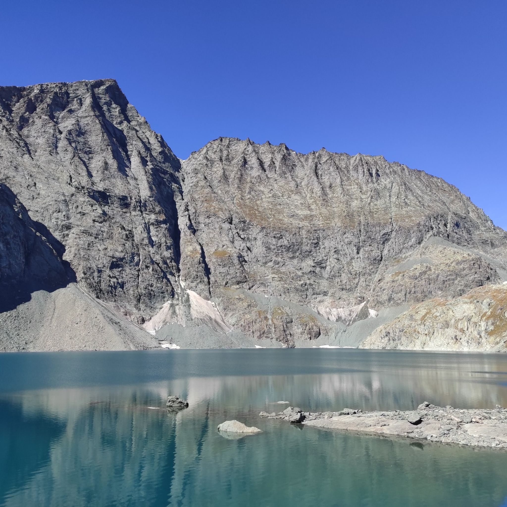
Cyclists can enjoy breathtaking alpine scenery, including wide vistas, glacial lakes, and extensive beech woods. The imposing Croce Rossa peak reflects upon the waters of Lake della Rossa, and routes often pass by natural features like the Stura stream and the artificial Malciaussià lake. Near Lake della Rossa itself, you can find the Bivacco San Camillo and a small chapel.
Are there any circular road cycling routes in the Lake della Rossa area?
Yes, several routes are designed as loops. For example, the Lake Malciaussia – Rifugio Vulpot loop from Usseglio and the Pietra Bridge of Lemie – Forno Bridge (Lemie) loop from Usseglio are excellent options for a circular ride.
What do other road cyclists enjoy most about cycling in the Lake della Rossa region?
The area is highly rated by the komoot community, with an average score of 5.0 stars. Reviewers often praise the stunning alpine scenery, the challenging climbs, and the sense of accomplishment from navigating the mountainous terrain. The quiet roads and natural beauty are frequently highlighted.
Are there any road cycling routes suitable for families or beginners?
The road cycling routes in this guide are generally rated as moderate to difficult due to significant elevation changes and mountainous terrain. While Usseglio can serve as a base for various routes, direct family-friendly or beginner-specific road cycling routes are not prominently featured in this challenging alpine environment.
Where can I find parking for road cycling routes in the Lake della Rossa area?
Usseglio, situated at 1200 meters above sea level, serves as a common starting point for many routes in the Lanzo Valleys. Parking facilities are typically available in and around towns like Usseglio, which can serve as a convenient base for your cycling adventures.
What kind of gear should I bring for road cycling in this region?
Given the challenging alpine terrain and significant elevation changes, it's essential to bring a well-maintained road bike with appropriate gearing for climbing. Essential gear includes a helmet, suitable cycling apparel for varying weather conditions (layers are recommended), plenty of water and nutrition, a repair kit, and navigation tools. Always check the weather forecast before heading out.
Are there cafes or accommodation options near the road cycling routes?
Usseglio, a key starting point for many routes, offers various services including cafes and accommodation. While direct access to Lake della Rossa is remote, towns in the broader Lanzo Valleys provide options for refreshments and overnight stays, allowing you to refuel and rest after your rides.
What is the longest road cycling route available in this guide?
The longest route featured is the Stura di Lanzo – Ala di Stura loop from Balme, covering a distance of approximately 71 kilometers with over 1400 meters of elevation gain, making it a challenging and rewarding ride.
Can I reach the starting points of these routes by public transport?
While direct public transport to every trailhead might be limited in this alpine region, towns like Usseglio, which serve as starting points for several routes, may have public transport connections. It is advisable to check local bus schedules or regional transport options in advance, especially for reaching more remote starting locations.
Most popular routes around Lake della Rossa

Get inspired with the komoot mobile app


Explore more
Browse the best Road cycling routes in other regions.
