The 17 Most Amazing Peaks around Majaelrayo
Best mountain peaks around Majaelrayo are found in the Sierra de Ayllón, within Guadalajara, Spain. This region provides access to several notable mountain peaks, making it a destination for hikers. The area is characterized by its natural landscapes and the "black architecture" of its villages. It offers diverse terrain, from shrublands and oak forests to mountainous ridges.
Best mountain peaks around Majaelrayo
- The most popular mountain peaks is Pico del Lobo, a summit that is the highest peak in…
Last updated: May 23, 2026
Pico Ocejón
Highlight • Summit
Translated by Google •
Tip by

Pico del Lobo
Highlight • Summit
Translated by Google •
Tip by

Sign up now to discover places like this
Get recommendations on the best single tracks, peaks, & plenty of other exciting outdoor places.
Sign up for free
Ocejoncillo Summit
Highlight • Summit
It does not have a geodesic, but it has a very worthy marker of slates.
It …
Translated by Google •
Tip by

Cabeza de Ranas (1,492 m)
Highlight • Summit
Translated by Google •
Tip by
Dragon's Crest
Highlight (Segment) • Climb
It is necessary to continually climb up and down rocks.
It …
Translated by Google •
Tip by
Sign up for free to discover even more peaks around Majaelrayo.
Sign up for free
Already have an account?
Start today with a free account
Your next adventure awaits.
Login or Signup

Other adventures around Majaelrayo

Tips from the Community

The most popular route to ascend Pico Ocejón begins in Valverde de los Arroyos and is known for its scenic beauty and moderate difficulty. The hike is approximately 14.74 km and typically takes around 6 hours with stops. Along the way, hikers can enjoy spectacular views and the rich biodiversity of the area.
6
0

The highest peak in the province of Guadalajara is a special place to admire the landscape in all directions. In winter, with the snow, it is even more beautiful, but at the same time more demanding due to the cold.
1
1

The climb is hard, but it is worth it. Although we were not lucky enough to see all the scenery that should be seen from that height. The descent is almost harder than the ascent.
1
0
Pico del Lobo is the highest mountain in the Sierra de Ayllón and in the province of Guadalajara, with an altitude of 2,274 metres. It is a popular destination for hiking and offers spectacular views of both Segovia and Guadalajara.
7
0
At 2049 metres above sea level, it is one of the highest and most popular peaks for hiking in the region. There are several routes to climb Pico Ocejón, the most common being those starting from Majaelrayo and Valverde de los Arroyos. Both routes offer stunning landscapes and the opportunity to enjoy nature at its best.
6
0
Once the effort of the climb has passed, and the required photos have been taken, it is advisable to sit in the sun on the blackboards and enjoy the restorative food. But... if it's cold, quickly begin the descent to more protected heights.
2
1
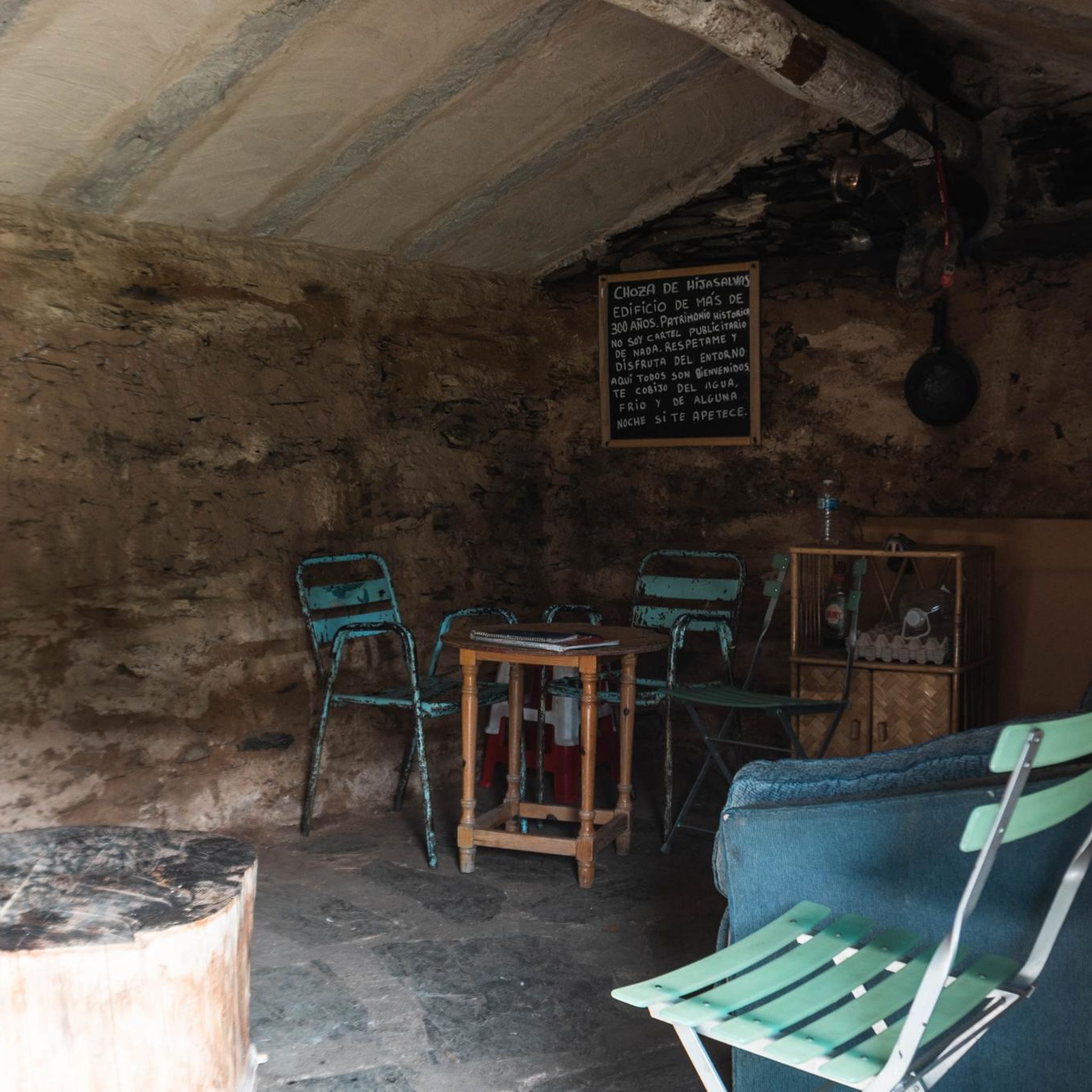
He is named in diminutive because he is very close to his brother Ocejón. It does not have a geodesic, but it has a very worthy marker of slates. It also has a very old slate cabin where the ancients sheltered from the cold and winds. From Ocejoncillo you can see extraordinarily beautiful landscapes.
1
0
It is a stretch of Summits and Hills formed by vertical Slates, which simulate THE CREST OF A DRAGON. It is necessary to continually climb up and down rocks. It is only feasible for experienced mountaineers. When the slates are wet or snowy, they are very dangerous because they are very slippery. You have to go only when they are dry. On clear days, without fog, the landscape is spectacular.
1
0
Frequently Asked Questions
What are the most notable mountain peaks to explore near Majaelrayo?
The Sierra de Ayllón, accessible from Majaelrayo, offers several remarkable peaks. Among the most prominent are Pico del Lobo, which is the highest peak in the Sierra de Ayllón and Guadalajara province, and Pico Ocejón, a very popular destination known for its diverse terrain and panoramic views. Another significant peak is Ocejoncillo Summit, located near Pico Ocejón, offering expansive views.
What kind of views can I expect from the mountain peaks in Majaelrayo?
From the summits around Majaelrayo, you can expect spectacular panoramic views. For instance, Pico Ocejón offers breathtaking vistas of the Sierra de Ayllón, the Sorbe River valley, and distant ranges like the Sierra de Guadarrama. From Pico del Lobo, you can see both Segovia and Guadalajara. Ocejoncillo Summit also provides extraordinarily beautiful landscapes.
Are there challenging hikes to mountain peaks around Majaelrayo?
Yes, several challenging options are available. The ascent to Pico Ocejón is considered a challenging hike, especially the route from Majaelrayo. Pico del Lobo is also a challenging climb due to its altitude. For experienced mountaineers, the Dragon's Crest offers a very challenging stretch of vertical slates, requiring continual climbing up and down rocks.
When is the best time of year to hike the mountain peaks around Majaelrayo?
The spring and autumn seasons are particularly recommended for hiking the mountain peaks around Majaelrayo. During these times, the weather is generally pleasant, and the diverse ecosystems, from shrublands to oak forests, offer rich flora and fauna, enhancing the scenic appeal. Winter hiking is possible but requires appropriate gear due to potential snow and slippery conditions, especially on slate formations like the Dragon's Crest.
How long do hikes to the main peaks around Majaelrayo typically take?
Hiking times vary depending on the peak and route. For example, the popular route to Pico Ocejón from Majaelrayo (CM-1) is about 13 km long with a 940-meter elevation gain, typically taking around 5 hours of effective hiking time. A route from Valverde de los Arroyos to Pico Ocejón is approximately 14.74 km and can take around 6 hours with stops.
What outdoor activities can I do near these mountain peaks?
Beyond peak bagging, the region around Majaelrayo offers a variety of outdoor activities. You can find numerous hiking trails, including challenging routes like the 'Arroyo de la Prahihuela – Ocejoncillo Summit loop' or the 'Majaelrayo – Peña de San Bernardo loop'. For more hiking options, explore the Hiking around Majaelrayo guide. Cycling is also popular, with routes like the 'Puerto de la Hiruela – Puerto del Cardoso loop'. Discover more cycling adventures in the Cycling around Majaelrayo guide. Additionally, there are running trails available, such as the 'GR 60 Pueblos de la Arquitectura Negra'. You can find more running routes in the Running Trails around Majaelrayo guide.
Are there any intermediate hiking options for mountain peaks near Majaelrayo?
Yes, there are intermediate options for hikers. While Pico Ocejón can be challenging, some routes are considered moderate difficulty, such as the one starting from Valverde de los Arroyos. Ocejoncillo Summit is also categorized as an intermediate summit. Additionally, Cabeza de Ranas (1,492 m) is another intermediate summit in the area.
What unique natural features can I observe while hiking the peaks?
The region is rich in natural beauty. You'll encounter diverse terrain, from undulating paths through dense rockrose shrubs to dense oak forests. Higher up, the landscape transitions to more mountainous terrain, featuring peculiar rock formations like Peña Bernardo, which offers excellent viewpoints. The area is also known for its 'black slate,' which forms part of the natural landscape and characterizes the local villages. The presence of wild blueberries and varied plant life adds to the scenic appeal, especially in spring and autumn.
Can I bring my dog on the mountain trails around Majaelrayo?
While specific regulations for each trail may vary, many outdoor areas in Spain are generally dog-friendly, especially if dogs are kept on a leash and owners practice responsible pet etiquette, such as cleaning up after their pets. It's always advisable to check local signage or specific park rules for the particular trail you plan to hike to ensure it's suitable for dogs.
What cultural heritage is connected to the mountain peaks in this region?
The mountain peaks around Majaelrayo are deeply intertwined with the cultural landscape of the 'Pueblos Negros' (Black Villages). The unique 'black architecture' of these villages, characterized by the use of local black slate, is a prominent feature. Hiking through the area offers a complete experience of nature and local heritage, as the same black slate forms part of the natural landscape and is used in structures like the old slate cabin found on Ocejoncillo Summit.
Are there any family-friendly mountain peaks or trails suitable for children near Majaelrayo?
While many of the prominent peaks like Pico Ocejón and Pico del Lobo involve challenging ascents, there are generally easier sections or shorter trails in the foothills that can be suitable for families with children. Look for routes described as 'moderate' or 'easy' in the nearby hiking guides. For example, some sections of the 'Los Lomanillos' area near Majaelrayo offer scenic routes that might be more accessible for families, though specific 'family_friendly' categories are not explicitly listed for the peaks themselves.
What are the parking options for accessing mountain trails near Majaelrayo?
For popular peaks like Pico Ocejón, common starting points like Majaelrayo and Valverde de los Arroyos typically have designated parking areas for hikers. It is advisable to arrive early, especially during peak seasons, as parking can fill up quickly. Always ensure you park in marked areas and respect local regulations to avoid fines or obstructing access.
Most popular attractions around Majaelrayo

Get inspired with the komoot mobile app


Explore more
See even more amazing summits around Majaelrayo with these guides:
