Top 6 Gorges in the Aquarius Plateau
Best canyons in the Aquarius Plateau are characterized by diverse geological formations and varied terrain. The region features impressive canyon systems, including those carved by tributaries of the Escalante River. These areas offer a range of exploration opportunities, from remote wilderness to accessible viewpoints. The landscape is defined by Navajo sandstone and limestone walls, creating distinct natural features.
Best canyons in the Aquarius Plateau
- The most popular canyons is Capitol Reef National Park, a natural monument known for its…
Last updated: May 15, 2026
Capitol Reef National Park
Highlight • Natural Monument
Tip by

Death Hollow Creek
Highlight • Canyon
Tip by

Sign up now to discover places like this
Get recommendations on the best single tracks, peaks, & plenty of other exciting outdoor places.
Sign up for free
Hell's Backbone and Bridge
Highlight • Bridge
Tip by

Long Canyon Overlook
Highlight • Viewpoint
Tip by

Escalante Overlook
Highlight • Viewpoint
Tip by

Burro Wash Trail
Highlight • Canyon
Tip by

Start today with a free account
Your next adventure awaits.
Login or Signup
Tips from the Community

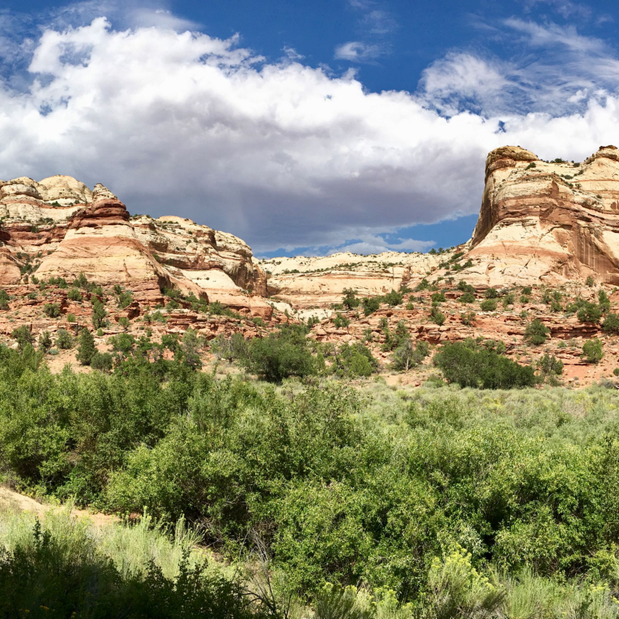
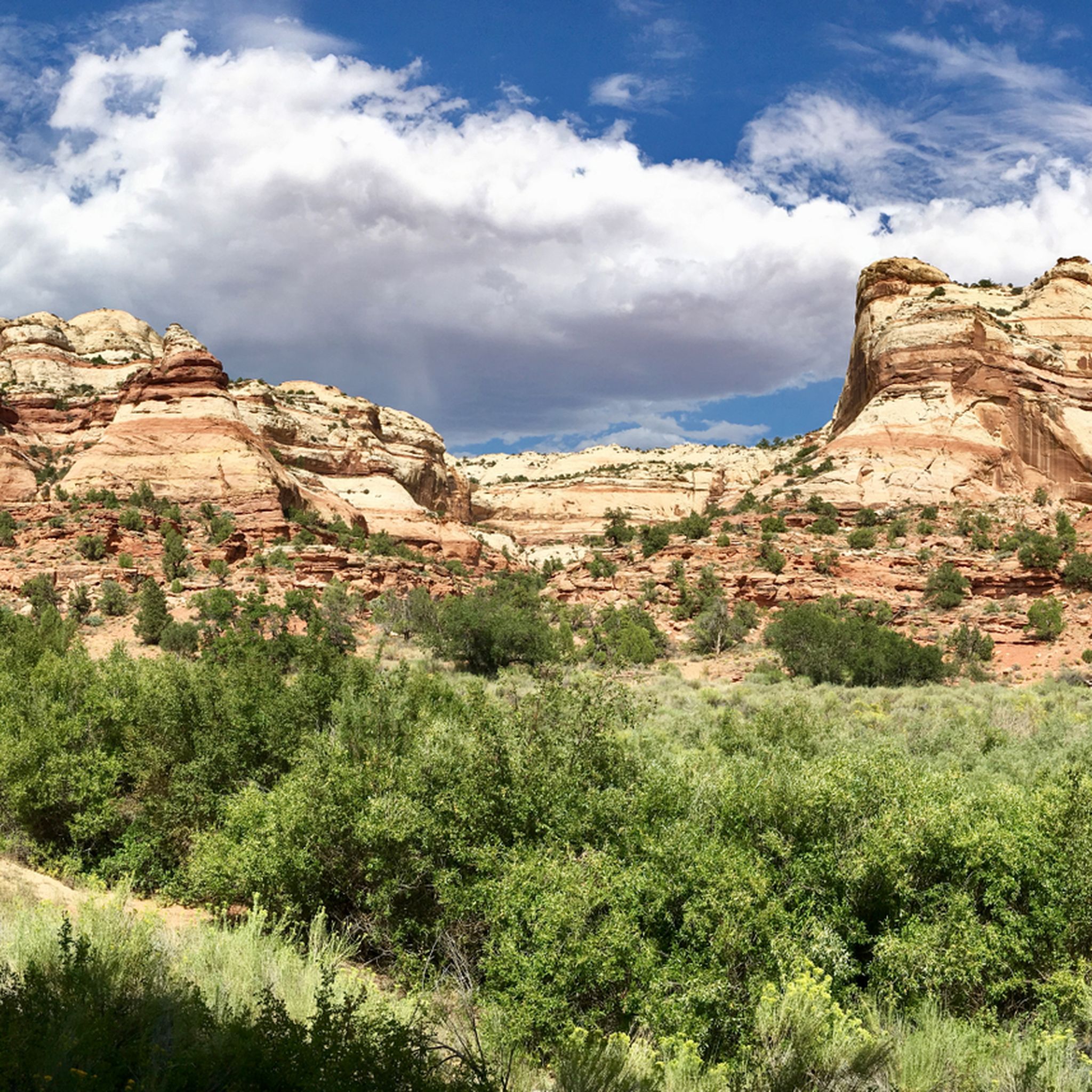
Often overlooked for other famous national park in Utah, Capitol Reef is hidden gem that is worthy of a visit. You'll find a landscape of dramatic folds, towering cliffs, twisting canyons, and quiet desert solitude. The park protects over 240,000 acres filled with slickrock domes, natural arches, and layered sandstone badlands. Explore the historic Fruita orchards, hike through colorful canyon trails like Hickman Bridge or Capitol Gorge, or head farther into Cathedral Valley or Halls Creek Narrows for remote wilderness. With clear night skies, a diverse array of plant and animal life, and sweeping vistas at every turn, Capitol Reef is a gem for both adventurers and those seeking more peaceful escape than is available at the more well known parks.
0
0

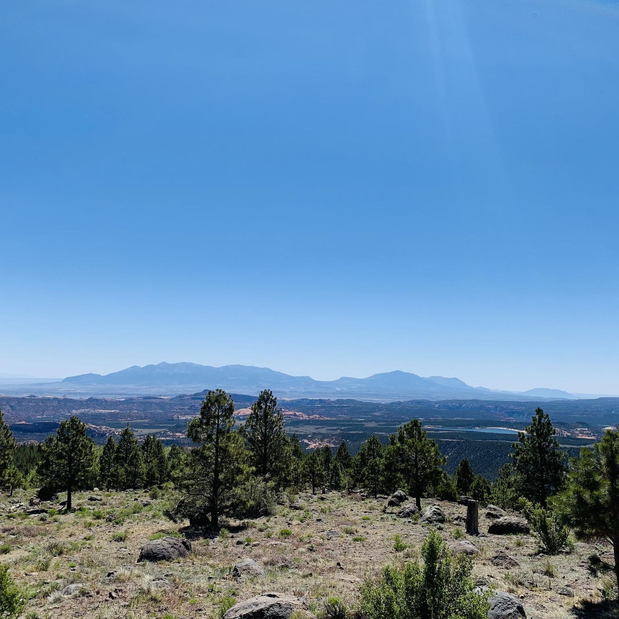
The Long Canyon Overlook is a fantastic spot with incredible sweeping views of the Circle Cliffs and the Henry Mountains in the distance. The overlook is typically quiet, with minimal traffic—making it a perfect spot to take a break in solitude and enjoy the beauty of Grand Staircase-Escalante.
0
0

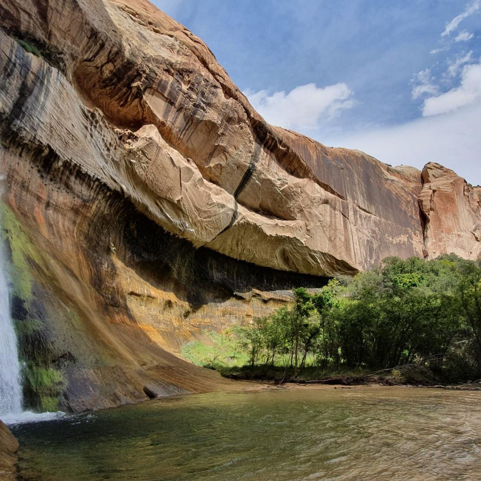
Death Hollow Creek spans over 20 miles, offering scenic canyons and expansive rock slabs. It is one of the Escalante River's longest tributaries through the Navajo sandstone canyon with pools, and small waterfalls The creek begins at 9,000 feet on Boulder Mountain's forested slopes, then descends steeply and levels out before merging with the Escalante River at 5,400 feet.
0
0

This viewpoint is just about half an hour away from the next parking lot and offers the perfect spot to get an overview of the rocky landscape and Escalante River that flows below.
0
0

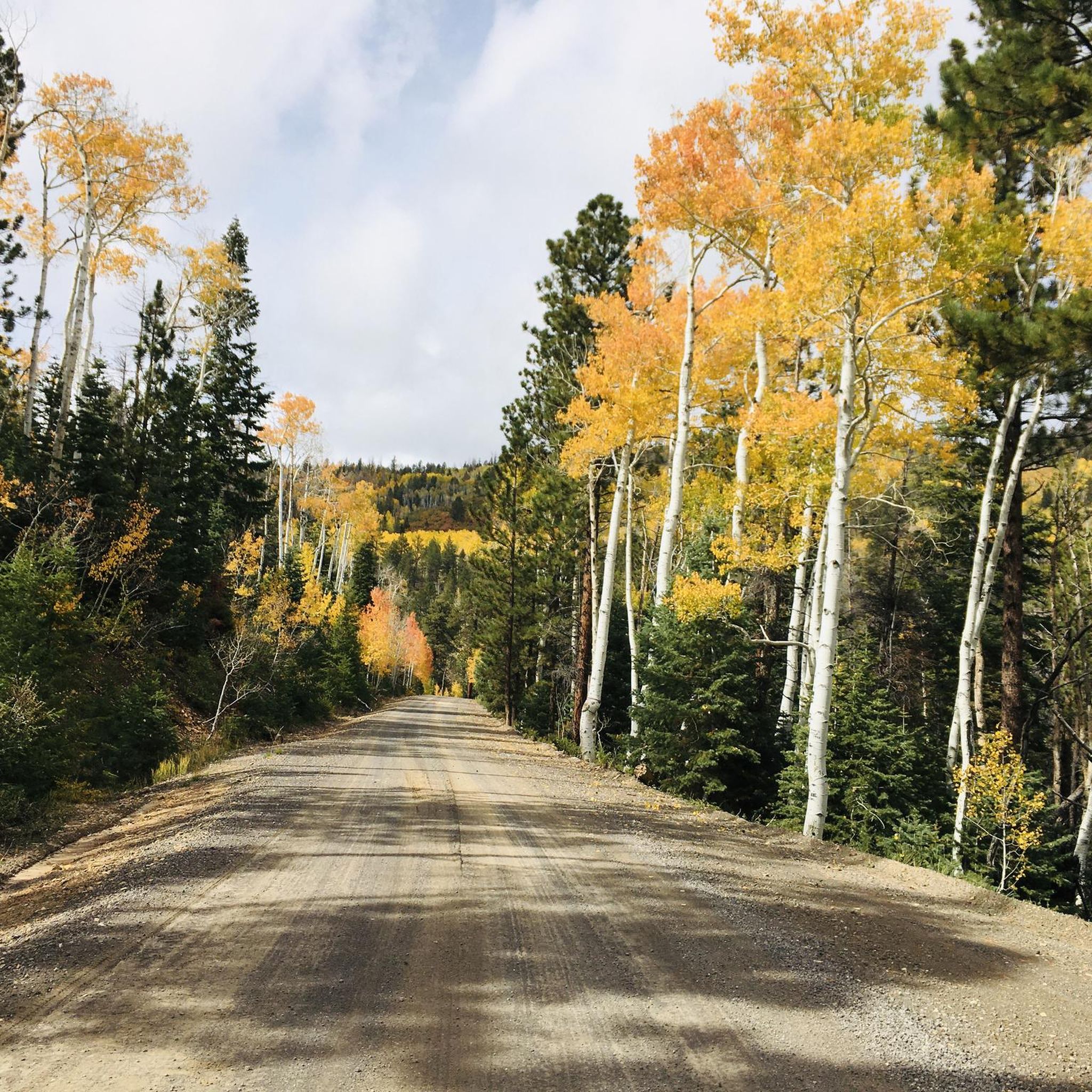
Hell's Backbone (and the bridge named after it) is a must-see and worthy of a pause in your ride in order to appreciate the views--and the engineering.
0
0

The first part is walking up the wash. Then you climb some boulders in some narrow slots. The trail ends in a cool, narrow canyon.
1
0
Frequently Asked Questions
What are some notable natural features and landmarks in the Aquarius Plateau canyons?
The Aquarius Plateau region is rich in diverse geological formations. You can find impressive Navajo sandstone and limestone walls, river-carved canyons, and natural amphitheaters. A prominent landmark is Hell's Backbone and Bridge, offering expansive views of the surrounding gorges. Capitol Reef National Park, bordering the plateau, features dramatic folds, towering cliffs, and the unique Waterpocket Fold.
Are there any challenging canyons for experienced adventurers in the Aquarius Plateau?
Yes, for experienced adventurers, the Aquarius Plateau offers challenging terrain. The Box-Death Hollow Wilderness Area, particularly 'The Box' and Death Hollow Creek, is known for its rugged beauty and challenging routes, often requiring wading or swimming. The Boulder Mail Trail, which traverses canyons like Sand Creek and Mamie Creek, also presents a challenging multi-day backpacking experience, especially through Death Hollow with its potential for swimming and downclimbs.
What kind of wildlife can I expect to see in the Aquarius Plateau canyons?
The canyons and wilderness areas around the Aquarius Plateau support diverse wildlife. In places like the Box-Death Hollow Wilderness, you might spot mule deer, elk, cougars, and various bird species. The creeks, such as Pine Creek and Sand Creek, are home to abundant brown and rainbow trout.
Are there family-friendly canyon experiences in the Aquarius Plateau?
Yes, there are options for families. The Long Canyon Overlook is noted as a family-friendly spot with incredible sweeping views. While some canyons require more strenuous activity, many viewpoints offer accessible ways to appreciate the scenery. For specific family-friendly hikes, it's always best to check trail difficulty and conditions beforehand.
What is the best time of year to visit the canyons of the Aquarius Plateau?
The best time to visit depends on your planned activities. For multi-day backpacking and avoiding high summer temperatures, spring, fall, and winter are often recommended, especially for trails like the Boulder Mail Trail. Summer can be very hot, and some areas may have poison ivy along streams. Always check local conditions before your visit.
Can I find easy hiking trails within the Aquarius Plateau canyons?
While many canyons offer challenging routes, there are also easier options. For instance, Capitol Reef National Park offers colorful canyon trails like Hickman Bridge and Capitol Gorge, which can be explored. Additionally, you can find easy hiking routes in the broader Aquarius Plateau region, such as the Sulphur Creek Trail or Mossy Cave Trail, which are listed in the Waterfall hikes in the Aquarius Plateau guide.
What outdoor activities can I do near the Aquarius Plateau canyons?
Beyond exploring the canyons themselves, the Aquarius Plateau offers a variety of outdoor activities. You can find numerous road cycling routes, including those from Bryce Canyon City or Boulder, as detailed in the Road Cycling Routes in the Aquarius Plateau guide. There are also general cycling tours, such as the Boulder to Escalante Cycle Route, available in the Cycling in the Aquarius Plateau guide, and various hiking trails, including those to waterfalls.
Are there any historical aspects to the canyons in the Aquarius Plateau region?
Yes, the region holds historical significance. The Boulder Mail Trail, for example, is a historic 16-mile route that once served as the mail and telegraph path between Boulder and Escalante. Exploring this trail offers a unique glimpse into the region's past, combining natural beauty with historical context.
Where can I find panoramic views of the canyons in the Aquarius Plateau?
Several spots offer stunning panoramic views. Hell's Backbone and Bridge provides expansive vistas. The Long Canyon Overlook offers incredible sweeping views of the Circle Cliffs and Henry Mountains. Additionally, the Escalante Overlook provides a great overview of the rocky landscape and the Escalante River below.
What makes Bryce Canyon National Park unique compared to other canyons in the region?
Bryce Canyon National Park, while part of the larger High Plateaus Section, is distinct because it's not a single canyon but a series of natural amphitheaters filled with thousands of spire-shaped rock formations called 'hoodoos.' These vibrant red, orange, and white formations, carved by frost weathering and erosion, create an otherworldly landscape unparalleled in its visual spectacle. Visitors can explore these formations from rim overlooks or by hiking down into the amphitheaters.
What are some less-crowded canyon areas or 'hidden gems' in the Aquarius Plateau region?
While popular spots attract many, Capitol Reef National Park is often considered a hidden gem compared to other famous national parks in Utah. It offers a more serene and less crowded experience with diverse terrain, including slickrock domes and natural arches, and opportunities for remote wilderness exploration in areas like Cathedral Valley or Halls Creek Narrows.
Most popular routes in the Aquarius Plateau
Most popular attractions in the Aquarius Plateau

Get inspired with the komoot mobile app


Explore more
Already discovered everything in this region? See additional gorges in the Aquarius Plateau for your next adventure:
