The best walks and hikes in the Aquarius Plateau
4.7
(3307)
33,650
hikers
34
hikes
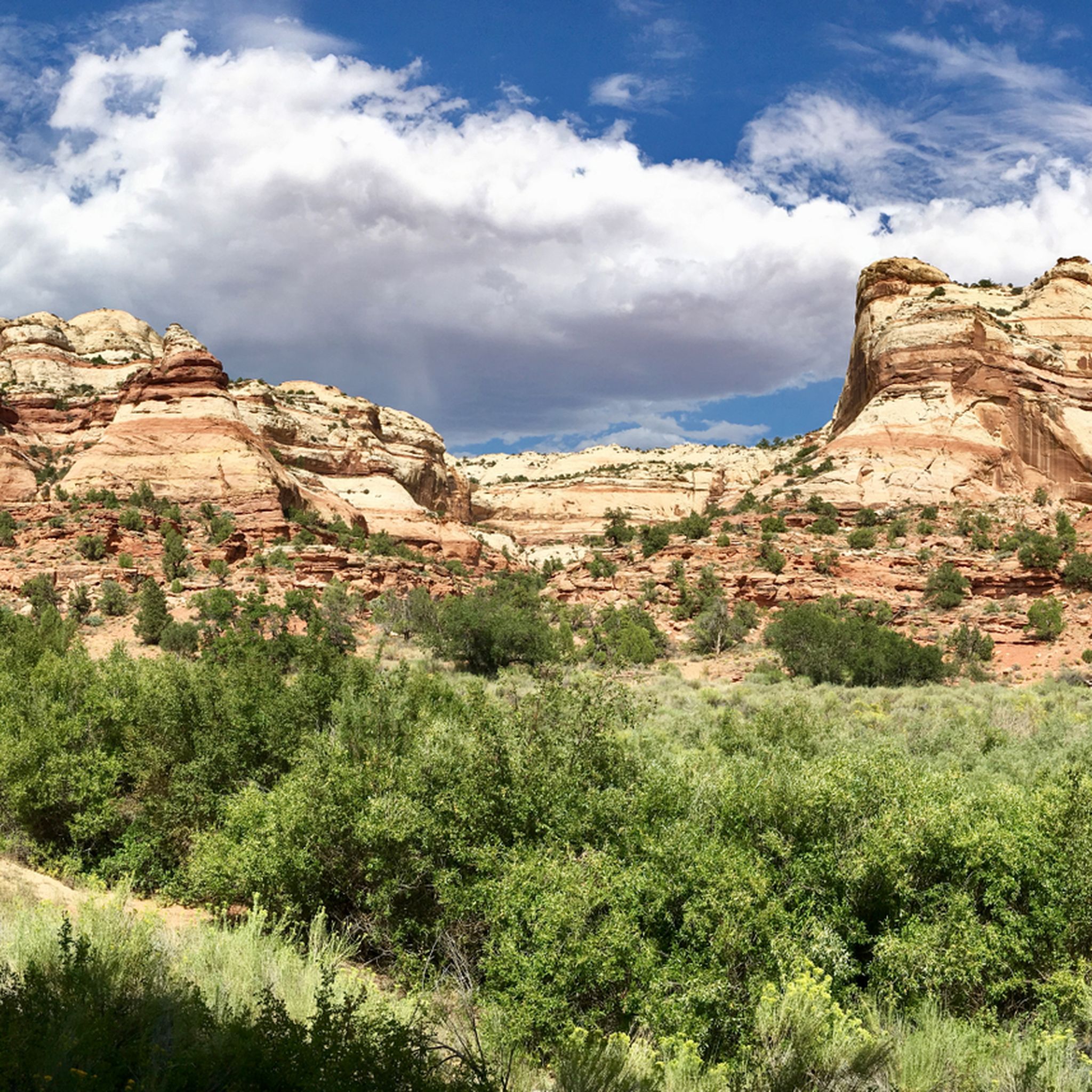
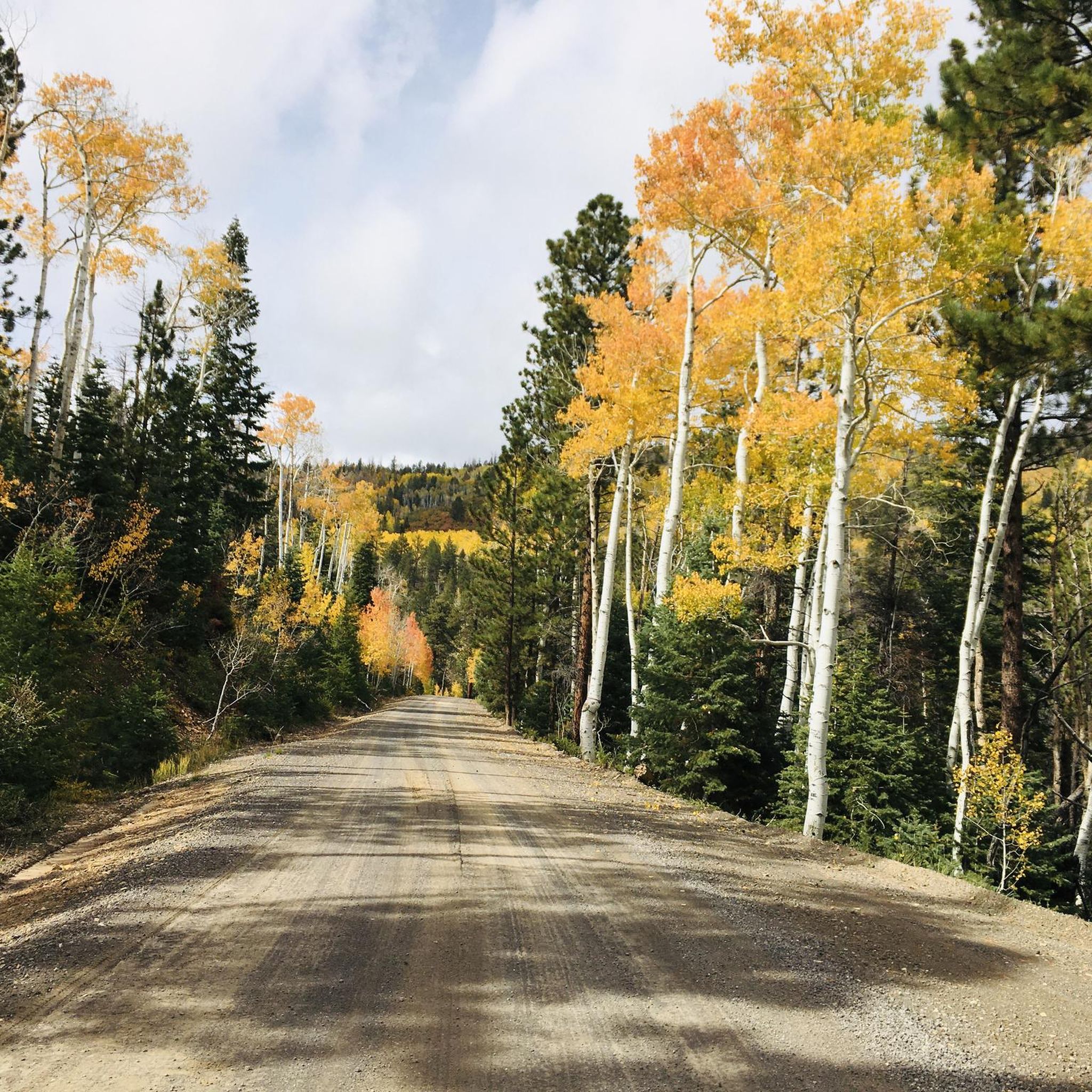
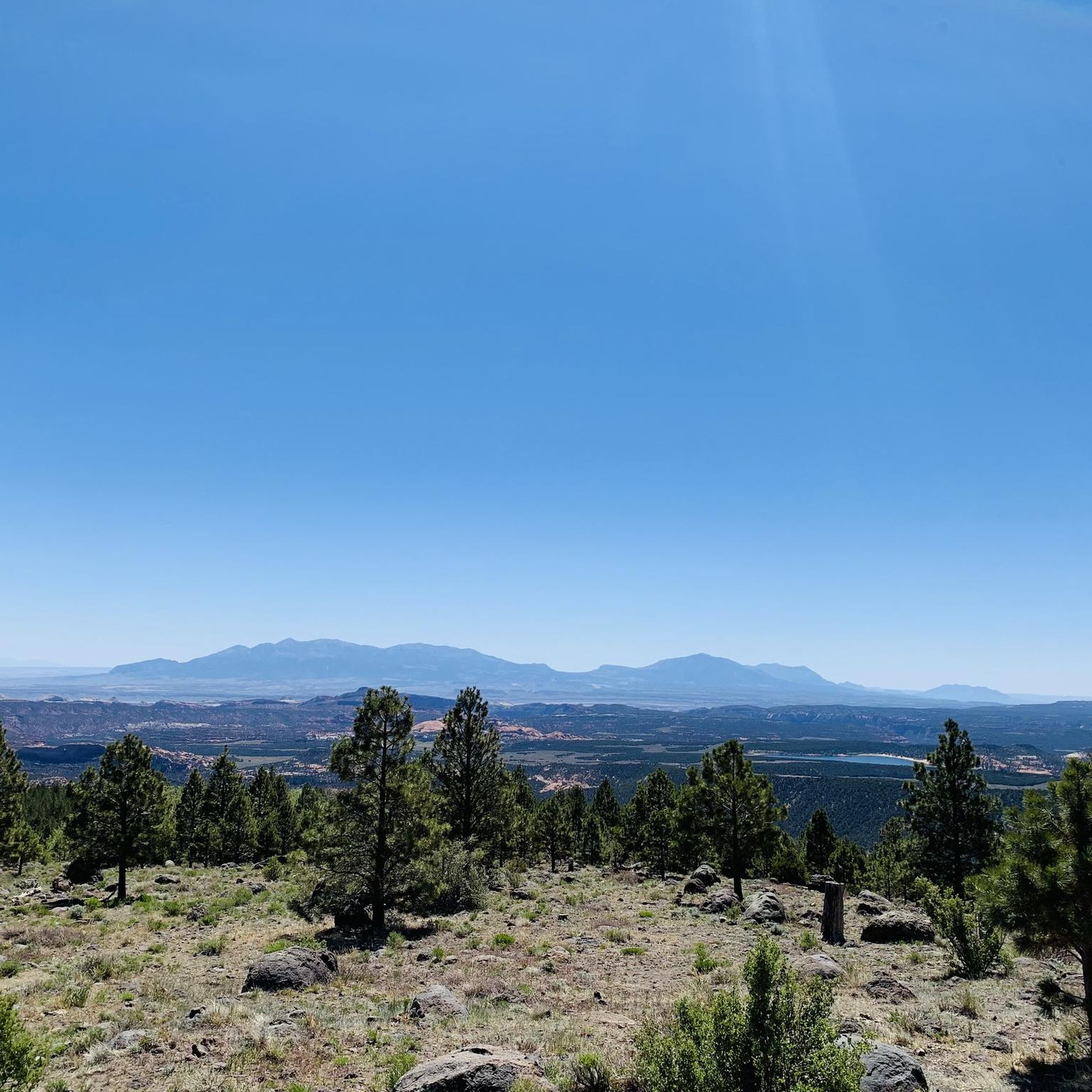
Hiking in the Aquarius Plateau, Utah, offers diverse terrain characterized by high-elevation forests, alpine lakes, and expansive plateaus. The region features a mix of geological formations, including petrified wood and sandstone canyons, providing varied landscapes for exploration. Trails often traverse through areas with significant elevation changes, leading to panoramic viewpoints over the surrounding wilderness.
Best hiking trails in the Aquarius Plateau
- The most popular hiking route is Petrified Forest Trail and Sleeping Rainbow Trail loop — Escalante Petrified Forest State Park, an easy 2.2 miles (3.5 km) trail that takes 1 hour 4 minutes to complete. This route showcases unique petrified wood formations and colorful badlands.
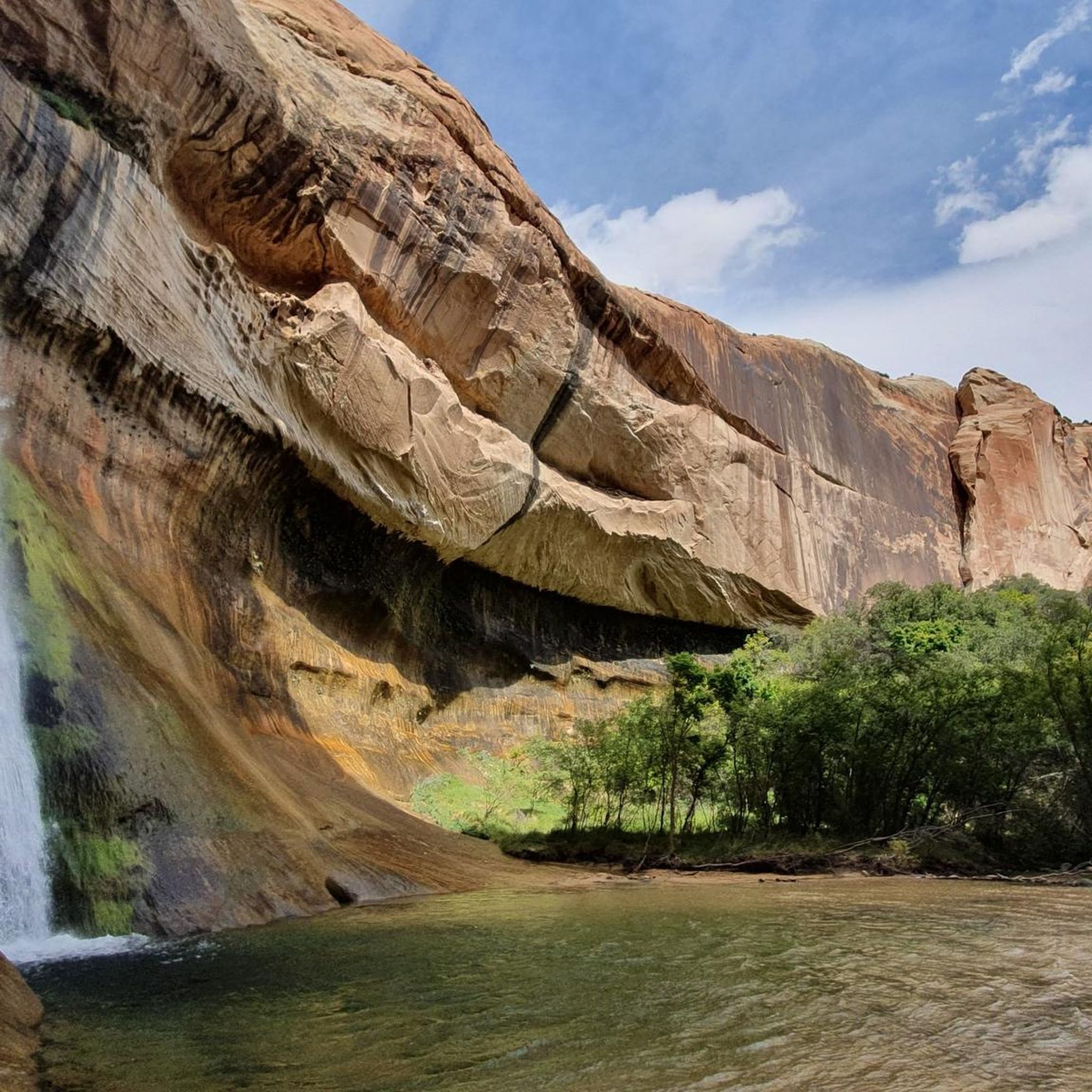
- Another top favourite among local hikers is Upper Calf Creek Waterfall Trail — Grand Staircase–Escalante National Monument, an easy 1.9 miles (3.0 km) path. This trail leads to a scenic waterfall within a canyon environment.
- Local hikers also love the Mossy Cave and Tropic Ditch Waterfall – Bryce Canyon National Park, a 0.9 miles (1.5 km) trail leading through a small canyon to a waterfall, often completed in about 25 minutes.
- Hiking in the Aquarius Plateau is defined by high-elevation forests, alpine lakes, and sandstone canyons. The network offers options for various ability levels, from easy strolls to challenging multi-day treks.
- The routes in Aquarius Plateau are highly rated by the komoot community with an average score of 4.7 stars from over 1,600 reviews. More than 16,000 hikers have used komoot to explore Aquarius Plateau's varied terrain.
Last updated: September 27, 2026
5.0
(3)
91
hikers
4.60km
01:15
30m
110m
Imagine a vibrant ribbon of green cutting through a vast, arid landscape; that's the essence of the Lower Calf Creek Falls Trail. This easy 2.9-mile (4.6 km) hike guides you along Calf Creek, where cottonwoods and lush vegetation thrive against a backdrop of towering, multi-hued Navajo sandstone cliffs. The path itself is often sandy, making some sections feel like a beach walk, but the constant presence of the creek and the dramatic canyon walls keep things interesting. The ultimate reward is the stunning 126-foot Lower Calf Creek Falls, plunging into a cool, deep pool. Expect to spend about 1 hour and 14 minutes on this route, gaining a gentle 111 feet (34 metres) in elevation. It's a fantastic choice for families or anyone looking for a high-reward, relatively short hike in a unique desert setting.
This popular trail is easily accessed off Highway 12, but its fame means the parking lot can fill up very quickly, especially during spring and fall. Your best bet is to arrive early in the morning to secure a spot and beat the heat, which can be intense in the desert. While no permit is required, always carry plenty of water, particularly if you're hiking in warmer conditions. The trail is well-maintained, making it suitable for most ability levels, but the sandy terrain can add a bit of extra effort to your steps.
What truly sets this trail apart is its striking contrast: a lush, flowing oasis nestled within the stark beauty of Grand Staircase-Escalante National Monument. Beyond the impressive waterfall, you'll discover ancient pictographs from the Fremont people tucked into the canyon walls, offering a fascinating glimpse into thousands of years of human history. The cool, green plunge pool at the base of the falls is a popular spot for a refreshing dip, making it a memorable experience that combines natural beauty with cultural significance.
6
hikers
869m
00:15
40m
0m
Embark on an easy 0.5-mile (0.9 km) hike along the Mossy Cave Trail, gaining a gentle 128 feet (39 metres) in just 15 minutes. This short route takes you through a unique landscape where vibrant red, pink, and white hoodoo formations meet lush greenery. You'll follow the flowing Tropic Ditch, passing tall pine trees and desert flora. A highlight is the Tropic Ditch Falls, Bryce Canyon's only named waterfall, before reaching the grotto of Mossy Cave itself.
While the Mossy Cave Trail is an accessible outing, plan for it being part of Bryce Canyon National Park's fee area, even though it lies outside the main park entrance off Highway 12. Pets are not permitted on this trail. Also, be aware that due to the natural terrain, which can be sandy in some areas, the route is not suitable for wheelchairs or strollers.
This trail offers a unique glimpse into Bryce Canyon's diverse natural features, showcasing where desert geology meets a surprising abundance of water. The grotto of Mossy Cave is particularly notable, as moss thrives there in summer, and impressive icicles form during winter months. It's a distinct experience within the broader park landscape.

1
hikers
47.3km
14:37
1,630m
1,680m
The Boulder Mail Trail and Death Hollow Loop offers a demanding hiking adventure, spanning 29.4 miles (47.3 km) with a significant elevation gain of 5348 feet (1630 metres). This difficult route, estimated to take 14 hours and 37 minutes, immerses you in diverse terrain. You will traverse juniper and pinyon pine forests, then navigate expansive Navajo sandstone slickrock. Expect dramatic descents into canyons like Death Hollow, where towering sandstone walls create an oasis with lush vegetation and deep pools. Keep an eye out for the Mamie Creek Natural Bridge, a distinctive landmark, and enjoy panoramic views of the surrounding mesas. Be prepared for sections where you will walk in streambeds and challenging slickrock navigation, often guided by cairns.
Planning your trip on the Boulder Mail Trail and Death Hollow Loop requires careful preparation. If you intend to make it an overnight trip, remember that permits are required, so secure yours in advance. It is essential to carry ample water, as sources can be scarce along the route; consider bringing a water filter for natural water sources you might encounter. Also, be aware that poison ivy is abundant in Death Hollow, so wearing long pants and sleeves is highly recommended to protect yourself. Ensure you are well-equipped for a multi-day excursion into remote wilderness.
This trail is situated within the vast Grand Staircase-Escalante National Monument, a region renowned for its unique geological formations and remote wilderness. The route's name, Boulder Mail Trail, hints at its historical significance as a former mail delivery path, adding a layer of heritage to your journey. You will experience the stark beauty of the desert landscape contrasted with the surprising lushness of canyon bottoms. The trail offers a deep dive into an ecosystem where ancient geological processes have sculpted a dramatic and challenging environment for hikers seeking solitude and adventure.
18.3km
05:09
240m
640m
The Box Trail offers a difficult hiking experience through a unique canyon landscape in Dixie National Forest. You will cover 11.4 miles (18.3 km) and gain 785 feet (239 metres) in elevation, typically taking around 5 hours and 9 minutes to complete. The route starts in a green forest with pine and fir trees, gradually transitioning as the canyon widens. You'll encounter impressive orange-gray sandstone walls that can reach 1,400 feet high, creating a dramatic backdrop for your journey. Cascading waterfalls tucked into alcoves add to the diverse scenery.
Planning your hike on The Box Trail requires you to be ready for numerous stream crossings, so expect to get your feet wet. It is best to undertake this route during warmer months to avoid the risk of hypothermia. Always be aware of potential flash flood dangers, especially during certain seasons, and check weather forecasts before you go. If you plan to complete the full point-to-point route, arranging a car shuttle is a convenient and recommended option for logistics.
This trail stands out for its dramatic transition from a lush forested environment to more open desert views within the canyon. The towering sandstone walls and hidden waterfalls create a memorable journey through a diverse ecosystem. It provides a challenging yet rewarding adventure for hikers looking to explore the unique geological features of the region.
4.62km
01:15
40m
100m
Embark on the Happy Valley Road Loop for an easy hiking experience through the scenic Fishlake National Forest. This gentle route covers 2.9 miles (4.6 km) with a modest elevation gain of 129 feet (39 metres), making it ideal for a relaxed stroll. You can expect to complete the loop in about 1 hour and 14 minutes. As you hike, keep an eye out for the refreshing Single Tree Waterfall, a peaceful highlight that adds a visual treat to your journey. The trail's relatively flat terrain offers a calm atmosphere, perfect for enjoying the natural surroundings.
Planning your visit to the Happy Valley Road Loop is straightforward. You will find the trailhead generally accessible, with parking readily available for your convenience. There are no specific warnings about snow conditions, road closures, or permits mentioned for this route, so you can typically plan your trip without major logistical hurdles. However, it is always a good practice to check local conditions before heading out, especially if you are visiting during the shoulder seasons.
This loop offers a pleasant and accessible outdoor experience for hikers of all skill levels within the broader Fishlake National Forest. The trail provides a wonderful opportunity to immerse yourself in a peaceful natural setting. Its easy difficulty and manageable length make it a great option for a quick escape into nature, allowing you to enjoy the forest's beauty without a strenuous effort.
1.43km
00:23
10m
30m
Embark on an easy hike along the Great Western Trail, a short and accessible route perfect for a quick outdoor escape. You will walk through pleasant woodlands, potentially spotting pine and birch trees, enjoying the fresh air. This trail covers 0.9 miles (1.4 km) with a gentle elevation gain of just 17 feet (5 metres), taking approximately 22 minutes to complete at a relaxed pace.
Planning your visit to this segment of the Great Western Trail is straightforward. While the larger trail system can experience snow closures at higher elevations from November to July, this particular easy route is often accessible year-round. However, if you plan a winter hike, be prepared with traction devices in case of ice on the path. Always check local conditions before you head out.
This specific section offers a glimpse into the natural beauty of the broader Great Western Trail system, which spans diverse landscapes. It provides a convenient opportunity to connect with nature, even if it doesn't feature dramatic vistas or significant elevation changes. The trail is a great option if you are looking for a short, undemanding walk to stretch your legs and enjoy the forest environment.
2.57km
00:42
50m
20m
Embark on an easy hike along the Deer Creek Lake Trail, a gentle 1.6 miles (2.6 km) route that takes you through diverse landscapes. You will gain a modest 171 feet (52 metres) in elevation, making it a perfect short outing that typically takes around 42 minutes to complete. As you follow the path, you will transition from open grasslands into peaceful pine and aspen forests. Keep an eye out for vibrant wildflowers blooming along West Deer Creek. The trail culminates at the picturesque Deer Creek Lake, nestled among woodlands and marshy meadows, offering a serene natural escape.
Before you set out, remember that the Deer Creek Lake Trail is situated at a high elevation of approximately 10,000 feet. This altitude might influence your pace, so plan accordingly and allow yourself time to acclimatize if needed. You may also encounter cattle grazing, which is a common sight across Boulder Mountain, so be mindful of your surroundings. Ensure you have appropriate footwear and water for this high-altitude environment.
This route provides an excellent introduction to high-elevation hiking within the vast Dixie National Forest. While the trail first passes Chriss Lake, mostly enclosed by trees, it then opens up to the larger Deer Creek Lake, offering expansive views. The area is known for its unique blend of ecosystems, from open grasslands to dense forests, and offers glimpses towards the distant canyons of the Escalante.
5.75km
01:57
480m
0m
Embark on the Blind Lake Trail, a moderate hike that takes you through shaded aspen and ponderosa trees. You will ascend 1570 feet (479 metres) over 3.6 miles (5.7 km), with the journey typically taking around 1 hours and 56 minutes. The forest gradually opens up to reveal the stunning Blind Lake, its deep turquoise waters resting beneath the cliffs of Boulder Mountain's summit plateau. This route offers a classic high-mountain lake experience, perfect for those seeking scenic beauty.
When planning your trip, you will find that no fees or permits are necessary to hike the Blind Lake Trail. It is considered a family-friendly option, and you can bring your dogs, often off-leash, to enjoy the outing with you. Be aware that the trail reaches high altitudes of about 10,000 feet, which might make the moderate rating feel more strenuous than usual. For the most vibrant scenery, consider hiking in the fall when the aspens display their brilliant colors.
This trail is nestled within Utah's Fishlake National Forest, an area renowned for its beautiful high-mountain lakes. The journey to Blind Lake is considered one of the most scenic hiking trails in the region, especially during the autumn months. It provides a rewarding experience for anyone looking for a high-mountain adventure in a picturesque setting.
124km
33:39
1,620m
2,110m
The Burr Trail OHV Road is less a single trail and more a gateway to some of Utah's most wild and spectacular canyon systems, offering a diverse hiking experience through Grand Staircase-Escalante and Capitol Reef National Park. You'll traverse varied terrain, from paved sections near Boulder to graded dirt roads that wind past Navajo Sandstone domes and through dramatic red rock formations. The highlight for many is the historic Burr Trail Switchbacks, a series of steep hairpin turns that descend an 800-foot rock escarpment, providing breathtaking views of the Waterpocket Fold and the Henry Mountains.
This is a difficult 76.8-mile (123.6 km) route with 5318 feet (1621 metres) of elevation gain, typically taking around 33 hours and 39 minutes to complete. While the main route is a road, many designated and undesignated hiking opportunities exist off it, ranging from easy walks like Pedestal Alley to strenuous, multi-day backpacking trips. Be aware that the unpaved sections can become muddy and impassable in wet conditions, even for 4WD vehicles, so check weather forecasts before you go. Always carry ample water, as shade is limited, and strong navigation skills are essential for exploring side canyons.
The Burr Trail is recognized as a scenic byway, providing continuous visual appeal and access to remarkable geological formations like the vividly colored Waterpocket Fold and the red Circle Cliffs. It's a historical route, originally a cattle trail developed by John Atlantic Burr, and offers a sense of untouched wilderness. Spring and fall are the best times to visit for milder temperatures, making it an ideal choice for experienced hikers seeking remote beauty and geological wonders.
47.7km
13:45
1,110m
1,410m
Embark on the Hells Backbone OHV Trail, a difficult hiking route that plunges you into Utah's rugged backcountry. You will traverse diverse landscapes, from juniper desert at lower elevations to lush pine and aspen forests above 9,000 feet. Prepare for a challenging journey covering 29.6 miles (47.7 km) with an elevation gain of 3647 feet (1111 metres), which typically takes around 13 hours and 45 minutes to complete. Along the way, you will encounter vistas of slickrock spires and deep canyons, including the Box-Death Hollow Wilderness Area, with the historic Hell's Backbone Bridge offering a dramatic visual landmark.
Before you head out, remember that this route is primarily a gravel road, which can vary from smooth sections to areas with washboard ruts. While it is accessible for vehicles in dry conditions, hiking this trail is demanding due to its steep grades and changing surfaces. Always check current weather and trail conditions, as they can shift quickly in this remote area. Planning your water and supplies carefully is essential for such a long and strenuous hike.
This trail is notable for its unique blend of natural beauty and a touch of history, offering a deep dive into the Dixie National Forest. The dramatic Hell's Backbone Bridge, perched high above a chasm, is not just a landmark but a testament to the area's rugged character. You will experience the raw, untamed essence of the region, making it a memorable adventure for those seeking a true wilderness challenge.
Get access to more routes and recommendations from other explorers.
Already have an account?
Our route recommendations are based on thousands of hikes, rides, and runs completed by other people on komoot.
Start today with a free account
Your next adventure awaits.
Tips from the Community

3 large figures painted into the rock face with red pigments
0
0

A little gem, few people but definitely worth a stop
0
0

The Long Canyon Overlook is a fantastic spot with incredible sweeping views of the Circle Cliffs and the Henry Mountains in the distance. The overlook is typically quiet, with minimal traffic—making it a perfect spot to take a break in solitude and enjoy the beauty of Grand Staircase-Escalante.
0
0


Lovely walk with a wonderful trail map explaining the various vistas
0
0

Nice little hike with always beautiful views of this unique landscape!
1
0

From where the trail between Boulder Mail Trail and Mamie Creek Natural Bridge Trail splits, it's less than one mile until you reach this highlight. After the walk through Mamie Creek's riverbed, you'll get to the natural bridge and can enjoy this amazing geological landmark.
0
0

Superb place, magnificent waterfall. Small river that can be descended on foot.
0
0
Frequently Asked Questions
What kind of terrain can I expect when hiking in the Aquarius Plateau?
The Aquarius Plateau offers diverse terrain, characterized by high-elevation forests, alpine lakes, and expansive plateaus. You'll encounter a mix of geological formations, including unique petrified wood and dramatic sandstone canyons, providing varied landscapes for exploration. Trails often feature significant elevation changes, leading to panoramic viewpoints.
How many hiking trails are available in the Aquarius Plateau?
There are over 19 hiking routes documented in the Aquarius Plateau on komoot. These trails cater to various skill levels, with 10 easy, 4 moderate, and 5 difficult options available for exploration.
Are there any easy hikes suitable for beginners or families in the Aquarius Plateau?
Yes, the Aquarius Plateau has several easy trails. For instance, the Petrified Forest Trail and Sleeping Rainbow Trail loop is an easy 2.2-mile (3.5 km) path showcasing unique petrified wood. Another great option is the Escalante Overlook, an easy 2.4-mile (3.9 km) trail with minimal elevation gain.
Are there any challenging multi-day hikes in the Aquarius Plateau?
Yes, for experienced hikers seeking a challenge, the Aquarius Plateau offers several difficult routes. The Phipps Arch Trail is a demanding 24.7-mile (39.7 km) hike with over 1,100 meters of elevation gain. Another strenuous option is the Fish Lake Loop – Lakeshore National Recreation Trail, covering 16.4 miles (26.4 km) around the lake.
What natural features or landmarks can I see along the trails?
The Aquarius Plateau is rich in natural wonders. You can visit the Escalante Petrified Forest, explore the dramatic Death Hollow Creek canyon, or enjoy views from the Long Canyon Overlook. Don't miss the scenic Tropic Ditch Falls or the impressive Hell's Backbone Bridge.
Are there any trails that lead to waterfalls?
Absolutely! The Aquarius Plateau features beautiful waterfall hikes. The Upper Calf Creek Waterfall Trail leads to a stunning waterfall within a canyon. You can also visit the Mossy Cave and Tropic Ditch Waterfall trail, which takes you through a small canyon to a picturesque waterfall.
What do other hikers say about the trails in the Aquarius Plateau?
The trails in the Aquarius Plateau are highly regarded by the komoot community, boasting an average rating of 4.7 out of 5 stars from over 1,600 reviews. Hikers frequently praise the diverse landscapes, from petrified forests to alpine lakes, and the rewarding panoramic views found along many routes.
Is there parking available at the trailheads?
Parking is available at various trailheads throughout the region. For example, the Mossy Cave Trailhead offers dedicated parking for hikers accessing that area. It's always advisable to check specific trail information for parking details before your visit.
What is the best time of year to hike in the Aquarius Plateau?
The best time to hike in the Aquarius Plateau is typically from late spring through early fall (May to October). During these months, the weather is generally mild, and trails are clear of snow, especially at higher elevations. Summer offers lush greenery and wildflowers, while fall brings vibrant autumn colors.
Are there any trails that offer views of canyons or overlooks?
Yes, many trails provide spectacular canyon views and overlooks. The Escalante Overlook trail offers expansive vistas. You can also find impressive views at the Long Canyon Overlook, providing a glimpse into the region's dramatic geological formations.
Are permits required for hiking in the Aquarius Plateau?
While many trails in the Aquarius Plateau are freely accessible, some areas within national parks or monuments, such as Capitol Reef National Park, may have specific regulations or require entrance fees. It's recommended to check with the relevant park or land management agency for the most current permit requirements for your chosen trail.
Most popular routes in the Aquarius Plateau
Most popular attractions in the Aquarius Plateau

Get inspired with the komoot mobile app


Explore more
Browse the best Hikes in other regions.
