The 9 Most Amazing Peaks around Kopfing im Innkreis
Best mountain peaks around Kopfing im Innkreis are found in the hilly to low-mountainous Sauwald region of Upper Austria. This area features a natural landscape characterized by forests and agricultural land, offering elevated points with scenic views. While not home to towering alpine peaks, the region provides opportunities for outdoor activities and peaceful recreation. Notable elevated points include Haugstein and Feichtberg, which offer diverse hiking experiences and panoramic vistas.
Best mountain peaks around Kopfing im Innkreis
- The most popular mountain…
Last updated: October 6, 2026
Haugstein Summit (895 m)
Highlight • Summit
Translated by Google •
Tip by

Penzenstein Viewpoint, Chapel and Summit Cross
Highlight • Viewpoint
Translated by Google •
Tip by

Sign up now to discover places like this
Get recommendations on the best single tracks, peaks, & plenty of other exciting outdoor places.
Turnstein – Highest Point in Natternbach
Highlight • Summit
Translated by Google •
Tip by

View from Ebenstein Rock across the Danube Valley
Highlight • Viewpoint
Translated by Google •
Tip by

Ameisberg Summit (729 m)
Highlight • Summit
is called Hochholzstein by the local population and has been a popular excursion …
Translated by Google •
Tip by

Sign up for free to discover even more peaks around Kopfing im Innkreis.
Already have an account?
Start today with a free account
Your next adventure awaits.
Popular around Kopfing im Innkreis

E-bike Tours in the Danube region in Upper Austria
Hiking around Kopfing im Innkreis
Cycling around Kopfing im Innkreis
MTB Trails around Kopfing im Innkreis
Road Cycling Routes around Kopfing im Innkreis
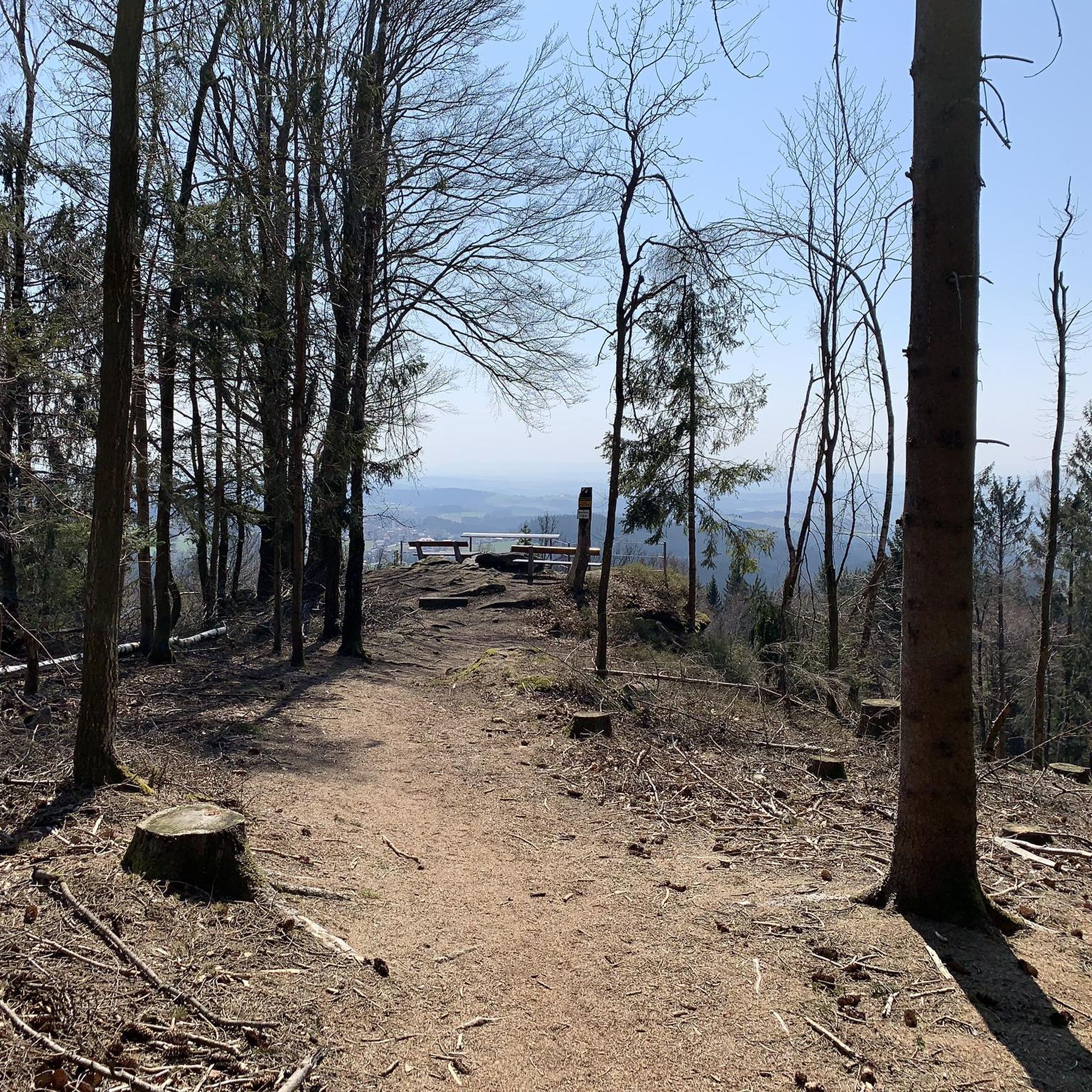
Running Trails around Kopfing im Innkreis

Mountain Hikes around Kopfing im Innkreis
Gravel biking around Kopfing im Innkreis
Other adventures around Kopfing im Innkreis

Tips from the Community

a beautiful viewpoint
0
0

The highest point of Natternbach with a rest area and a wonderful view
1
0

The Ebenstein is part of the geotope "Rock ensemble of Jochenstein on the Donauleite"! At the Donauleite, several rock ridges made of eye and pearl gneiss protrude from the slope, each ending in steep cliffs (10 to 15 m). A system of fissures that are almost at right angles to one another is responsible for the cuboid shape of the towers. The block flow between the ridges also consists of strikingly geometric gneiss blocks. The cliffs offer a fantastic view of the Danube's V-shaped valley and of Jochenstein (cliffs below the hiking trail; beware of falling!!!). Bavarian State Office for the Environment (LfU). More information: https://www.umweltatlas.bayern.de/standortauskunft/rest/reporting/sb_geotope/generate?additionallayerfieldvalue=275R010
1
0

The Donaublick Penzenstein is a viewing point overlooking the Danube. Visitors here enjoy magnificent views of the Danube Valley, the Jochenstein Power Plant, and Engelhartszell. The most popular tourist destination in the municipality is a must-see. At Penzenstein there is also a small chapel, where mass is held during the summer months (every 13th of the month) and which is also a popular pilgrimage destination. There is also a rest area on the Donausteig trail. Source: https://www.urlaub-neustift.at/genussurlaub/sehenswuerdigkeiten/details/6-donaublick-penzenstein.html
2
0
The Donausteig long-distance hiking trail runs along both banks of the river for 450 km from Passau via Linz to Grein. Along the way, hikers encounter wondrous legendary figures, impressive landscapes and unique cultural treasures.
2
1
From the Ebenstein rock there is a magnificent view of the Danube valley with the Jochenstein Danube power station, Haus am Strom and Engelhartszell on the opposite side of the Danube. A special feature is the chapel that is located at this vantage point.
2
0
On the Penzenstein, a 568 m high rocky outcrop with an iron cross and views of the Danube Valley and Engelhartszell, the chapel, built in 1790, nestles against the rocks. Legend tells that "Seppenhans" from Kramesau saved a statue of "St. Nepomuk" from a flood. When a wooden chapel was built on the Penzenstein, he placed his Nepomuk there, but this brought terrible misfortune to the Kramesau. He brought the statue home, but the surrounding villages continued to be haunted. A farmer from Großmollsberg decided to put an end to the haunting and built a new chapel on the Penzenstein. Only then did peace return.
3
0

Great view, quiet and sheltered spot, enough space for a rest and snack
1
0
Frequently Asked Questions
What are some popular mountain peaks to visit around Kopfing im Innkreis?
The region around Kopfing im Innkreis offers several noteworthy peaks. Haugstein Summit (895 m) is the highest mountain in the Sauwald and a significant point along the Donausteig trail, offering views across the Danube valley. Another popular spot is the Penzenstein Viewpoint, Chapel and Summit Cross, known for its wonderful views over the Danube valley and the Jochenstein Danube power station.
Are there family-friendly mountain peaks or trails in the region?
Yes, the Turnstein – Highest Point in Natternbach is noted as family-friendly and offers great views as far as the Alps, with a bench for resting. Additionally, many of the easy hiking routes available, such as those found in the Easy hikes around Kopfing im Innkreis guide, are suitable for families.
What kind of views can I expect from the peaks around Kopfing im Innkreis?
From various peaks, you can enjoy extensive panoramic views. For instance, Haugstein Summit (895 m) provides views stretching across the Danube valley into Bavaria. From the area around Feichtberg, including the nearby Ameisberg Summit (729 m), you can experience views across the Innviertel region, extending to the Salzkammergut and, on clear days, even to the majestic Alps, including prominent peaks like Ötscher, Dachstein, and Watzmann. The View from Ebenstein Rock across the Danube Valley also offers a fantastic perspective of the Danube.
What are the highest points in the Sauwald region near Kopfing im Innkreis?
The highest mountain in the Sauwald region is the Haugstein Summit (895 m). Another significant elevated point is Feichtberg (768 m), which is largely located within the municipal area of Kopfing im Innkreis and is recognizable by its radar facility.
Are there any historical or mystical sites associated with the peaks?
Yes, near Hochholzstein, which is the highest point of the Ameisberg Summit (729 m), there are intriguing “mystical and mythical boulders.” These are believed by some to have served as a Celtic cult or sacrificial site and are said to emanate “positive energy.” Additionally, the Penzenstein Viewpoint features a small chapel, and a pilgrimage is organized there annually.
What outdoor activities can I do near the mountain peaks?
The region is ideal for various outdoor activities. Hiking is very popular, with trails leading to summits like Haugstein and Feichtberg. You can find numerous routes for different sports, including easy hikes, running trails, and traffic-free bike rides. Explore options in guides like Easy hikes around Kopfing im Innkreis, Running Trails around Kopfing im Innkreis, and Traffic-free bike rides around Kopfing im Innkreis.
Are there specific hiking trails recommended for different difficulty levels?
Yes, the area offers trails for various fitness levels. For moderate mountaineering, trails to Haugstein Summit (895 m) are suitable. The Penzenstein Viewpoint is surrounded by super beautiful and challenging hiking trails. For easier options, consider routes like the "Ameisberg Summit (729 m) – Mystical Rock Formation loop from Großfasching" found in the Easy hikes around Kopfing im Innkreis guide.
When is the best time of year to hike the peaks around Kopfing im Innkreis?
The region is generally suitable for outdoor activities throughout the warmer months. While specific seasonal recommendations aren't provided, the mention of a pilgrimage to the Penzenstein chapel in the summer months suggests pleasant conditions during that time. The area's natural beauty, characterized by forests and agricultural land, makes it enjoyable in spring, summer, and autumn.
What unique landmarks or features can I find on these peaks?
On Feichtberg, a distinctive radar facility erected in 1968 resembles an "oversized golf ball" and is a recognizable symbol of Kopfing. The summit area of Haugstein is characterized by a wooded ridge dotted with individual granite blocks. The Penzenstein Viewpoint features a small chapel and a summit cross.
Can I find routes suitable for running or cycling near the peaks?
Absolutely. Komoot offers dedicated guides for various activities. You can explore numerous running trails in the Running Trails around Kopfing im Innkreis guide, with options ranging from easy to moderate. For cyclists, the Traffic-free bike rides around Kopfing im Innkreis guide provides routes, some of which are quite challenging, like the "Kopfting – Parish Church of Natternbach loop."
What should I know about accessibility or parking for these mountain peaks?
While specific parking details for each peak are not listed, many trails start from towns like Kopfing im Innkreis or nearby villages. The Turnstein – Highest Point in Natternbach is noted as easily reachable by mountain bike, suggesting good accessibility. For detailed starting points and parking, it's best to check individual route descriptions on Komoot.
Are there any less crowded options for hiking?
The Sauwald region, including Kopfing im Innkreis, is generally known for offering peaceful recreation away from urban hustle. While specific 'less crowded' highlights are not explicitly named, seeking out trails that are not directly leading to the most prominent viewpoints might offer a quieter experience. Exploring the various loops and less-trafficked routes in the Easy hikes around Kopfing im Innkreis guide could lead to more serene paths.
Most popular routes around Kopfing im Innkreis
Most popular attractions around Kopfing im Innkreis

Get inspired with the komoot mobile app


Explore more
See even more amazing summits around Kopfing im Innkreis with these guides:
