The best MTB trails around Tauernmoossee
4.5
(36)
142
riders
3
rides
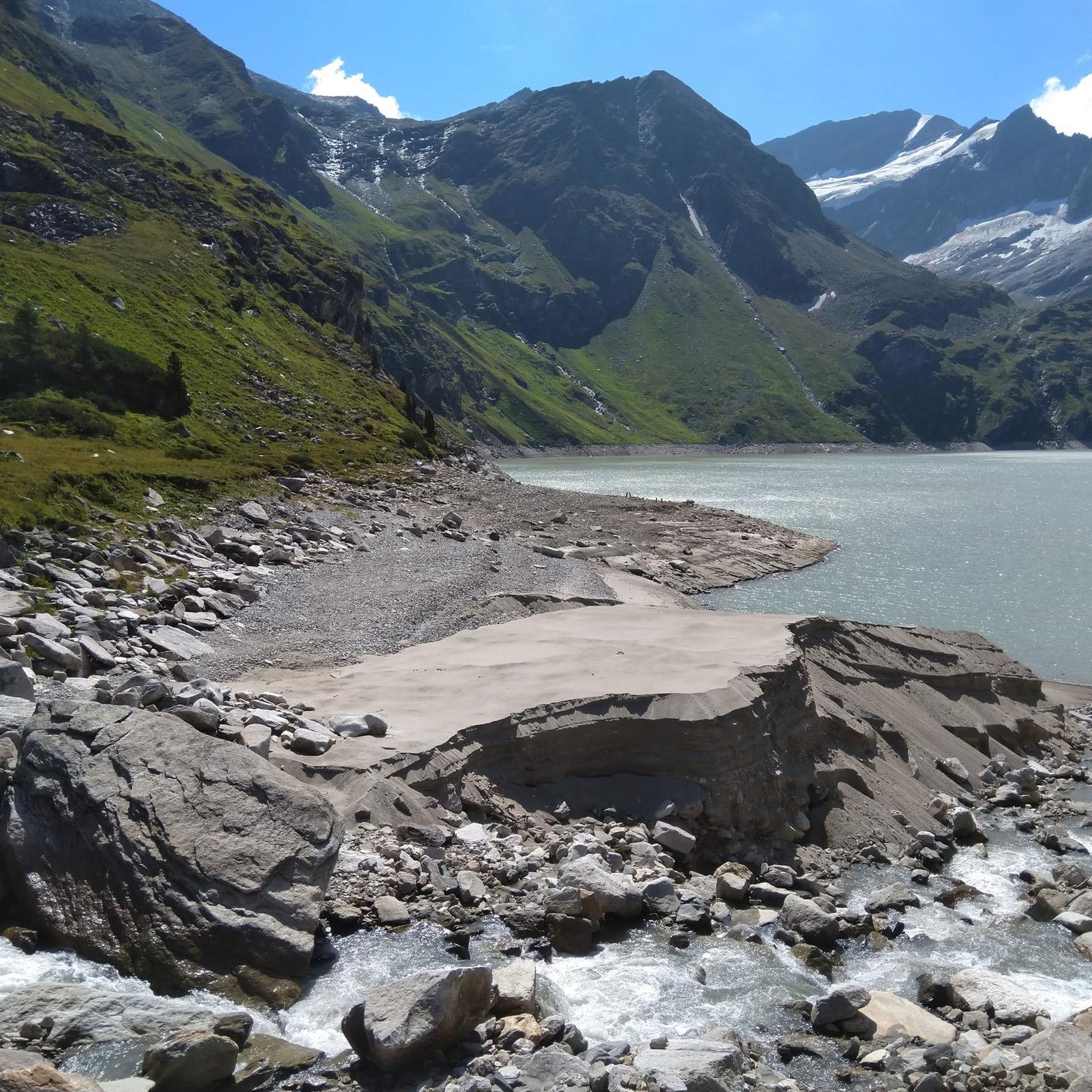
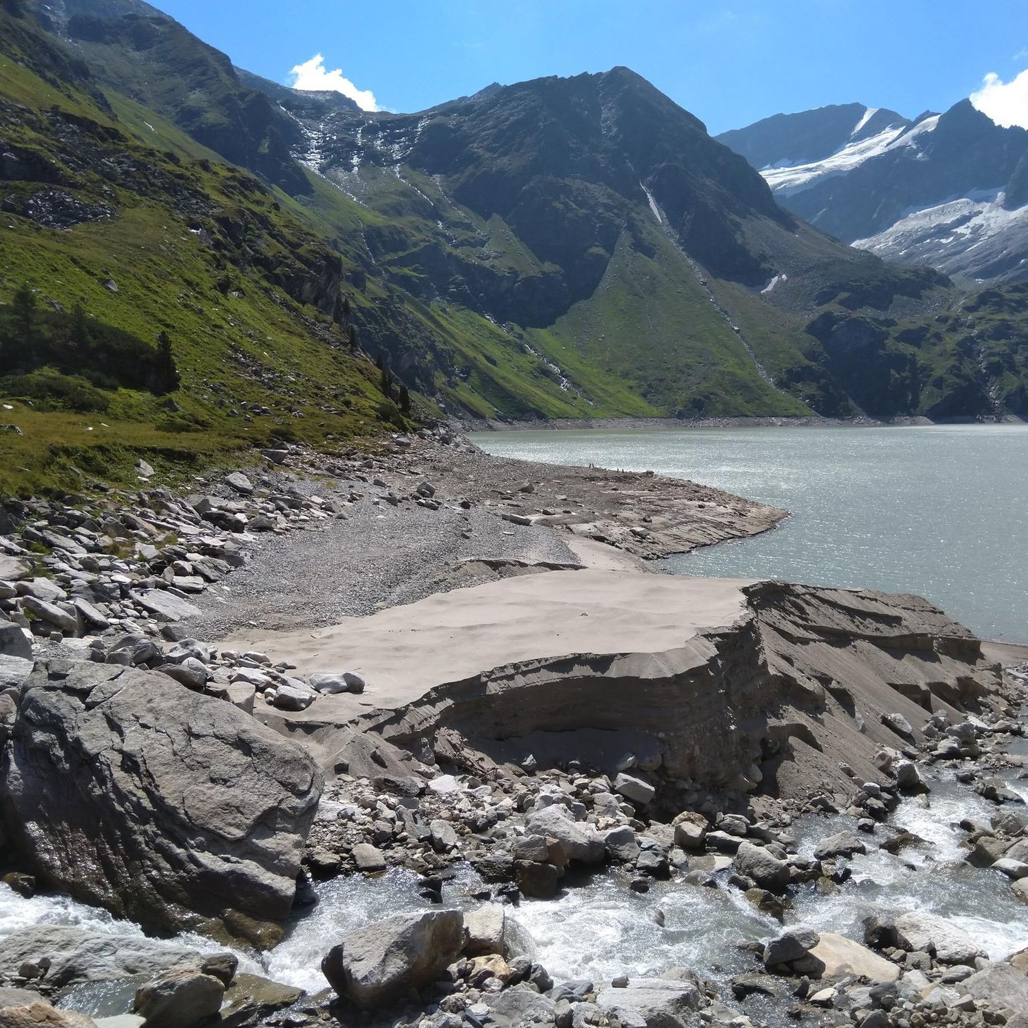
Mountain bike trails around Tauernmoossee are set within the high-alpine landscapes of the Salzburger Glocknergruppe mountains, part of the Hohe Tauern National Park. The region features dramatic terrain, including glacial elements, dammed lakes, and streams, with elevations reaching approximately 1,800 meters. Mountain biking here involves varied surfaces, from wide paths to technical sections with boulder fields and significant elevation changes, traversing spruce, larch, and Swiss pine forests.
Best mountain bike trails around Tauernmoossee
- The most popular mountain bike trail is…
Last updated: September 29, 2026
4.0
(2)
14
riders
13.7km
01:30
660m
660m
Moderate mountain bike ride. Good fitness required. Suitable for all skill levels.
5.0
(1)
19
riders
27.8km
04:01
1,630m
1,630m
Hard mountain bike ride. Very good fitness required. Suitable for all skill levels.

7
riders
8.03km
01:14
490m
490m
Hard mountain bike ride. Good fitness required. Advanced riding skills necessary. Some portions of the route may require you to push your bike.
4.5
(40)
99
riders
56.8km
03:26
490m
490m
Moderate mountain bike ride. Good fitness required. Suitable for all skill levels.
Our route recommendations are based on thousands of hikes, rides, and runs completed by other people on komoot.
Start today with a free account
Your next adventure awaits.
Popular around Tauernmoossee

Tips from the Community

Simple food, rustic hut, lovely spot, highly recommended!
0
0

The Kitzsteinhorn reaches a height of 3,029 meters at its highest point, the viewing platform. There are three cable cars from the valley station that take you up. The first cable car 🚡 is closed and accessible even for those with a fear of heights. Then comes a chairlift, which can be closed but isn't necessarily suitable for those with a fear of heights. The third cable car is a large gondola, which is fine again. Please be aware that the air at these altitudes is thin.
1
0
You should definitely take the cable cars to the Kitzsteinhorn if possible. Bus 660 runs from Zell and Kaprun to the stop. Get off at the second-to-last stop. The second cable car is more like a chairlift that can be closed if necessary. Not suitable for those with a fear of heights. Then you board the third, larger gondola. If you take the stairs or the elevator, you'll be at an altitude of 3,029 meters. There are always great views along the way. Included with a guest card. There are two platforms, a great nature film, and an exhibition. The second platform is after the tunnel (exhibition).
1
0


Reasonable prices, delicious food, and everyone exceptionally friendly. It still retains the rustic character and charm of a mountain hut. We always enjoy coming here for a break.
1
0

great river environment and a well-kept community image
2
0

Super nice alpine mountain bike trail. There are flowing passages and stone steps that can be rolled down. The trail is made for experienced enduro riders. Beginners and fans of built flow trails should take the forest path instead.
1
0

Beautiful driveway, but normally forbidden.
0
0
Frequently Asked Questions
What kind of terrain can I expect on mountain bike trails around Tauernmoossee?
The mountain bike trails around Tauernmoossee are characterized by high-alpine landscapes within the Salzburger Glocknergruppe mountains. You'll encounter varied surfaces, from wide paths to technical sections with boulder fields and significant elevation changes. The routes traverse spruce, larch, and Swiss pine forests, offering dramatic mountain panoramas and glacial elements.
Are there mountain bike trails suitable for beginners or families around Tauernmoossee?
While the region offers challenging routes, there are options for different ability levels. For a moderate experience with panoramic views, consider the Weißsee Panorama – Tauernmoossee loop from Enzingerboden Weißseeseilbahn. This route is 8.5 miles (13.7 km) long and takes about 1 hour 30 minutes, making it a good choice for those looking for a less strenuous ride.
When is the best time of year for mountain biking in the Tauernmoossee area?
The area around the Hohe Tauern, including Tauernmoossee, generally becomes accessible for mountain biking from April to October. During this period, you can expect favorable conditions to explore the diverse trails and enjoy the high-alpine scenery.
Are there any trails with waterfalls or other natural features?
Yes, some routes feature impressive natural elements. The Small ford at the waterfall – Amazing view loop from Winkeldörfl is a difficult 17.3 miles (27.9 km) path that includes sections near waterfalls, offering a scenic and challenging experience.
What do other mountain bikers enjoy most about the trails in Tauernmoossee?
The mountain bike routes in Tauernmoossee are highly rated by the komoot community, with an average score of 4.5 stars from over 20 reviews. Reviewers often praise the 'truly fantastic' climbs, amazing views, and the 'nice gravel section along the dam,' describing the area as a 'hidden gem' for cyclists.
Are there any circular mountain bike routes in the region?
Yes, several routes are designed as loops. For example, the Weißsee Panorama – Tauernmoossee loop from Enzingerboden Weißseeseilbahn offers a moderate circular ride, and the Krefelder Hut – Geißstein Trail loop from Häuslalm is a more difficult loop through alpine meadows and rocky sections.
Where can I find parking facilities for mountain biking near Tauernmoossee?
Parking is available at key access points to the trails. For instance, the Weißsee Panorama – Tauernmoossee loop starts from Enzingerboden Weißseeseilbahn, which typically has parking facilities for visitors accessing the cable car and surrounding trails.
Can I reach the Tauernmoossee area by public transport for mountain biking?
The presence of cable cars, such as one providing access to Grünsee and the Rudolfshütte, suggests that some areas are accessible, which can facilitate longer tours and provide resting points. For specific public transport options to trailheads, it's advisable to check local transport schedules for the Stubachtal valley.
Are there any specific viewpoints or landmarks along the mountain bike routes?
Many routes around Tauernmoossee offer impressive views of the surrounding mountain scenery, including glimpses of the Grossglockner. The region is part of the Hohe Tauern National Park, and the Stubachtal valley is known as a 'Valley of Lakes - Glacier Realm,' featuring numerous dammed and natural lakes. The Tauernmoossee itself is a striking reservoir.
Are permits required for mountain biking in the Tauernmoossee region?
The Tauernmoossee area is part of the Hohe Tauern National Park. While mountain biking is a key activity, it's always recommended to check local regulations regarding permits or specific trail access within national park boundaries. You can find more information about the national park at nationalpark.at.
Are there any cafes or places to eat near the mountain bike trails?
Traditional alpine huts are dotted throughout the landscape, providing opportunities for regional food and rest. These huts are often found along hiking and biking routes, offering convenient stops during your ride.

Get inspired with the komoot mobile app


Explore more
Browse the best MTB trails in other regions.
