The best waterfall hikes and walks in Coclé
4.6
(648)
2,802
hikers
13
hikes
Waterfall hiking trails in Coclé, Panama, traverse a landscape characterized by mountainous rainforests, volcanic calderas, and diverse elevations. The region features dense forests, river systems, and significant highland areas, providing varied terrain for hiking. These trails often lead to impressive waterfalls, which are a prominent natural feature of the area. The topography ranges from gentle slopes to steep inclines, offering a range of hiking experiences.
Best waterfall hiking trails in Coclé
- The most popular waterfall hiking route is View of the Rainforest – Viewpoint loop from El Valle, a 4.3 miles (7.0 km) trail that takes 2 hours 25 minutes to complete. This moderate route leads through lush rainforest, providing scenic vistas.
- Another top favourite among local hikers is Viewpoint – View of the Valley loop from Alto de la Estancia, a moderate 5.5 miles (8.8 km) path. This trail leads through varied terrain, often completed in about 2 hours 48 minutes.
- Local hikers also love the View of the Rainforest – Viewpoint loop from Entrance fee $3, a 3.1 miles (5.0 km) trail leading through dense cloud forest, often completed in about 1 hour 54 minutes.
- Hiking in Coclé is defined by mountainous rainforests, volcanic calderas, and numerous waterfalls. The network offers options for different ability levels, from easy strolls to more challenging ascents.
- The routes in Coclé are highly rated by the komoot community with an average score of 4.6 stars from over 550 reviews. More than 2000 hikers have used komoot to explore Coclé's varied terrain.
Last updated: June 25, 2026
4.7
(82)
273
hikers
8.79km
02:49
340m
340m
Moderate hike. Good fitness required. Mostly accessible paths. Sure-footedness required.
4.7
(64)
239
hikers
7.80km
02:38
290m
290m
Moderate hike. Good fitness required. Mostly accessible paths. Sure-footedness required.

Sign up for free
4.7
(13)
66
hikers
4.99km
01:55
290m
290m
Moderate hike. Great for any fitness level. Mostly accessible paths. Sure-footedness required.
5.0
(2)
11
hikers
18.9km
05:55
640m
640m
Hard hike. Very good fitness required. Mostly accessible paths. Sure-footedness required.
22
hikers
2.19km
00:50
150m
150m
Easy hike. Great for any fitness level. Easily-accessible paths. Suitable for all skill levels.
Get access to more routes and recommendations from other explorers.
Sign up for free
Already have an account?
Our route recommendations are based on thousands of hikes, rides, and runs completed by other people on komoot.
Start today with a free account
Your next adventure awaits.
Login or Signup


Other adventures in Coclé

Tips from the Community

comfortable bench to rest on with a great view
0
0
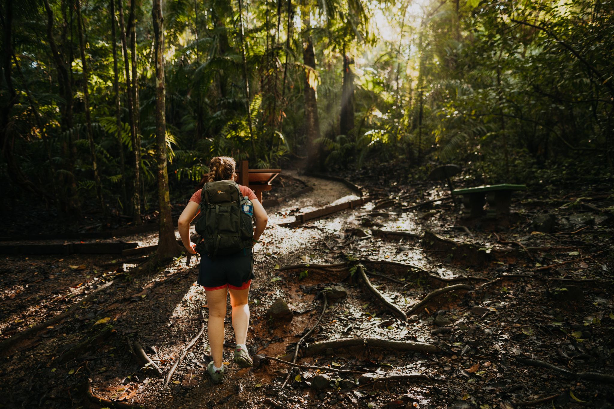
the roots are exposed here and form a natural staircase
0
0

And what do you think the drawings on the stone are?
0
0
He wears long trousers so as not to cut his legs with the suitcase.
0
0

Beautiful walk, mostly in the shade, except at the end on the ridge The path is well marked, it is sometimes difficult (slope, roots or mud) but very accessible The view of Antun is very beautiful, the descent can be done by another path to make a loop
2
0
Frequently Asked Questions
How many waterfall hiking trails are available in Coclé?
Coclé offers a diverse selection of over 10 waterfall hiking trails. These routes cater to various fitness levels, with 6 easy, 5 moderate, and 2 difficult options, ensuring there's a trail for everyone to explore the region's stunning natural beauty.
What is the best time of year to go waterfall hiking in Coclé?
The dry season, from January to April, is generally the most ideal time for waterfall hiking in Coclé. During this period, the weather is cooler, with highland temperatures around 75°F, making for more comfortable hiking conditions. While waterfalls flow year-round, the trails are less muddy and more accessible.
Are there any family-friendly waterfall hikes in Coclé?
Yes, Coclé offers several trails suitable for families. While specific 'easy' waterfall routes are not detailed, the region has 6 easy hiking trails in total. These often feature gentler slopes and shorter distances, providing a great way for families to enjoy the natural scenery and discover waterfalls together. Always check individual route details for suitability.
Can I bring my dog on the waterfall hiking trails in Coclé?
While many outdoor areas in Panama are dog-friendly, it's always best to check specific trail regulations before heading out. Some protected areas or private lands may have restrictions. If allowed, ensure your dog is on a leash and you carry waste bags to maintain the pristine natural environment.
What kind of terrain can I expect on waterfall hikes in Coclé?
Waterfall hikes in Coclé traverse a varied landscape, from mountainous rainforests and cloud forests to volcanic calderas. You can expect dense forests, river systems, and significant highland areas. Trails can range from gentle slopes to steep inclines, and some, like the Cerro Turega trail, are known for challenging and slippery sections, especially near waterfalls.
What should I wear for a waterfall hike in Coclé?
Given the varied terrain and tropical climate, it's recommended to wear lightweight, breathable clothing that dries quickly. Sturdy, waterproof hiking boots with good grip are essential, as trails can be muddy and slippery, especially near waterfalls. Bringing a rain jacket, insect repellent, and plenty of water is also advisable.
Are there any circular waterfall routes in Coclé?
Yes, Coclé features several circular routes that allow you to experience the region's beauty, often including waterfall views. For example, the Viewpoint – View of the Valley loop from El Valle is a moderate 7.0-mile (11.3 km) trail offering expansive views. Another option is the View of the Rainforest – Viewpoint loop from El Valle, a moderate 4.3-mile (7.0 km) path through lush rainforest.
What are some notable natural attractions or landmarks near the waterfall trails?
Many waterfall trails are located near or pass through significant natural attractions. The region around El Valle de Antón, nestled in an extinct volcano caldera, is a hub for such trails. You can also find impressive views from the India Dormida ridge, which resembles a sleeping person, and explore the El Gaital Trail, known for its dense forests and challenging sections.
What do other hikers enjoy most about waterfall hiking in Coclé?
The komoot community highly rates the waterfall hiking trails in Coclé, with an average score of 4.6 stars from over 400 reviews. Hikers often praise the region's stunning natural beauty, the refreshing experience of discovering impressive waterfalls, and the diverse terrain that offers both challenging ascents and scenic strolls through mountainous rainforests and volcanic landscapes.
Are there opportunities to see wildlife on the waterfall trails?
Absolutely! Coclé's mountainous rainforests and cloud forests are rich in biodiversity. While hiking, especially in areas like Altos de Campana National Park or Cerro Gaital, you have the chance to spot hundreds of bird species, unique wildlife, and a variety of orchids. Keep an eye out for colorful birds and other forest creatures near the water sources.
Is public transport available to reach the waterfall hiking areas?
Public transport options to reach specific trailheads can vary. While major towns like El Valle de Antón are accessible by bus, reaching more remote waterfall trails might require local taxis or organized tours. It's advisable to research specific routes and their accessibility in advance, especially if relying solely on public transport.
Are there cafes or places to eat near the waterfall trails?
In popular areas like El Valle de Antón, you'll find a selection of cafes and restaurants where you can refuel before or after your hike. For more remote waterfall locations, dining options might be limited, so it's a good idea to pack snacks and water. Always check local listings for establishments near your chosen trailhead.
What is the difficulty level of the waterfall hikes in Coclé?
Coclé offers a range of difficulty levels for waterfall hikes. You can find easy strolls, moderate paths like the Viewpoint – View of the Valley loop from Alto de la Estancia, and more challenging ascents. Some trails, such as those leading to Chorros de Ola or Cerro Turega, can be quite strenuous with steep inclines and slippery sections, requiring a good level of fitness.
Most popular attractions in Coclé

Get inspired with the komoot mobile app


Didn’t find what you were looking for?
Check out more Hikes throughout Coclé below and find the perfect route in your destination.
Explore more
Browse the best Hikes in other regions.
