Easy hikes and walks around Réserve naturelle des Hauts Plateaux du Vercors
4.5
(4126)
35,808
hikers
858
hikes
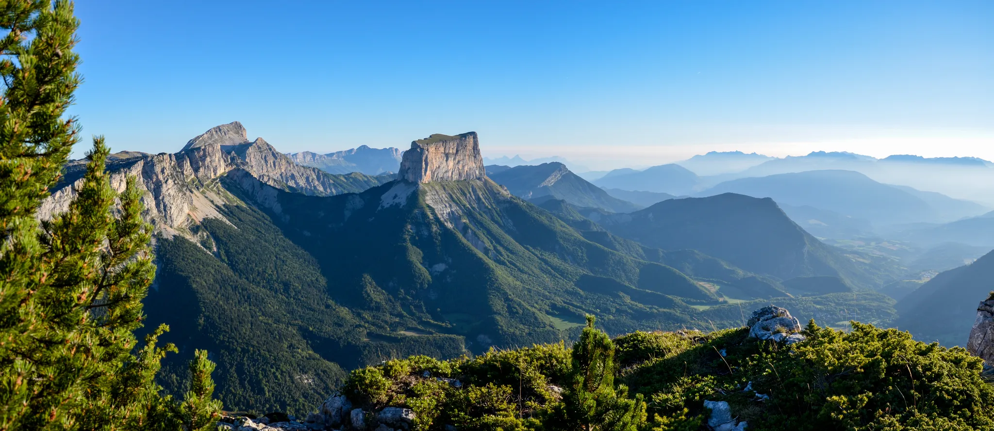
Easy hiking trails around Réserve naturelle des Hauts Plateaux du Vercors traverse a vast wilderness characterized by diverse terrain. This region features alpine pastures, dense forests, and imposing limestone cliffs, forming the highest and wildest part of the Vercors massif. The landscape is shaped by its limestone geology, including extensive mountain pine forests. It is a biodiversity hotspot where Alpine and Mediterranean species converge, offering a unique natural environment for hikers.
Best easy hiking trails around Réserve naturelle des Hauts…
Last updated: June 30, 2026
5.0
(2)
17
hikers
4.20km
01:26
230m
230m
Easy hike. Great for any fitness level. Easily-accessible paths. Suitable for all skill levels.
2
hikers
Easy hike. Great for any fitness level. Easily-accessible paths. Suitable for all skill levels.

Sign up for free
4.7
(3)
6
hikers
4.94km
01:25
120m
120m
Easy hike. Great for any fitness level. Easily-accessible paths. Suitable for all skill levels.
18
hikers
Easy hike. Great for any fitness level. Easily-accessible paths. Suitable for all skill levels.
7
hikers
3.93km
01:09
110m
110m
Easy hike. Great for any fitness level. Easily-accessible paths. Suitable for all skill levels.
Get access to more routes and recommendations from other explorers.
Sign up for free
Already have an account?
Our route recommendations are based on thousands of hikes, rides, and runs completed by other people on komoot.
Start today with a free account
Your next adventure awaits.
Login or Signup
Popular around Réserve naturelle des Hauts Plateaux du Vercors


Other adventures around Réserve naturelle des Hauts Plateaux du Vercors


Tips from the Community

Memorial of the resistance, always flowery
0
0
It is an iconic mountain of the Vercors. It is the cradle of mountaineering. This mountain was climbed using wooden ladders.
0
0
the waterfall doesn't seem to flow in summer
1
0

magnificent view. watch out for the water
1
0

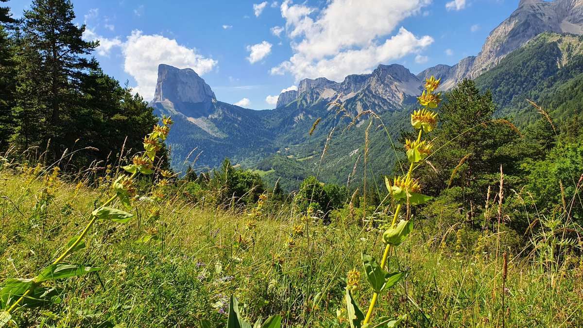
It's worth the effort to climb this spot for the views of Mont Aiguille.
0
0
Refuge near the Pas de l'Aiguille. From this refuge, you have unique views of Mont Aiguille.
0
0

Departure from hike at all from Mont Aiguille to be done on trail or on foot
0
0
Frequently Asked Questions
How many easy hiking trails are available in Réserve naturelle des Hauts Plateaux du Vercors?
There are over 180 easy hiking trails in the Réserve naturelle des Hauts Plateaux du Vercors, offering a wide range of options for exploring this unique natural area.
What is the best time of year for easy hikes in the Réserve naturelle des Hauts Plateaux du Vercors?
The best time for easy hikes is generally from late spring to early autumn (May to October). During these months, the alpine pastures are vibrant, and the weather is most favorable for exploring the diverse terrain. Winter offers opportunities for snowshoeing and cross-country skiing, but many hiking trails may be covered in snow.
Are there any family-friendly easy hikes in the Réserve naturelle des Hauts Plateaux du Vercors?
Yes, many easy trails are suitable for families. For example, the High valley – View of Mont Aiguille loop from Chichilianne is a shorter option at just under 4 km, offering beautiful views without excessive challenge. The reserve's varied landscapes, from forests to open pastures, provide engaging scenery for all ages.
Can I bring my dog on the easy hiking trails in the Réserve naturelle des Hauts Plateaux du Vercors?
The Réserve naturelle des Hauts Plateaux du Vercors is a protected area with specific regulations to preserve its biodiversity. Dogs are generally not permitted, even on a leash, to protect wildlife such as chamois, marmots, and ground-nesting birds. Always check local signage and official park guidelines before bringing a pet.
Are there circular easy hiking routes in the Réserve naturelle des Hauts Plateaux du Vercors?
Yes, many easy trails are designed as circular routes, allowing you to start and end at the same point. A popular option is the Views of Mont Aiguille – Pisse Waterfall loop from Mont Aiguille, which offers stunning vistas and a waterfall feature. Another is the View of Mont Aiguille loop from Chichilianne.
What kind of natural features can I expect to see on easy hikes?
Easy hikes in the Réserve naturelle des Hauts Plateaux du Vercors will take you through diverse landscapes including alpine pastures, dense forests, and dramatic limestone cliffs. You'll encounter a rich variety of flora, from alpine grasslands to wild tulips, and may spot wildlife like marmots or chamois. Notable natural landmarks include the impressive Grand Veymont and the Baume Rousse Spring.
What do other hikers enjoy most about the easy trails in Réserve naturelle des Hauts Plateaux du Vercors?
The easy trails in Réserve naturelle des Hauts Plateaux du Vercors are highly rated by the komoot community, with an average score of 4.6 stars. Hikers frequently praise the stunning, untouched wilderness, the dramatic limestone formations, and the chance to experience true tranquility away from roads and human presence.
Are there any specific landmarks or points of interest along the easy hiking trails?
Yes, even on easy trails, you can encounter significant points of interest. The region is known for its dramatic peaks like Grand Veymont and Pié Ferré (Le Dôme). You might also pass through historic pastoral landscapes or discover viewpoints like The Pas des Chattons, offering expansive vistas.
Where can I find parking for easy hiking trails in the Réserve naturelle des Hauts Plateaux du Vercors?
While the reserve itself has no roads, access points and parking are typically available at its periphery, often near villages like Chichilianne or Mont Aiguille. These serve as starting points for trails leading into the reserve. It's advisable to check specific trailheads for designated parking areas.
Is public transport available to reach the easy hiking trails?
Public transport options directly into the heart of the Réserve naturelle des Hauts Plateaux du Vercors are limited, as the reserve is intentionally kept free of roads. Access points are usually reached by car. Some regional bus services may connect to nearby villages, from which you would need to walk or arrange further transport to trailheads.
Do I need a permit to hike the easy trails in the Réserve naturelle des Hauts Plateaux du Vercors?
Generally, no specific permit is required for day hiking on marked trails within the Réserve naturelle des Hauts Plateaux du Vercors. However, as it is a protected area, certain activities like bivouacking or specific research may require authorization. Always respect the regulations and signage of the nature reserve.
What is the typical duration for an easy hike in this region?
Easy hikes in the Réserve naturelle des Hauts Plateaux du Vercors typically range from 1.5 to 3 hours. For instance, the Views of Mont Aiguille – Pisse Waterfall loop from Mont Aiguille can be completed in about 1 hour 26 minutes, while the View of Mont Aiguille – Memorial of Pas de l'Aiguille loop from Chichilianne takes around 1 hour 58 minutes.
Most popular routes around Réserve naturelle des Hauts Plateaux du Vercors
Most popular attractions around Réserve naturelle des Hauts Plateaux du Vercors

Get inspired with the komoot mobile app


Explore more
Browse the best Hikes in other regions.
