Easy hikes and walks around Baesweiler
4.4
(10665)
43,224
hikers
73
hikes
Easy hiking trails around Baesweiler traverse a landscape shaped by both natural features and industrial heritage. The region is situated near the Hohes Venn-Eifel Nature Park, offering access to varied terrain. Key features include the CarlAlexanderPark, a redeveloped former coal mine site with transformed coal deposits (Halde) and viewpoints. Disused quarries have also been repurposed into natural areas, providing additional walking opportunities.
Best easy hiking trails around Baesweiler
- The most popular easy hiking route is Halden Circular Hiking Trail – Bergfoyer CarlAlexanderPark loop from Baesweiler, a 3.8 miles (6.2 km) trail that takes 1 hour 40 minutes to complete. This route explores the redeveloped CarlAlexanderPark, combining natural paths with industrial heritage and offering panoramic views from the Halde.
- Another top favourite among local hikers is Historic Orchard Eifel – Station Flowerich loop from Floverich, an easy 4.0 miles (6.4 km) path. This trail leads through historic orchards and the Eifel region, characterized by gentle gradients and open landscapes.
- Local hikers also love the Kapellchen Chapel, Baesweiler – Heggeströfer Railway Memorial loop from Baesweiler, a 4.7 miles (7.6 km) trail leading through local countryside, often completed in about 1 hour 58 minutes. This route connects cultural landmarks with rural paths.
- Hiking around Baesweiler is defined by transformed industrial landscapes like CarlAlexanderPark, former quarries, and the Wurmtalweg. The network offers options for easy hiking trails suitable for various fitness levels.
- The routes in Baesweiler are highly rated by the komoot community with an average score of 4.5 stars from over 170 reviews. More than 1,300 hikers have used komoot to explore Baesweiler's varied terrain.
Last updated: October 3, 2026
4.6
(37)
186
hikers
Easy hike. Great for any fitness level. Easily-accessible paths. Suitable for all skill levels.
4.3
(3)
15
hikers
6.41km
01:38
20m
20m
Easy hike. Great for any fitness level. Easily-accessible paths. Suitable for all skill levels.

4.9
(9)
26
hikers
Easy hike. Great for any fitness level. Easily-accessible paths. Suitable for all skill levels.
5.0
(3)
16
hikers
Easy hike. Great for any fitness level. Easily-accessible paths. Suitable for all skill levels.
4.6
(8)
76
hikers
Easy hike. Great for any fitness level. Easily-accessible paths. Suitable for all skill levels.
Get access to more routes and recommendations from other explorers.
Already have an account?
Our route recommendations are based on thousands of hikes, rides, and runs completed by other people on komoot.
Start today with a free account
Your next adventure awaits.

Tips from the Community

De Grube Carl-Alexander was een voormalig steenkolenbergwerk in Baesweiler gelegen in het Aachener Steinkohlenrevier in Noord-Rijn-Westfalen Duitsland. Deze mijn maakt deel uit van de geschiedenis van de zware industrie in de Euregio Maas-Rijn en heeft van het begin van de 20ste eeuw tot halverwege de jaren 70 grote invloed gehad op de economie en het sociale leven van de omgeving. De geschiedenis van Carl-Alexander begint rond 1908 toen de Röchling’sche Eisen und Stahlwerke AG uit Völklingen (Duitsland) en de Société des Aciéries de Longwy uit Frankrijk samen het recht op steenkoolwinning verworven in een gebied van ongeveer 36 km² ten noorden van Alsdorf. De naam Carl-Alexander verwijst naar de voornamen van de twee directeuren van deze staalbedrijven: Carl (Röchling) en Alexander (Dreux) In 1908 begon men met de aanleg van de mijnschachten maar de werken werden vertraagd door geologische uitdagingen zoals zwakke grondlagen en door de Eerste Wereldoorlog. Pas in 1919 en 1921 waren de schachten afgediept en gereed voor de winning waarna de commerciële kolenproductie in 1921 echt van start ging. Voor de aansluiting op het spoorwegnet en het faciliteren van het vervoer van kolen werd in 1925 een spoorverbinding aangelegd. Tot die tijd gebeurde het vervoer vaak nog met gewone wagens wat de logistiek bemoeilijkte. In de jaren dertig en veertig groeide de mijn snel en rond 1938 bereikte Carl-Alexander een jaarlijkse productie van ongeveer 920.000 ton steenkool met een personeelsbestand van circa 2.000 medewerkers. Tijdens de Tweede Wereldoorlog bleef de productie doorgaan ook al werkte men onder moeilijke omstandigheden en met gedwongen inzet van buitenlandse arbeidskrachten. Na de oorlog werden de installaties gemoderniseerd wat leidde tot verdere verhoging van de productie. In de jaren 60 werd zelfs de grens van meer dan 1 miljoen ton kolen per jaar overschreden. Door afnemende vraag naar steenkool en economische druk eind jaren 60 kwam de continuïteit van de mijn onder druk te staan. In 1965 werd de exploitatie overgenomen door de Eschweiler Bergwerks-Verein (EBV) om de goede werking te behouden en werkgelegenheid veilig te stellen. Desondanks werden delen van de installatie zoals de kokerei stopgezet en sloopte men onderdelen vanwege kostenbesparing. Een belangrijke stap richting het einde was de aanleg van een verbinding met de nabijgelegen mijn Emil-Mayrisch in Siersdorf waardoor de nog aanwezige kolen op het Carl-Alexander-veld via de andere mijn konden worden gewonnen. Ondanks deze maatregelen werd de kolenwinning op Carl-Alexander op 30 september 1975 definitief beëindigd. De laatste kolen uit het gebied van Carl-Alexander werden vervolgens nog tot 1992 via de Emil-Mayrisch-schachten gewonnen waarna ook die mijn sloot en de actieve steenkoolwinning in de regio geheel stopte. De mijn was in zijn tijd niet alleen een bron van energie maar ook van werkgelegenheid en woon en leefstructuur. Gedurende de decennia zijn rondom de installatie verschillende arbeiderskolonies gebouwd om de werknemers en hun gezinnen te huisvesten. Deze koloniën droegen bij aan de groei en ontwikkeling van Baesweiler van een klein agrarisch dorp tot een sterk gemoderniseerde gemeente. Na de sluiting in 1975 werden de meeste bovengrondse installaties en gebouwen van de mijn afgebroken. Wat bewaard bleef was hoofdzakelijk de grote Bergehalde een kunstmatig opgeworpen heuvel van 80 meter hoogte gevormd door mijnsteen en ander restmateriaal en een van de oude werkhallen die later door een particulier bedrijf werd hergebruikt. Jarenlang bleef de heide-achtige mijn-halde braak liggen totdat vanaf 2002 plannen werden ontwikkeld om het terrein te herbestemmen als recreatief en ecologisch park. De stad Baesweiler organiseerde een landschapsarchitectonische competitie waaruit een concept ontstond om de halde en het omliggende terrein toegankelijk te maken voor publiek met behoud van natuur en waarden van de post-industriële landschapsstructuur. In het kader van de EuRegionale 2008 een regionaal samenwerkingsproject voor ruimtelijke ontwikkeling in de grensstreek werd het voormalige mijnterrein en de halde getransformeerd tot het CarlAlexanderPark een groots recreatie en natuurgebied met wandelpaden uitzichtpunten en belevingsroutes. De ontwikkeling van het park omvatte onder meer de aanleg van een Haldenrundweg (rondweg rond de halde) een Landschaftsader (groene verbindingszone) het Bergfoyer als startpunt en informatiepunt de Schwebesteg (hangbrug) en de Himmelsstiege (trap naar het panorama-plateau). Het park opende officieel in mei 2008 en werd later beloond met de Duitse Landschapsarchitectuurprijs. Tegenwoordig is de halde rijk begroeid met bomen en planten en is een groot deel aangemerkt als natuurgebied en bieden de paden en uitkijkpunten rust recreatie en panoramische vergezichten over de Euregio Maas-Rijn. Het park ligt open en vrij toegankelijk voor bezoekers en verbindt op aantrekkelijke wijze industriegeschiedenis natuurbeleving en vrijetijdsbesteding.
0
0
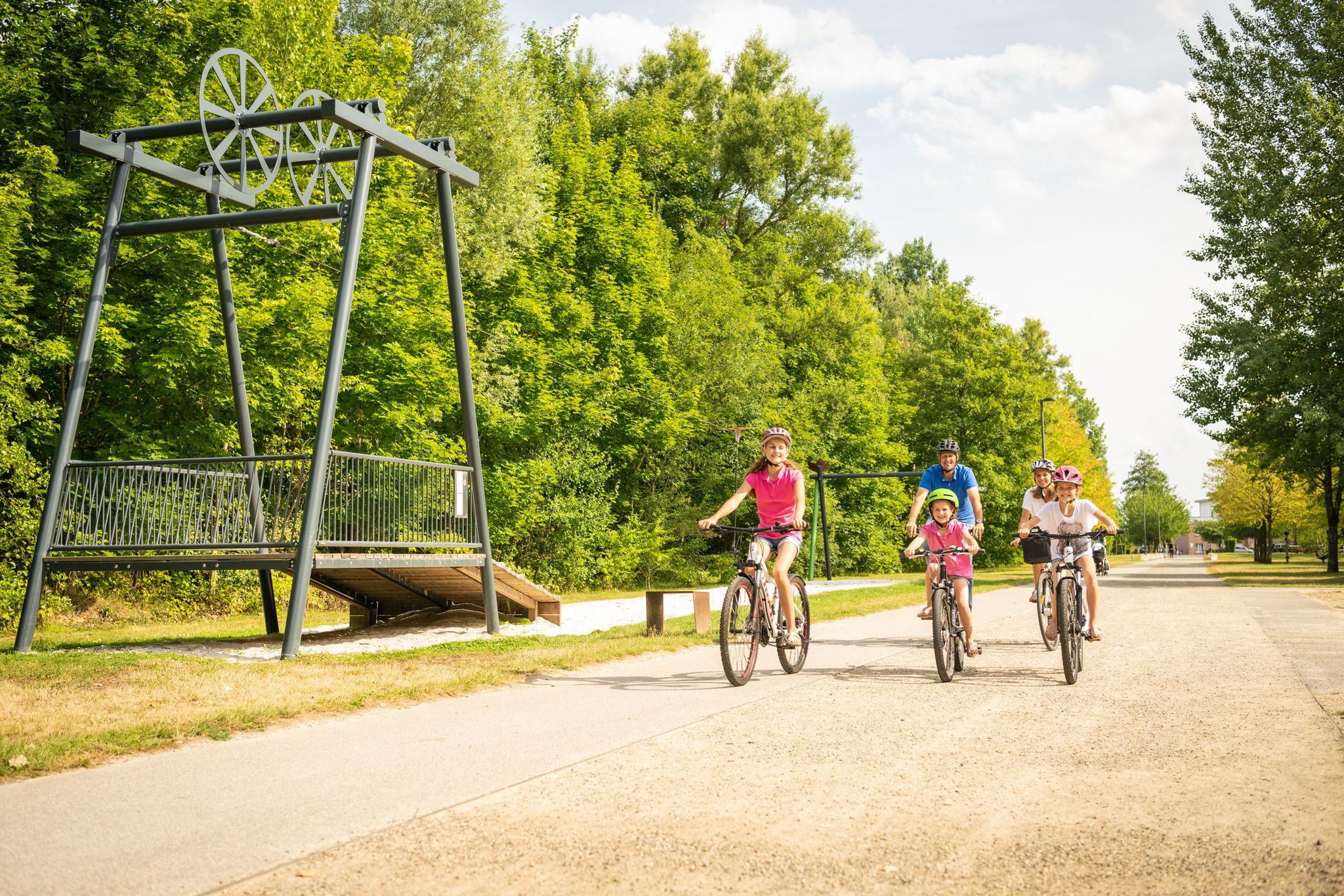
🌉 Schwebesteg – the Suspension Bridge in Carl-Alexander Park The Schwebesteg is one of the most characteristic features of the hiking trail in Carl-Alexander Park near Baesweiler, Germany. The name Schwebesteg means "suspended" or "floating" pedestrian bridge, and that's precisely what you'll find here: a bridge that forms a path above ground level through the trees and forms part of the ascent to the viewing platform on the Bergehalde Carl-Alexander. The Schwebesteg is a suspension bridge, approximately 25 meters long, that begins shortly after leaving the Bergfoyer and then transitions into the Himmelsstiege and the stairs leading to the summit plateau of the large slag heap. The bridge allows you to walk above the forest and the slope halfway up the ascent, creating an experience that is visually and physically different from a regular hiking trail.
0
0
🏞️ Carl-AlexanderPark – landscape history and transformation. Carl-AlexanderPark is located on the site of the former Grube Carl Alexander coal mine in Baesweiler, North Rhine-Westphalia, Germany. The mine began extracting coal in 1921 and ceased operations in 1975, with the last mine in the area closing in 1992. The remaining structures, particularly the high bergehalde (mine stone deposits), still dominate the landscape. Between 2002 and 2008, the area was redeveloped as a public park with a landscape architectural design that combines nature, recreation, heritage, and viewpoints. This project was part of the EuRegionale 2008 and has also won regional architecture awards. The park is open and free to enter, combining nature experiences with reminders of the region's industrial history. The route to the top is a hike suitable for most hikers in terms of length and difficulty, yet still offers a sense of adventure. You begin at the striking Bergfoyer (the park's central information and starting point) and walk across a suspension bridge between the treetops, then enter the Himmelsstiege, which takes you over 80 meters of elevation to the viewing platform. The path runs partially above ground through the trees, providing a rewarding climb over the surrounding landscape. The steps are steep but manageable, and there are places along the way to rest and take in the scenery. Once you reach the top, a spectacular panorama of the surrounding Meuse-Rhine Euregio unfolds. On clear days, the view extends across fields, forests, and villages to the horizon. This view emphasizes the contrast between the region's industrial past and its reclaimed natural value as a recreational and natural environment. The plateau is a popular spot for photography, tranquility, and experiencing the spatial scale of the landscape. The climb and the view make the Himmelsstiege one of the biggest attractions of CarlAlexanderPark for hikers and nature lovers.
0
0
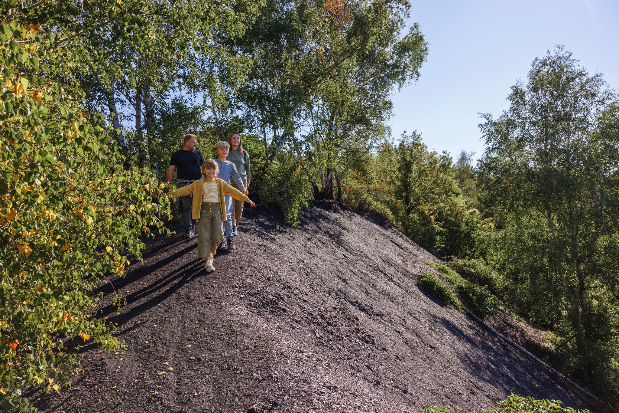
CarlAlexanderPark is a large recreation and out-of-the-way area in the German town of Baesweiler (North Rhine-Westphalia), near the border with the Netherlands. It is best known for its landscape park, which was created on the site of a former coal mine, and its Bergfoyer (Bergfoyer) as a central starting point for visitors. CarlAlexanderPark is a redeveloped former mining site (Grube Carl Alexander) that now serves as a large-scale nature walking and recreation area. The old coal deposits (heaps/halde) have been transformed into a park with hiking trails, viewpoints, and recreational facilities. The park has several paths and a steep route to an 80-meter-high mountain plateau with views over the Meuse-Rhine Euregion. The halde and surrounding areas have been restored as a nature reserve with unique flora and fauna, and information signs along the path. There are also playgrounds, open spaces, and a youth campsite in the Bergpark at the foot of the halde.
0
0

Baesweiler is a very beautiful town
0
1

Great starting point
0
1

The Baesweiler Chapel, also known as the Sebastianus Chapel, is a charming little chapel in Baesweiler, North Rhine-Westphalia, Germany. It was built between 1880 and 1890 on the site of an older medieval chapel that gave the area its name (Bastwilre/Sebastianusweiler). The chapel is owned by the EBV (Eschweiler Bergwerks-Verein) and is a beautiful place for quiet reflection and historical research.
1
0

Because it is beautiful here and there are many things to discover, especially for children!
1
0
Frequently Asked Questions
How many easy hiking trails are available around Baesweiler?
Baesweiler offers a wide selection of easy hiking trails, with over 50 routes specifically categorized as easy. In total, there are more than 70 hiking routes in the area, catering to various preferences.
What kind of terrain can I expect on easy hikes in Baesweiler?
Easy hikes in Baesweiler feature a diverse landscape, blending natural areas with transformed industrial heritage. You'll find paths through redeveloped former coal mine sites like CarlAlexanderPark, gentle routes through historic orchards, and trails alongside former quarries that have become natural areas. The terrain is generally mild, suitable for relaxed walks.
Are there any easy circular walks in Baesweiler?
Yes, many easy trails in Baesweiler are circular, allowing you to start and end at the same point. For example, the Zeche Carl-Alexander – Carl Alexander Park Playground loop from Baesweiler is an easy 4.7 km circular route within the CarlAlexanderPark, offering a great way to explore the area's unique landscape.
Are the easy hiking trails in Baesweiler suitable for families with children?
Absolutely. The easy hiking trails around Baesweiler are generally well-suited for families. Routes within areas like CarlAlexanderPark often feature accessible paths and points of interest like the Carl-Alexander Park itself, which includes recreational facilities. The gentle gradients and manageable distances make them ideal for children.
Can I bring my dog on these easy hikes?
Most easy hiking trails in Baesweiler are dog-friendly, allowing you to enjoy the outdoors with your canine companion. It's always recommended to keep your dog on a leash, especially in nature reserve areas or near wildlife, and to carry waste bags. Always check local signage for specific restrictions.
Are there trails with good viewpoints in Baesweiler?
Yes, the region offers several viewpoints, particularly within the CarlAlexanderPark. The transformed coal deposits (Halde) feature a steep route leading to the Himmelsstiege, an 80-meter-high mountain plateau. From here, you can enjoy spectacular panoramic views over the Meuse-Rhine Euregion on clear days.
What interesting landmarks or attractions can I see along the easy hiking trails?
Many easy trails in Baesweiler pass by or lead to interesting landmarks. The Carl-Alexander Park itself is a major attraction, showcasing the region's industrial heritage transformed into nature. You might also encounter historical sites like the Trips Castle or the Wilhelmstein Castle, which are part of the broader regional landscape.
How long do the easy hikes in Baesweiler typically take?
The duration of easy hikes varies depending on the route and your pace. For instance, the Kapellchen Chapel, Baesweiler – Baesweiler Countryside Loop is a shorter 3 km trail that can be completed in under an hour, while others like the Zeche Carl-Alexander – Carl Alexander Park Playground loop (4.7 km) might take around 1.5 hours.
Is there public transport access to the trailheads in Baesweiler?
Baesweiler has local bus connections that can provide access to various parts of the town and surrounding areas. While some trailheads, especially those within town limits or near major parks like CarlAlexanderPark, might be reachable by public transport, it's advisable to check local bus schedules and routes for specific starting points.
Where can I park for easy hikes in Baesweiler?
Parking is generally available at key access points for popular hiking areas. For example, CarlAlexanderPark, a central hub for many easy trails, offers designated parking facilities, including at the Bergefoyer. For other routes, street parking in nearby villages or specific trail parking areas may be available.
What is the best time of year for easy hiking in Baesweiler?
Baesweiler's easy hiking trails can be enjoyed year-round. Spring brings blooming orchards and fresh greenery, while autumn offers vibrant fall colors, especially in wooded areas and around the former quarries. Summer is pleasant for longer walks, and even mild winter days can be beautiful for a crisp hike, particularly on well-maintained paths.
What do other hikers enjoy most about hiking in Baesweiler?
The hiking routes in Baesweiler are highly rated by the komoot community, with an average score of 4.5 stars from over 170 reviews. Hikers often praise the unique blend of industrial heritage and natural beauty, particularly the transformation of former mining sites into recreational areas, and the well-maintained, accessible paths suitable for all levels.
Most popular routes around Baesweiler
Most popular attractions around Baesweiler

Get inspired with the komoot mobile app


Explore more
Browse the best Hikes in other regions.
