Easy hikes and walks in Sic Altopiano Dei Sette Comuni
4.4
(16568)
83,131
hikers
158
hikes
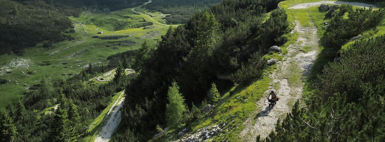
Hiking in Sic Altopiano Dei Sette Comuni offers a network of easy hiking trails across a high-altitude plateau. The region is characterized by expansive alpine meadows, dense conifer forests, and gentle hills, providing varied terrain suitable for relaxed walks. These trails often feature panoramic views of the surrounding mountains and valleys. The landscape is shaped by its geological history, resulting in a mix of open spaces and sheltered woodland paths.
Best easy hiking trails in Sic Altopiano Dei Sette Comuni
…Last updated: July 7, 2026
4.6
(92)
436
hikers
6.38km
01:49
140m
140m
Easy hike. Great for any fitness level. Easily-accessible paths. Suitable for all skill levels.
3.9
(8)
113
hikers
7.16km
01:56
90m
90m
Easy hike. Great for any fitness level. Easily-accessible paths. Suitable for all skill levels.

Sign up for free
4.6
(12)
109
hikers
5.55km
01:37
160m
160m
Easy hike. Great for any fitness level. Easily-accessible paths. Suitable for all skill levels.
3.0
(4)
20
hikers
5.16km
01:23
60m
60m
Easy hike. Great for any fitness level. Easily-accessible paths. Suitable for all skill levels.
4.7
(3)
18
hikers
6.98km
01:58
150m
150m
Easy hike. Great for any fitness level. Easily-accessible paths. Suitable for all skill levels.
Get access to more routes and recommendations from other explorers.
Sign up for free
Already have an account?
Our route recommendations are based on thousands of hikes, rides, and runs completed by other people on komoot.
Start today with a free account
Your next adventure awaits.
Login or Signup
Popular around Sic Altopiano Dei Sette Comuni
Other adventures in Sic Altopiano Dei Sette Comuni

Tips from the Community

The road that runs along the ridge of Monte Costesin in a fairly flat way
0
0
Beautiful mountain hut, used for summer pasture. It is located in a huge grassy basin surrounded by a fir forest
0
0
Small alpine pasture in the green. From here the road to Mount Verena and Verena mountain hut starts. At Croce del Civello there is a crossroads with other hiking possibilities to Casara Gruppach and Mount Erio
0
0
Former mountain hut transformed into accommodation in a grassy hollow. In winter, an important cross-country ski center with well-maintained trails
0
0
The beautiful trail for a scenic hike on cima Manderiolo
0
0


Route taken on the afternoon of September 1st
0
0

Possibility of refreshments and purchase of mountain cheeses.
0
0
Frequently Asked Questions
How many easy hiking trails are available in Sic Altopiano Dei Sette Comuni?
Sic Altopiano Dei Sette Comuni offers a good selection of easy hiking trails, with 19 routes specifically categorized as easy. In total, the region features over 150 hiking routes across various difficulty levels.
Are there circular easy walks in Sic Altopiano Dei Sette Comuni?
Yes, many easy trails in the region are circular. For example, the Porta Manazzo – Val Formica Mountain Hut loop from Rifugio Larici is a popular 6.4 km circular route. Another option is the Val Formica Mountain Hut – Porta Manazzo loop from Rifugio Val Formica, which is 5.7 km.
What is the typical distance and duration for easy hikes in the area?
Easy hikes in Sic Altopiano Dei Sette Comuni typically range from 4 to 7 kilometers. Most can be completed within 1.5 to 2.5 hours. For instance, the Campolongo Hut loop from Casara di Campovecchio is 7.2 km and takes about 1 hour 55 minutes.
Are the easy hiking trails suitable for families with children?
Yes, the easy hiking trails in Sic Altopiano Dei Sette Comuni are generally very family-friendly, featuring gentle hills and well-maintained paths. The region's focus on accessible routes makes it ideal for walks with children.
Are dogs allowed on the easy hiking trails?
Most trails in Sic Altopiano Dei Sette Comuni are dog-friendly, but it's always recommended to keep dogs on a leash, especially in areas with livestock or protected wildlife. Check specific trail regulations if you plan to visit a nature reserve.
What kind of natural attractions can I expect to see on easy hikes?
The easy hikes often lead through expansive alpine meadows and dense conifer forests. You might also encounter geological formations like the Castelloni of San Marco, a natural monument, or enjoy views from points like View of Vallone Secco.
Are there any mountain huts or cafes along the easy routes for refreshments?
Yes, several easy routes pass by mountain huts (rifugi) where you can often find refreshments. For example, the Porta Manazzo – Val Formica Mountain Hut loop and the Campolongo Hut loop from Forte Campolongo both offer opportunities for a break at a hut.
What is the best time of year for easy hiking in Sic Altopiano Dei Sette Comuni?
The best time for easy hiking is typically from late spring to early autumn (May to October), when the weather is mild, and the trails are clear of snow. Summer offers lush meadows and comfortable temperatures, while autumn brings vibrant foliage.
Are there viewpoints or panoramic spots on the easy trails?
Many easy trails offer panoramic views of the surrounding mountains and valleys due to the plateau's elevated position. While specific viewpoints vary, the open alpine meadows frequently provide wide vistas. You can also find specific viewpoints like View of Vallone Secco.
Where can I find parking for easy trailheads?
Parking is generally available at the starting points of many popular trails. For routes like the Campolongo Hut loop from Casara di Campovecchio, you'll find parking near the casara or designated trailheads. Mountain huts often have parking facilities as well.
What do other hikers say about the easy trails in Sic Altopiano Dei Sette Comuni?
The easy trails in Sic Altopiano Dei Sette Comuni are highly rated by the komoot community, with an average score of 4.5 stars from over 2,600 reviews. Hikers often praise the well-maintained paths, the serene alpine scenery, and the accessibility of the routes for all skill levels.
Can I hike in Sic Altopiano Dei Sette Comuni during winter?
While some trails may be accessible, many areas of the Altopiano dei Sette Comuni experience significant snowfall in winter. Easy hiking might be limited to specific, cleared paths or require snowshoes. Always check local conditions and trail accessibility before heading out in winter.
Most popular routes in Sic Altopiano Dei Sette Comuni
Most popular attractions in Sic Altopiano Dei Sette Comuni

Get inspired with the komoot mobile app


Explore more
Browse the best Hikes in other regions.
