Easy hikes and walks in Boundary Waters Canoe Area Wilderness
5.0
(9)
134
hikers
23
hikes
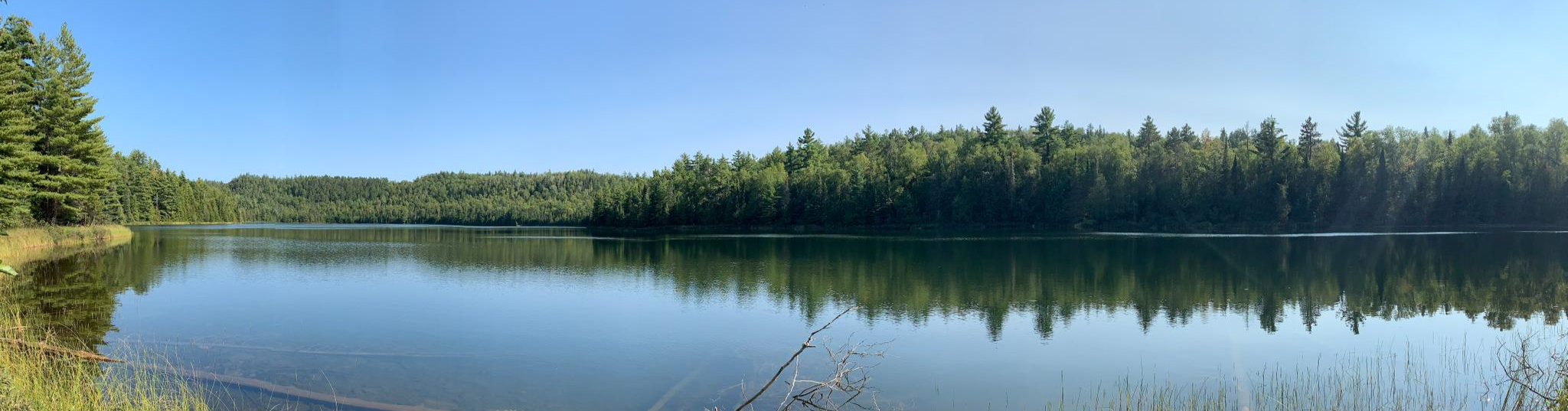
Easy hiking trails in Boundary Waters Canoe Area Wilderness traverse a glacially-carved landscape characterized by rugged cliffs, rocky shores, and thousands of lakes. Dense boreal forests cover the region, contributing to its primitive wilderness character. Hikers will encounter varied terrain, from gentle paths around lakes to areas with moderate elevation changes. The area is also recognized for its clean waters and naturally quiet environment.
Best easy hiking trails in Boundary Waters Canoe Area Wilderness
- The most popular easy hiking route is Blackstone Lake – Secret Lake loop from Secret Blackstone Trailhead, a 3.2 miles (5.1 km) trail that takes 1 hour 21 minutes to complete. This loop offers a walk through forested areas around pristine lakes.
- Another top favourite among local hikers is Magnetic Rock Trail, an easy 3.0 miles (4.9 km) path. This route leads to a notable geological feature, the Magnetic Rock, within a forested setting.
- Local hikers also love the Kawishiwi Falls Trail, a 0.8 miles (1.3 km) trail leading through forested areas to the Kawishiwi Falls, often completed in about 20 minutes.
- Hiking in Boundary Waters Canoe Area Wilderness is defined by glacially-carved terrain, extensive lake systems, and dense boreal forests. The network offers options for various ability levels, including many easy trails suitable for families.
- The routes in Boundary Waters Canoe Area Wilderness are highly rated by the komoot community with an average score of 5.0 stars from more than 8 reviews. More than 120 hikers have used komoot to explore Boundary Waters Canoe Area Wilderness's varied terrain.
Last updated: August 17, 2026
1
hikers
3.39km
00:54
30m
30m
The Blackstone Lake Loop offers a delightful, easy hike through the varied landscapes of Superior National Forest. You'll wander past the serene waters of Blackstone Lake and Secret Lake, with views from 30 to 80 feet above the water, and experience a mix of cedar groves and pine-covered ridges. Despite its easy rating, the 2.1-mile (3.4 km) path, with its 106 feet (32 metres) of elevation gain, is often rocky and rugged underfoot, so be ready to watch your step and enjoy the diverse flora, including many wildflowers.
This roughly 53-minute hike is an excellent way to quickly immerse yourself in the wilderness near Ely, Minnesota. Sturdy footwear is a must due to the uneven terrain, which features numerous tree roots and stones. The trail is part of a larger system, providing options if you decide to explore further, but this loop itself is a straightforward and rewarding experience.
The area is rich in natural history, showcasing the forest's regeneration after the 1999 Blowdown event. Keep an eye out for local wildlife like beavers and various bird species, making it a great spot for wildlife spotting. The geological formation of these glacial lakes, with Blackstone Lake's winding shoreline, adds another layer of interest to your journey.
10
hikers
Easy hike. Great for any fitness level. Easily-accessible paths. Suitable for all skill levels.

Sign up for free
850m
00:13
10m
0m
Hike the easy 0.5-mile Chik-wauk Blueberry Hill via Gneiss Trail in Superior National Forest for panoramic views and seasonal blueberry pick
1
hikers
7.12km
01:55
80m
100m
The Bridal Veil Falls via Crab Lake Spur trail offers a delightful journey through varied terrain, starting with easy, grassy paths alongside Crab Lake before transitioning to more rugged sections with rocks and roots. You'll encounter vibrant wildflowers, moss, and ferns, all leading to the stunning Bridal Falls, a true hidden gem. This 4.4-mile (7.1 km) hike, with only 267 feet (81 metres) of elevation gain, is rated easy and takes about 1 hour and 54 minutes, making it a great option for a rewarding outing without extreme effort.
Before you head out, remember that a Boundary Waters Canoe Area (BWCA) day permit is necessary for this route, as part of it enters the wilderness area. Parking is available at the trailhead, but it's always wise to arrive early during peak times. Spring runoff offers the most spectacular views of Bridal Falls, which can span up to 100 yards wide, but be prepared for potentially muddy conditions after rain.
This trail provides a unique glimpse into forest regeneration, showcasing areas affected by the 2007 Ham Lake Fire and a 1999 blowdown, with blackened tree trunks and vibrant purple fireweed. The connection to the Border Route Trail (BRT) also offers a taste of a renowned wilderness experience, known for its rugged beauty and potential for wildlife sightings like moose or black bears.
1.25km
00:24
80m
0m
The High Cliffs Overlook trail offers an easy hike through Superior National Forest, leading you to spectacular panoramic views. You will gain 257 feet (78 metres) in elevation over just 0.8 miles (1.3 km), making it a quick 23-minute journey. From the dramatic cliffs, you can enjoy expansive vistas, often looking out over large bodies of water like Gunflint Lake. This route provides unique perspectives of the geological features and surrounding forested hills, perfect for a short outdoor escape.
Before you head out, it is always a good idea to check local conditions for the High Cliffs Overlook. Confirm details like parking availability and any specific access information for the trailhead. Knowing your limits and taking your time on any trail is always recommended for a safe and enjoyable experience. Plan your visit by checking current weather and trail status.
This route is renowned for its panoramic vistas, showcasing the natural beauty of the Superior National Forest. You will experience the unique geological features of the area as you hike along or to the top of the dramatic cliffs. The trail's elevated positions offer broad views, making it a notable spot for appreciating the region's landscape.
Get access to more routes and recommendations from other explorers.
Sign up for free
Already have an account?
Our route recommendations are based on thousands of hikes, rides, and runs completed by other people on komoot.
Start today with a free account
Your next adventure awaits.
Login or Signup
Popular around Boundary Waters Canoe Area Wilderness
Other adventures in Boundary Waters Canoe Area Wilderness

Tips from the Community

Crab Lake can be accessed from BWCAW Access Point #4, just off of County Road 404. The lake is popular for canoeing, and is an easy portage from the trailhead. There is a campsite along the Crab Lake Spur Trail that has shoreline pitches.
0
0
Bridal Falls is one of the tallest waterfalls in all of the BWCAW. The falls can be found on the Border Route Trail (BRT), and the easiest way to reach the falls is by taking the Crab Lake Spur Trail to the BRT. The falls are named after their similar appearance to a bridal veil, especially when the water is quite high.
0
0
Secret Lake is aptly named because if you were to just do the loop of Blackstone Trail then you may miss out on the lake entirely. It is situated in between Blackstone and Ennis Lake, and is a quite spot to stop and enjoy your surroundings.
0
0
The first lake you will come to on the Blackstone Trail, this is the second biggest lake in the trail system.
0
0
Frequently Asked Questions
How many easy hiking trails are there in Boundary Waters Canoe Area Wilderness?
There are over 10 easy hiking trails available in the Boundary Waters Canoe Area Wilderness, offering a variety of experiences for different preferences.
What kind of terrain can I expect on easy hikes in Boundary Waters Canoe Area Wilderness?
Easy hikes in the Boundary Waters Canoe Area Wilderness traverse a glacially-carved landscape, featuring rugged cliffs, rocky shores, and dense boreal forests. While generally easy, you may encounter varied terrain with some gentle elevation changes, particularly around the thousands of lakes and streams.
What makes the Boundary Waters Canoe Area Wilderness unique for easy hiking?
The region is unique for its pristine, glacially-carved landscape, extensive network of clean lakes, and dense boreal forests. It's also recognized as a Dark Sky Sanctuary, offering exceptional stargazing, and is one of the few remaining 'naturally quiet' areas, providing a profound sense of solitude.
Are there family-friendly easy hikes in Boundary Waters Canoe Area Wilderness?
Yes, many easy trails in the Boundary Waters Canoe Area Wilderness are suitable for families. For example, the Chik-wauk Blueberry Hill via Gneiss Trail is a short and accessible option, and the Kawishiwi Falls Trail is a very short walk to a scenic waterfall, perfect for all ages.
Are easy hiking trails in Boundary Waters Canoe Area Wilderness dog-friendly?
Generally, dogs are permitted on trails within the Boundary Waters Canoe Area Wilderness, but they must be kept on a leash. Always check specific trail regulations or permit requirements before heading out with your dog.
Is parking available at easy trailheads in Boundary Waters Canoe Area Wilderness?
Parking is typically available at designated trailheads for easy access to the trails. However, given the wilderness nature of the area, facilities can be basic. It's advisable to arrive early, especially during peak seasons, to secure a spot.
Do I need a permit for easy day hikes in Boundary Waters Canoe Area Wilderness?
Yes, permits are required for all visitors entering the Boundary Waters Canoe Area Wilderness, including day hikers. These permits help manage visitor numbers and preserve the wilderness. It's essential to obtain your permit in advance through the official channels.
What natural features or landmarks can I see on easy hikes in Boundary Waters Canoe Area Wilderness?
Easy hikes can lead you to various natural features. You might encounter pristine lakes like Rose Lake or Pine Lake, or unique geological formations such as the Magnetic Rock on the Magnetic Rock Trail. The region's glacially-carved landscape itself is a significant feature.
Are there any waterfalls on easy hiking trails in Boundary Waters Canoe Area Wilderness?
Yes, the Kawishiwi Falls Trail is an easy, short hike that leads directly to the scenic Kawishiwi Falls, offering a beautiful natural spectacle.
Are there easy loop trails in Boundary Waters Canoe Area Wilderness?
Yes, there are several easy loop trails. A popular option is the Blackstone Lake Loop, which offers a pleasant walk through forested areas around pristine lakes.
What do other hikers enjoy most about easy hiking in Boundary Waters Canoe Area Wilderness?
The area is highly rated by the komoot community, with an average score of 5.0 stars. Reviewers often praise the profound sense of solitude, the stunning natural beauty of the lakes and forests, and the opportunity to experience a truly quiet wilderness environment.
What are some shorter easy hikes suitable for a quick outing?
For a quick outing, the Kawishiwi Falls Trail is a very short 0.8-mile (1.3 km) path. Another short option is the Chik-wauk Blueberry Hill via Gneiss Trail, which is less than a mile long.
Most popular routes in Boundary Waters Canoe Area Wilderness
Most popular attractions in Boundary Waters Canoe Area Wilderness

Get inspired with the komoot mobile app


Explore more
Browse the best Hikes in other regions.
