The best walks and hikes in Boundary Waters Canoe Area Wilderness
5.0
(9)
141
hikers
22
hikes
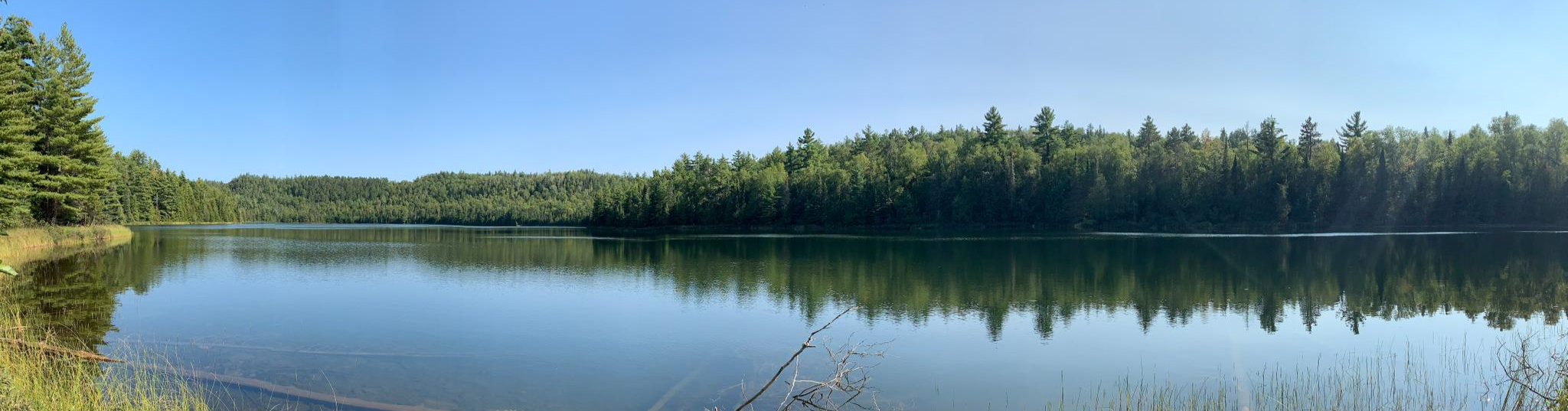
Hiking in Boundary Waters Canoe Area Wilderness is defined by a glacially-carved landscape, featuring rugged cliffs, rocky shores, and an extensive network of over 1,100 lakes and streams. The region is characterized by dense boreal forests and significant elevation changes, including Minnesota's highest point, Eagle Mountain. These physical features contribute to diverse and challenging hiking terrains throughout the wilderness.
Best hiking trails in Boundary Waters Canoe Area Wilderness
- The most popular hiking route is Eagle Mountain via Eagle Mountain Trail…
Last updated: October 10, 2026
2
hikers
3.39km
00:54
30m
30m
The Blackstone Lake Loop offers a delightful, easy hike through the varied landscapes of Superior National Forest. You'll wander past the serene waters of Blackstone Lake and Secret Lake, with…
25.4km
07:05
360m
360m
The Brule Lake and Eagle Mountain Trail offers a rugged and immersive hiking experience deep within the Boundary Waters Canoe Area Wilderness. You'll navigate a challenging 15.8-mile (25.4 km) route,…

8.69km
02:13
20m
20m
Hike the moderate 5.4-mile Powwow Trail in Minnesota's Boundary Waters Canoe Area Wilderness, exploring a regenerating post-wildfire landsca
10
hikers
Easy hike. Great for any fitness level. Easily-accessible paths. Suitable for all skill levels.
850m
00:13
10m
0m
Hike the easy 0.5-mile Chik-wauk Blueberry Hill via Gneiss Trail in Superior National Forest for panoramic views and seasonal blueberry pick
Get access to more routes and recommendations from other explorers.
Already have an account?
Our route recommendations are based on thousands of hikes, rides, and runs completed by other people on komoot.
Start today with a free account
Your next adventure awaits.
Popular around Boundary Waters Canoe Area Wilderness


Other adventures in Boundary Waters Canoe Area Wilderness

Tips from the Community

The trailhead is the start of the 2.7 mile section of the trail known as the "Stem". At the end of the "Stem" you will find an intersection with the much larger "Loop" part of the Powwow trail. The "Loop" is over 25 miles in length. The intersection of the "Stem" and the "Loop" is known as the "Wye".
0
0
The Wye intersection is where the Powwow path splits and begins its 25 mile loop through the wilderness. Taking the right trail with take you counterclockwise, and the left will go clockwise. Here you may wish to turn around and head back to the trailhead if you are not overnight camping. Just before the Wye you will find ponds made by beavers, and you may even be able to see beaver lodges as well.
0
0
Here you will find a bridge crossing the Isabella River. From the bridge you can expect to see fantastic views of Isabella Lake to the East. Just before the bridge you will find a campsite with compost toilets.
0
0
The Powwow Trailhead offers parking and BWCAW permits for hikers traveling into the area. Permits are necessary for both day and overnight hiking. The trailhead is the start of the 2.7 mile section of the trail known as the "Stem". At the end of the "Stem" you will find an intersection with the much larger "Loop" part of the Powwow trail. The "Loop" is over 25 miles in length. The intersection of the "Stem" and the "Loop" is known as the "Wye".
0
0
The Brule Lake Trailhead can be found at the end of Forest Road 326. The trailhead is located a quarter of a mile from the parking area, back on the road you used to get to the parking. At the trailhead you will find a permit box with BWCAW permits, which must be filled out if you are day hiking or camping within the area.
0
0
Secret Lake is aptly named because if you were to just do the loop of Blackstone Trail then you may miss out on the lake entirely. It is situated in between Blackstone and Ennis Lake, and is a quite spot to stop and enjoy your surroundings.
0
0
The first lake you will come to on the Blackstone Trail, this is the second biggest lake in the trail system.
0
0
Brule Lake is one of the largest lakes in the BWCAW. It has numerous campsites surrounding it. The Brule Lake Trailhead can be found just down the access road from the car park.
0
0
Frequently Asked Questions
How many hiking trails are available in Boundary Waters Canoe Area Wilderness?
Boundary Waters Canoe Area Wilderness offers a wide range of hiking experiences with over 19 trails documented on komoot. These routes vary in difficulty and length, providing options for both day trips and multi-day backpacking adventures.
What kind of terrain can I expect when hiking in Boundary Waters Canoe Area Wilderness?
The terrain in Boundary Waters Canoe Area Wilderness is largely shaped by glacial activity, featuring rugged cliffs, rocky shores, and an extensive network of over 1,100 lakes and streams. You'll hike through dense boreal forests, experiencing significant elevation changes, including Minnesota's highest point, Eagle Mountain. This creates diverse and often challenging hiking conditions.
Are there any easy day hikes suitable for beginners in Boundary Waters Canoe Area Wilderness?
Yes, there are several easier options perfect for a shorter outing. A great choice is the Blackstone Lake – Secret Lake loop from Secret Blackstone Trailhead, which is an easy 3.2-mile (5.1 km) trail leading through forested areas around pristine lakes. This route is typically completed in about 1 hour 21 minutes.
What are some challenging multi-day backpacking options in Boundary Waters Canoe Area Wilderness?
For experienced backpackers, the BWCAW offers iconic long-distance trails. The Powwow Trail is a 30.1-mile loop that typically takes 2-3 days. Other notable options include the Sioux Hustler Trail (approx. 30.8 miles), the Kekekabic Trail (nearly 40 miles point-to-point), and the Border Route Trail, which is the longest at approximately 63.8 miles and can take 4-6 days, offering sections right along the Minnesota-Canadian border with excellent vistas.
Are there any trails that feature waterfalls in Boundary Waters Canoe Area Wilderness?
Yes, the region is home to several stunning waterfalls. The Caribou Rock Trail, an 11-mile hike, guides visitors past three different Boundary Waters lakes and offers stunning views, including Rose Falls. Other notable waterfalls in the area include Lower Basswood Falls, Rebecca Falls, Curtain Falls, Fifty Foot Falls, High Falls, and Grass River Cascade.
Can I find circular hiking routes in Boundary Waters Canoe Area Wilderness?
Yes, there are several excellent loop trails. The Angleworm Lake Loop via Angleworm Trail is a challenging 13.1-mile (21.0 km) route offering a primitive wilderness experience. For a shorter option, the Blackstone Lake – Secret Lake loop is an easy 3.2-mile (5.1 km) trail.
What are some notable natural features or landmarks to see along the trails?
Hikers can discover a variety of natural features and landmarks. You can visit Rose Lake, known for its breathtaking views, or Pine Lake with its impressive ridgelines. The Eagle Mountain Trail leads to Minnesota's highest point. Additionally, ancient Native American pictographs can be found on rock faces near Angleworm Lake and North Hegman Lake.
Are permits required for hiking in Boundary Waters Canoe Area Wilderness?
Yes, permits are generally required for both day and overnight hiking within the Boundary Waters Canoe Area Wilderness. It's essential to check the official regulations and secure your permit in advance before planning your trip.
What do other hikers enjoy most about hiking in Boundary Waters Canoe Area Wilderness?
The area is highly rated by the komoot community, with an average score of 5.0 stars from over 8 reviews. Hikers frequently praise the profound solitude and the opportunity for a deep connection with nature that the BWCAW offers. The pristine boreal forests, numerous lakes, and unique glacially-carved landscapes are often highlighted as key attractions.
Are there opportunities for stargazing or seeing the Northern Lights?
Yes, the Boundary Waters is Minnesota's first designated Dark Sky Sanctuary. This means it offers exceptional opportunities for stargazing and, under the right conditions, witnessing the spectacular Northern Lights due to its minimal light pollution.
What is the best time of year to hike in Boundary Waters Canoe Area Wilderness?
While the BWCAW offers year-round beauty, late spring, summer, and early fall are generally considered the best times for hiking. Spring brings lush greenery and fewer bugs, summer offers warmer temperatures for swimming and longer daylight hours, and fall showcases stunning foliage. Winter hiking is possible but requires specialized gear and experience due to snow and ice conditions.
Most popular routes in Boundary Waters Canoe Area Wilderness
Most popular attractions in Boundary Waters Canoe Area Wilderness

Get inspired with the komoot mobile app


Explore more
Browse the best Hikes in other regions.
