The best mountain hikes around Hartmannswiller
4.5
(7)
21
hikers
4
hikes
Mountaineering routes around Hartmannswiller are set within the challenging terrain of the Vosges mountains in France's Haut-Rhin department. The region is dominated by the Hartmannswillerkopf, a prominent rocky spur reaching over 950 meters, offering expansive views across the Alsace plain and the Black Forest. This area features a rugged landscape with significant elevation changes, providing a satisfying challenge for mountaineers. The terrain includes a mix of rocky paths and forested sections, often incorporating historical World War I trenches and bunkers.
…Last updated: July 9, 2026
5.0
(2)
7
hikers
Moderate mountaineering route. Great for any fitness level. Mostly accessible paths. Sure-footedness required.
5.0
(3)
6
hikers
Moderate mountaineering route. Great for any fitness level. Mostly accessible paths. Sure-footedness required.

Sign up for free
4
hikers
26.8km
08:45
1,200m
1,200m
Hard mountaineering route. Very good fitness required. Easily-accessible paths. Suitable for all skill levels.
5.0
(1)
2
hikers
15.1km
05:12
820m
820m
Hard mountaineering route. Very good fitness required. Easily-accessible paths. Suitable for all skill levels.
3.0
(1)
2
hikers
12.8km
04:02
490m
490m
Moderate mountaineering route. Good fitness required. Easily-accessible paths. Suitable for all skill levels.
Our route recommendations are based on thousands of hikes, rides, and runs completed by other people on komoot.
Start today with a free account
Your next adventure awaits.
Login or Signup
Tips from the Community

Beautiful hike and beautiful viewpoint
1
0

very beautiful view, you can sometimes see the Alps.
0
0


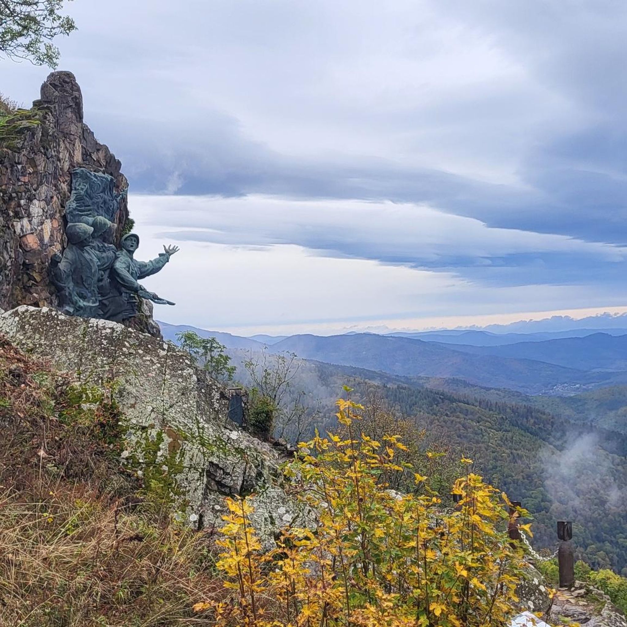
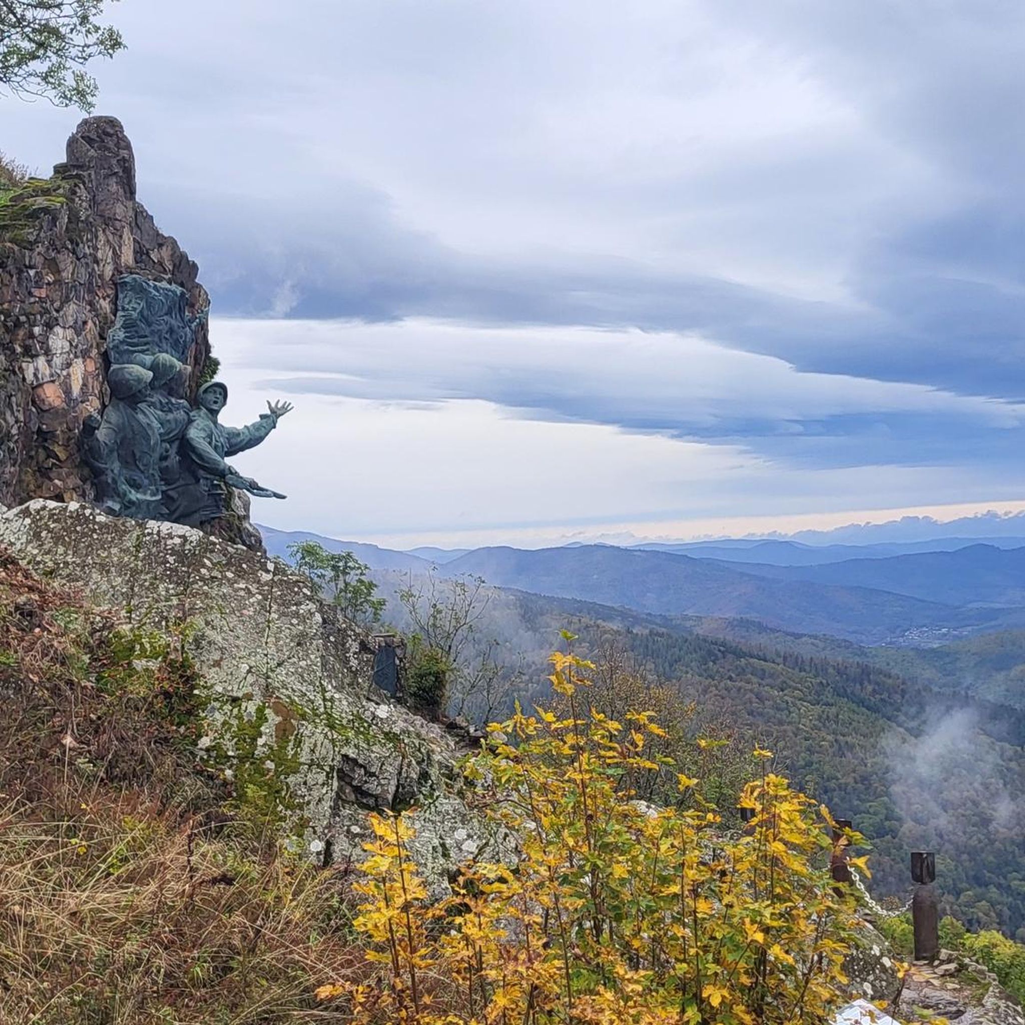
Vieil Armand, also known as Hartmannswillerkopf, is a striking mountain peak in the southern Vosges, near the Col Amic. This place is not only popular with cyclists because of the challenging climb and the panoramic view of the Rhine plain, but also an important historical monument. During the First World War, fierce fighting took place here between French and German troops, resulting in a static trench warfare. Today, the area is a national memorial with a crypt, military cemetery and well-preserved trenches. The climb to Vieil Armand via the Col Amic is not only sportingly rewarding, but also impressive because of the historical significance of the landscape.
6
0

Ferme Auberge Gsang: great view, good food
0
0

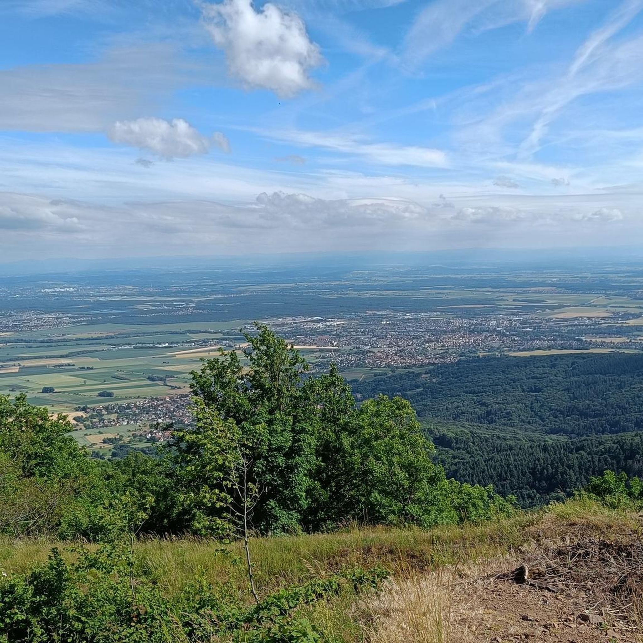
Breathtaking panoramic views across the Rhine plain to the Black Forest, and on clear days, even the Alps. Highly recommended.
3
0

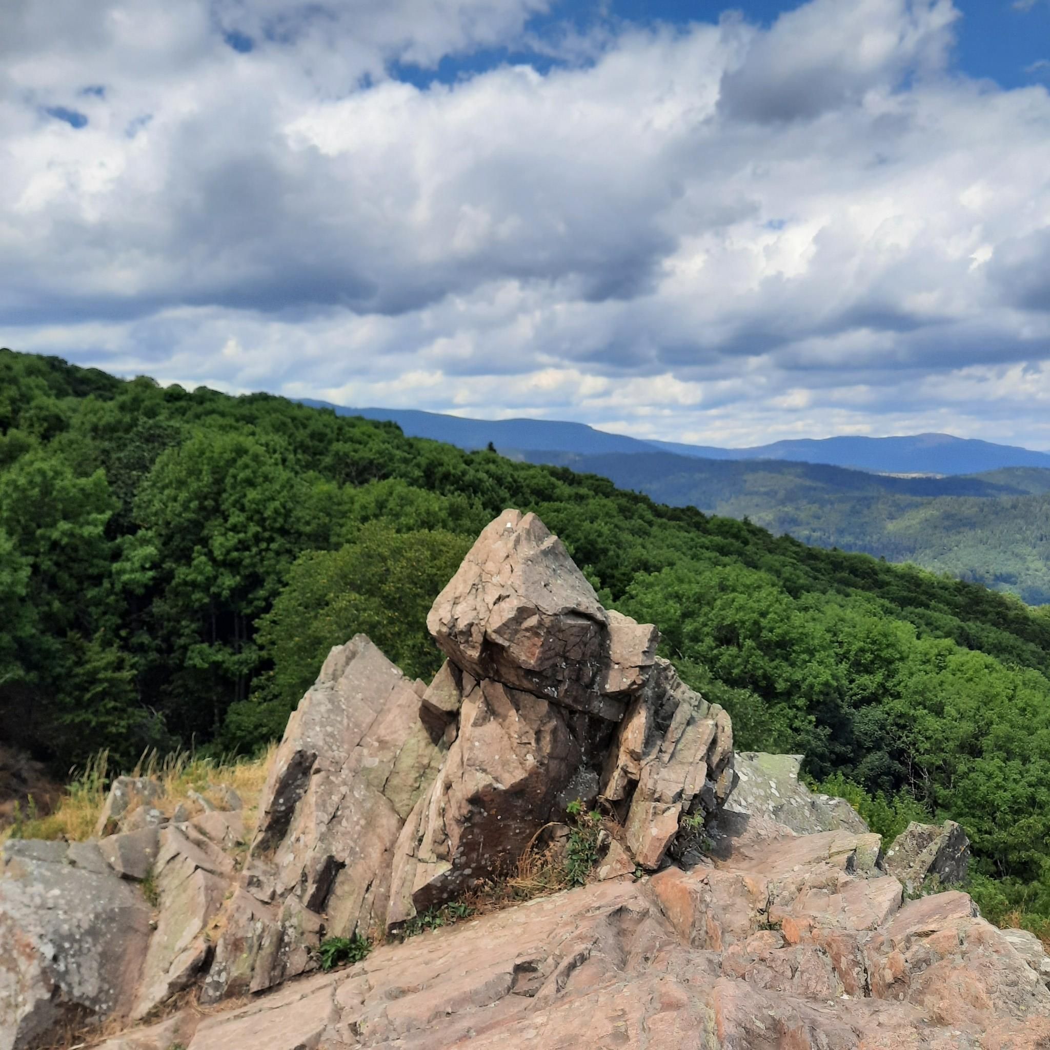
Beautiful rocky viewpoint pointing towards Belacker, Drumont and Tête des Perches
1
0

Frequently Asked Questions
What kind of terrain can I expect on mountaineering routes around Hartmannswiller?
Mountaineering routes in Hartmannswiller feature a challenging mix of rocky paths, forested sections, and significant elevation changes within the Vosges mountains. Many trails also incorporate historical World War I trenches and bunkers, offering a unique blend of natural beauty and historical exploration.
Are there routes suitable for different skill levels?
Yes, the area offers a range of mountaineering options. You'll find moderate ascents, such as the Grand Ballon – Panoramic view from the Grand Ballon summit loop from Grand Ballon, which is 2.2 miles long, as well as more difficult and longer routes like the Hundsruck Pass – Vogelstein (Bird Rock) loop from Willer-sur-Thur, which spans 16.6 miles.
What are the best viewpoints along the mountaineering trails?
Many routes offer breathtaking panoramic views. The Grand Ballon summit, the highest point of the Vosges, provides expansive vistas. Additionally, the Viewpoint at the summit of Vieil Armand (Hartmannswillerkopf) offers stunning views across the Alsace plain, the Black Forest, and even the distant Alps on clear days.
Are there any circular mountaineering routes in the area?
Yes, several routes are designed as loops. For instance, you can enjoy the Grand Ballon – Panoramic view from the Grand Ballon summit loop from Col du Grand Ballon, a moderate 2.5-mile path, or the more challenging Hundsruck Pass – Vogelstein (Bird Rock) loop from Willer-sur-Thur.
What historical landmarks can I explore while mountaineering near Hartmannswiller?
The Hartmannswillerkopf (Vieil Armand) is a significant historical site. Many trails traverse the extensive network of preserved World War I trenches, bunkers, and memorials from the battlefield. You can also find historical sites like the Musée de la Porte de Thann nearby.
What do other mountaineers say about the routes in Hartmannswiller?
The routes in Hartmannswiller are highly rated by the komoot community, with an average score of 4.5 stars from 5 reviews. Mountaineers often praise the challenging mountain terrain, the unique historical battlefield landscapes, and the rewarding panoramic viewpoints.
Are there any longer, more challenging mountaineering routes?
For those seeking a longer challenge, the Hundsruck Pass – Vogelstein (Bird Rock) loop from Willer-sur-Thur is a difficult 16.6-mile trail that typically takes over 8 hours to complete. Another difficult option is the Viewpoint loop from Wattwiller, which is 14.8 miles long.
What other attractions are near the mountaineering routes?
Beyond the trails, you can explore several nearby attractions. These include the impressive Grand Ballon summit, the serene Ballon Lake, and various castles such as The Witch's Eye (Engelbourg Castle) and the Ruins of Hohrupf Castle.
What is the best time of year for mountaineering in Hartmannswiller?
The Vosges mountains offer different experiences throughout the year. While specific recommendations depend on your tolerance for conditions, generally spring through autumn provide the most favorable weather for hiking. Winter mountaineering is possible but requires appropriate gear and awareness of snow and ice conditions.
What should I wear for mountaineering in Hartmannswiller?
Given the challenging terrain and potential for significant elevation changes, sturdy hiking boots with good ankle support are essential. Layered clothing is recommended to adapt to changing weather conditions, and waterproof outerwear is advisable, especially in the mountains. For more advanced routes, some alpine experience and gear might be beneficial.
Are there any easier mountaineering routes for beginners or families?
While many routes are moderate to difficult, some shorter loops like the Grand Ballon – Panoramic view from the Grand Ballon summit loop from Grand Ballon (2.2 miles) or the Grand Ballon – Panoramic view from the Grand Ballon summit loop from Col du Grand Ballon (2.5 miles) might be more approachable for those with good physical condition, though they are still rated as moderate.
Can I bring my dog on the mountaineering trails?
While specific regulations can vary by trail and protected areas, generally, dogs are welcome on many hiking trails in the Vosges mountains, provided they are kept on a leash and you clean up after them. It's always best to check local signage or park regulations for the specific route you plan to take.
Most popular routes around Hartmannswiller
Most popular attractions around Hartmannswiller

Get inspired with the komoot mobile app


Explore more
Browse the best Mountain Hikes & Routes in other regions.
