The best walks and hikes around Hartmannswiller
4.6
(3930)
19,238
hikers
14
hikes
Hiking around Hartmannswiller offers routes through forested slopes, vineyards, and historical battlefields in the foothills of the Vosges Massif. The region is characterized by rolling hills and the prominent Hartmannswillerkopf mountain, which rises to 956 meters and provides panoramic views of the Alsace Plain. This area combines natural landscapes with significant World War I historical sites, featuring well-preserved trenches and memorials. The terrain includes varied elevations suitable for different hiking levels.
Best hiking trails around Hartmannswiller
- The most popular hiking…
Last updated: August 18, 2026
4.4
(8)
41
hikers
14.1km
04:44
670m
670m
Moderate hike. Good fitness required. Mostly accessible paths. Sure-footedness required.
4.3
(4)
19
hikers
14.8km
04:54
680m
680m
Moderate hike. Good fitness required. Mostly accessible paths. Sure-footedness required.

Sign up for free
21
hikers
12.6km
04:02
530m
530m
Moderate hike. Good fitness required. Easily-accessible paths. Suitable for all skill levels.
5.0
(3)
17
hikers
17.6km
05:37
730m
730m
Hard hike. Very good fitness required. Easily-accessible paths. Suitable for all skill levels.
4.5
(4)
19
hikers
7.24km
02:03
160m
160m
Moderate hike. Good fitness required. Easily-accessible paths. Suitable for all skill levels.
Get access to more routes and recommendations from other explorers.
Sign up for free
Already have an account?
Our route recommendations are based on thousands of hikes, rides, and runs completed by other people on komoot.
Start today with a free account
Your next adventure awaits.
Login or Signup

Tips from the Community

Château Ollwiller is the second oldest wine estate in France. The origins of Château Ollwiller date back to the 12th century.
0
0

This German World War I military cemetery is located in the middle of the forest on the outskirts of the village of Hartmannswiller, just a few minutes' walk from the Zeller-Kantine (mountain hut), on the eastern slope of the Hartmannswillerkopf battlefield. This military cemetery contains 36 graves, bordered by a low rubble wall. It is located in the middle of the forest and lined with large trees. https://www.memorial-hwk.eu/de
0
0

A must-see place in the truest sense of the word, a whole page of French history lies before your eyes and reminds everyone that those who fought and died here did so for all of us...
0
0

It is very sad when you visit this military cemetery. Mainly very young fallen soldiers are buried here
0
0

The central point of the hike, several remains of the First World War are nearby.
0
0
Good shoes recommended as the ground can be slippery.
0
0

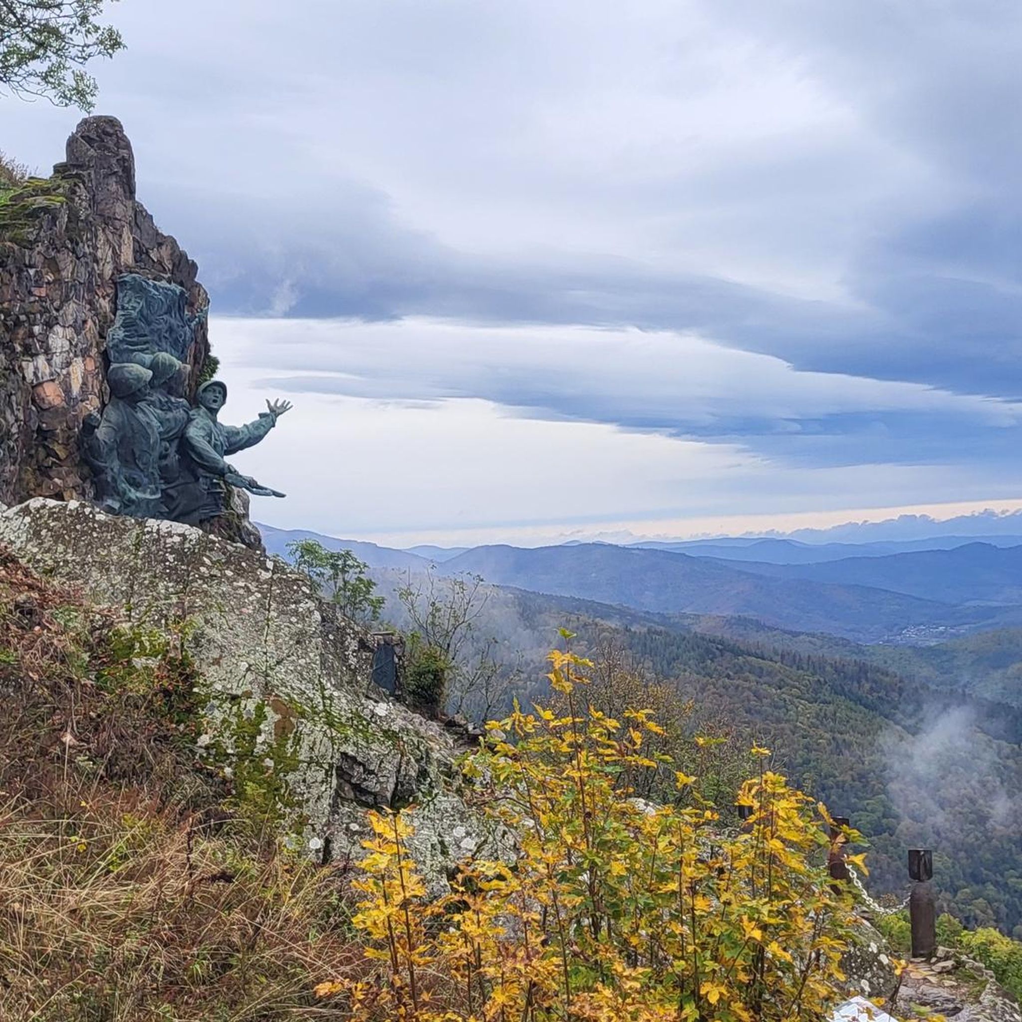
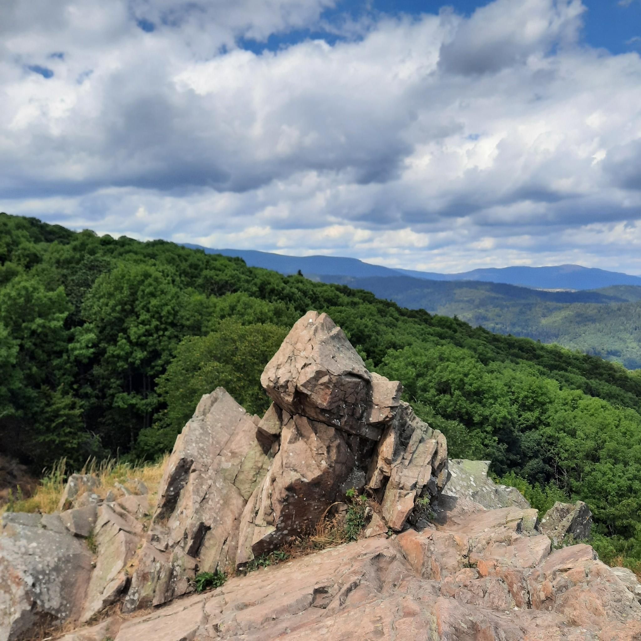
The “Roche Sermet” is a rock formation located on the Hartmannswillerkopf¹ battlefield. It is located at an altitude of approximately **910 meters**². Hartmannswillerkopf, also known as Vieil Armand, is a pyramidal rocky spur in the Vosges massif, overlooking the Alsace plain from its 957 meters¹. During the First World War, it was a strategic summit hotly contested by the French and German armies¹. Today, the Hartmannswillerkopf is a place of memory, bearing witness to the suffering of the soldiers who fought in the name of their country¹. The German remains encountered on the ground, sometimes quite spaced apart from each other, are witnesses to this historical period¹. Source: conversation with Bing, 05/07/2024 (1) HWK: Vestiges of the Past - e-monsite. https://hartmannswillerkopf.e-monsite.com/pages/hwk-vestiges-du-passe.html. (2) Presentation. https://hartmannswillerkopf.e-monsite.com/pages/presentation.html. (3) The Hartmannswillerkopf | Paths of memory. https://www.cheminsdememoire.gouv.fr/en/hartmannswillerkopf. (4) The Hartmannswillerkopf - Official website. https://www.memorial-hwk.eu/.
1
0

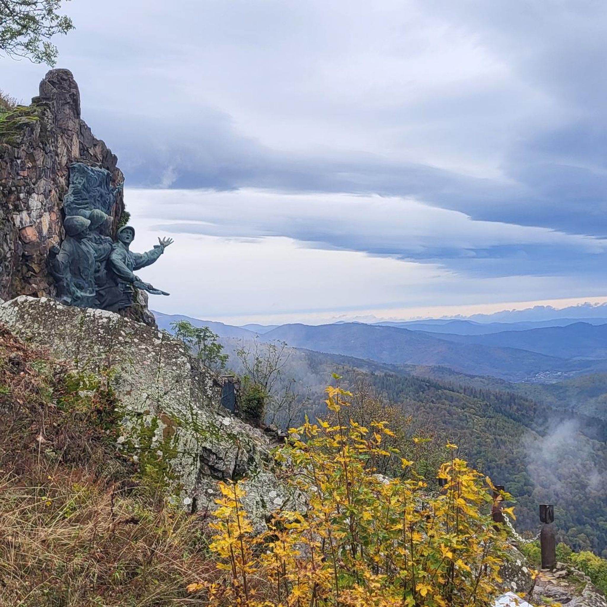
An impressive memorial from the time of the war. When you walk along the paths and through the trenches, you are accompanied by an uneasy feeling. This can only give us an idea of how it must have felt for the men during the war.
1
0
Frequently Asked Questions
What kind of terrain can I expect on hikes in Hartmannswiller?
Hiking around Hartmannswiller offers a diverse landscape, primarily characterized by forested slopes, picturesque vineyards, and rolling hills. The prominent Hartmannswillerkopf mountain, rising to 956 meters, provides a unique mountainous setting within the Alsace Plain. You'll encounter varied elevations, from gentle paths through vineyards to more challenging ascents on the mountain, often featuring well-preserved historical WWI sites.
How many hiking trails are available around Hartmannswiller?
There are over 10 hiking routes available around Hartmannswiller, catering to various fitness levels. The komoot community has explored more than 16,000 tours in the area, indicating a rich network of paths.
Are there easy hiking options suitable for beginners or casual walkers?
Yes, while many routes involve elevation, there are easier options. For instance, the region offers paths that are less strenuous, often focusing on the lower slopes or vineyard areas. While the guide lists 1 easy route, many of the moderate trails can be adapted for a more casual pace, especially those focusing on historical exploration rather than significant elevation gain.
Are there challenging hikes for experienced trekkers?
Absolutely. Hartmannswiller offers several challenging routes, particularly those ascending the Hartmannswillerkopf. For example, the Roche Sermet – German Trench loop from Haut-Rhin is a difficult 17.8 km trail with over 700 meters of elevation gain, providing a strenuous workout combined with historical exploration.
What historical sites can I explore while hiking around Hartmannswiller?
The Hartmannswillerkopf battlefield is a central feature, offering a profound historical experience. While hiking, you can explore numerous well-preserved WWI remnants such as trenches, shelters, bunkers, and old cemeteries. Notable sites include the 15-2 monument, the summit cross, and the Silberloch memorial. The Hartmannswillerkopf National Monument and Military Cemetery is a key landmark.
Are there specific viewpoints offering panoramic views?
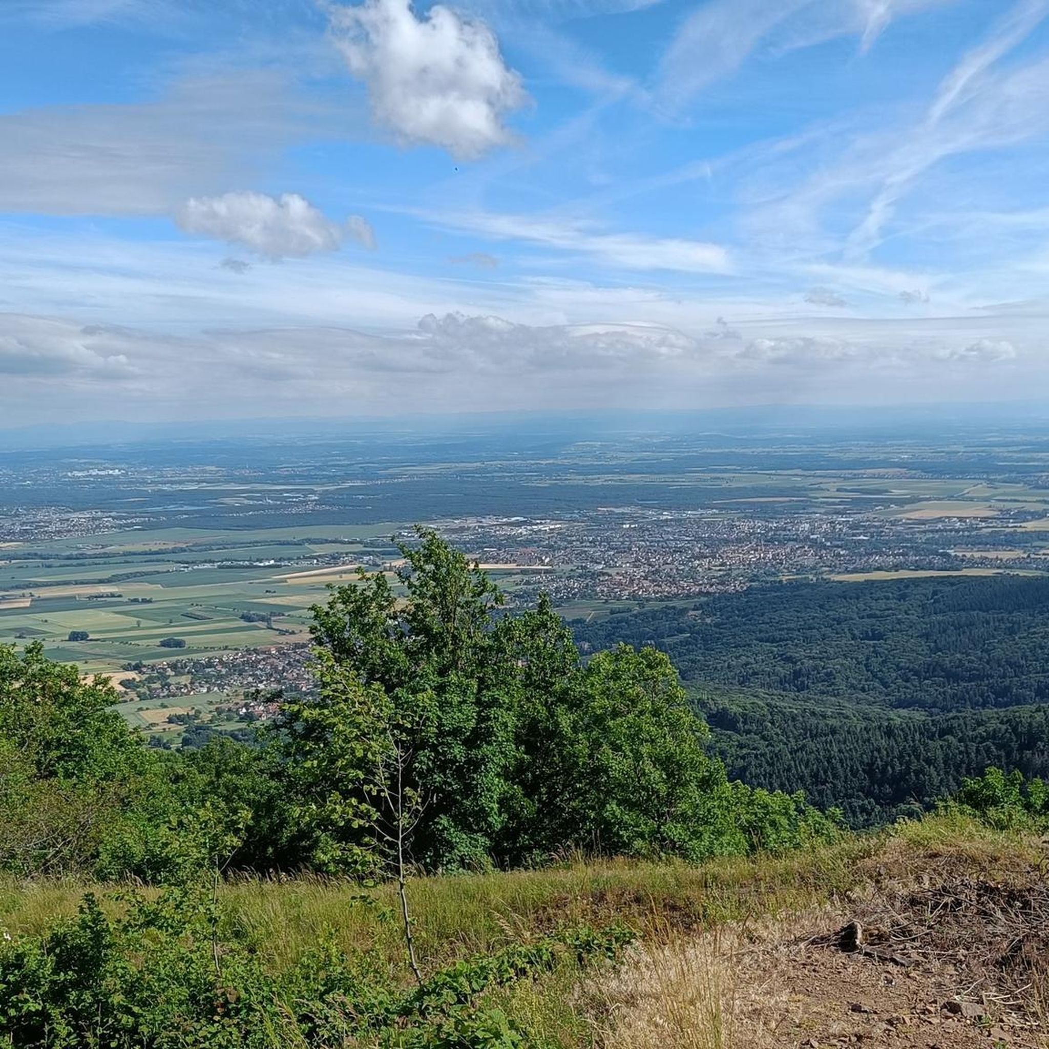
Yes, the Hartmannswillerkopf mountain itself offers magnificent panoramic views of the Alsace Plain, the Black Forest, and even the distant Alps on clear days. Key viewpoints include the Viewpoint at the summit of Vieil Armand and the View from the Summit Cross of Hartmannswillerkopf.
Can I find places to eat or drink along the trails?
Yes, the Zeller canteen, a 1914-1918 bunker, serves refreshments on weekends and is located along some of the historical hiking paths on Hartmannswillerkopf. This provides a unique opportunity for a break and a snack during your hike.
Are there circular hiking routes available in Hartmannswiller?
Yes, many of the popular routes around Hartmannswiller are circular, allowing you to start and end at the same point. Examples include the Monument to the 152nd Regiment – Tunnel loop from Haut-Rhin and the German Trench – Roche Sermet loop from Hartmannswiller, which are both popular circular options.
Is Hartmannswiller a good destination for family hikes?
Hartmannswiller can be a good destination for families, especially those interested in history. Many trails are well-maintained, and shorter loops can be found. The historical context of the Hartmannswillerkopf can be a unique educational experience for older children. However, some routes involve significant elevation and historical sites that might be somber, so choosing appropriate trails is key.
Are dogs allowed on the hiking trails around Hartmannswiller?
Generally, dogs are welcome on hiking trails in the Alsace region, including around Hartmannswiller. However, it's always advisable to keep them on a leash, especially in historical areas, near wildlife, or when passing through vineyards. Be mindful of other hikers and any specific signage regarding pets.
What is the best time of year to go hiking in Hartmannswiller?
The best time for hiking in Hartmannswiller is typically from spring through autumn (April to October). During these months, the weather is generally pleasant, and the trails are clear. Spring brings blooming vineyards, while autumn offers vibrant fall foliage. Winter hiking is possible but requires appropriate gear due to potential snow and ice, especially at higher elevations on Hartmannswillerkopf.
How accessible are the trailheads by public transport?
While Hartmannswiller is a village, public transport options to specific trailheads might be limited. It's recommended to check local bus schedules for connections from larger towns in the region. Many hikers opt to drive to the main parking areas near the Hartmannswillerkopf memorial or specific trail starting points.
Where can I find parking for hiking trails in Hartmannswiller?
There are designated parking areas available, particularly near the Hartmannswillerkopf National Monument and other popular trailheads. These are typically well-signposted. It's advisable to arrive early during peak season to secure a spot.
What do other hikers enjoy the most about hiking in Hartmannswiller?
The area is highly rated by the komoot community, with an average score of 4.6 stars from over 3200 reviews. Reviewers often praise the unique combination of natural beauty and profound historical significance, particularly the well-preserved WWI trenches and memorials, as well as the panoramic views from Hartmannswillerkopf.
Most popular routes around Hartmannswiller
Most popular attractions around Hartmannswiller

Get inspired with the komoot mobile app


Explore more
Browse the best Hikes in other regions.
