The best running trails around Hartmannswiller
4.4
(203)
9,691
runners
544
runs
Jogging routes around Hartmannswiller traverse a diverse landscape at the foot of the Vosges Mountains, characterized by rolling hills, extensive forests, and the picturesque Alsatian vineyards. The region features varying elevations, from gentle slopes through agricultural areas to more challenging ascents within wooded terrain. Notable natural features include the historic Hartmannswillerkopf, offering a unique blend of natural and historical elements. This environment provides a range of running experiences suitable for different fitness levels.
Best jogging routes around Hartmannswiller
- The most…
Last updated: July 11, 2026
4.5
(4)
320
runners
24.3km
03:16
1,010m
1,010m
Hard run. Very good fitness required. Sure-footedness, sturdy shoes and alpine experience required.
95
runners
7.68km
00:52
130m
130m
Moderate run. Good fitness required. Mostly paved surfaces. Suitable for all skill levels.

Sign up for free
5.0
(1)
72
runners
12.8km
01:34
400m
400m
Hard run. Very good fitness required. Mostly paved surfaces. Suitable for all skill levels.
5.0
(1)
34
runners
18.4km
02:22
650m
650m
Hard run. Very good fitness required. Sure-footedness, sturdy shoes and alpine experience required.
5.0
(1)
19
runners
22.9km
02:53
820m
820m
Hard run. Very good fitness required. Sure-footedness, sturdy shoes and alpine experience required.
Get access to more routes and recommendations from other explorers.
Sign up for free
Already have an account?
Our route recommendations are based on thousands of hikes, rides, and runs completed by other people on komoot.
Start today with a free account
Your next adventure awaits.
Login or Signup
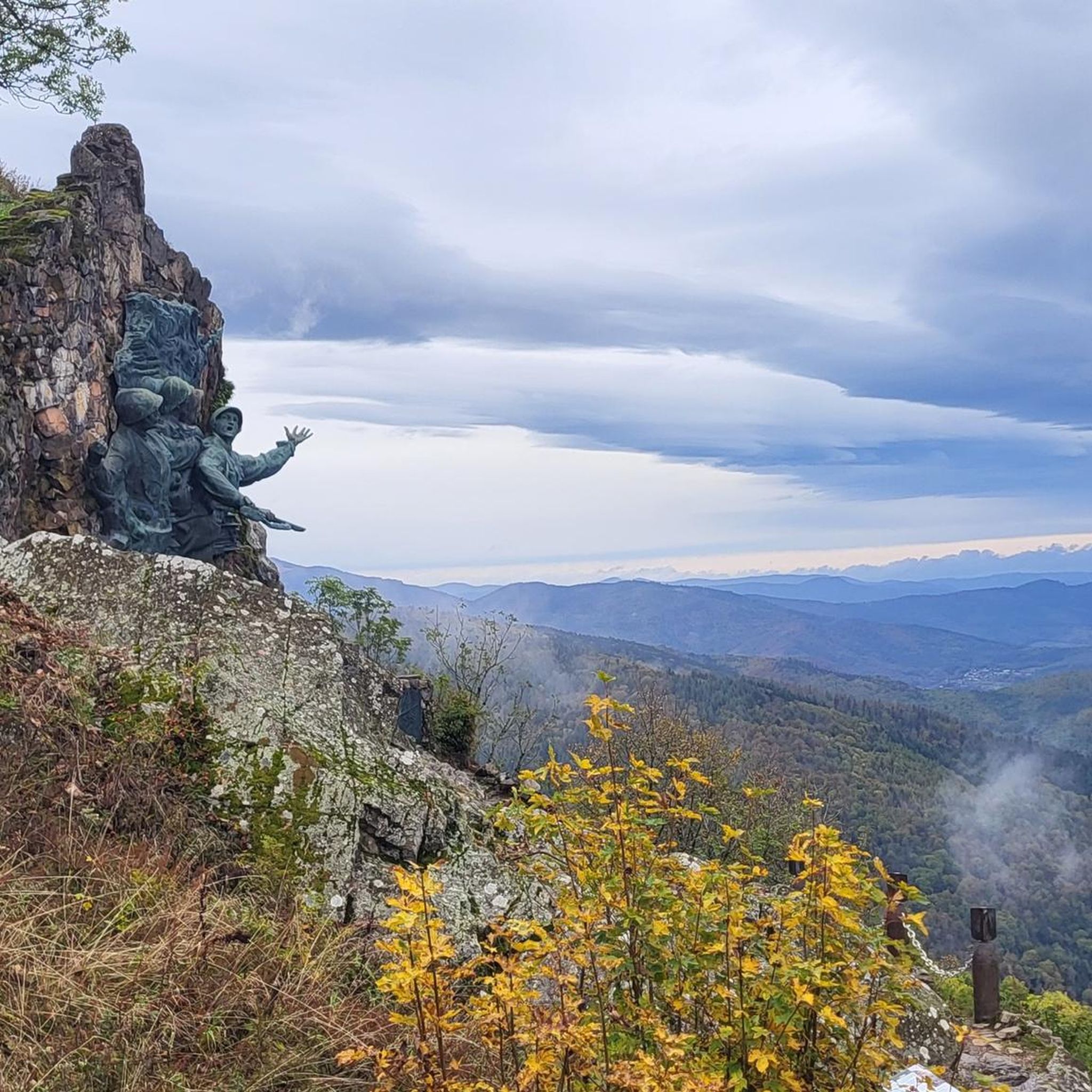
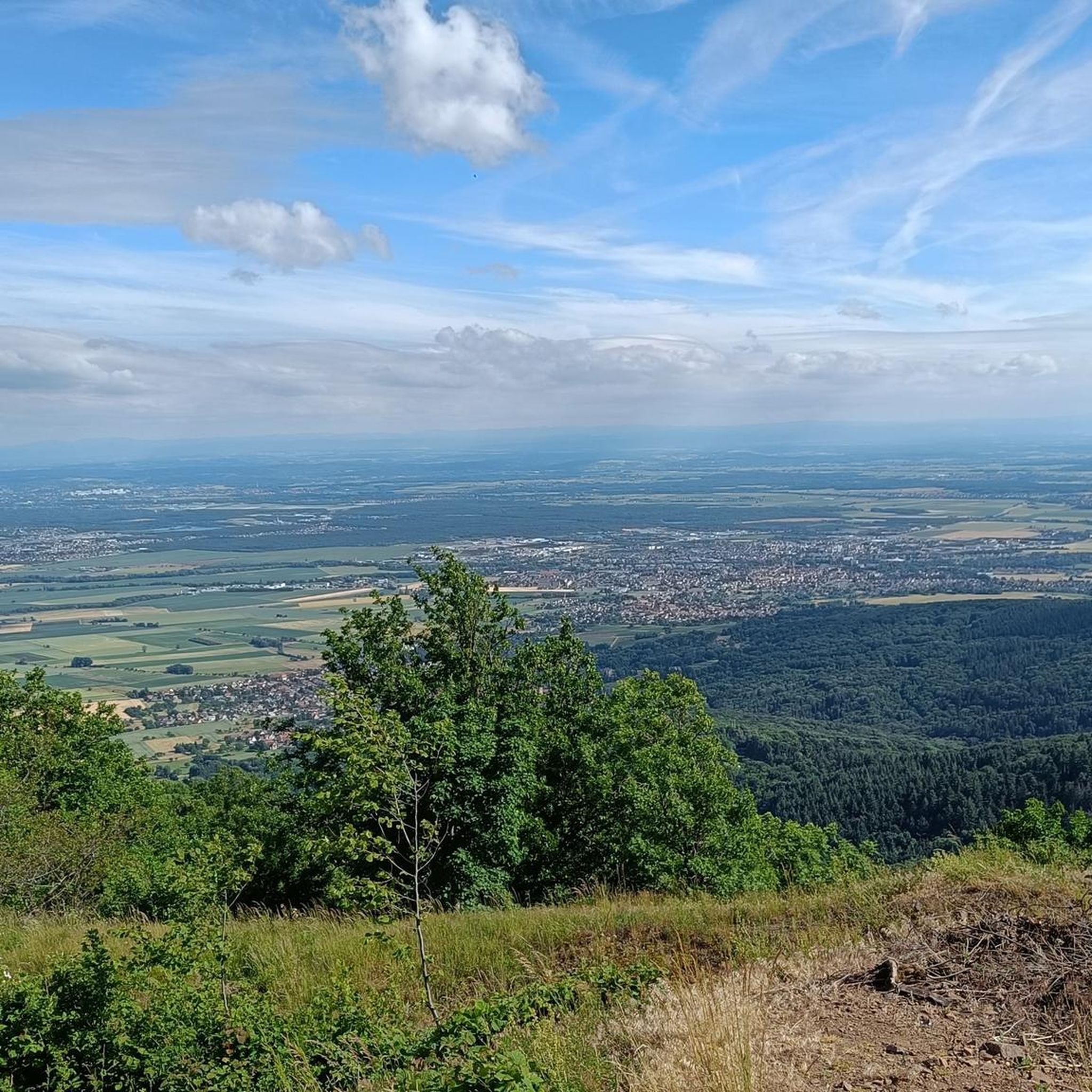
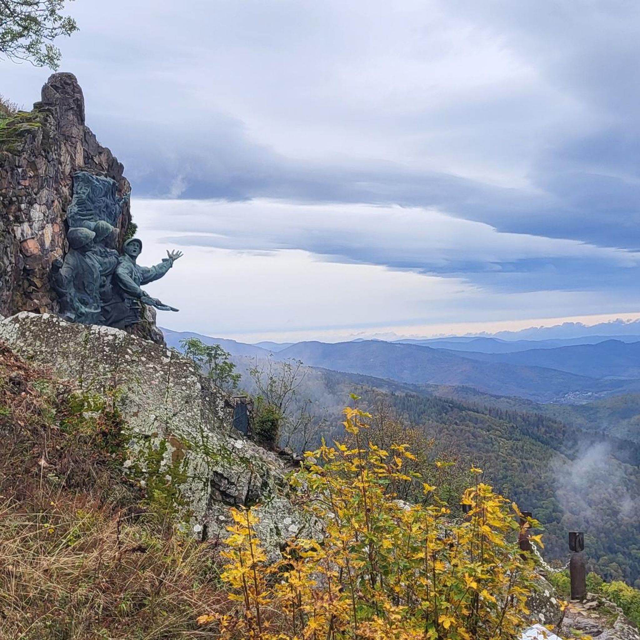
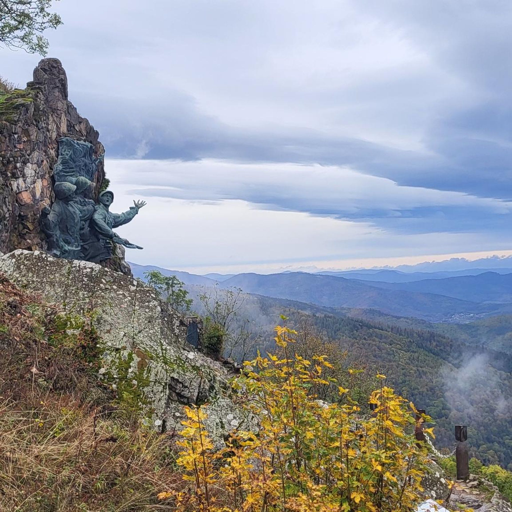
Tips from the Community


A must-see place in the truest sense of the word, a whole page of French history lies before your eyes and reminds everyone that those who fought and died here did so for all of us...
0
0

The highest elevation on the Hartmannsweilerkopf, unfortunately also one of the most tragic places on this battlefield. Around the cross there are many trenches, fortresses and fortifications which can also be visited. These tell the sad story of this otherwise beautiful place.
2
0
Beautiful viewpoint that almost makes you forget the tragic history of this place.
1
0

Historical place in the Vosges that was hotly contested during the First World War
5
0
Another contemporary testimony from the First World War
1
1

Artillery position with two underground rooms. She is named after Lt. Emil Ratz from the 14th Engineer Company of the 2nd Landwehr Regiment.
0
1
Frequently Asked Questions
How many running routes are available around Hartmannswiller?
There are over 500 running routes around Hartmannswiller, catering to various fitness levels. This includes 28 easy routes, 281 moderate routes, and 199 difficult routes, ensuring options for every runner.
Are there easy or beginner-friendly jogging routes in Hartmannswiller?
Yes, Hartmannswiller offers 28 easy running routes perfect for beginners or those looking for a more relaxed jog. These routes often traverse the picturesque Alsatian vineyards or gentler forest paths, providing a pleasant experience without significant elevation changes.
What kind of terrain can I expect on the running trails in Hartmannswiller?
The running trails in Hartmannswiller feature diverse terrain. You'll find everything from gentle slopes through the Alsatian vineyards to more challenging ascents within the dense Vosges Mountains forests. The region also includes historical sites like Hartmannswillerkopf, where paths wind through reclaimed nature and former trenches.
Are there any circular running routes in the Hartmannswiller area?
Many of the running routes around Hartmannswiller are circular, offering convenient starting and ending points. For example, the View over the plain loop from Haut-Rhin is a popular moderate 5.1-mile (8.3 km) option that can be completed in about 58 minutes.
What are some notable landmarks or attractions I can see while running near Hartmannswiller?
While running, you can encounter several interesting landmarks. The historic Hartmannswillerkopf, also known as 'The Old Warrior,' offers a unique blend of natural beauty and World War I history. You might also pass by mountain passes like Haag Pass or explore historical sites such as the Adlerhorst Command Post – World War I.
What do other runners say about the trails in Hartmannswiller?
The running routes in Hartmannswiller are highly regarded by the komoot community, with an average rating of 4.4 stars from over 150 reviews. Runners often praise the diverse landscapes, from vineyards to mountain forests, and the unique combination of natural beauty with historical immersion, especially around Hartmannswillerkopf.
Can I find long-distance running routes for more challenging workouts?
Absolutely. Hartmannswiller offers several challenging long-distance routes. For instance, the Grand Ballon – Judenhut Shelter loop from Wuenheim is a difficult 17.1-mile (27.5 km) route with significant elevation gain, ideal for experienced runners seeking a strenuous workout.
Is Hartmannswiller suitable for running during different seasons?
Yes, the region is suitable for running across various seasons. The Vosges Mountains and forests offer shaded paths in summer, while the vineyards provide beautiful scenery in spring and autumn. Winter running is also possible, though conditions on higher mountain trails may require appropriate gear and caution.
Are there any running routes that offer panoramic views?
Many routes in Hartmannswiller provide stunning panoramic views. The View of the Countryside loop from Haut-Rhin, a difficult 8-mile (12.9 km) route, is known for its expansive vistas across the region's diverse landscape of vineyards, forests, and mountains.
What is the typical length and duration of running trails in Hartmannswiller?
Running trails in Hartmannswiller vary significantly in length and duration. You can find shorter routes like the 5.1-mile (8.3 km) View over the plain loop from Haut-Rhin, which takes about 58 minutes, up to challenging routes like the 15.3-mile (24.6 km) Old Armand – View of the Countryside loop from Haut-Rhin, which can take over 3 hours.
Where can I find more information about the natural environment of Alsace?
For more details on the natural environment and well-being opportunities in the broader Alsace region, you can visit the official tourism website: visit.alsace.
Most popular routes around Hartmannswiller
Most popular attractions around Hartmannswiller

Get inspired with the komoot mobile app


Explore more
Browse the best Running Trails & Routes in other regions.
