The best gravel rides in Mclaughlin Eastshore State Park
4.5
(19)
148
riders
26
rides
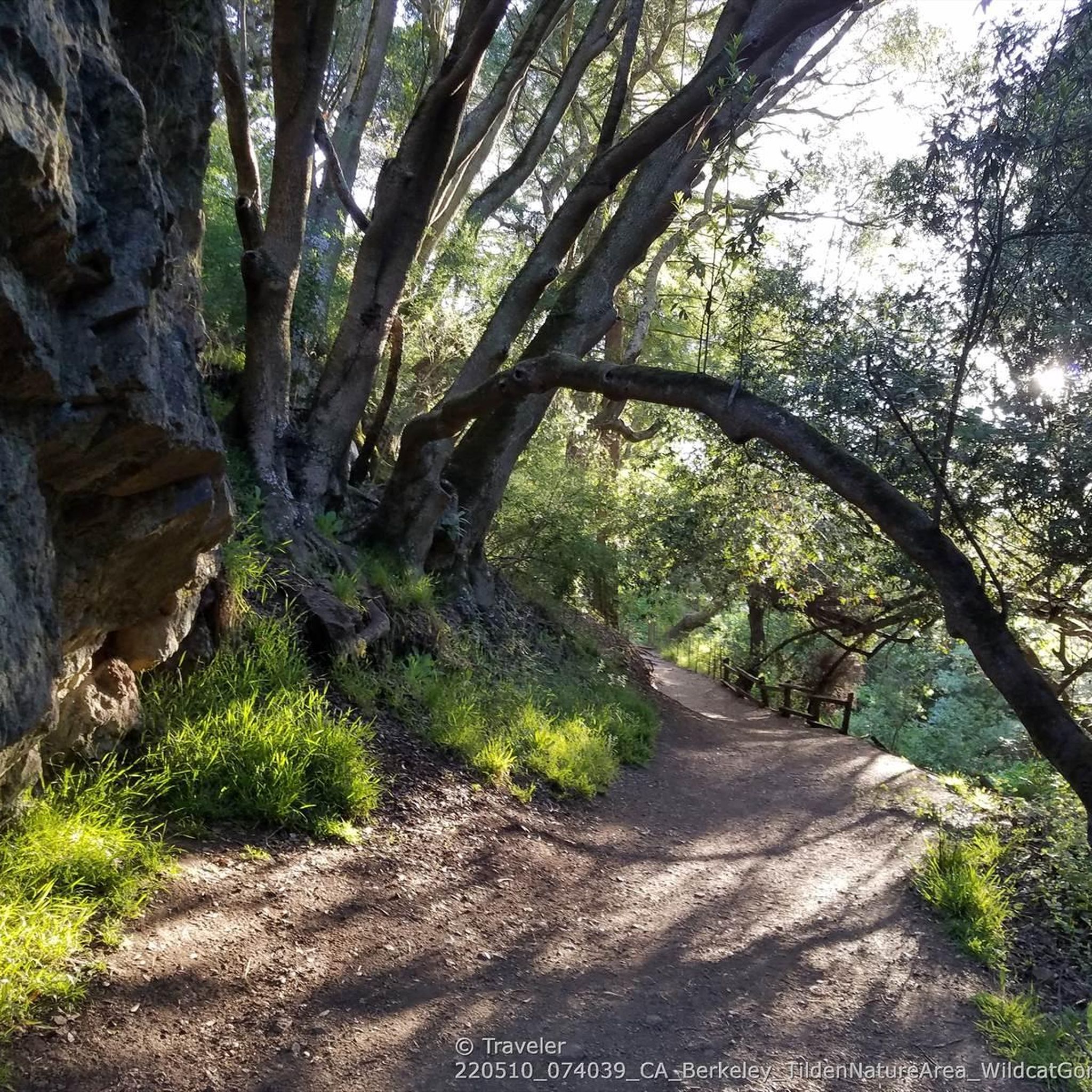
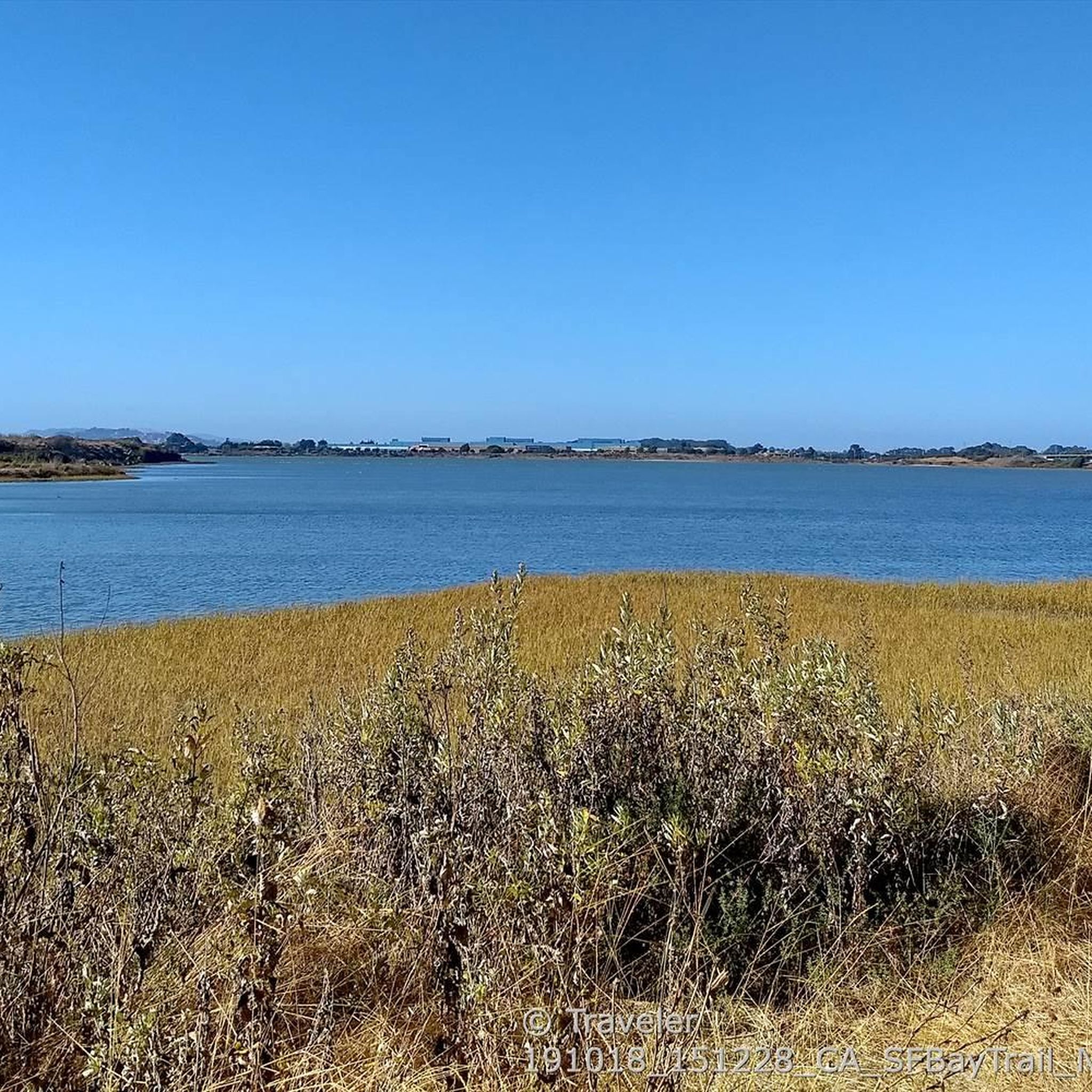
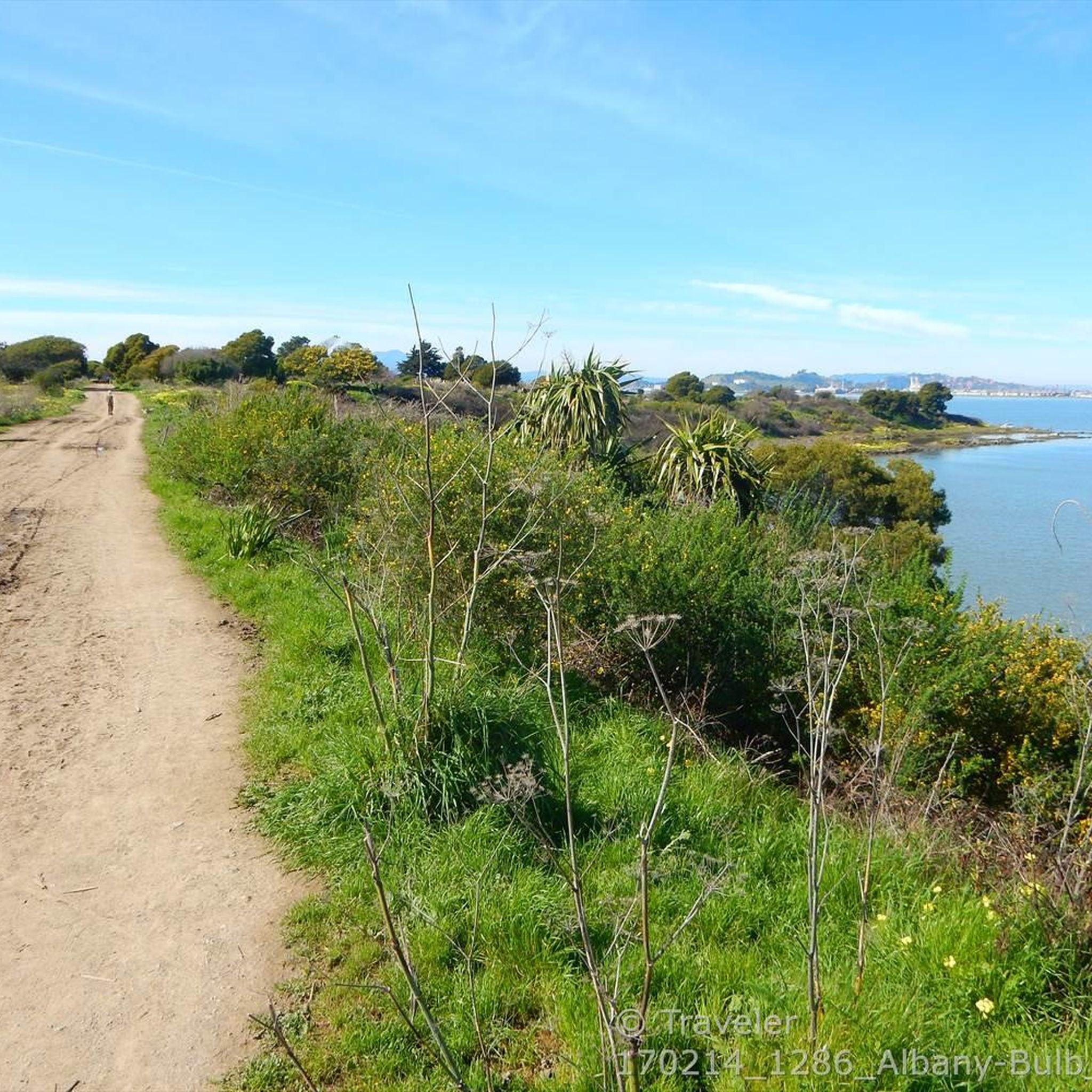
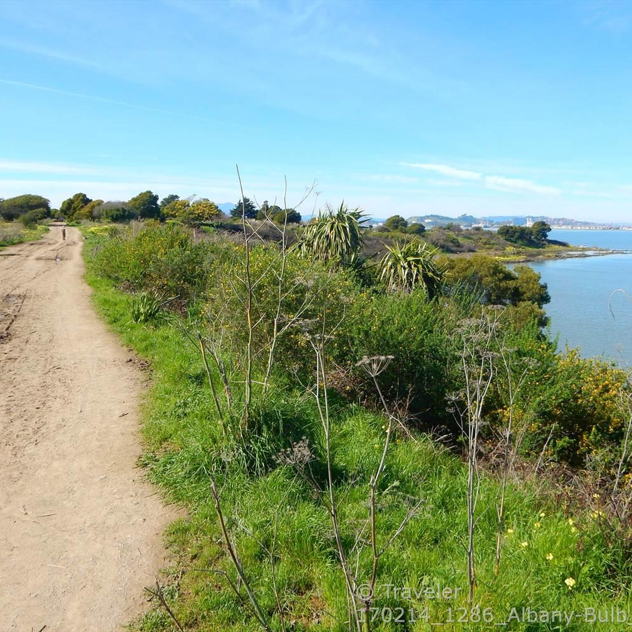
Gravel biking in McLaughlin Eastshore State Park offers diverse terrain along 8.5 miles of San Francisco Bay shoreline, stretching from Richmond to Emeryville and Oakland. The park features a mix of natural and restored wetlands, tidal marshes, beaches, and mudflats, providing varied landscapes for riders. Routes often incorporate unpaved sections and fire roads, connecting to the San Francisco Bay Trail and offering panoramic views of the Bay and the Golden Gate Bridge. The area also provides access to the East…
Last updated: July 3, 2026
4.5
(2)
17
riders
31.7km
03:05
800m
800m
If you're looking for a gravel biking adventure that truly showcases the East Bay, the East Bay Skyline Loop delivers. This difficult 19.7-mile (31.7 km) route winds through a stunning…
12
riders
54.9km
04:26
1,040m
1,040m
The East Bay Skyline and Berkeley Hills Loop offers a quintessential gravel biking experience, blending challenging climbs with diverse terrain and expansive Bay Area views. You'll navigate a mix of…

Sign up for free
10
riders
41.8km
02:44
570m
570m
Hard gravel ride. Very good fitness required. You may need to push your bike for some segments of this route.
7
riders
29.5km
01:59
440m
440m
The Wildcat Creek Trail – Jewel Lake loop from El Cerrito Plaza offers a fantastic gravel biking experience, blending wide fire roads with dirt and gravel paths. You'll journey through…
6
riders
46.4km
03:32
1,070m
1,070m
Hard gravel ride. Very good fitness required. Mostly paved surfaces. Suitable for all skill levels.
Get access to more routes and recommendations from other explorers.
Sign up for free
Already have an account?
Our route recommendations are based on thousands of hikes, rides, and runs completed by other people on komoot.
Start today with a free account
Your next adventure awaits.
Login or Signup
Tips from the Community

One of the wonderfull view from the park. Please discover this park. You will not regret it
0
0

This road parallels the ridgeline above and have great views over the bay and surrounding hills.
0
0

Wildcat Creek Trail is a packed-dirt trail that is about four miles long. One end of the trail is at Jewel Lake, near the Environmental Education Center, and the other end of the trail is at the Alvarado Staging Area. This trail offers great views of Wildcat Creek and has some picnic tables you could stop at along the side of the trail.
0
0
Conlon Trail is a connector trail off of Nimitz Way Trail that spits you out on its south side at the intersection of Havey Canyon Trail and Wildcat Creek Trail. Conlon Trail offers from sweet views, but it's open to hikers and bikers, so keep an eye out for folks on foot.
0
0

The public library is right across the street from the Ohlone Greenway. This pretty little red and white striped building is open to the public and has clean restrooms, WiFi, and water fountains as well as books.
1
0

This crossing was created by the Friends of Five Creeks as part of one of their larger restoration projects that began in 1999 to revive the area where Codornices Creek crosses the Ohlone Greenway. Inspired and led by local architect Todd Jersey, the project has transformed the site by replacing ivy and trash with native plants, improving access, and adding a beautiful observation railing.
0
0
Frequently Asked Questions
How many gravel bike trails are available in McLaughlin Eastshore State Park?
There are over 25 gravel bike trails in McLaughlin Eastshore State Park, offering a range of experiences from moderate to difficult. You'll find routes that traverse the San Francisco Bay shoreline and connect to the East Bay Hills.
What kind of terrain can I expect on gravel bike trails in McLaughlin Eastshore State Park?
The park offers a diverse mix of terrain, including unpaved sections, fire roads, and parts of the San Francisco Bay Trail. You'll encounter varied landscapes such as natural and restored wetlands, tidal marshes, beaches, and mudflats, with some routes featuring challenging climbs and significant elevation changes, especially those extending into the East Bay Hills.
Are there any family-friendly gravel biking options in McLaughlin Eastshore State Park?
Yes, while many routes offer significant challenges, you can find easier loops suitable for families or those seeking a more relaxed ride. These typically have minimal elevation gain and can be completed in about 2 hours, offering scenic views along the Bay shoreline.
What are some notable natural features or landmarks I might see while gravel biking in the park?
While riding, you'll enjoy panoramic views of the San Francisco Bay and the Golden Gate Bridge. The park itself features diverse habitats like tidal marshes and wetlands. Specific points of interest include Point Isabel Regional Shoreline Park, the unique artwork and labyrinth at Albany Bulb, and the vibrant Berkeley Marina.
Are there any challenging gravel routes for experienced riders?
Absolutely. Many routes in and around McLaughlin Eastshore State Park are rated as difficult, featuring substantial climbs and significant elevation gain, particularly those that venture into the East Bay Hills. For example, the Inspiration Point Overlook – Grizzly Peak Boulevard loop from North Berkeley offers over 1000 meters of elevation gain.
Can I find circular gravel bike routes in the park?
Yes, there are several excellent circular routes available. For instance, the Wildcat Creek Trail – Inspiration Point Overlook loop from El Cerrito del Norte provides a challenging loop experience with diverse scenery.
What is the best time of year to go gravel biking in McLaughlin Eastshore State Park?
The park is generally enjoyable year-round. However, for the most comfortable riding conditions and clear views, spring and fall often offer mild temperatures and less chance of extreme weather. Summer can be pleasant with the Bay breezes, while winter might bring occasional rain.
Is McLaughlin Eastshore State Park dog-friendly for gravel biking?
The park is known for being dog-friendly, particularly areas like Point Isabel Regional Shoreline, which is a popular off-leash dog park. While dogs are generally allowed on trails, it's always best to check specific trail regulations within the park for any restrictions or leash requirements on bike paths.
What do other gravel bikers enjoy most about riding in McLaughlin Eastshore State Park?
The area is highly rated by the komoot community, with an average score of 4.5 stars from over 16 reviews. Reviewers often praise the stunning panoramic views of the San Francisco Bay and the Golden Gate Bridge, the diverse terrain that keeps rides interesting, and the accessibility to both shoreline paths and challenging climbs in the East Bay Hills.
Are there opportunities for wildlife spotting while gravel biking?
Yes, the park's diverse habitats, including tidal marshes and wetlands, support a variety of wildlife. You might spot numerous bird species, especially shorebirds in areas like the Emeryville Crescent, and small animals like squirrels along the trails, making it a great spot for bird-watching.
How can I access the park by public transport for gravel biking?
McLaughlin Eastshore State Park is accessible via public transport, particularly through its connections to the San Francisco Bay Trail. Specific trailheads and staging areas may be reachable by local bus services or BART stations, allowing for convenient access without a car. For example, the Ohlone Greenway – Cedar Rose Park loop from North Berkeley starts near public transport options.
Most popular routes in Mclaughlin Eastshore State Park
Most popular attractions in Mclaughlin Eastshore State Park

Get inspired with the komoot mobile app


Explore more
Browse the best Gravel rides in other regions.
