Meshomasic State Forest
Meshomasic State Forest
The best gravel rides in Meshomasic State Forest
4.7
(9)
55
riders
7
rides
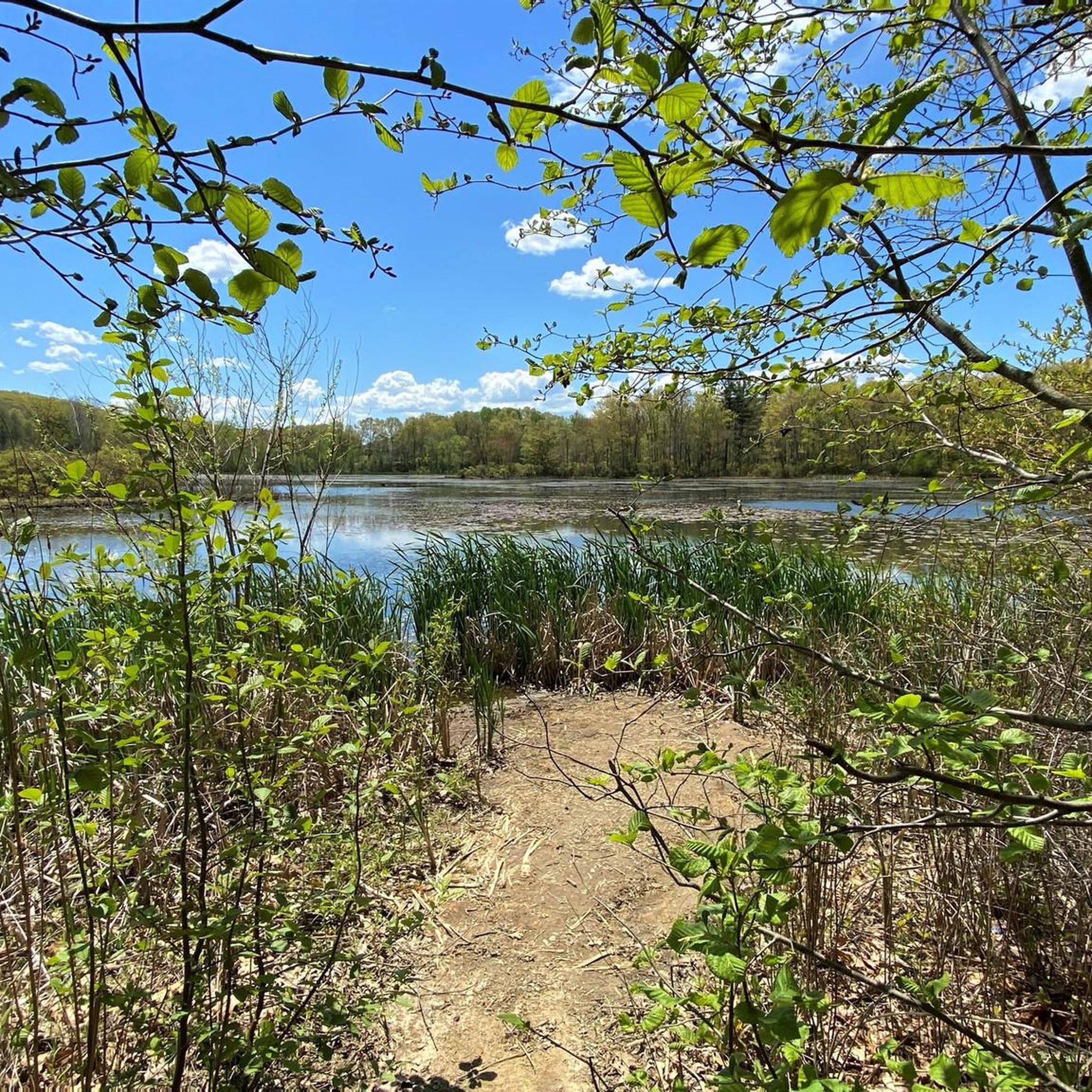
Gravel biking in Meshomasic State Forest offers an extensive network of unpaved roads and varied terrain across more than 9,000 acres. The landscape features hilly topography with significant elevation changes, shaped by glacial activity, resulting in a forest floor scattered with boulders and rocks. This second-growth forest includes a mix of deciduous trees and white pines, providing diverse riding conditions. Elevations within the forest range from 400 to 900 feet above sea level, with numerous trails and unpaved roads suitable…
Last updated: August 21, 2026
1
riders
Hard gravel ride. Very good fitness required. Mostly paved surfaces. Suitable for all skill levels.
5.0
(1)
11
riders
46.4km
02:34
450m
450m
Hard gravel ride. Very good fitness required. Mostly paved surfaces. Suitable for all skill levels.

Sign up for free
5.0
(1)
13
riders
18.6km
01:38
170m
170m
Moderate gravel ride. Good fitness required. Mostly paved surfaces. Suitable for all skill levels.
5
riders
87.6km
05:53
820m
820m
Hard gravel ride. Very good fitness required. Mostly paved surfaces. Suitable for all skill levels.
2
riders
34.8km
02:14
390m
390m
Moderate gravel ride. Good fitness required. Mostly paved surfaces. Suitable for all skill levels.
Get access to more routes and recommendations from other explorers.
Sign up for free
Already have an account?
Our route recommendations are based on thousands of hikes, rides, and runs completed by other people on komoot.
Start today with a free account
Your next adventure awaits.
Login or Signup




Tips from the Community

The Air Line State Park Trail in Connecticut is a rail trail and linear state park that is a part of the East Coast Greenway. There are several sections including: South (25 miles from East Hampton to Windham), North (21 miles from Windham to Putnam), Thompson addition (6.6 miles from Thompson to the Massachusetts state line), and an additional 3.6-mile spur to Colchester. Recognized as a national recreation trail by the U.S. Department of the Interior in 2002, it offers scenic routes for hiking and biking. This southern section of the trail near East Hampton is a gravel crushed trail that is great to ride on its own, or to access singeltrack in the nearby Salmon River Forest.
0
0

This park runs alongside the Willimantic River, providing scenic views of the water. On the opposite side, there are train tracks where you can occasionally observe interesting carts passing by.
0
0

All told, this multi-use trail runs for 2.5 miles through central Manchester. It's built on an old railroad bed and presents a lovely opportunity to walk, run, or bike your way through town and includes side stops at a couple of notable green spaces.
0
0

Founded in 1704 and incorporated on 2 May 1708, Hebron is a charming New England town with a rich history. Wander through its streets to admire the architecture of buildings that reflect this heritage, offering a glimpse into the town's storied past. It's a great place to hop off your bike and explore.
0
0

One of several trailheads for the Cheney Rail Trail. The path is built on an old railroad bed and runs for 2.5 miles through central Manchester. The surface is a mix of pavement and hard packed gravel, so if you have wider tires on your road bike and are looking for a bit more adventure, this is a good path to try.
0
0

From here you can take the Colchester Spur Trail. The area surrounding the trail played a small but fascinating role in the American Revolution. Look for markers mentioning skirmish sites and troop movements.
1
0

The Air Line Trail is a paved 50-mile multi-use trail that connects the cities of Thompson and Portland. This trail is open to walkers, bikes, and even horses.
0
0
This former railroad trail is now highly popular among hikers, runners, and bikers. Stretching over 20 miles, it passes through several towns. This section features a well-maintained hard packed dirt trail surrounded by lush green forest.
0
0
Frequently Asked Questions
How many gravel bike trails are available in Meshomasic State Forest?
Meshomasic State Forest offers a selection of 6 gravel bike routes on komoot, ranging from moderate to difficult. These routes utilize the extensive network of gravel roads and varied terrain within the forest.
What is the typical difficulty level for gravel biking in Meshomasic State Forest?
The gravel biking routes in Meshomasic State Forest are generally considered moderate to difficult. The terrain is hilly, with significant elevation gains, and some routes may require good to very good fitness. For example, the Former Lyman Viaduct – Air Line Trail loop from East Hampton is a moderate option, while the Hop River State Trail – Former Lyman Viaduct loop from Town Open Space (Pine Brook) is a more challenging ride.
Are there any family-friendly gravel biking options in Meshomasic State Forest?
While many routes in Meshomasic State Forest feature challenging hilly terrain and significant elevation, some sections of the former railway lines, like parts of the Air Line Trail, might offer flatter, more accessible riding for families. However, it's important to review individual route details for elevation and distance to ensure suitability for all family members. The forest's extensive network of gravel roads provides varied options, but riders should be prepared for some climbs.
What kind of natural features can I expect to see while gravel biking in Meshomasic State Forest?
You'll encounter diverse natural beauty, including a second-growth forest with impressive white pines, some over a century old. The landscape is shaped by glaciers, featuring large boulders and rocks. Notable natural highlights include Great Hill, which offers extraordinary views of the Connecticut River and Great Hill Pond, and various brooks like Buck Brook and Mott Hill Brook. The forest also encompasses Kongscut Mountain, known for its rugged character.
Are there any historical sites or landmarks along the gravel bike trails?
Yes, Meshomasic State Forest is rich in history. You can explore remnants of past human activity, such as old farm stone walls, cellar holes, and several mines (cobalt and mica quarries) dating back to the late seventeenth century. The forest also contains ruins of a Nike missile site (HA-36) from the Cold War era, offering a unique glimpse into more recent history.
What do other gravel bikers enjoy most about riding in Meshomasic State Forest?
The area is highly rated by the komoot community, with an average score of 4.3 stars from over 10 reviews. Riders often praise the extensive network of gravel roads, the challenging hilly terrain, and the immersive experience of riding through the diverse second-growth forest. The historical features and scenic overlooks also add to the appeal.
Can I find circular gravel biking routes in Meshomasic State Forest?
Yes, several routes in Meshomasic State Forest are designed as loops, allowing you to start and end at the same point. For example, the Colchester Spur Trail junction – Former Lyman Viaduct loop from Arbor Acres Open Space is a popular circular route that takes you through forested areas and along former railway lines.
Where can I park when visiting Meshomasic State Forest for gravel biking?
Access points for the routes often include designated open spaces. For instance, routes like the Former Lyman Viaduct – Air Line Trail loop from Arbor Acres Open Space suggest starting from Arbor Acres Open Space, implying parking availability there. It's advisable to check the specific starting points of your chosen route for parking details.
Are dogs allowed on the gravel bike trails in Meshomasic State Forest?
Meshomasic State Forest is generally dog-friendly, allowing leashed dogs on its trails. However, it's always recommended to check the latest regulations from the Connecticut Department of Energy and Environmental Protection (DEEP) or the specific trail rules before heading out with your pet. Be aware that Kongscut Mountain (Rattlesnake Mountain) in the forest is known for timber rattlesnakes, an endangered species.
What is the best time of year to go gravel biking in Meshomasic State Forest?
The forest offers enjoyable riding conditions across multiple seasons. Spring and fall provide pleasant temperatures and beautiful foliage. Summer can be warm, but the forest canopy offers shade. Winter riding is possible, but trail conditions may vary with snow and ice, so appropriate gear and caution are necessary. The gravel roads are generally well-maintained, making them accessible for much of the year.
Are there any cafes or pubs near Meshomasic State Forest for post-ride refreshments?
Meshomasic State Forest is located near several towns, including East Hampton, Portland, and Marlborough. These towns offer various local establishments where you can find cafes, pubs, or restaurants for refreshments after your ride. It's a good idea to check local listings for options closest to your chosen starting or ending point.
What kind of elevation gain can I expect on gravel bike routes in Meshomasic State Forest?
Gravel bike routes in Meshomasic State Forest feature significant elevation changes due to the hilly terrain. Elevations within the forest range from 400 to 900 feet above sea level, with Meshomasic Mountain reaching 916 feet. Some routes can have elevation gains exceeding 1,000 meters, such as the Former Lyman Viaduct – Air Line Trail loop from Arbor Acres Open Space, which has over 1,100 meters of ascent.
Most popular routes in Meshomasic State Forest

Get inspired with the komoot mobile app


Explore more
Browse the best Gravel rides in other regions.
