The best gravel rides around Poussan
4.2
(25)
328
riders
62
rides
Gravel biking around Poussan offers diverse terrain, situated between the Moure hills and expansive vineyards in the Hérault department of France. The region features rugged "garrigues" scrubland to the west and agricultural plains to the east. Proximity to the Thau Lagoon provides access to protected natural areas, including wetlands and grasslands. Riders can expect varied surfaces, from rocky paths to vineyard tracks.
Best gravel bike trails around Poussan
- The most popular gravel bike trail is On the heights of Poussan…
Last updated: October 6, 2026
9
riders
29.9km
02:13
360m
360m
Moderate gravel ride. Good fitness required. Mostly paved surfaces. Suitable for all skill levels.
9
riders
26.5km
02:00
320m
330m
Moderate gravel ride. Good fitness required. Mostly paved surfaces. Suitable for all skill levels.

4.0
(2)
23
riders
51.7km
03:11
380m
380m
Moderate gravel ride. Good fitness required. Mostly paved surfaces. Suitable for all skill levels.
5
riders
119km
08:37
1,300m
1,300m
Hard gravel ride. Very good fitness required. Mostly paved surfaces. Suitable for all skill levels.
5.0
(2)
14
riders
86.6km
05:37
930m
930m
Hard gravel ride. Very good fitness required. Mostly paved surfaces. Suitable for all skill levels.
Get access to more routes and recommendations from other explorers.
Already have an account?
Our route recommendations are based on thousands of hikes, rides, and runs completed by other people on komoot.
Start today with a free account
Your next adventure awaits.
Tips from the Community

The view plunges over the Thau lagoon and its immense checkerboard of shellfish farms. These regular alignments are the breeding facilities where the oysters and mussels of the lagoon are produced. Bouzigues holds a special place in this history: in 1925, Antoine Louis Tudesq and other Bouzigues oyster farmers developed the "Pyramid" technique, which contributed to the development of shellfish farming in the lagoon. Thus, the panorama allows us to read the landscape differently: behind this vast expanse of water lies a real production area, shaped for over a century by the work of the "sea farmers".
0
0
From La Catonnière, the view plunges over the étang de Thau and its immense checkerboard of shellfish tables. These regular alignments are the breeding facilities where the lagoon's oysters and mussels are produced. Bouzigues holds a special place in this history: in 1925, Antoine Louis Tudesq and other Bouzigues oyster farmers developed the "Pyramid" technique, which contributed to the development of shellfish farming in the étang. The panorama thus allows us to read the landscape differently: behind this vast expanse of water lies a true production space, shaped for over a century by the work of the "sea peasants".
0
0
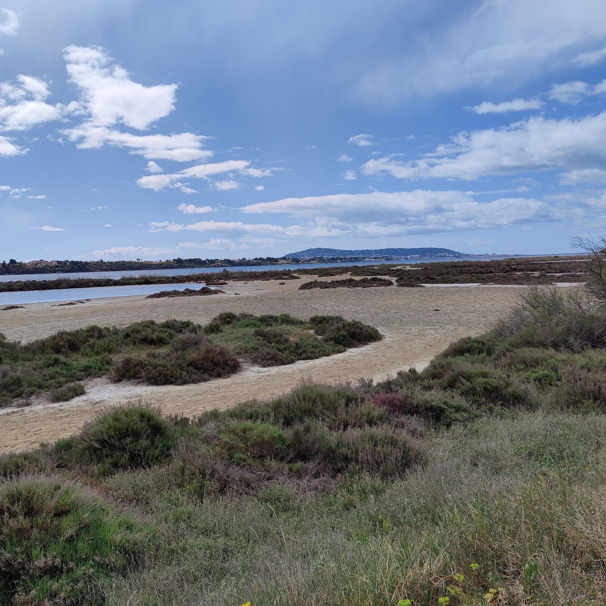
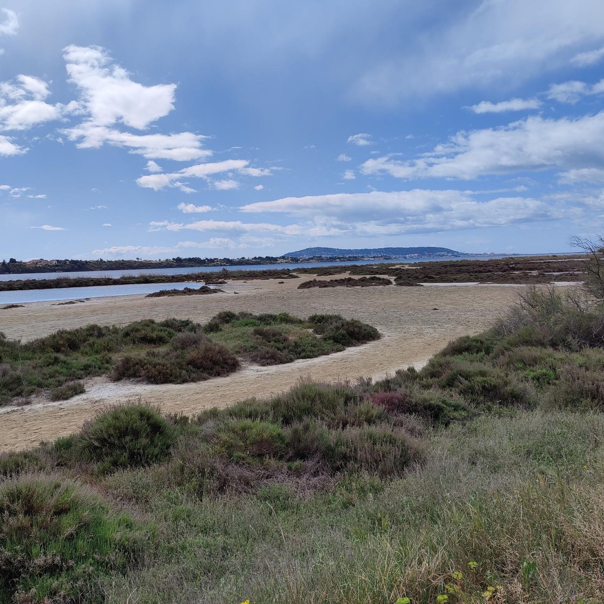
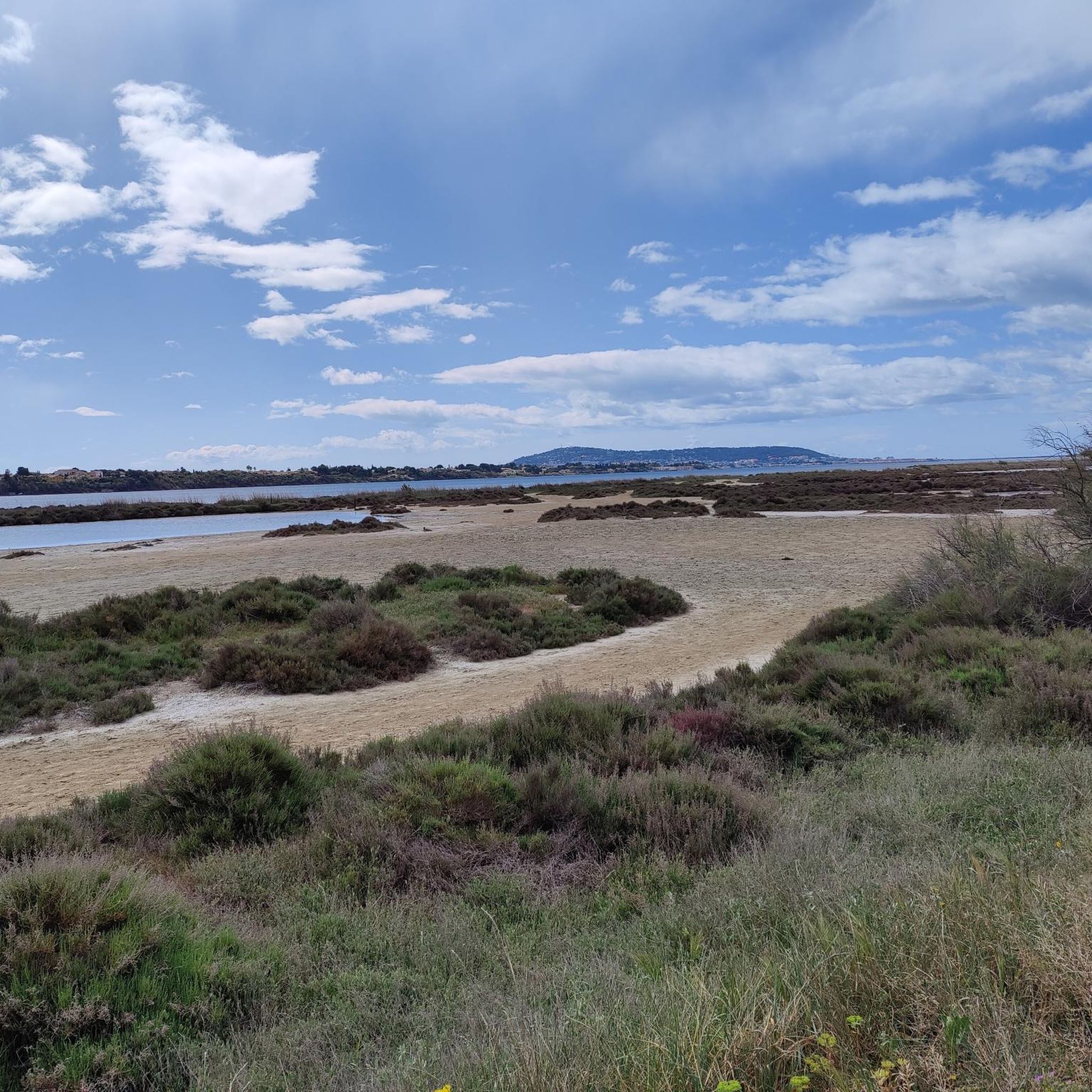
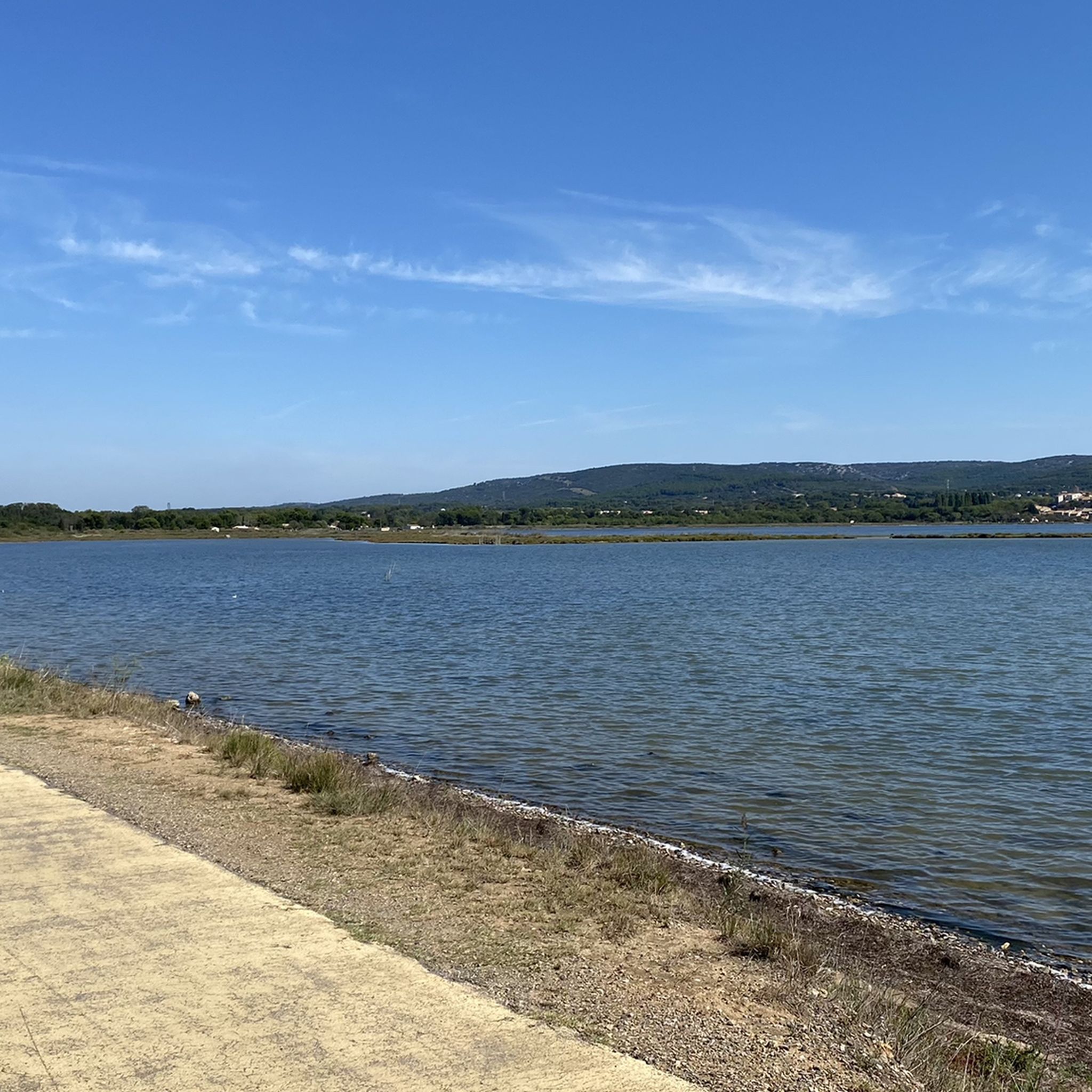
From this path, the view descends towards Vic-la-Gardiole and its pond.
0
0
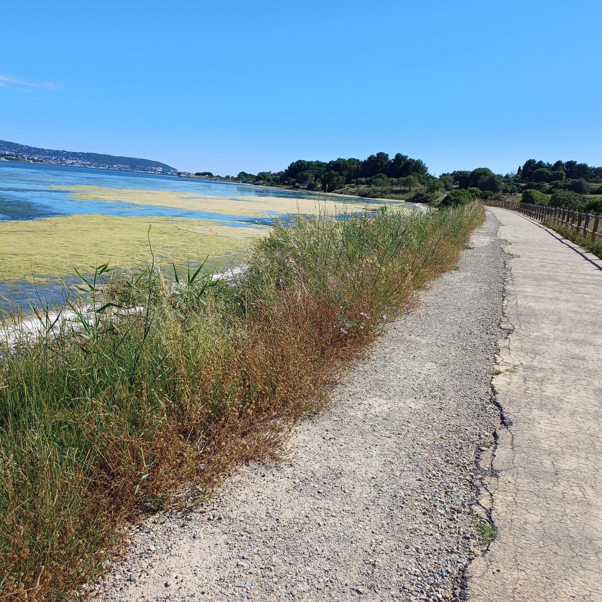
The greenway runs here on a narrow strip of land between the Étang de la Moulière and the Crique de l’Angle. To the south, the view opens up beyond the Crique de l’Angle over the Étang de Thau, then over Sète, dominated by the silhouette of Mont Saint-Clair (183 m).
0
0
This sector offers a climb on a limestone ground characteristic of the massif. The view opens up magnificently over the Thau lagoon and its shellfish farming tables. On a clear day, you can also enjoy a panorama of the Combe de Saint-Félix and the ruins of the ancient Benedictine abbey of Saint-Félix-de-Montceau.
0
0
From Frontignan to Palavas-les-Flots, the route follows the Canal du Rhône à Sète through one of the large lagoon complexes on the Languedoc coast. After the Étang d'Ingril and the Aresquiers, the canal successively crosses or runs alongside the Étangs de Vic and de Pierre-Blanche, then passes between those of l'Arnel and du Prévost before reaching Palavas. The canal itself is a major historical element of this landscape. Its construction began in 1701 under the name Canal des Étangs, in order to ensure continuity between the Royal Canal of Languedoc – today the Canal du Midi – and the Rhône. The route, completed in 1829, passes through Frontignan, Maguelone and Palavas before joining Aigues-Mortes and then Beaucaire. In Frontignan, its opening in the 18th century profoundly modified the landscape: the canal notably separated the former Étang de Frontignan into two complexes, giving rise to the Étang d'Ingril and that of La Peyrade.
2
0
From the greenway, the panorama opens onto the Étang de Vic. This vast coastal lagoon of over 1,000 hectares stretches between the Gardiole massif and the Aresquiers lido. Protected within the Natura 2000 site of the Palavasian ponds and recognized as a wetland of international importance under the Ramsar convention, the pond forms a vast landscape of lagoon, salt marshes, and wetlands here. This opening allows its full extent to be appreciated from the surroundings of Vic-la-Gardiole.
2
0

The greenway between Frontignan and Vic-la-Gardiole is a cycle path of about 9 kilometers, entirely safe and without elevation gain. It runs alongside the departmental road D114, offering a route of great beauty between the sea and the ponds.
0
0
Frequently Asked Questions
What kind of terrain can I expect on gravel bike trails around Poussan?
The Poussan region offers a diverse mix of terrain. To the west, you'll find rugged "garrigues" scrubland, characterized by thorns and stones, while the east features expansive vineyards and agricultural plains. Many routes also explore coastal paths along the Thau Lagoon. This variety means you'll encounter everything from rocky paths to smoother vineyard tracks.
Are there gravel bike routes suitable for beginners or families in Poussan?
Yes, Poussan offers routes for all skill levels, including easy options perfect for beginners or families. For example, the Greenway under the bridge – Old fishing port loop from Balaruc-les-Bains is an easy 18.36 km trail that provides a gentler introduction to gravel biking in the area. There are 4 easy tours available in total.
What are some notable landmarks or viewpoints I can see while gravel biking in Poussan?
The region is rich in natural beauty and historical sites. You can explore the "Capitelles de la Moure" path for panoramic views of the village and the Thau Lagoon, encountering ancient dry-stone structures. Other highlights include the picturesque Port of Mèze, the historic Abbaye Saint Félix de Montceau ruins with their well-maintained garden, and stunning vistas from Vue du Mont Saint-Clair sur l'étang de Thau.
Are there any circular gravel bike routes available in Poussan?
Many of the gravel bike routes around Poussan are designed as loops, allowing you to start and finish in the same location. An example is the challenging Voie Verte Canal du Midi – Bagnas Nature Reserve loop from Mèze, which covers 66.29 km and explores the Canal du Midi and a protected natural area.
What is the best time of year for gravel biking in Poussan?
The Languedoc region generally offers pleasant conditions for outdoor activities. While specific recommendations depend on personal preference, the local "garrigues" terrain can be rugged. It's advisable to check local weather forecasts, especially for summer heat or potential winter conditions. The area is known for hosting gravel biking events, suggesting good riding conditions for much of the year.
What kind of tires are recommended for gravel biking in Poussan?
Given the rugged nature of the local "garrigues" terrain, which can feature thorns and stones, it is highly recommended to use tires with a minimum width of 42mm. A tubeless setup is also advised to minimize punctures and enhance your riding experience.
Can I find routes that offer views of the Thau Lagoon?
Absolutely. Poussan's proximity to the Thau Lagoon means many routes offer beautiful views of this significant natural asset. For instance, The land of oyster beds – View of Sète loop from Loupian is a popular 36.70 km trail that leads through the Thau Lagoon area, providing scenic vistas.
What do other gravel bikers enjoy most about the trails in Poussan?
The gravel biking routes in Poussan are highly rated by the komoot community, with an average score of 4.25 stars from over 80 reviews. Riders frequently praise the diverse terrain, which includes rugged scrubland, scenic vineyards, and coastal paths, as well as the opportunities to explore protected natural areas and historical sites.
Are there any challenging gravel bike routes in the Poussan area?
Yes, for experienced gravel bikers seeking a challenge, Poussan offers several difficult routes. There are 40 difficult tours available in the region. The Voie Verte Canal du Midi – Bagnas Nature Reserve loop from Mèze, at 66.29 km, is classified as difficult and provides a substantial ride through varied landscapes.
Are there any routes that pass through vineyards?
Yes, the region east of Poussan is abundant with grapevines, and many routes will take you through these expansive vineyards. The presence of numerous winegrowers' houses underscores the significant viticultural activity that shapes the landscape, offering a unique backdrop for your ride.
How many gravel bike trails are available around Poussan?
There are over 70 gravel bike trails available around Poussan, catering to various skill levels. This includes 4 easy, 32 moderate, and 40 difficult routes, ensuring there's something for every gravel biker.
Can I find gravel bike routes that offer views from the heights around Poussan?
Yes, you can. The On the heights of Poussan 😍 – Montbazin Church loop from Cournonsec is a moderate 29.33 km path that specifically offers views from the elevated areas surrounding Poussan, providing beautiful panoramas of the landscape.
Are there any coastal cycling paths accessible from Poussan?
Yes, a dedicated cycle path, the Chemin de la plage, Agde to Sète, connects Marseillan Plage and Sète, offering frequent access to the beach. This provides an excellent option for those who enjoy coastal rides and views.
Most popular attractions around Poussan

Get inspired with the komoot mobile app


Explore more
Browse the best Gravel rides in other regions.
