The best running trails around Poussan
4.6
(92)
2,472
runners
22
runs
Jogging around Poussan offers diverse terrain for runners, situated between the Moure hills and expansive vineyards. The region features Mediterranean garrigues to the west, providing natural, uneven surfaces for trail running. To the north, the Thau Lagoon offers access to protected natural areas and mostly paved routes. Additionally, greenways provide traffic-free paths ideal for uninterrupted running.
Best jogging routes around Poussan
- The most popular jogging route is Running loop from Poussan, a 5.9 miles (9.5 km) trail that takes…
Last updated: October 8, 2026
5.0
(1)
68
runners
16.1km
01:42
70m
70m
Hard run. Very good fitness required. Mostly paved surfaces. Suitable for all skill levels.
49
runners
11.3km
01:10
50m
50m
Moderate run. Good fitness required. Mostly paved surfaces. Suitable for all skill levels.

5.0
(1)
88
runners
8.59km
00:54
30m
30m
Moderate run. Good fitness required. Mostly paved surfaces. Suitable for all skill levels.
5.0
(2)
82
runners
12.0km
01:28
190m
190m
Moderate run. Good fitness required. Mostly paved surfaces. Suitable for all skill levels.
8
runners
6.56km
00:41
20m
20m
Moderate run. Good fitness required. Mostly paved surfaces. Suitable for all skill levels.
Get access to more routes and recommendations from other explorers.
Already have an account?
Our route recommendations are based on thousands of hikes, rides, and runs completed by other people on komoot.
Start today with a free account
Your next adventure awaits.
Tips from the Community

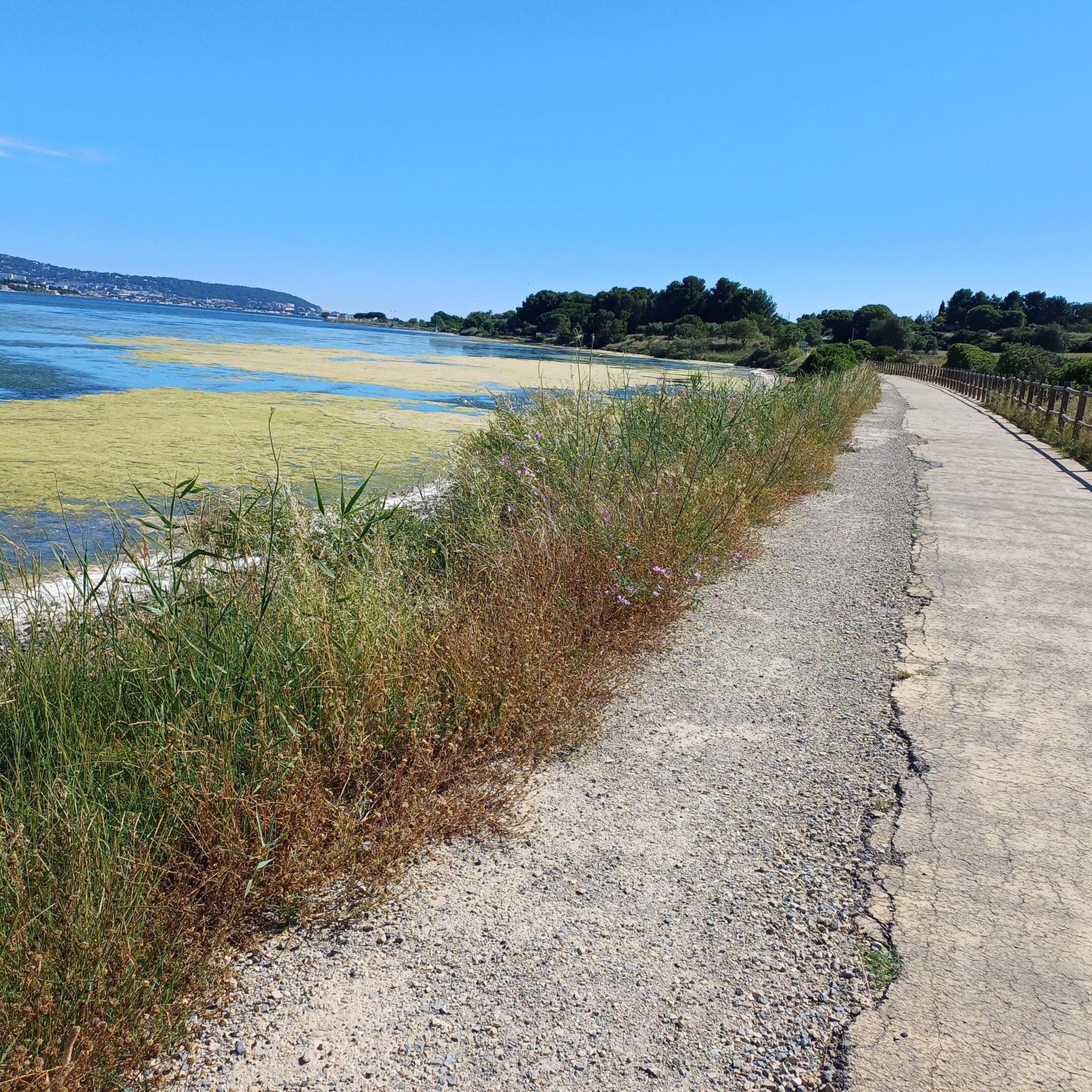
The path that crosses the Catonnière is developed and secured. Between Bouzigues and Balaruc-le-Vieux, this greenway partly follows the old railway line that once connected the two towns. It then gradually reaches the wetlands on the edge of the Thau lagoon. As you approach the Crique de l’Angle, the route becomes particularly unique: the path advances through the water, with ponds on either side. This wetland is a refuge for many birds, especially flamingos. Further on, the greenway returns to dry land in the direction of Balaruc-le-Vieux.
0
0
From the greenway, your gaze plunges onto the Thau pond and its immense checkerboard of shellfish farming tables. These regular alignments are the farming facilities where the lagoon's oysters and mussels are produced. Bouzigues holds a special place in this story: in 1925, Antoine Louis Tudesq and other Bouzigues oyster farmers developed the "Pyramid" technique, which contributed to the development of shellfish farming in the pond.
0
0
Between Bouzigues and Balaruc-le-Vieux, this greenway partly follows the old railway line that once connected the two towns. After crossing landscapes of scrubland and vineyards, it gradually joins the wetlands on the edge of the Thau lagoon. As you approach the Crique de l’Angle, the route becomes particularly unique: the path advances through the water, with ponds on either side. This wetland is a refuge for many birds, especially flamingos. Further on, the greenway returns to dry land in the direction of Balaruc-le-Vieux.
0
0
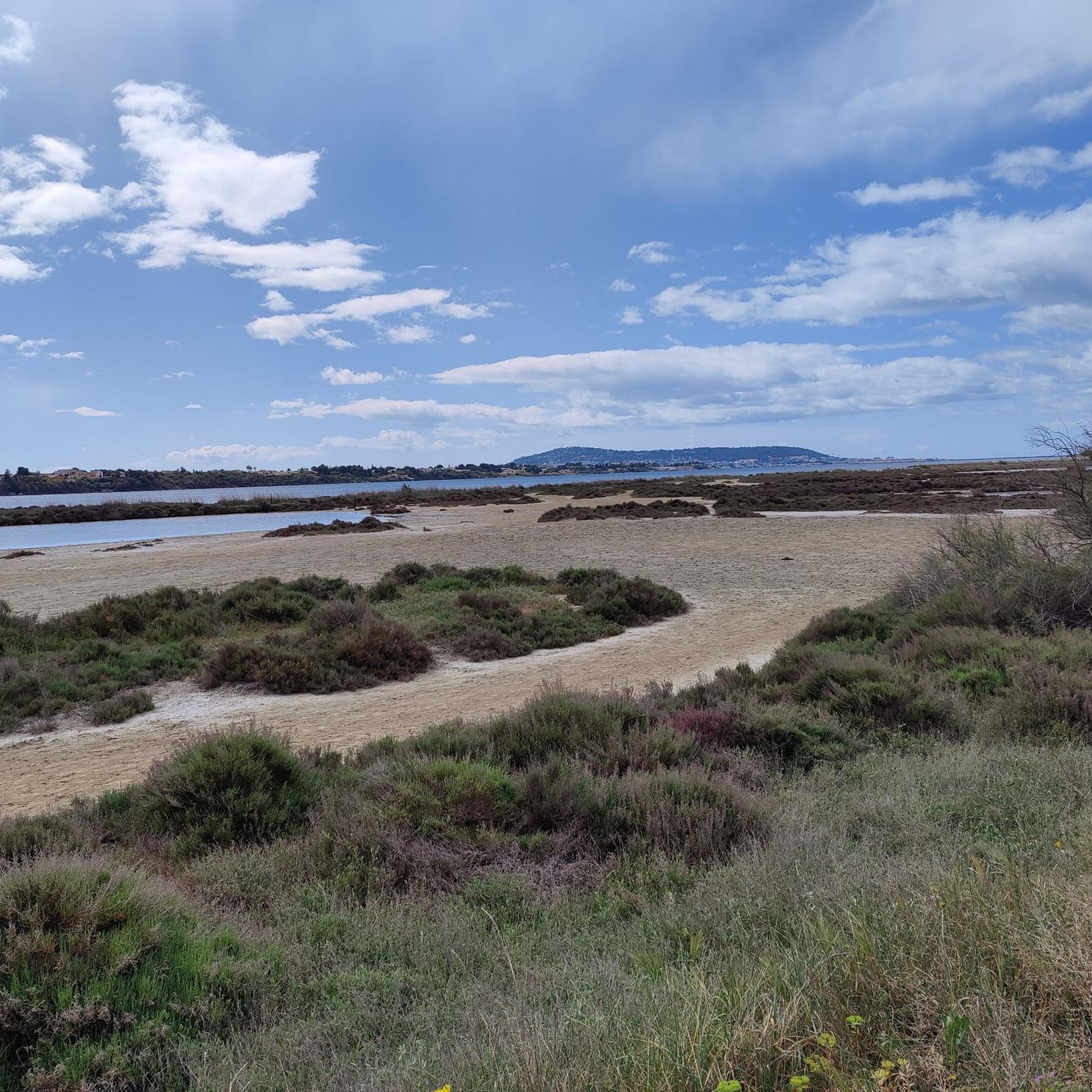
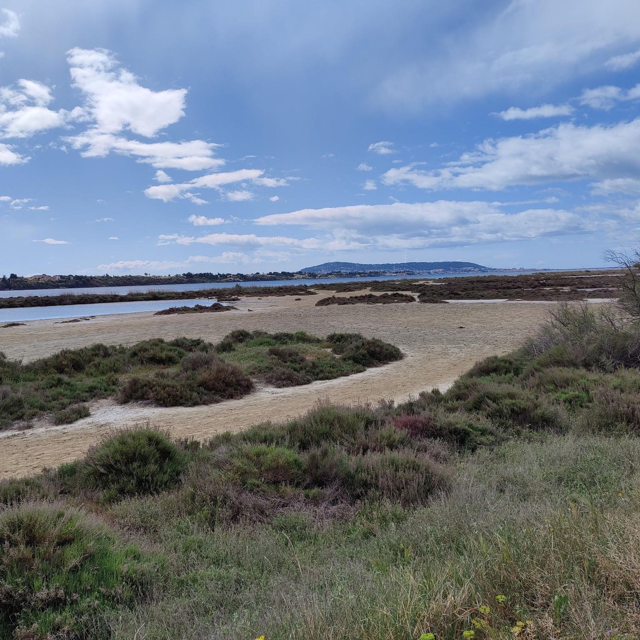
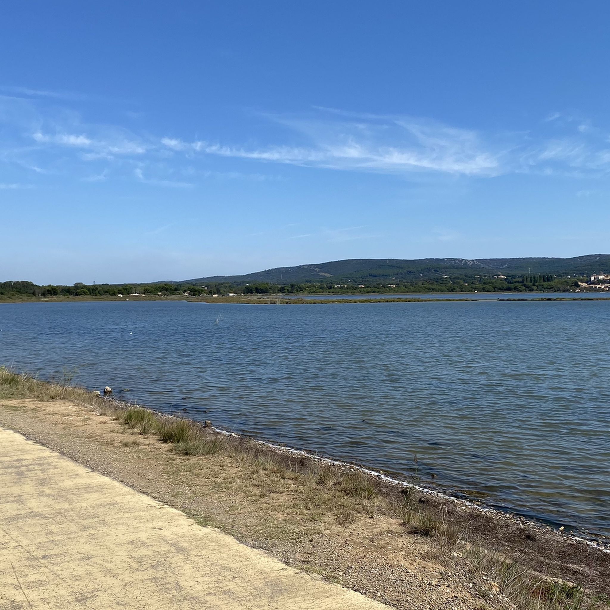
The greenway runs here on a narrow strip of land between the Étang de la Moulière (to the north) and the Crique de l’Angle (to the south). The latter is a natural cove located at the eastern end of the Étang de Thau, where the fresh waters of the Vène meet the brackish waters of the lagoon. This wetland, classified as Natura 2000, hosts numerous water birds in particular. Facing south, the gaze crosses this cove to embrace the Étang de Thau, then Sète, dominated by the silhouette of Mont Saint-Clair (183 m).
0
0
The view plunges over the Thau lagoon and its immense checkerboard of shellfish farms. These regular alignments are the breeding facilities where the oysters and mussels of the lagoon are produced. Bouzigues holds a special place in this history: in 1925, Antoine Louis Tudesq and other Bouzigues oyster farmers developed the "Pyramid" technique, which contributed to the development of shellfish farming in the lagoon. Thus, the panorama allows us to read the landscape differently: behind this vast expanse of water lies a real production area, shaped for over a century by the work of the "sea farmers".
0
0
From La Catonnière, the view plunges over the étang de Thau and its immense checkerboard of shellfish tables. These regular alignments are the breeding facilities where the lagoon's oysters and mussels are produced. Bouzigues holds a special place in this history: in 1925, Antoine Louis Tudesq and other Bouzigues oyster farmers developed the "Pyramid" technique, which contributed to the development of shellfish farming in the étang. The panorama thus allows us to read the landscape differently: behind this vast expanse of water lies a true production space, shaped for over a century by the work of the "sea peasants".
0
0
The greenway runs here on a narrow strip of land between the Étang de la Moulière and the Crique de l’Angle. To the south, the view opens up beyond the Crique de l’Angle over the Étang de Thau, then over Sète, dominated by the silhouette of Mont Saint-Clair (183 m).
0
0
From Bouissat (191 m altitude), the view opens widely to the south and southwest. Poussan appears in the foreground. Beyond, the Montagne de la Gardiole stands out, forming a long relief line between the plain and the coast. The panorama extends to the Thau basin and Sète. In particular, the Mont Saint-Clair can be distinguished in the distance, clearly dominating the city and serving as an excellent landmark for orienting oneself in the landscape.
2
0
Frequently Asked Questions
How many running routes are available around Poussan?
There are over 15 dedicated running routes around Poussan, offering a variety of terrains and distances. These include 5 easy routes, 9 moderate routes, and 3 more challenging options for experienced runners.
What kind of terrain can I expect on the jogging trails in Poussan?
Poussan's jogging trails offer diverse terrain. You'll find gentle slopes through vineyards, more challenging paths in the Moure hills, and natural, uneven surfaces in the Mediterranean garrigues. There are also mostly paved routes around the Thau Lagoon and traffic-free greenways for smoother runs.
Are there any easy or beginner-friendly running routes in the area?
Yes, Poussan offers several easy running routes perfect for beginners or those looking for a relaxed jog. An example is the La Moulière loop from Poussan, a 4.4 km trail that's often completed in under 30 minutes. Another easy option is the Walk by the Pond loop from Balaruc-le-Vieux, which is about 3.15 km.
Can I find challenging running routes with significant elevation gain near Poussan?
Absolutely. For a more strenuous workout, consider routes like the Grotte du Col de Gigean loop from Issanka. This difficult 12 km path features significant elevation gain through the Col de Gigean area, providing a rewarding challenge.
Are there any running routes that offer scenic views or pass by natural features?
Many routes in Poussan offer beautiful scenery. The area is surrounded by the Moure hills and vineyards, providing picturesque backdrops. You can also find routes near the Thau Lagoon, offering tranquil views of the saltwater body. For stunning panoramic views, consider routes that ascend towards points like the Vue du Mont Saint-Clair sur l'étang de Thau.
What do other runners say about the trails in Poussan?
The running routes in Poussan are highly rated by the komoot community, with an average score of 4.5 stars from over 50 reviews. Runners often praise the varied terrain, from the peaceful vineyards to the more rugged hills, and the well-maintained paths, especially the greenways.
Are there any historical sites or landmarks I can see while running?
Yes, you can incorporate historical exploration into your run. The magnificent Abbaye Saint Félix de Montceau, a ruin perched on a hilltop, offers not only a historical point of interest but also a destination for a scenic jog with panoramic views. Some routes also pass near the Royal Canal of Sète.
Are there any circular running routes available?
Many of the running routes around Poussan are designed as circular loops, allowing you to start and finish in the same location. Examples include the popular Running loop from Poussan and the Walk by the Pond loop from Poussan.
Are there any running paths near water bodies or lakes?
Poussan is situated north of the Thau Lagoon, offering access to protected natural areas around this large body of saltwater. The "Promenade au Bord de l'Étang" (Lakeside Walk) provides a moderate jogging route, mostly on paved surfaces, allowing runners to enjoy the tranquility and unique ecosystem of the lagoon. You can also find routes near Vic Pond.
What are 'Voies Vertes' and are they suitable for running in Poussan?
Voies Vertes, or 'Greenways,' are typically disused railway lines or canal towpaths converted into multi-use paths. In Poussan, these greenways offer traffic-free, often shaded, and relatively flat surfaces, making them ideal for uninterrupted jogging and enjoying the natural surroundings.
Is there a dedicated fitness trail in Poussan?
Yes, Poussan features a dedicated 'Parcours de Santé' (Fitness Trail) located behind the gymnasium. This trail is equipped with apparatus for physical conditioning, offering joggers the opportunity to incorporate strength and flexibility exercises into their routine for a comprehensive outdoor workout.
Can I find running routes that are easily accessible from the village center?
Many routes, such as the Running loop from Poussan and the La Moulière loop from Poussan, start directly from the village, making them very convenient for local residents and visitors staying in Poussan.
Most popular attractions around Poussan

Get inspired with the komoot mobile app


Explore more
Browse the best Running Trails & Routes in other regions.
