The best walks and hikes around Poussan
4.4
(912)
7,254
hikers
399
hikes
Hiking around Poussan offers trails through the varied landscapes of the Hérault department. The region is characterized by rolling hills, Mediterranean scrubland, and views towards the coast and nearby lagoons. Elevation changes are generally moderate, making the terrain accessible for different hiking abilities. The area provides a mix of open paths and routes through local villages.
Best hiking trails around Poussan
- The most popular hiking route is View of Sète – View of Sète from Bouzigues loop from Balaruc-le-Vieux,…
Last updated: September 28, 2026
4.6
(11)
75
hikers
Moderate hike. Good fitness required. Easily-accessible paths. Suitable for all skill levels.
4.3
(13)
92
hikers
13.4km
03:41
210m
210m
Moderate hike. Good fitness required. Easily-accessible paths. Suitable for all skill levels.

5.0
(3)
15
hikers
Moderate hike. Good fitness required. Easily-accessible paths. Suitable for all skill levels.
4.3
(7)
55
hikers
16.5km
04:29
240m
240m
Moderate hike. Good fitness required. Easily-accessible paths. Suitable for all skill levels.
4.0
(4)
17
hikers
12.3km
03:27
250m
250m
Moderate hike. Good fitness required. Easily-accessible paths. Suitable for all skill levels.
Get access to more routes and recommendations from other explorers.
Already have an account?
Our route recommendations are based on thousands of hikes, rides, and runs completed by other people on komoot.
Start today with a free account
Your next adventure awaits.
Tips from the Community

At Plan de Lacan, at the crossroads of several Gardiole trails, these cisterns intended for forest fire defense have been transformed into true works of street art as part of the Cit’Art project, led by the Département de l’Hérault. Since 2017, twelve cisterns in the massif have served as canvases for the creations of several artists from the Line Up collective.
0
0
At Plan de Lacan, at the crossroads of several trails in the Gardiole, these cisterns, intended for forest fire defense, have been transformed into true works of street art as part of the Cit’Art project, led by the Département de l’Hérault. Since 2017, twelve cisterns in the massif have served as canvases for the creations of several artists from the Line Up collective.
0
0
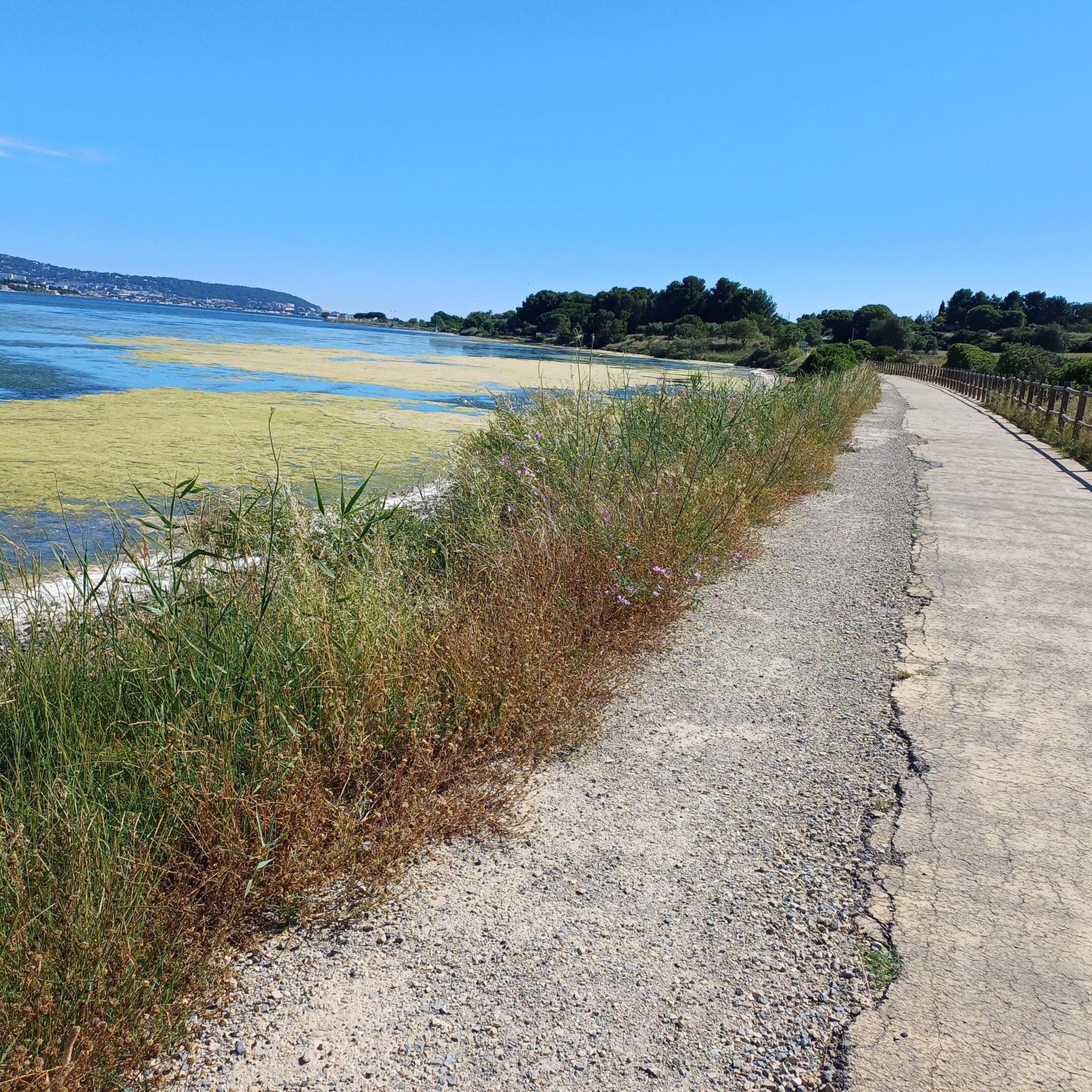
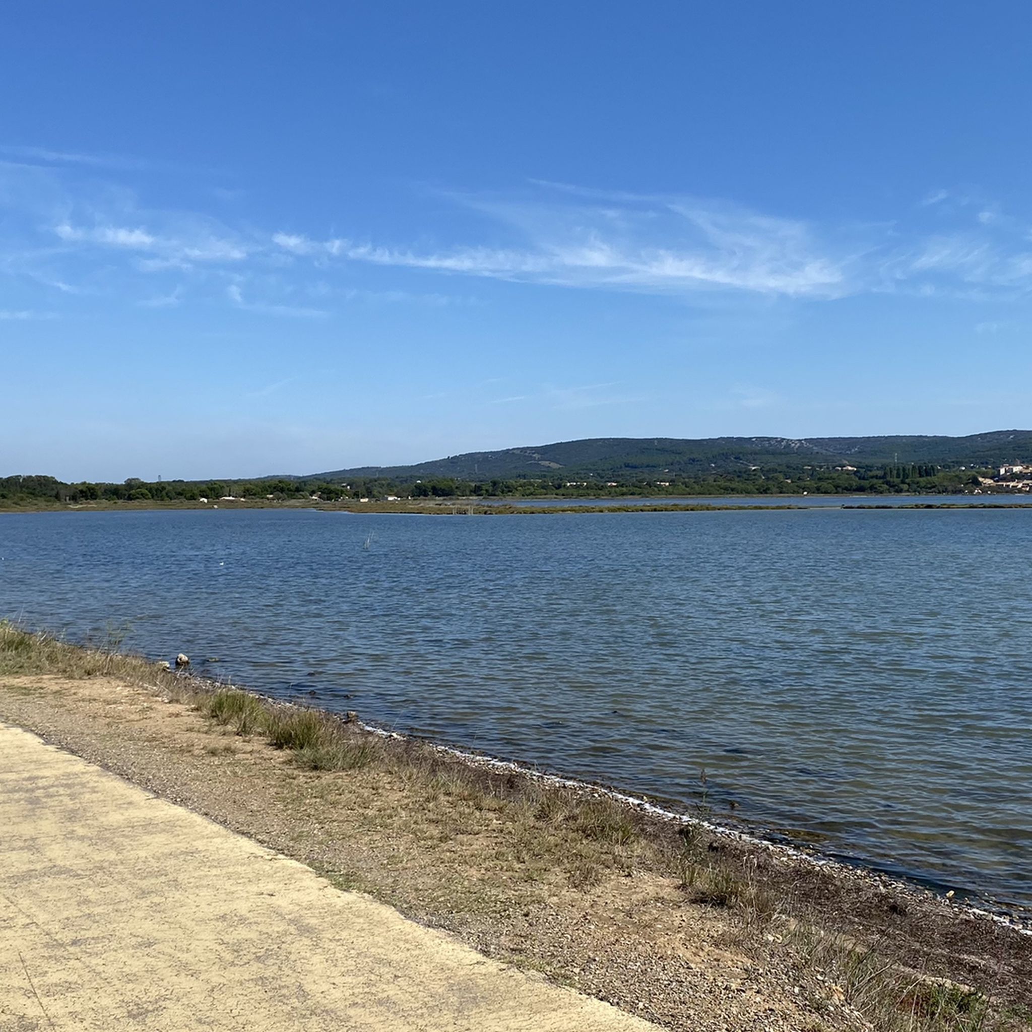
Between Bouzigues and Balaruc-le-Vieux, this greenway partly follows the old railway line that once connected the two towns. After crossing landscapes of scrubland and vineyards, it gradually joins the wetlands on the edge of the Thau lagoon. As you approach the Crique de l’Angle, the route becomes particularly unique: the path advances through the water, with ponds on either side. This wetland is a refuge for many birds, especially flamingos. Further on, the greenway returns to dry land in the direction of Balaruc-le-Vieux.
0
0
At the place called “ Le Badaud ”, several Gardiole trails converge around this cistern, a true landmark in the heart of the garrigue. From this crossroads, the trails allow access to different sectors of the massif: to the north, the Saint-Félix-de-Montceau abbey; to the south, the ridges overlooking the coast and the Vic-la-Gardiole lagoon.
0
0
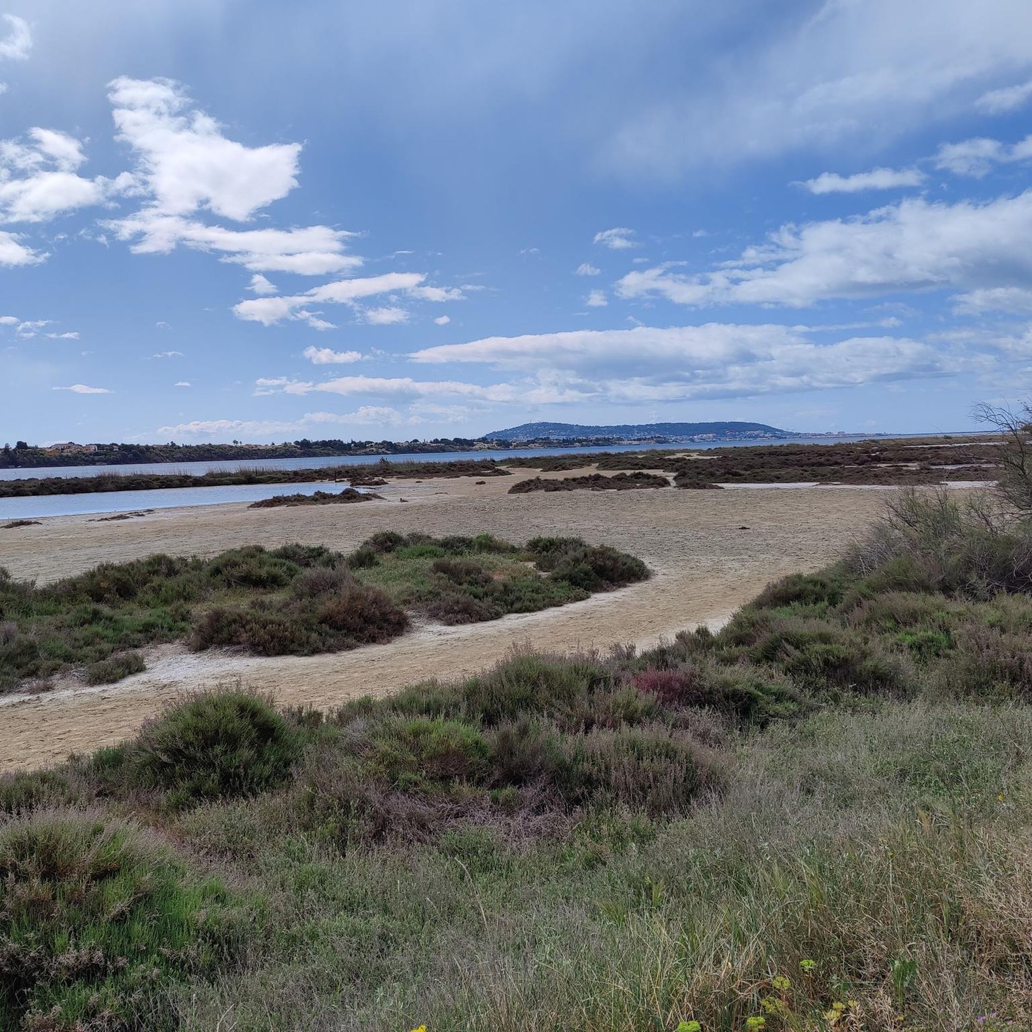
The greenway runs here on a narrow strip of land between the Étang de la Moulière (to the north) and the Crique de l’Angle (to the south). The latter is a natural cove located at the eastern end of the Étang de Thau, where the fresh waters of the Vène meet the brackish waters of the lagoon. This wetland, classified as Natura 2000, hosts numerous water birds in particular. Facing south, the gaze crosses this cove to embrace the Étang de Thau, then Sète, dominated by the silhouette of Mont Saint-Clair (183 m).
0
0
The greenway runs here on a narrow strip of land between the Étang de la Moulière and the Crique de l’Angle. To the south, the view opens up beyond the Crique de l’Angle over the Étang de Thau, then over Sète, dominated by the silhouette of Mont Saint-Clair (183 m).
0
0
At the turn of the paths of La Gardiole, the ruins of the ancient abbey Saint-Félix-de-Montceau appear. The site, attested as early as 1104, was occupied for several centuries by a community of nuns, first Benedictine and then, for a period, Cistercian. The Gothic abbey church, built at the end of the 13th century, is today the most spectacular remnant of this medieval complex. Abandoned as a monastic site after the transfer of the community to Gigean in 1514, the site was long left to ruin before an association undertook its preservation in 1970. Today, the stones of the abbey church stand in the heart of the garrigue, on the northern slope of the limestone massif with the plain of Gigean in the background.
1
0

Loop trail around the abbey poorly marked. I ended up on the road.
0
0
Frequently Asked Questions
How many hiking trails are available around Poussan?
Poussan offers a wide variety of hiking opportunities, with over 350 routes recorded on komoot. These range from easy strolls to more challenging excursions, catering to different fitness levels.
Are there easy or beginner-friendly hikes in Poussan?
Yes, Poussan is well-suited for beginners and those looking for easier walks. There are nearly 200 easy routes available, often featuring gentle terrain through Mediterranean scrubland and local villages. These trails typically have moderate elevation changes, making them accessible for a relaxed outing.
What is the best time of year to go hiking in Poussan?
The best time to hike in Poussan is generally during spring (April-May) and autumn (September-October). During these seasons, the weather is mild and pleasant, avoiding the intense heat of summer and the cooler, sometimes wetter, winter months. The Mediterranean landscape is particularly vibrant in spring.
Are there any circular hiking routes around Poussan?
Many of the trails in the Poussan area are designed as circular routes, allowing you to start and end at the same point. An example is the Surroundings of Montbazin loop from Montbazin, which explores diverse terrain and offers a complete experience without retracing your steps.
Can I bring my dog on the hiking trails in Poussan?
Many trails around Poussan are dog-friendly, but it's always recommended to check specific route details for any restrictions, especially in nature reserves or protected areas. Keep your dog on a leash, particularly during nesting seasons or when passing through agricultural land, and always clean up after your pet.
What kind of terrain can I expect on hikes in Poussan?
The terrain around Poussan is characterized by rolling hills and Mediterranean garrigue. You'll find a mix of open paths, tracks through vineyards, and routes passing through charming local villages. Elevation changes are generally moderate, offering accessible hiking for various abilities.
Are there any challenging hikes for experienced hikers in Poussan?
While Poussan is known for its accessible trails, there are also options for more experienced hikers. The region offers 13 difficult routes that provide greater elevation gain and longer distances. These trails will test your endurance while rewarding you with expansive views.
What are some interesting landmarks or attractions to see while hiking near Poussan?
The Poussan area is rich in natural beauty and historical sites. You can explore highlights such as the historic Abbaye Saint Félix de Montceau, or enjoy stunning coastal vistas from viewpoints like Vue du Mont Saint-Clair sur l'étang de Thau. Many routes also pass by the picturesque Bouzigues oyster farms and views of the Étang de Thau.
Are there family-friendly hiking options in Poussan?
Yes, Poussan offers many trails suitable for families. The abundance of easy routes with moderate terrain makes it ideal for outings with children. Look for shorter, well-maintained paths that allow for leisurely exploration of the local landscapes and villages.
What do other hikers say about the trails in Poussan?
The hiking trails around Poussan are highly regarded by the komoot community, with an average rating of 4.5 stars from over 780 reviews. Hikers often praise the diverse landscapes, the panoramic views towards the coast and lagoons, and the well-maintained paths that make for an enjoyable experience.
Where can I find parking for hiking trails in Poussan?
Parking is generally available near the starting points of many popular trails and in the villages surrounding Poussan. It's advisable to check the specific route details on komoot, as many tours provide information on recommended parking spots, often in village centers or designated trailheads.
Are there any hikes that offer views of the coast or lagoons?
Absolutely. The region around Poussan is known for its proximity to the coast and lagoons. For example, the View of Sète – View of Sète from Bouzigues loop from Balaruc-le-Vieux offers panoramic views of Sète and the surrounding coastal area, providing a beautiful Mediterranean hiking experience.
What is the typical duration of hikes in Poussan?
Hikes in Poussan vary in duration depending on the route's length and difficulty. Many popular moderate trails, such as the View of Vic-la-Gardiole – Abbaye Saint Félix de Montceau loop from Balaruc-le-Vieux, can take around 4 to 5 hours to complete. Shorter, easy routes are available for quicker outings, while longer options can extend your adventure.
Most popular attractions around Poussan

Get inspired with the komoot mobile app


Explore more
Browse the best Hikes in other regions.
