The best gravel rides around Macharaviaya
3.0
(1)
33
riders
4
rides
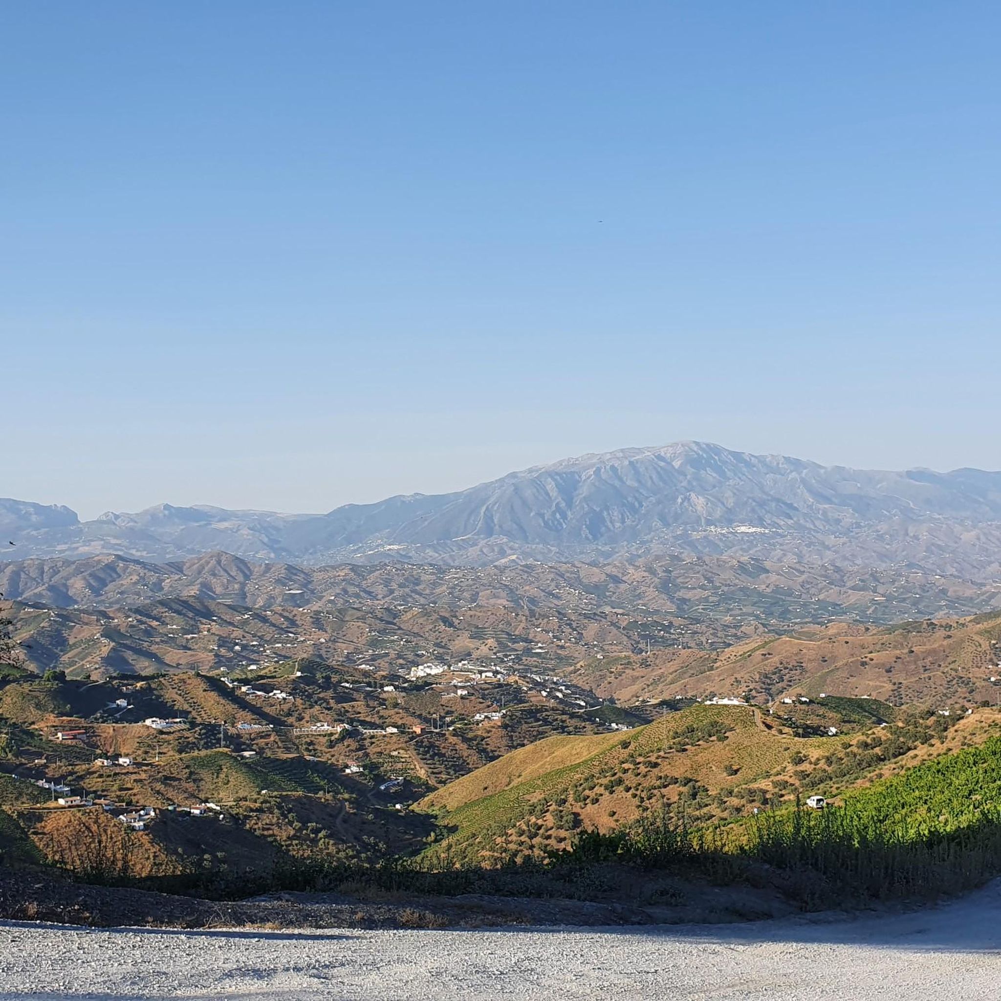
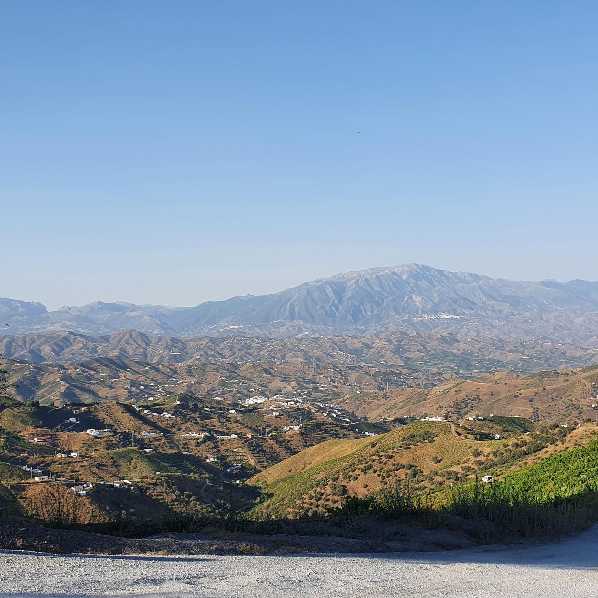
Gravel biking around Macharaviaya offers varied landscapes across its hilly terrain, providing views of the Mediterranean Sea and the Axarquía coast. The region is characterized by extensive vine plantations and Mediterranean bush. This network of trails provides diverse riding experiences, combining paved roads with gravel paths through agricultural areas. Rugged features like steep cliffs and flowing streams add to the varied topography.
Best gravel bike trails around Macharaviaya
- The most popular gravel bike trail is Torre del Cantal – Rincón…
Last updated: July 3, 2026
11
riders
Easy gravel ride. Great for any fitness level. Mostly paved surfaces. Suitable for all skill levels.
15
riders
95.9km
06:28
1,620m
1,620m
Hard gravel ride. Very good fitness required. Mostly paved surfaces. Suitable for all skill levels.

Sign up for free
2
riders
Hard gravel ride. Very good fitness required. Mostly paved surfaces. Suitable for all skill levels.
3.0
(1)
3
riders
Hard gravel ride. Very good fitness required. Mostly paved surfaces. Suitable for all skill levels.
2
riders
34.5km
02:37
720m
720m
Hard gravel ride. Very good fitness required. Mostly paved surfaces. Suitable for all skill levels.
Our route recommendations are based on thousands of hikes, rides, and runs completed by other people on komoot.
Start today with a free account
Your next adventure awaits.
Login or Signup
Tips from the Community

The Casa Fuerte de Bezmiliana is one of the most emblematic buildings in Rincón de la Victoria and was built in 1766, during the reign of Charles III. Its function was to reinforce the defense of the coast against pirate attacks and invasions, complementing the area's watchtower system. With its square floor plan, robust walls, corner towers, and old moat, it is a good example of 18th-century coastal military architecture. Today it functions as a cultural space and hosts exhibitions and activities throughout the year.
1
0
The Cantal tower is an old watchtower located on a rocky promontory, about 30 meters above the sea. Of Nasrid or Moorish origin, it was part of the coastal defense system and was used to warn of possible pirate attacks by means of smoke or fire signals. Today it is protected as a Site of Cultural Interest and is one of the best spots to enjoy the coastal views.
1
0
The Rincón de la Victoria tunnels were excavated in the rock for the old train that connected Málaga with Vélez-Málaga. That train, popularly known as La Cochinita, transported passengers and goods until it stopped running in 1960. Today, crossing these tunnels is a curious way to glimpse the railway history of the Málaga coast, with sea views between one section and another.
1
0

The Bezmiliana Fortress was built in 1766 in present-day Rincón de la Victoria, in the province of Málaga, and is a typical example of 18th-century military coastal architecture. Its construction took place under the reign of King Charles III, in order to better protect the Andalusian Mediterranean coast against pirate raids and enemy fleets, as the older watchtowers were no longer able to cope with these threats. The fortress has a square floor plan with massive walls, corner towers, and a moat, and was designed to serve both defensive purposes and to house soldiers and horses. Over time, the fortress lost its military importance and partially fell into disrepair. It was only towards the end of the 20th century that it was extensively restored and put to a new use. Since 1992, the Bezmiliana Fortress has served as a cultural center, hosting exhibitions, concerts, and other events. Thus, it has evolved from a military defense structure into an important historical and cultural site in the region.
0
0
The Torre Vigía de El Cantal is a 14th-century Moorish coastal watchtower that was part of a defense system against pirates. It stands on a rocky outcrop about thirty meters above the sea. The tower is approximately eight to ten meters high, built of stone and limestone, and was used for signaling with smoke and fire. After the Reconquista, it lost its military significance but remained as a landmark. Today, it is protected as a cultural monument ("Bien de Interés Cultural") and offers a breathtaking view of the coast.
4
0
The Paseo Virgen del Carmen in Rincón de la Victoria is a particularly picturesque stretch of the seafront promenade, extending along the rocky coast to the cliffs of El Cantal. The path offers magnificent views of the Mediterranean Sea, and at its end, a small chapel is nestled into the rocks. This section of the Paseo Virgen del Carmen thus impressively combines nature, faith, and art – ideal for a peaceful moment by the sea, especially at sunset when the rocks and the sea are bathed in golden light.
2
1
The sculpture ensemble "Dolphins by the Sea" by artist Salvador Gómez Escaño is located on the Rincón de la Victoria seafront and was inaugurated in March 2024. It is a work that symbolizes the close relationship between the coastal town, the sea, and its natural environment. The inscription emphasizes that the beaches are more than just water and sand – they are places of life and inspiration. Their preservation is seen as a duty, their enjoyment as a privilege. With this ensemble, the town of Rincón de la Victoria honors the importance of the sea to the life of the community and simultaneously sets an artistic example of environmental awareness and connection to the coast.
1
0

they are spectacular...
2
1
Frequently Asked Questions
What types of landscapes can I expect on gravel bike trails around Macharaviaya?
Gravel biking around Macharaviaya offers a diverse experience, traversing hilly terrain with extensive vine plantations and Mediterranean bush. You'll encounter rugged features like steep cliffs and flowing streams, often with spectacular views of the Mediterranean Sea and the Axarquía coast from higher points. Routes combine paved roads with gravel paths through agricultural areas.
Are there any easy gravel bike routes suitable for beginners in Macharaviaya?
Yes, there are easy routes available. For instance, the Torre del Cantal – Rincón de la Victoria Beach loop from Rincón de la Victoria is an easy 15.4 km (9.5 miles) trail with minimal elevation gain, perfect for a relaxed ride along the coast. Another easy option is the Rincón de la Victoria Beach – Paseo de la Marina loop from La Cala del Moral, covering 15.0 km (9.3 miles).
What are some challenging gravel bike routes for experienced riders in the Macharaviaya area?
For experienced riders seeking a challenge, Macharaviaya offers several difficult routes with significant elevation changes. The Sayalonga Town Center – Monument to Peace loop from Busdiensten is a demanding 66.3 km (41.2 miles) path that traverses diverse landscapes. Another difficult option is the Direct Ascent to Canillas de Aceituno – Monument to Peace loop from Benagalbón, which spans 95.9 km (59.6 miles) with substantial climbs.
Can I find circular gravel bike routes around Macharaviaya?
Yes, many of the gravel bike routes in the area are loops, allowing you to start and end in the same location. Examples include the Torre del Cantal – Rincón de la Victoria Beach loop and the Torre de Albenda – Junction to Camino del Tunante loop, both starting from Rincón de la Victoria.
What are some interesting landmarks or attractions I might see along the gravel bike routes?
While riding, you can encounter various points of interest. Near the coast, you might pass the Tunnels of the Coastal Greenway or enjoy the Rincón de la Victoria Beach. Inland, routes can lead you past natural features like the Bolina Pass or offer views of charming settlements such as Comares Village. You might also spot the Peñón del Cuervo rock formation or the Cueva del Tesoro.
What do other gravel bikers say about the trails in Macharaviaya?
The gravel biking routes around Macharaviaya are generally well-regarded by the komoot community, holding an average rating of 3.7 stars from several reviews. Riders often appreciate the varied terrain, the stunning Mediterranean views, and the mix of coastal paths and challenging inland climbs.
Are there any routes that offer sea views?
Absolutely. Macharaviaya's elevated position and proximity to the coast mean many routes provide spectacular views of the Mediterranean Sea and the Axarquía coastline. Coastal routes like the Torre del Cantal – Rincón de la Victoria Beach loop offer direct sea vistas, while higher inland trails also provide panoramic coastal outlooks.
What is the best time of year for gravel biking in Macharaviaya?
Macharaviaya is suitable for gravel biking for much of the year. The Mediterranean climate means mild winters, making it a good destination for winter riding. Spring and autumn offer pleasant temperatures, ideal for exploring the varied terrain without extreme heat. Summers can be hot, so early morning or late afternoon rides are recommended during those months.
Are there any routes that pass through vineyards or agricultural areas?
Yes, the region around Macharaviaya is characterized by extensive vine plantations. Many gravel routes, particularly those venturing inland, will take you through these picturesque vineyards and other agricultural landscapes, offering a unique scenic experience.
How many gravel bike trails are available in the Macharaviaya area?
There are at least 6 gravel bike trails documented in the Macharaviaya area, offering a range of difficulties from easy coastal rides to challenging routes with significant elevation gains.
Are there any natural features like rivers or rock formations to see?
Yes, the landscape includes natural features such as the Macharaviaya and Fuente Horno streams. You can also find impressive rock formations like the Peñón del Cuervo and the Raven Rock, which add to the scenic beauty of the area.
What kind of elevation changes can I expect on the gravel routes?
The elevation changes vary significantly depending on the route. Easy coastal trails have minimal elevation gain, while more difficult routes, such as the Sayalonga Town Center – Monument to Peace loop, can feature over 1,200 meters (3,900 feet) of ascent, providing a challenging workout through the hilly terrain.
Most popular routes around Macharaviaya
Most popular attractions around Macharaviaya

Get inspired with the komoot mobile app


Explore more
Browse the best Gravel rides in other regions.
