The best gravel rides around Gündlischwand
4.8
(40)
469
riders
19
rides
Gravel biking around Gündlischwand offers routes through the Lütschine Valley, characterized by its alpine setting and surrounding peaks. The region features a mix of forested sections, open valley floors, and ascents into higher mountain terrain. Riders can expect varied surfaces, from compacted gravel paths to more rugged tracks, often alongside rivers or through small villages.
Best gravel bike trails around Gündlischwand
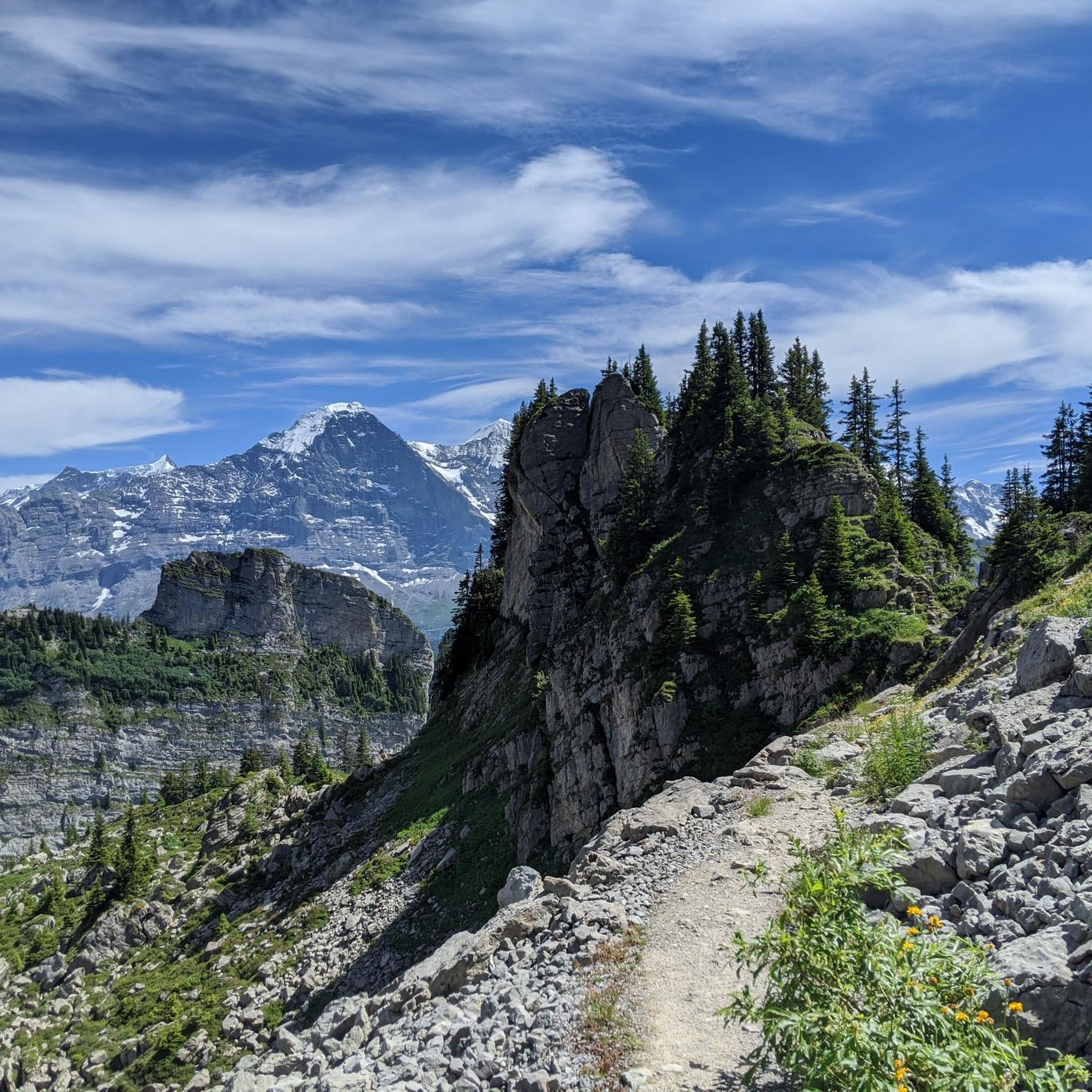
- The most popular gravel bike trail is Männlichen Viewpoint – View of the Eiger loop from Wengen, a…
Last updated: July 2, 2026
30
riders
55.6km
05:05
1,460m
1,460m
Hard gravel ride. Very good fitness required. Mostly paved surfaces. Suitable for all skill levels.
5.0
(3)
13
riders
26.1km
03:08
1,090m
1,090m
Hard gravel ride. Very good fitness required. Mostly paved surfaces. Suitable for all skill levels.

Sign up for free
53
riders
57.8km
04:54
1,850m
1,850m
Hard gravel ride. Very good fitness required. Mostly paved surfaces. Suitable for all skill levels.
5.0
(1)
48
riders
57.1km
04:39
1,720m
1,720m
Hard gravel ride. Very good fitness required. Mostly paved surfaces. Suitable for all skill levels.
5.0
(2)
35
riders
37.1km
02:41
760m
760m
Hard gravel ride. Very good fitness required. Mostly paved surfaces. Suitable for all skill levels.
Get access to more routes and recommendations from other explorers.
Sign up for free
Already have an account?
Our route recommendations are based on thousands of hikes, rides, and runs completed by other people on komoot.
Start today with a free account
Your next adventure awaits.
Login or Signup

Tips from the Community

The lakeside road connects Thun and Interlaken along the northern shore. It's recommended to cycle towards Interlaken, as this offers the best views of the beautiful lake. Since you'll pass through several short tunnels, your bicycle should be equipped with front and rear lights. Please note that due to the limited space on the hillside, there is no dedicated cycle lane. However, as it's not a main thoroughfare, cycling is still quite pleasant.
1
0
The small village of Habkern lies seven kilometers from Interlaken in the direction of Lombachalp. Many stately wooden farmhouses stand around the village fountain, which is guarded by a hawk. Especially in spring and summer, when the red geraniums bloom in front of the windows, this creates a unique sight.
1
0

Have a flashlight ready for the lower section.
0
0

Benches with a sensational view. Very cheap drinks available from the refrigerator.
1
0

Couldn't do the last part because it went up too steeply on a very narrow road.
0
0

Dreamlike landscape, turquoise lake, snow-covered 4,000-meter peaks in the background, swimming spots everywhere.
1
0

It is always more pleasant to drive around Lake Thun on the left-hand side when looking from Thun.
1
0

At the foot of the Bernese Alps, one of its highest peaks already stands before you in its entirety. This is the Wetterhorn, the most visible peak from Grindelwald.
0
0
Frequently Asked Questions
How many gravel bike trails are available around Gündlischwand?
There are over 30 gravel bike trails around Gündlischwand, offering a diverse range of experiences through the Lütschine Valley and surrounding alpine terrain. The komoot community has explored these routes more than 800 times.
What is the general difficulty level of gravel biking in Gündlischwand?
Gravel biking around Gündlischwand offers a mix of difficulties. While there is 1 easy route, the majority of trails are more challenging, with 7 moderate and 26 difficult routes. Riders can expect significant elevation gains and varied terrain, characteristic of alpine environments.
Are there any easy gravel bike routes suitable for beginners or families?
Yes, there is 1 easy gravel bike route available. While many trails feature challenging ascents, some sections along the valley floor are more gentle. For a relatively less strenuous option, consider parts of the Staubbach Falls – Lauterbrunnen Valley loop from Lütschental, which follows the scenic Lauterbrunnen Valley.
Which gravel bike trails offer the most spectacular views?
Many trails in Gündlischwand boast incredible views. The Männlichen Viewpoint – View of the Eiger loop from Wengen is renowned for its panoramic views of the Eiger. Another excellent choice for extensive mountain vistas is the Grosse Scheidegg – Spectacular view loop from Wilderswil, which navigates stunning alpine landscapes.
What natural attractions can I see along the gravel bike trails?
The region is rich in natural beauty. You can encounter impressive waterfalls like Staubbach Falls and Giessbach Falls. Some routes also pass by beautiful lakes such as Bachalpsee or offer views towards Hinterburgseeli. The View of Oltschibach Waterfall – Giessbach Falls loop from Matten b. Interlaken specifically highlights these natural wonders.
Are there many loop trails for gravel biking in Gündlischwand?
Yes, many of the gravel bike routes around Gündlischwand are designed as loops, allowing you to start and finish at the same point. Examples include the Männlichen Viewpoint – View of the Eiger loop from Wengen and the Staubbach Falls – Lauterbrunnen Valley loop from Lütschental.
What is the typical length and duration of gravel bike trails in this area?
The gravel bike trails around Gündlischwand vary significantly in length and duration. You'll find routes ranging from shorter options like the Staubbach Falls – Lauterbrunnen Valley loop from Lauterbrunnen at about 12 miles (19.7 km) taking around 1 hour 30 minutes, to longer, more demanding tours such as the Männlichen Viewpoint – View of the Eiger loop from Wengen, which is 35.9 miles (57.8 km) and can take nearly 6 hours.
When is the best time of year for gravel biking in Gündlischwand?
The best time for gravel biking in Gündlischwand is generally from late spring to early autumn (May to October). During these months, the weather is more stable, and higher alpine passes are typically clear of snow, offering access to the full network of trails. Always check local weather and trail conditions before heading out.
What do other gravel bikers say about the trails in Gündlischwand?
The gravel biking routes in Gündlischwand are highly rated by the komoot community, with an average score of 4.7 stars from over 70 reviews. Riders frequently praise the stunning alpine scenery, the varied terrain, and the challenging yet rewarding ascents that lead to spectacular viewpoints.
Are there options for public transport to access gravel bike trails in Gündlischwand?
Gündlischwand and the surrounding Lütschine Valley are well-served by public transport, including trains and post buses, which often allow bicycle transport (check specific service rules). This makes it convenient to access various starting points for gravel bike trails, such as Lütschental or Wilderswil, and to plan one-way routes if desired.
Where can I find parking for gravel biking in Gündlischwand?
Parking is generally available in the villages and towns surrounding Gündlischwand, such as Lütschental, Wilderswil, or Matten b. Interlaken, which serve as common starting points for many gravel bike routes. Look for designated parking areas, often near train stations or public facilities. Some trailheads in smaller hamlets may have limited parking, so planning ahead is advisable.
Are there cafes or places to stop for refreshments along the gravel bike routes?
Yes, many gravel bike routes in the Gündlischwand area pass through or near charming villages and mountain huts where you can find cafes, restaurants, or small shops for refreshments. Especially on longer tours or those ascending to higher elevations, you'll often find opportunities to refuel and enjoy local hospitality.
Most popular routes around Gündlischwand
Most popular attractions around Gündlischwand

Get inspired with the komoot mobile app


Explore more
Browse the best Gravel rides in other regions.
