The best mountain hikes around Gündlischwand
4.8
(116)
1,274
hikers
61
hikes
Mountaineering routes around Gündlischwand navigate through the rugged terrain of the Bernese Oberland, characterized by significant elevation changes and alpine landscapes. The region features prominent peaks and deep valleys, offering challenging ascents and panoramic views. Routes often traverse rocky paths, alpine meadows, and areas with mountain huts, providing a classic high-alpine experience.
Best mountaineering routes around Gündlischwand
- The most popular mountaineering route is Lobhornhütte – Lobhörner loop from Gündlischwand, a 7.9 miles (12.7 km) trail that takes 6 hours 10 minutes to complete, featuring a mountain hut and challenging alpine sections.
- Another top favourite among local mountaineers is Sulsbach Bridge – Lobhornhütte loop from Gündlischwand, a moderate 6.4 miles (10.3 km) path that includes river crossings and climbs towards a mountain refuge.
- Local mountaineers also love the Sulsbach Bridge – Lobhörner loop from Gündlischwand, a 6.2 miles (9.9 km) trail leading through varied alpine terrain and towards the Lobhörner peaks, often completed in about 5 hours 15 minutes.
- Mountaineering around Gündlischwand is defined by high alpine trails, mountain huts, and challenging ascents, with options available for both moderate and advanced mountaineering routes.
- The routes in Gündlischwand are highly rated by the komoot community with an average score of 4.9 stars from over 100 reviews. More than 1,200 mountaineers have used komoot to explore Gündlischwand's varied terrain.
Last updated: October 9, 2026
4.5
(4)
34
hikers
12.7km
06:11
1,000m
1,000m
Hard mountaineering route. Very good fitness required. Mostly accessible paths. Sure-footedness required.
23
hikers
10.3km
04:59
860m
860m
Moderate mountaineering route. Good fitness required. Mostly accessible paths. Sure-footedness required.

29
hikers
9.91km
05:15
910m
910m
Hard mountaineering route. Very good fitness required. Mostly accessible paths. Sure-footedness required.
5.0
(1)
16
hikers
15.8km
05:22
830m
830m
Hard mountaineering route. Very good fitness required. Easily-accessible paths. Suitable for all skill levels.
15
hikers
5.73km
02:50
430m
430m
Moderate mountaineering route. Good fitness required. Mostly accessible paths. Sure-footedness required.
Get access to more routes and recommendations from other explorers.
Already have an account?
Our route recommendations are based on thousands of hikes, rides, and runs completed by other people on komoot.
Start today with a free account
Your next adventure awaits.
Tips from the Community

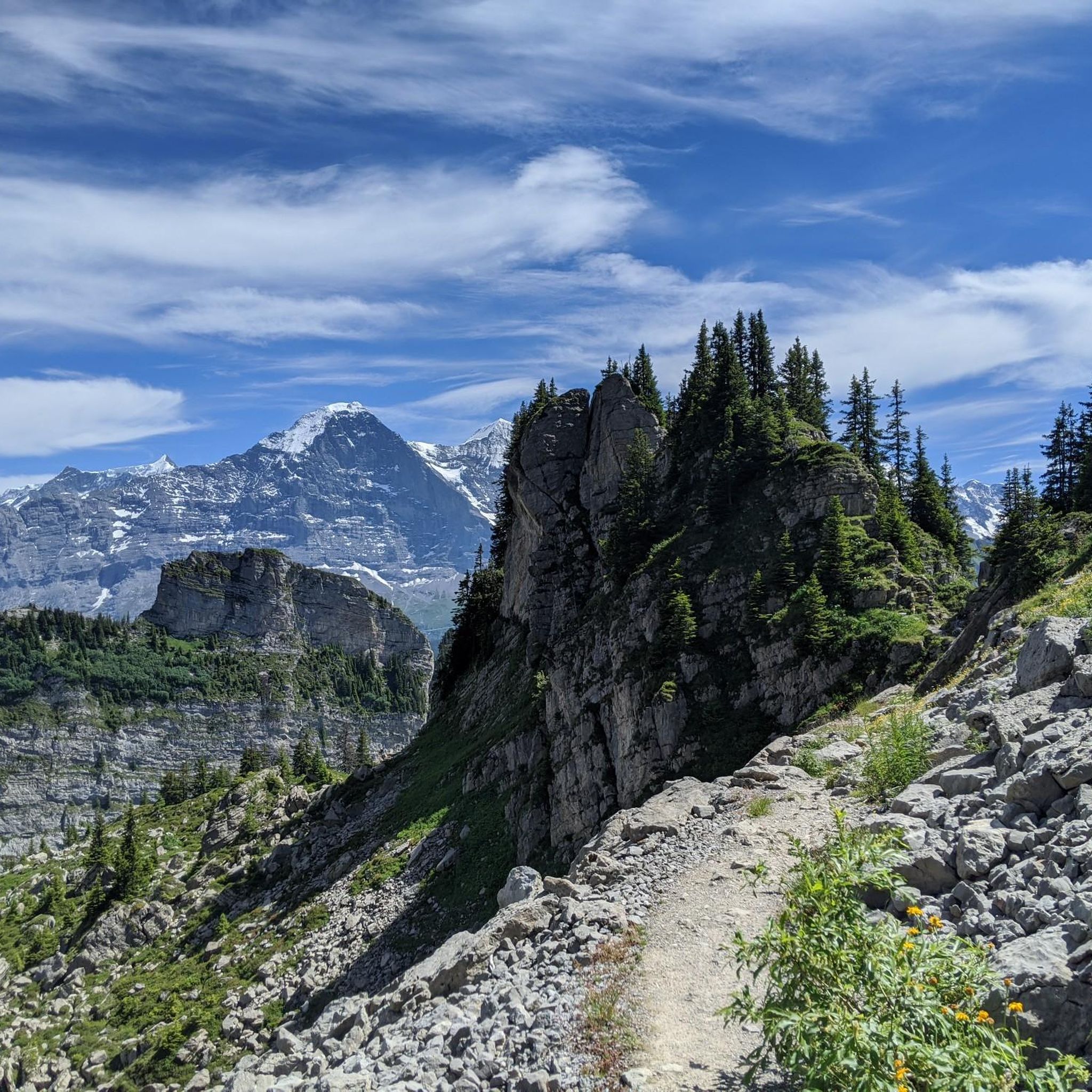
A beautifully located mountain restaurant at 2,116 m above sea level, above Kleine Scheidegg – perfect for a cozy break during a hiking or biking tour 🥾🚲. From the terrace, you can enjoy a fantastic view of the Eiger, Mönch, and Jungfrau 😍🏔️. Culinary-wise, there is down-to-earth Swiss cuisine 🇨🇭 – just the thing after gaining some altitude. Especially the location slightly off the beaten track on Kleine Scheidegg makes Grindelwaldblick a really nice stopover ☕🥘🌄. ⭐ Highlight: the large sun terrace and, of course, the unique mountain panorama – dining with an Eiger view included 🤩⛰️
0
0

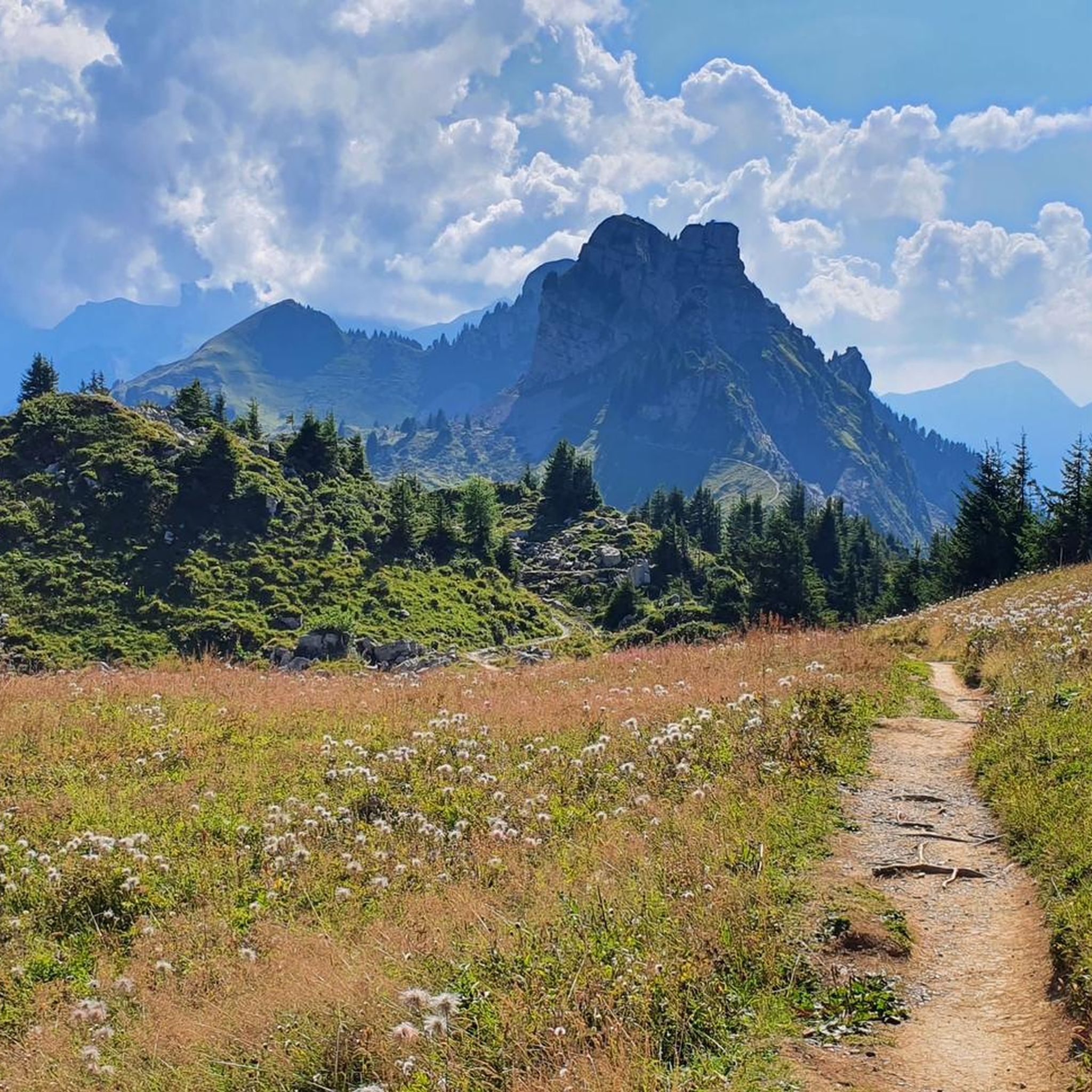
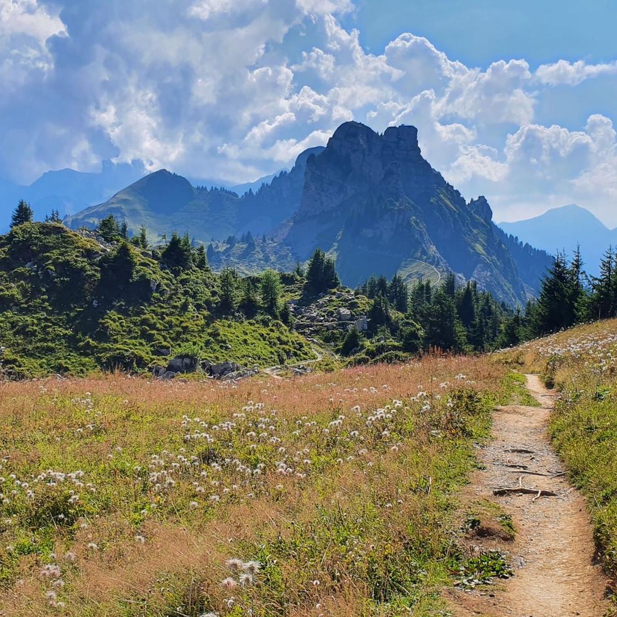
Super view of the big Lobhörner
0
0


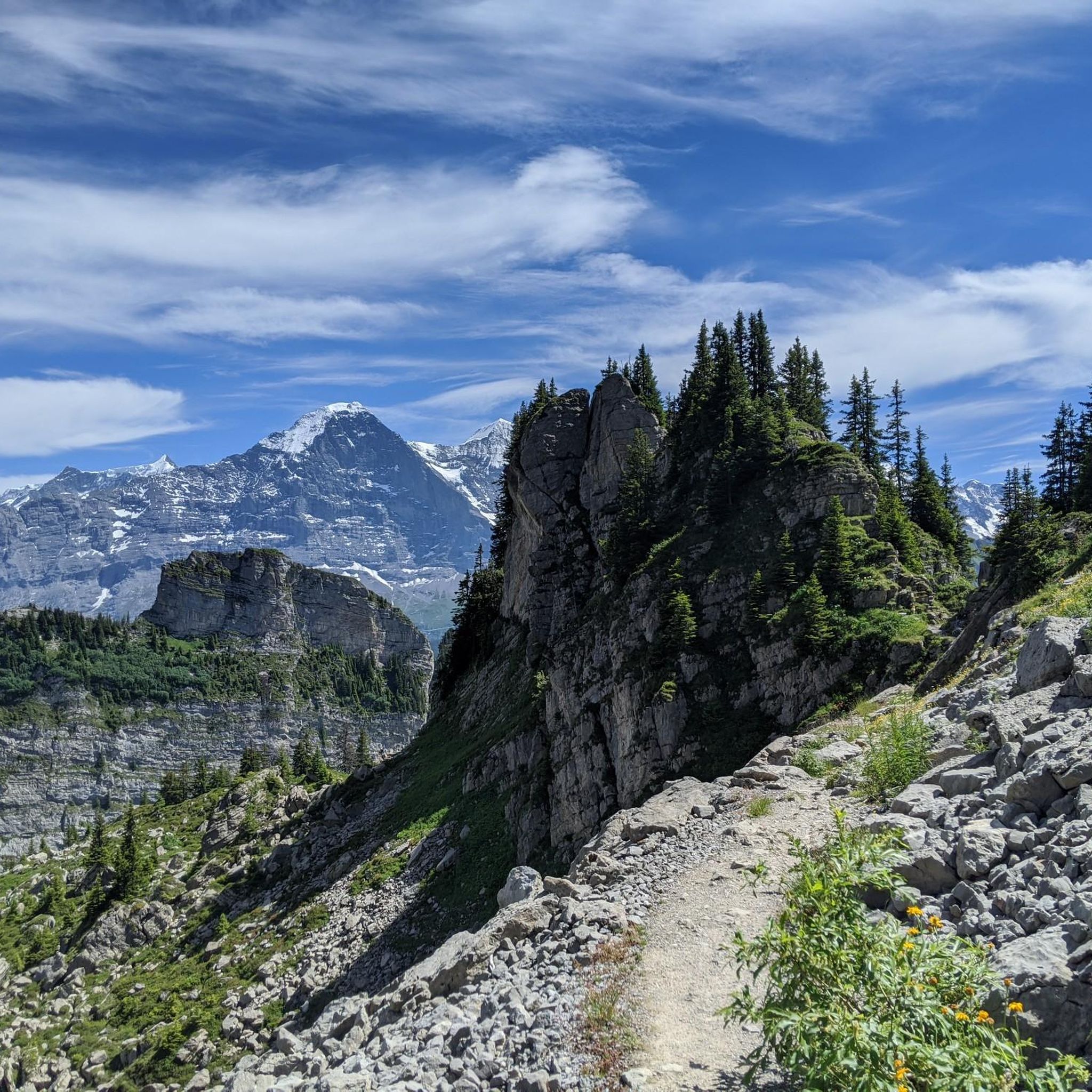
On the Wengernalp, an impressive panorama of the majestic peaks of the Bernese Alps awaits you. From here, you can look down into the beautiful Lauterbrunnen Valley and at the famous mountains Eiger, Mönch, and Jungfrau.
1
0


The Grindelwaldblick restaurant is located at 2,116 meters and is a great place to stop for refreshments during a trail run above Grindelwald. The views of the Eiger, Mönch, and Jungfrau are fantastic. The restaurant also offers overnight accommodations. More information can be found on the website: https://www.grindelwaldblick.ch/.
0
0
starting point for many beautiful mountain hikes
9
0

At Wengernalp, you’ll enjoy breathtaking views of the majestic peaks of the Bernese Alps. This vantage point overlooks the beautiful Lauterbrunnen Valley and the iconic Eiger, Mönch and Jungfrau mountains. This scenic location offers well-marked trails that cater to all levels, allowing you to immerse yourself in the beauty of the Alpine landscape as you ride.
2
0
Frequently Asked Questions
What are the typical difficulty levels for mountaineering routes around Gündlischwand?
The mountaineering routes in Gündlischwand primarily range from moderate to difficult. You'll find 23 moderate routes and 44 difficult routes, characterized by significant elevation changes and alpine terrain. There are no easy mountaineering routes listed in this area.
Are there any circular mountaineering routes in Gündlischwand?
Yes, Gündlischwand offers several excellent circular mountaineering routes. For instance, the Lobhornhütte – Lobhörner loop from Gündlischwand is a challenging 7.9-mile (12.7 km) trail, while the Sulsbach Bridge – Lobhornhütte loop from Gündlischwand offers a moderate 6.4-mile (10.3 km) option.
What kind of terrain can I expect on mountaineering routes in the Gündlischwand region?
Mountaineering routes around Gündlischwand navigate through the rugged terrain of the Bernese Oberland. You can expect rocky paths, alpine meadows, and areas with mountain huts, providing a classic high-alpine experience with challenging ascents and panoramic views.
What do other mountaineers say about the routes in Gündlischwand?
The routes in Gündlischwand are highly rated by the komoot community, with an average score of 4.9 stars from over 100 reviews. Mountaineers often praise the challenging alpine sections, the stunning views, and the well-defined trails that lead to prominent peaks and mountain refuges.
Are there any mountaineering routes suitable for advanced climbers seeking a challenge?
Absolutely. Gündlischwand is known for its challenging ascents. A notable difficult route is the Wengen Railway Station – Kleine Scheidegg loop from Wengen, which covers nearly 15 km with significant elevation gain, offering a demanding high-alpine experience.
Can I find any routes that lead to mountain huts or refuges?
Yes, many routes in the region incorporate mountain huts. The Lobhornhütte – Lobhörner loop from Gündlischwand, for example, features a mountain hut, providing a classic high-alpine experience and potential resting points.
What are some interesting natural attractions or landmarks near the mountaineering routes?
The region around Gündlischwand is rich in natural beauty. You can find stunning waterfalls like Staubbach Falls and Giessbach Falls. There are also impressive mountain passes such as Grosse Scheidegg and Kleine Scheidegg, offering breathtaking views and historical significance.
Are there any shorter mountaineering routes for those with less time?
If you're looking for a shorter option, consider the Mountaineering loop from Schynige Platte. This moderate route is about 5.7 km long and can be completed in around 2 hours, offering a taste of the alpine environment without a full-day commitment.
What is the elevation gain typically like on these mountaineering routes?
The mountaineering routes around Gündlischwand involve significant elevation changes. For example, the Sulsbach Bridge – Lobhörner loop from Gündlischwand has an elevation gain of over 900 meters, while the Sulsbach Bridge – Lobhornhütte loop from Gündlischwand involves around 850 meters of ascent.
Are there any routes that offer views of the Lobhörner peaks?
Yes, several routes provide excellent views of the Lobhörner peaks. The Sulsbach Bridge – Lobhörner loop from Gündlischwand is specifically designed to lead through varied alpine terrain towards these iconic peaks, offering memorable vistas.
How many mountaineering routes are available in the Gündlischwand area?
There are 67 mountaineering routes available around Gündlischwand, offering a wide variety of options for exploring the Bernese Oberland's rugged terrain.
Most popular routes around Gündlischwand
Most popular attractions around Gündlischwand

Get inspired with the komoot mobile app


Explore more
Browse the best Mountain Hikes & Routes in other regions.
