The best running trails in Palo Corona Regional Park
4.6
(12)
966
runners
89
runs
Jogging in Palo Corona Regional Park offers diverse landscapes across over 4,500 acres, featuring rolling grasslands, serene oak woodlands, and riparian habitats along the Carmel River. The park's varied terrain includes elevations from near sea level to over 3,400 feet, providing options from gentle riverbanks to challenging hills. This ecological diversity supports a rich array of flora and fauna, making it an engaging location for running. The extensive trail system spans over 25 miles, with a newly developed cross-country running…
Last updated: July 7, 2026
4
runners
6.83km
00:49
100m
100m
Moderate run. Good fitness required. Mostly paved surfaces. Suitable for all skill levels.
54
runners
Hard run. Very good fitness required. Mostly paved surfaces. Suitable for all skill levels.

Sign up for free
13
runners
7.06km
00:56
210m
210m
Moderate run. Good fitness required. Mostly paved surfaces. Suitable for all skill levels.
12
runners
15.0km
01:55
350m
350m
Hard run. Very good fitness required. Mostly paved surfaces. Suitable for all skill levels.
5.0
(1)
7
runners
8.47km
00:58
60m
60m
Moderate run. Good fitness required. Mostly paved surfaces. Suitable for all skill levels.
Get access to more routes and recommendations from other explorers.
Sign up for free
Already have an account?
Our route recommendations are based on thousands of hikes, rides, and runs completed by other people on komoot.
Start today with a free account
Your next adventure awaits.
Login or Signup
Popular around Palo Corona Regional Park
Tips from the Community

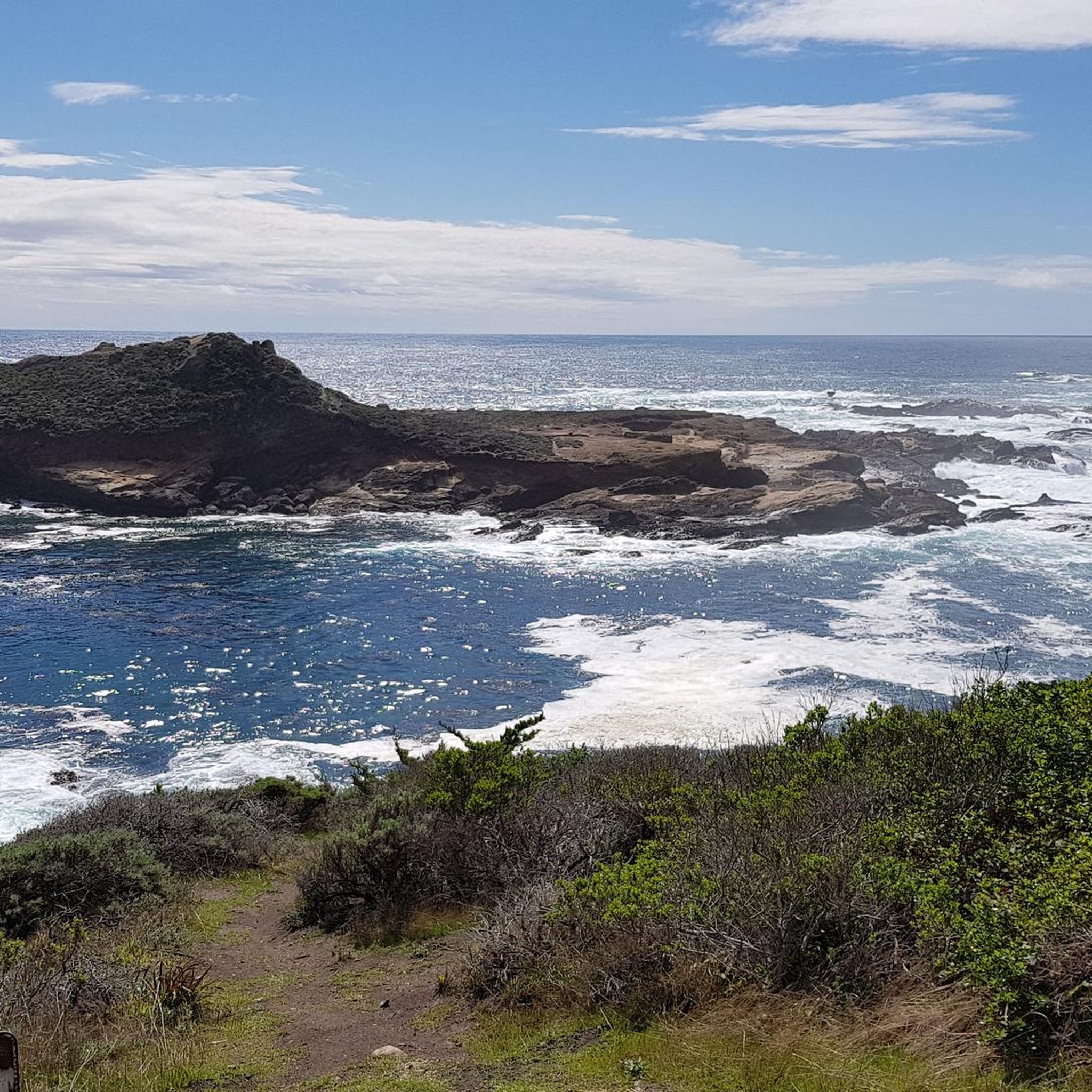
A few steps away from the Rumsien Trail will lead you to this spectacular coastal vantage point, making it an ideal spot to pause and rejuvenate. The overlook provides sweeping panoramic views of the coastline, where the meeting of land and sea creates a mesmerizing backdrop. Time your run to catch either the crisp morning light or the golden hues of sunset.
0
0

The scenery is absolutely stunning. Unfortunately, it's not really suitable for swimming.
1
0

A true hiking highlight Definitely worth a visit
1
0
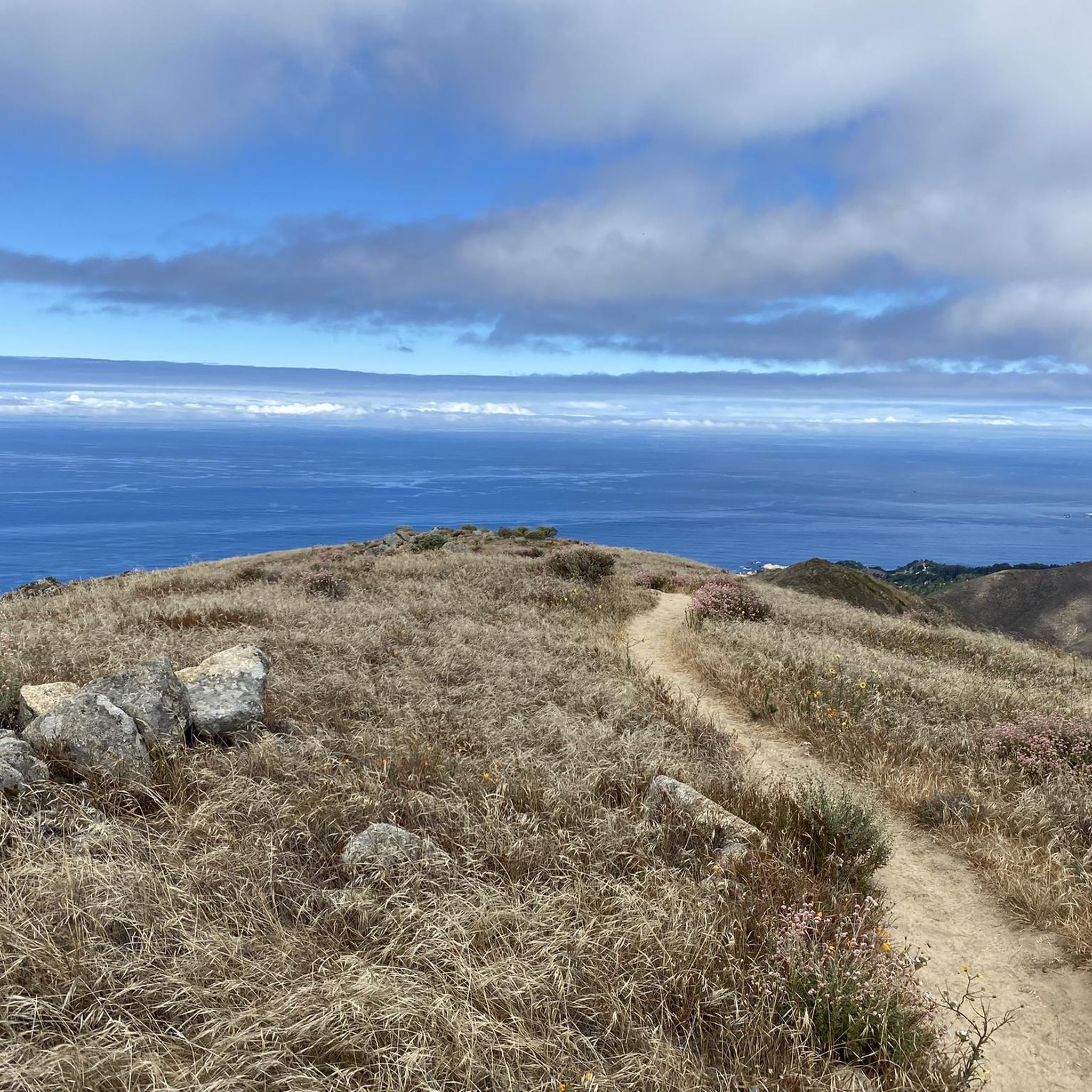
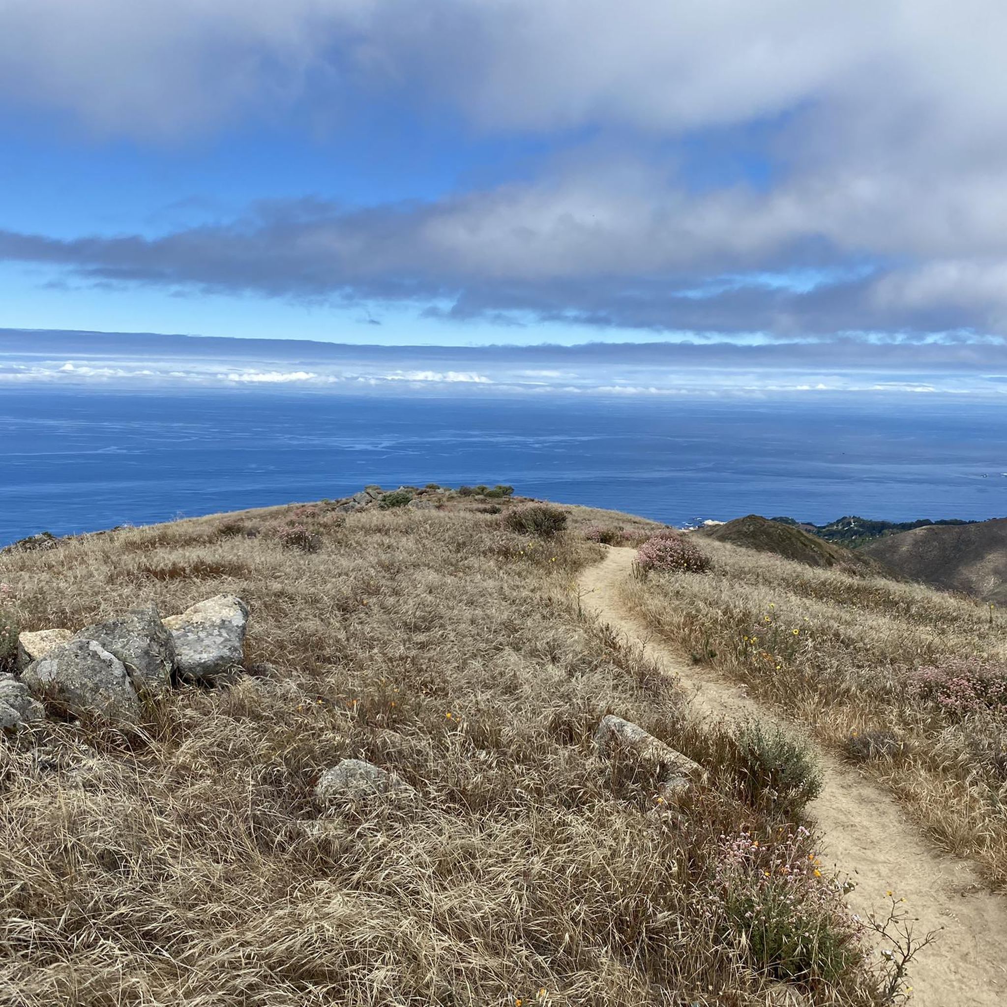
The Inspiration Point overlook gives wonderful views overlooking the Monterey Bay and surrounding areas. You'll also find a few picnic benches here, perfect for a lunch break or stop to take in your surroundings.
1
0
Carmel River State Beach is a mile long beach on Carmel Bay with a unique bird sanctuary and lagoon.
0
0
Historic area of Monterey & Carmel where the Ohone people once inhabitated.
1
0
Animas Pond is a small lake and wetland area full of diverse wildlife and serenity due to the lack of foot traffic.
0
0
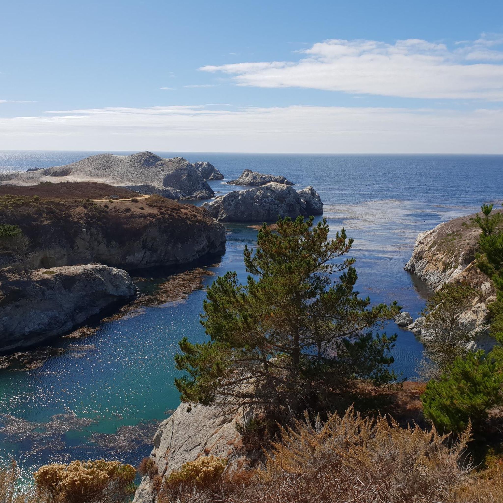
As part of Point Lobos, the Sea Lion Point & Cove offers an incredible experience. Among the diverse plant life and botanics, you'll likely be able to witness many sea lions and seals going about their day.
3
0
Frequently Asked Questions
How many running routes are available in Palo Corona Regional Park?
Palo Corona Regional Park offers over 70 diverse running routes, catering to various fitness levels. You can find everything from easy, flat paths to more challenging trails with significant elevation changes.
What kind of terrain can I expect on the running trails?
You'll experience a mix of rolling grasslands, serene oak woodlands, and riparian habitats along the Carmel River. The park's elevation ranges significantly, providing varied terrain from riverbanks to plateaus and hills, ensuring a diverse running experience.
Are there easy running options for beginners or casual joggers?
Yes, the park has several easy options. Trails like the Carmel Meadows Trail offer minimal elevation gain, perfect for a relaxed run. A 2-mile relatively flat, partially-paved option is also available from the Discovery Center to the South Bank Trail, suitable for all abilities. The Rumsien Overlook via Tulas Trail loop is a moderate route that many find accessible.
Are there challenging running routes for experienced runners?
Absolutely. For those seeking a more intense workout, the Inspiration Point Trail involves a moderate to strenuous climb. More extensive and challenging runs, such as the 9.0-mile trek from the Discovery Center to San Jose Creek Bridges with a 1,290-foot elevation gain, are recommended for fit and experienced runners. The Carmel River State Beach – Seals at Point Lobos loop from Mission San Carlos Borromeo de Carmelo is a difficult 27.7-mile path for endurance runners.
Can I find routes with panoramic views in the park?
Yes, several trails offer rewarding vistas. The Inspiration Point Trail provides expansive views over the coast and Carmel Valley. From certain points, you can also enjoy a bird's-eye view of the Monterey Bay National Marine Sanctuary.
Are there running paths along the Carmel River?
Yes, the park includes tranquil paths along the Carmel River. The South Bank Trail meanders along the river, ideal for leisurely jogs and bird-watching. The Multi-Benefit Community Trail also crosses the Carmel River twice, allowing you to experience the peaceful riparian habitat.
Is Palo Corona Regional Park suitable for family runs?
Yes, the park offers options suitable for families. The easier, flatter trails like the Carmel Meadows Trail or the paved section from the Discovery Center to the South Bank Trail are great for family outings. The diverse scenery also provides an engaging environment for children.
Are dogs allowed on the running trails?
Palo Corona Regional Park is generally dog-friendly, but specific trail regulations may apply. It's always best to check the park's official guidelines for the most current information regarding leash requirements and restricted areas to ensure a pleasant experience for everyone.
What kind of wildlife might I encounter while running?
Palo Corona is rich in biodiversity. While running, you might encounter deer, bobcats, and numerous bird species such as red-tailed hawks, peregrine falcons, and great horned owls. The park also provides habitat for coastal trout, steelhead fisheries, and rare amphibians.
Are there any dedicated running courses in the park?
Yes, the park is home to a new cross-country running course at the former Rancho Cañada Golf Club unit. This course features grass, dirt, and wood chip paths with 2,000 and 3,000-meter loops, designed for races and open year-round for community use.
What do other runners say about the trails in Palo Corona Regional Park?
The running routes in Palo Corona Regional Park are highly rated by the komoot community, with an average score of 4.7 stars from over 20 reviews. Runners often praise the diverse landscapes, the variety of trail difficulties, and the beautiful views, making it a favorite for outdoor enthusiasts.
Are there loop trails available for running?
Yes, many of the park's trails are designed as loops, offering a convenient way to explore without retracing your steps. For example, the Running loop from Carmel-by-the-Sea is a popular 5.2-mile option, and the Seals at Point Lobos loop from Carmel-by-the-Sea provides a longer experience.
Where can I park when visiting Palo Corona Regional Park for a run?
Palo Corona Regional Park has accessible parking facilities, including at the Discovery Center, which serves as the district headquarters. Specific trailheads may also have designated parking areas. It's advisable to check the park's official website for detailed parking information and any potential fees.
Most popular routes in Palo Corona Regional Park

Get inspired with the komoot mobile app


Explore more
Browse the best Running Trails & Routes in other regions.
