The best running trails in Topanga State Park
4.8
(104)
14,725
runners
242
runs
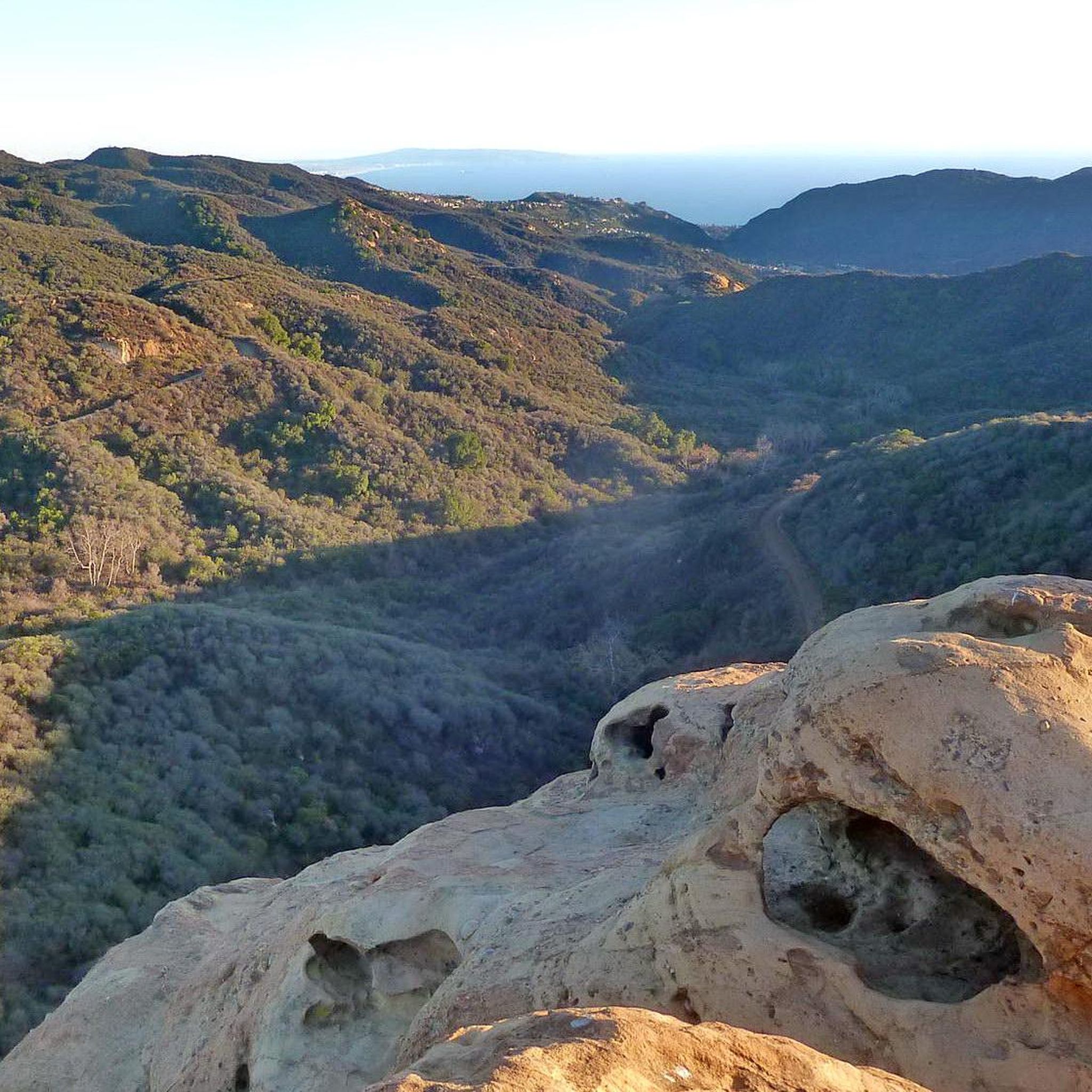
Jogging in Topanga State Park offers access to an extensive trail network within the Santa Monica Mountains, featuring diverse landscapes. The park is characterized by open grasslands, chaparral-covered hills, and oak woodlands, providing varied terrain for runners. Geological formations like crumbly sandstone and volcanic intrusions are present, and many routes offer panoramic views of the Pacific Ocean and the surrounding mountains. This region is known for its significant natural features, making it a unique setting for outdoor activities.
Best jogging routes in Topanga State Park
- The most popular jogging route is Temescal Ridge Trail loop from Pacific Palisades — Santa Monica Mountains National Recreation Area, a 3.5 miles (5.6 km) trail that takes about 48 minutes to complete. This moderate route features a steady elevation gain and scenic views.
- Another top favourite among local runners is Inspiration Point loop from Pacific Palisades — Santa Monica Mountains National Recreation Area, an easy 2.4 miles (3.9 km) path. This route offers accessible terrain and overlooks the surrounding area.
- Local runners also love the Los Liones Trail and East Topanga Fire Road Loop, a 3.2 miles (5.2 km) trail leading through varied terrain, often completed in about 40 minutes.
- Jogging in Topanga State Park is defined by its diverse ecosystems, including open grasslands, chaparral, and oak woodlands. The extensive network offers options for various ability levels, from easy strolls to challenging runs.
- The routes in Topanga State Park are highly rated by the komoot community with an average score of 4.8 stars from over 50 reviews. More than 7,000 runners have used komoot to explore Topanga State Park's varied terrain.
Last updated: September 27, 2026
32
runners
5.56km
00:48
250m
250m
The Temescal Canyon Loop Trail offers a moderate jogging experience, covering 3.5 miles (5.6 km) with an elevation gain of 805 feet (245 metres), typically completed in about 47 minutes. You will move from wide dirt paths into narrower, uneven sections, winding through shaded canyon floors filled with oak and sycamore trees. As you ascend to the open ridge lines, you can enjoy panoramic views of Los Angeles and the Pacific Ocean from the Ocean Overview Lookout. On clear days, you might even spot Catalina Island in the distance.
Before you head out, be aware that parking at the trailhead typically requires a fee. You will find convenient facilities like toilets and water available there. If you plan to bring your dog, remember they are welcome in the lower canyon but not on the main loop once the trail enters Topanga State Park. It's a good idea to check conditions, especially after rain, as the seasonal Temescal Canyon Falls can be a highlight.
This popular route provides a rewarding workout within Temescal Gateway Park, offering a diverse landscape for your jogging adventure. The trail's varied terrain, from shaded canyons to exposed ridge lines, makes it a dynamic experience. Keep an eye out for the seasonal Temescal Canyon Falls, which are particularly impressive after significant rainfall. This trail is a local favorite for its accessibility and scenic rewards.
8
runners
3.92km
00:26
90m
90m
Lace up for an easy jogging experience on the Inspiration Loop Trail, a 2.4-mile (3.9 km) route that you can complete in about 26 minutes. You'll gain 300 feet (91 metres) in elevation, making it a refreshing and accessible option. As you jog, the dry landscape unfolds with chaparral yucca and eucalyptus trees. The highlight is Inspiration Point, where you can pause to take in sweeping 360-degree views. From this vantage point, you'll see the Pacific Ocean, the Topanga Mountains, and even the distant skyline of Downtown Los Angeles.
To enjoy a more peaceful jogging experience, consider visiting the Inspiration Loop Trail early in the morning or during the week, as it can become quite busy on weekends. The route offers little shade in many areas, so be sure to bring plenty of water and adequate sun protection. If you plan to bring your dog along, remember to check the current park regulations beforehand, as rules can vary. This preparation will help ensure a comfortable and enjoyable outing.
This easy loop is nestled within the Santa Monica Mountains National Recreation Area, a vast and diverse landscape. The trail's unique position allows you to appreciate the varied ecosystems, from coastal views to the chaparral-covered hills. It stands out as a quick and rewarding way to experience the region's natural beauty and expansive vistas without committing to a longer, more strenuous trek.

5.0
(1)
4
runners
5.22km
00:40
190m
190m
Los Liones Trail and East Topanga Fire Road Loop is a moderate 3.2-mile jogging route with 610 feet of gain and ocean views.
5.0
(1)
51
runners
Hard run. Very good fitness required. Mostly paved surfaces. Suitable for all skill levels.
5.0
(1)
43
runners
Moderate run. Good fitness required. Mostly paved surfaces. Suitable for all skill levels.
Get access to more routes and recommendations from other explorers.
Already have an account?
Our route recommendations are based on thousands of hikes, rides, and runs completed by other people on komoot.
Start today with a free account
Your next adventure awaits.
Tips from the Community

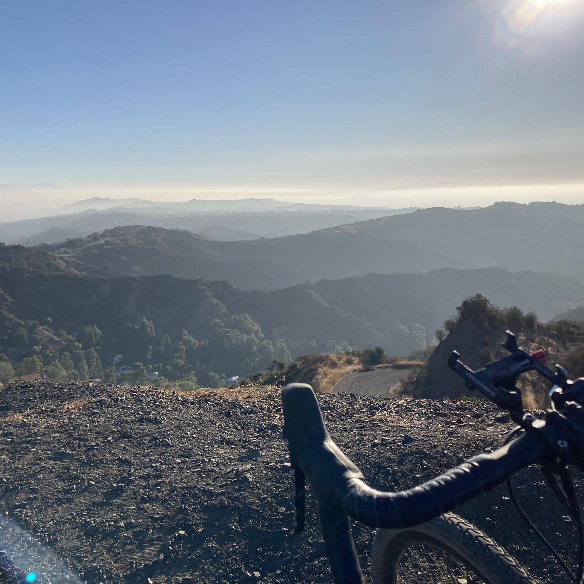
This section of Mulholland Drive is unpaved, making it hugely popular with mountain and gravel bikers. It's also a useful part of hiking the Caballero Canyon outer loop, or tying in to the other north/south trails in this area for some shorter loops. You get expansive views all along the road.
0
0

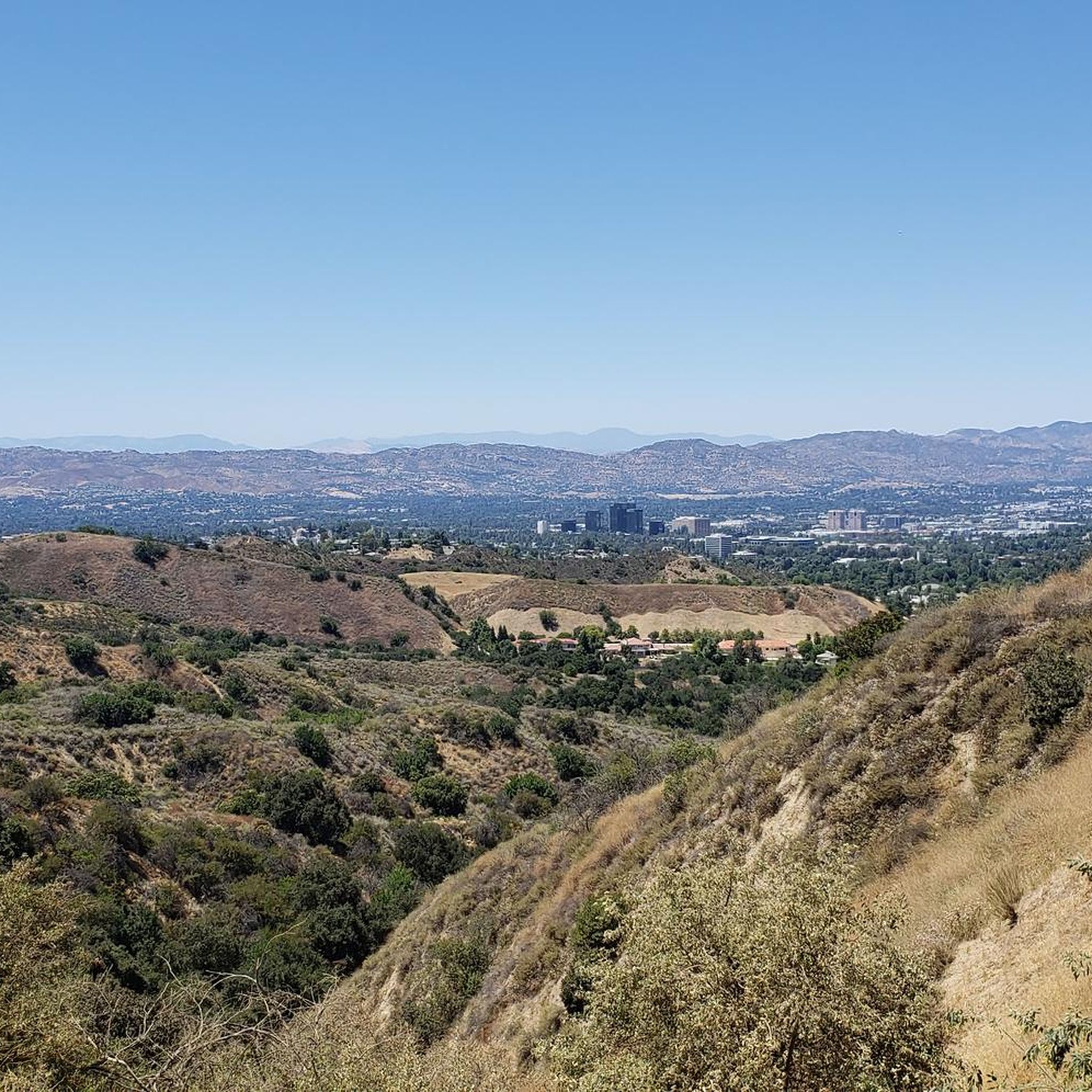
San Vicente Mountain Park, located 2.7 miles west of the 405 freeway on an unpaved section of Mulholland Drive, has awesome 360-degree views and access to extensive hiking, mountain biking, and equestrian trails. The 10.2-acre park has public picnic areas, bathrooms, and is a gateway to Westridge Canyonback Park and the 20,000-acre “Big Wild” wilderness area. A short walk along a wide dirt road leads visitors to this historic site, which once housed a Nike-Ajax missile radar station during the Cold War (1956–1968). The original radar tower now provides panoramic views of the Santa Monica Mountains, Encino Reservoir, San Fernando Valley, and Los Angeles Basin, making it one of the best spots in the region to watch a sunset.
1
0

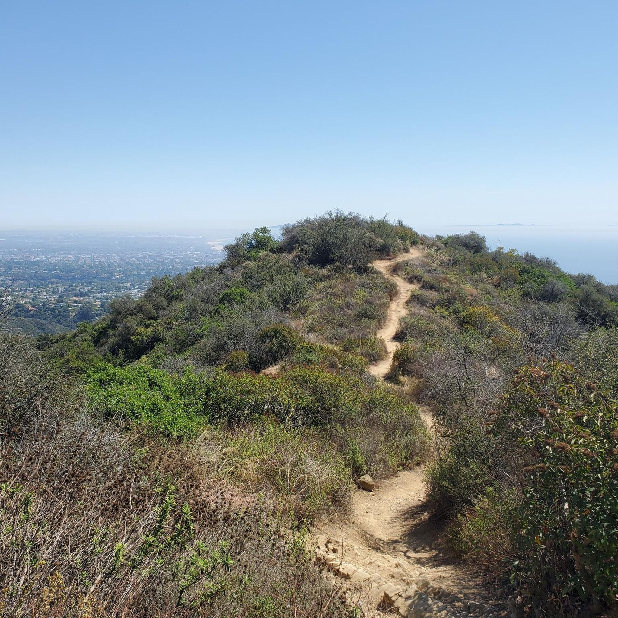
Sweeping panoramic overlook across Pacific Palisades, West LA, Santa Monica, and the Pacific Ocean bay at the junction of Paseo Miramar and Los Leones Trail
0
0

West Mandeville Fire Road is a 3.7-mile trail located on the eastern edge of Topanga State Park. This popular, steep trail climbs from Santa Monica to Mulholland Drive and San Vicente Mountain Park, offering sweeping views of the city, mountains, and adjcent canyons. The wide fire road is ideal for biking, but is not a technical trail. It is popular with horseback riders and and hikers, so be on the look out for them. There is little shade so it can get hot, but this means that you get great views! The trail can be accessed from Mandeville Canyon Park in Santa Monica at the staging area at the end of Westridge Road, with access on the west side of the lot.
0
0


The central stretch of this iconic highway remains unpaved, safeguarding it from vehicular traffic. Nearly a century ago, visionary engineer Mulholland carved it along the crest of the Santa Monica Mountains, linking Los Angeles to the beaches east of Malibu. The route offers uninterrupted views, primarily to the north, throughout its entirety.
0
0

This is a great little summit, it makes for a good effort just to get here. The views from this platformed type summit with its raised observation tower is super good. You get great vistas of the Santa Monica Mountains, Encino Reservoir and the San Fernando Valley. There is a restroom and a toilet here.
0
0
This view point is at the top of the East Topanga Fire Road or at the end of the Los Leones Trail depending which way you come. Either way there are simply amazing views of Los Angeles and the Pacific Palisades. The views of the ocean and downtown LA are simply outstanding.
0
0
Frequently Asked Questions
How many running routes are available in Topanga State Park?
Topanga State Park offers an extensive network of trails, with over 200 running routes available on komoot. These routes cater to various fitness levels, from easy strolls to challenging runs, traversing diverse landscapes within the Santa Monica Mountains.
What types of terrain and scenery can I expect on the jogging trails?
Jogging in Topanga State Park provides a dynamic experience with varied terrain. You'll encounter open grasslands, chaparral-covered hills, and lush oak woodlands. Many routes also offer breathtaking panoramic views of the Pacific Ocean, the Santa Monica Mountains, and even the San Gabriel Valley, especially from viewpoints like Parker Mesa Overlook.
Are there any routes with waterfalls in Topanga State Park?
Yes, the park features the Temescal Canyon Falls, which can be reached via trails like the Santa Ynez Canyon Waterfall Trail. While the trail can sometimes be overgrown, it offers a unique natural feature to discover during your run.
Are there family-friendly running routes in the park?
Absolutely. For a more relaxed and family-friendly jog, the Musch Trail is a great option. It features shaded sections and a gentle ascent, making it suitable for a leisurely run with children. Another easy option is the Inspiration Point loop from Pacific Palisades, which is 2.4 miles long with accessible terrain.
Can I bring my dog on the running trails in Topanga State Park?
Regulations regarding dogs in Topanga State Park can vary by trail and specific areas. Generally, dogs are permitted on paved roads and fire roads, but often not on single-track trails. It's always best to check the latest park rules or signage at trailheads before heading out with your canine companion.
Are there circular running routes available?
Yes, many of the running routes in Topanga State Park are designed as loops, allowing you to start and finish at the same point. For example, the Los Liones Trail & East Topanga Road Loop offers a moderate 3.2-mile circular path through varied terrain.
What are some notable landmarks or viewpoints I can see while running?
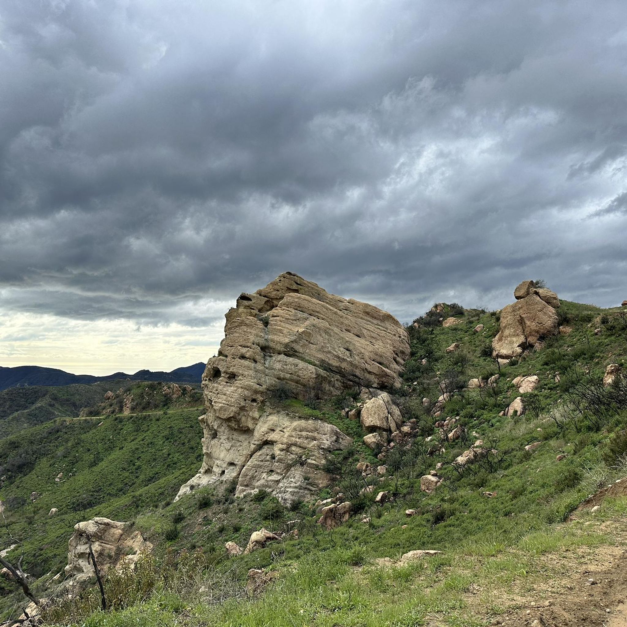
The park is rich with natural landmarks and stunning viewpoints. You can run past geological formations and reach iconic spots like Eagle Rock, which offers 360-degree panoramic views after an invigorating climb. Other notable points include The Hub and Parker Mesa Overlook, both providing expansive vistas.
What is the best time of year to go running in Topanga State Park?
Topanga State Park is enjoyable year-round, but the cooler months from fall through spring often provide the most comfortable running conditions. During these seasons, the temperatures are milder, and the landscape can be particularly lush after winter rains. Summer can be hot, so early morning or late afternoon runs are recommended.
Is public transportation available to Topanga State Park?
While Topanga State Park is largely within Los Angeles city limits, public transportation options directly to trailheads can be limited. It's advisable to check local bus schedules and routes, as some services may drop off near the park's entrances, though direct access to specific trailheads often requires a car.
Are there challenging routes for experienced trail runners?
Yes, Topanga State Park offers several challenging routes for experienced runners. Options like the MRCA Open Space loop, which covers 12 km with significant elevation, provide a demanding workout. For an even greater challenge, the West Mandeville Ridge Trail – Gizmo Peak loop extends over 24 km with substantial elevation gain.
What do other runners enjoy most about jogging in Topanga State Park?
The running routes in Topanga State Park are highly rated by the komoot community, with an average score of 4.8 stars from over 80 reviews. Runners frequently praise the park's diverse ecosystems, the stunning panoramic views of the Pacific Ocean, and the variety of trails that cater to all ability levels. The feeling of being in a vast wildland within a major city is also a common highlight.
Are there less crowded running routes in the park?
While some popular trails can see more visitors, Topanga State Park's extensive network of over 36 miles of trails means you can often find quieter paths. Exploring routes during off-peak hours (early mornings or weekdays) or venturing onto some of the longer, more challenging trails can lead to a more secluded running experience.
Most popular routes in Topanga State Park
Most popular attractions in Topanga State Park

Get inspired with the komoot mobile app


Explore more
Browse the best Running Trails & Routes in other regions.
