The best MTB trails in Ernest E. Debs Regional Park
4.7
(10)
163
riders
11
rides
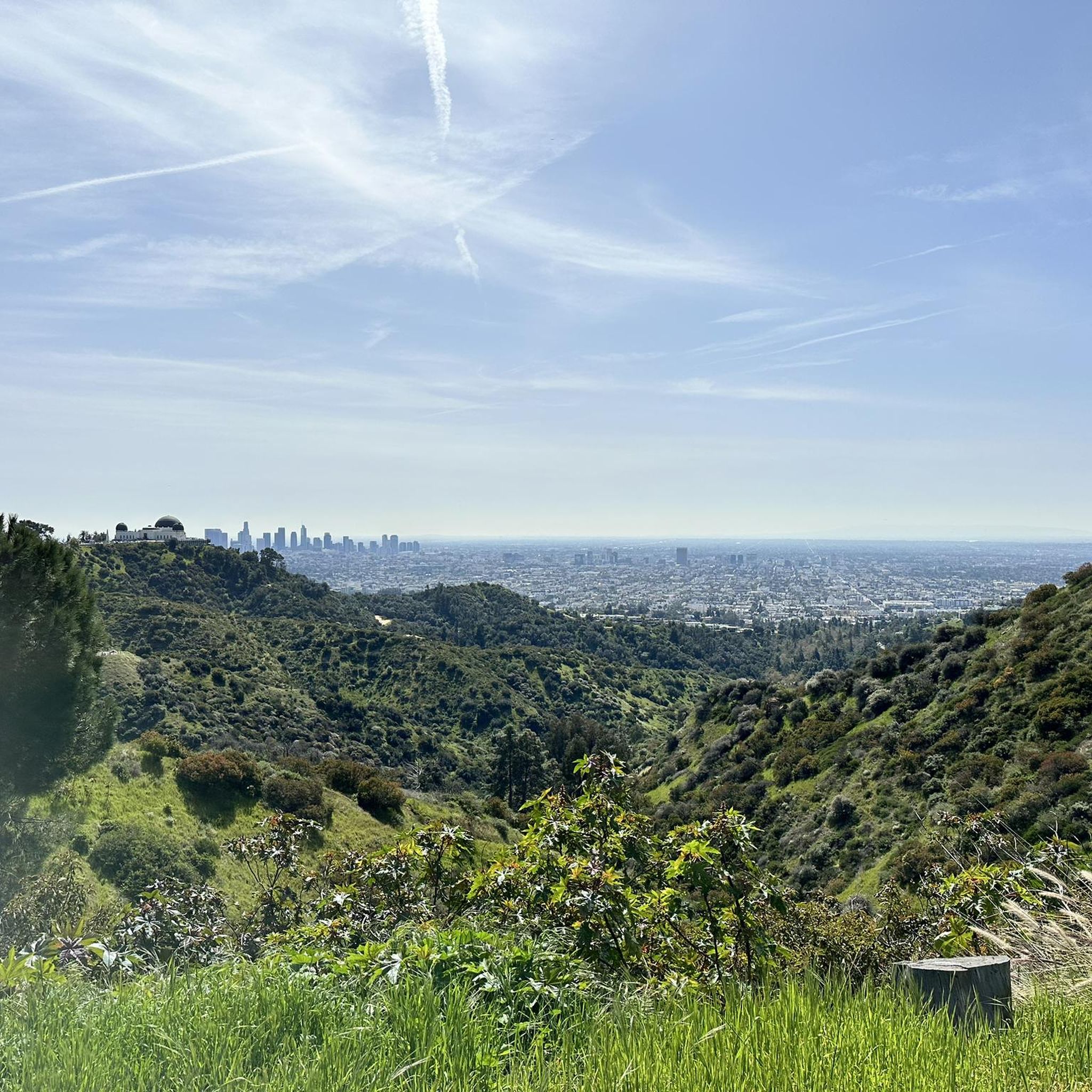
Mountain biking in Ernest E. Debs Regional Park offers a diverse experience across its 282-acre hillside preserve in the Montecito Hills of Los Angeles. The terrain features rolling hills with both gentle slopes and some steep inclines, winding through native California walnut and oak woodlands. Many trails are suitable for mountain biking, including unpaved segments, and the park provides access to the Arroyo Seco Trail. From various points, riders can experience panoramic views of the Downtown Los Angeles skyline and the San Gabriel Mountains.
Best mountain bike trails in Ernest E. Debs Regional Park
- The most popular mountain bike trail is Brookside Park – Cherry Canyon Park loop from Highland Park, a 23.5 miles (37.9 km) trail that takes 2 hours 39 minutes to complete. This moderate route offers varied terrain through parklands.
- Another top favourite among local mountain bikers is Wella's Peak – Pasadena Historic City Hall loop from Memorial Park, a difficult 22.3 miles (35.9 km) path. This route features significant elevation changes and expansive views.
- Local mountain bikers also love the Ridge Motorway – Defenders Park loop from Memorial Park, a 22.6 miles (36.3 km) trail leading through varied park landscapes, often completed in about 2 hours 35 minutes.
- Mountain biking in Ernest E. Debs Regional Park is defined by rolling hills, native woodlands, and connections to the Arroyo Seco Trail. The network offers options for easy, moderate, and difficult ability levels, catering to a range of mountain biking experiences.
- The routes in Ernest E. Debs Regional Park are highly rated by the komoot community with an average score of 4.5 stars from more than 3 reviews. More than 170 mountain bikers have used komoot to explore Ernest E. Debs Regional Park's varied terrain.
Last updated: September 30, 2026
7
riders
37.9km
02:39
590m
590m
Moderate mountain bike ride. Good fitness required. Suitable for all skill levels.
4
riders
22.9km
01:42
420m
420m
Moderate mountain bike ride. Good fitness required. Suitable for all skill levels.

4.0
(1)
2
riders
37.5km
02:38
530m
530m
Moderate mountain bike ride. Good fitness required. Suitable for all skill levels.
5
riders
21.8km
01:25
230m
230m
Easy mountain bike ride. Great for any fitness level. Suitable for all skill levels.
5.0
(2)
8
riders
12.6km
00:59
330m
330m
Moderate mountain bike ride. Good fitness required. Suitable for all skill levels.
Get access to more routes and recommendations from other explorers.
Already have an account?
Our route recommendations are based on thousands of hikes, rides, and runs completed by other people on komoot.
Start today with a free account
Your next adventure awaits.


Tips from the Community


Cherry Canyon Park is an area of 130 acres in the San Rafael Hills, close to La Cañada Flintridge. It features multiple trails and fire roads for horses, mountain bikers and hikers, but also various single tracks that are only for hiking. From the trails, you will get a great overview over the area.
0
0

Quite narrow spot
0
0

Climb out of the Brookside Golf Club area and into the Pasadena suburban area. This climb has a nice shoulder and is lined with trees.
0
0

The Gabrielino Trail spans 28.8 miles in the heart of Angeles National Forest, featuring a mix of well-known and secluded areas. This scenic route is perfect for running and boasts historical importance as well. In 1970, it became the first National Recreation Trail (NRT) in the country, honored for its regional representation, support of a diverse community, and recognition as one of America's finest trails.
0
0
Defenders Park is a small neighborhood park in the southwest corner of Orange Grove and Colorado Boulevard, along the California Mission Trail. There is plenty of open space surrounded by trees for shade, along with drinking fountains, perfect for a quick break during a run.
0
0
Brookside Park is Pasadena's largest fully maintained park at 61.1 acres. It sits south of Rose Bowl Stadium with tons of parking off Arroyo Boulevard. The park features a lighted baseball diamond, two softball diamonds, and a large, lighted, multi-purpose field for soccer and flag football. There is also a speaker's platform with permanent seating, numerous picnic tables, barbecue pits, a play area, restrooms, and drinking fountains.
0
0
Built in 1920, Devil's Gate Dam is the oldest dam constructed by the Los Angeles County Flood Control District, designed to protect Pasadena, South Pasadena, and Los Angeles from floods. The dam was named after a rock formation resembling a devil’s face and gained popularity in the 1940s when occultists performed rituals there. Today, Devil's Gate Dam attracts hikers, paranormal investigators, and TV crews checking out its haunted reputation.
0
0
Frequently Asked Questions
What kind of terrain can I expect when mountain biking in Ernest E. Debs Regional Park?
Ernest E. Debs Regional Park features diverse terrain, including rolling hills with both gentle slopes and some steep inclines. You'll ride through native California walnut and oak woodlands, as well as eucalyptus, pine, and birch trees. While some segments within the park can be unpaved and more challenging, many trails are suitable for mountain biking, offering a varied experience.
How many mountain bike trails are available in Ernest E. Debs Regional Park?
There are over a dozen mountain bike trails available in Ernest E. Debs Regional Park, catering to various skill levels. You'll find a mix of easy, moderate, and difficult routes to explore.
Are there any easy mountain bike trails suitable for beginners or families in Ernest E. Debs Regional Park?
Yes, there are easy mountain bike trails in the park. For a family-friendly option, consider the Gabrielino Trail (NRT) loop from Memorial Park, which is rated easy and offers a pleasant ride. The park also provides access to the Arroyo Seco Trail, a popular cycling path known for its smooth asphalt and family-friendly experience.
What are some notable natural features or viewpoints along the mountain bike trails?
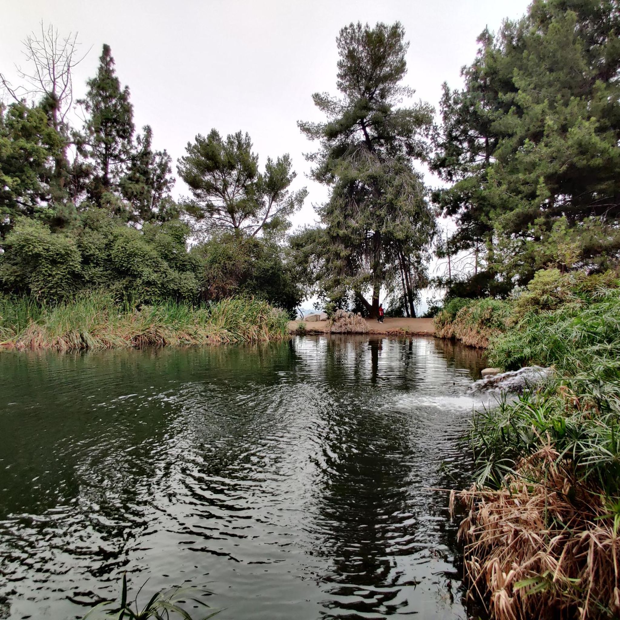
From various points within Ernest E. Debs Regional Park, you can enjoy panoramic views of the Downtown Los Angeles skyline, the Arroyo Seco, and the distant San Gabriel Mountains. A serene highlight is Debs Lake (also known as Debs Pond or Peanut Lake), a hilltop lake surrounded by trees, offering a peaceful spot for relaxation.
Are there any challenging mountain bike routes for experienced riders?
Yes, experienced riders can find challenging routes. The Wella's Peak – Pasadena Historic City Hall loop from Memorial Park is a difficult 22.3-mile path featuring significant elevation changes and expansive views, perfect for those seeking a more demanding ride.
What do other mountain bikers say about the trails in Ernest E. Debs Regional Park?
The mountain bike routes in Ernest E. Debs Regional Park are highly rated by the komoot community, with an average score of 4.5 stars. Riders often praise the varied terrain, the beautiful woodlands, and the scenic views of the city and mountains.
Can I find circular mountain bike routes in the park?
Yes, many of the mountain bike routes in Ernest E. Debs Regional Park are designed as loops. For example, the Brookside Park – Cherry Canyon Park loop from Highland Park is a moderate 23.5-mile trail that offers a complete circular experience through varied parklands.
Are there any attractions or facilities near the mountain bike trails?
Beyond the trails, the park features the Audubon Center at Debs Park, an eco-friendly nature and education facility with exhibits on local wildlife and a children's area. There are also landscaped picnic areas with BBQ pits, making it suitable for family outings.
What is the typical duration for mountain bike rides in Ernest E. Debs Regional Park?
The duration of rides varies depending on the trail and your pace. Moderate routes like the Ridge Motorway – Defenders Park loop from Memorial Park typically take around 2 hours 35 minutes, while longer, more difficult routes can take over 3 hours.
Is Ernest E. Debs Regional Park suitable for mountain biking with dogs?
Ernest E. Debs Regional Park is generally dog-friendly, with many trails allowing leashed dogs. However, it's always best to check specific trail regulations or signage within the park to ensure your furry companion is welcome on your chosen mountain bike route.
What are the best times of year to go mountain biking in Ernest E. Debs Regional Park?
Given Los Angeles's mild climate, mountain biking in Ernest E. Debs Regional Park is enjoyable year-round. However, the cooler months from fall through spring (October to May) are often preferred to avoid the summer heat, especially during midday. Always check local weather conditions before heading out.
How can I access the Arroyo Seco Trail from Ernest E. Debs Regional Park?
Ernest E. Debs Regional Park serves as a key access point to the Arroyo Seco Trail, a popular cycling path. While specific entry points might be limited due to elevation differences, you can connect to this trail from within the park's network, allowing for a longer, scenic ride through the historic Arroyo Seco canyon.
Most popular routes in Ernest E. Debs Regional Park

Get inspired with the komoot mobile app


Explore more
Browse the best MTB trails in other regions.
