The best walks and hikes in Verdugo Mountains Open Space Preserve
4.6
(126)
1,987
hikers
118
hikes
Hikes in Verdugo Mountains Open Space Preserve explore a rugged mountain range located within the greater Los Angeles area. The terrain is characterized by a network of fire roads, known as motorways, that ascend to ridges and peaks with expansive views over the San Fernando Valley. The preserve's landscape includes woodlands of coast live oak and sycamore, with trails suitable for a range of fitness levels.
Best hiking trails in Verdugo Mountains Open Space Preserve
- The most popular hiking route is Tongva Peak via the Beaudry Motorway loop — Verdugo Mountains, a 6.7 mile (10.9 km) trail that takes about 3 hours 30 minutes to complete. This route follows wide motorways up to the ridgeline, reaching Tongva Peak.
- Another top favourite among local hiking enthusiasts is Vergudo and Tongva Peaks via the Beaudry and Verdugo Motorways loop — Verdugo Mountains, a difficult 11.9 mile (19.1 km) path. This longer hike involves significant elevation gain and connects two of the main peaks in the range.
- Local hiking enthusiasts also love the Mount Thom Viewpoint loop from Sparr Heights, a 5.0 mile (8.0 km) trail leading through the preserve's lower slopes, often completed in about 2 hours 40 minutes.
- Hiking in Verdugo Mountains Open Space Preserve is defined by wide fire roads, sustained climbs, and ridgeline paths with city views. The trail network offers options for both moderate workouts and more challenging long-distance hikes.
- The routes in Verdugo Mountains Open Space Preserve are highly rated by the komoot community with an average score of 4.6 stars from over 70 reviews. More than 1,200 hikers have used komoot to explore Verdugo Mountains Open Space Preserve's varied terrain.
Last updated: August 22, 2026
1.38km
00:23
20m
20m
Easy 0.9-mile hike in Crescenta Valley County Park, perfect for families and dog owners, with native flora and birdwatching.
5.0
(3)
65
hikers
10.9km
03:31
480m
480m
Hike the moderate 6.7-mile Beaudry Motorway Loop in the Verdugo Mountains for panoramic views and a rewarding outdoor experience.

Sign up for free
5
hikers
19.1km
05:55
700m
700m
Hike the difficult 11.9-mile Verdugo and Tongva Peaks Loop for panoramic views of Los Angeles and the San Gabriel Mountains.
9
hikers
8.03km
02:39
370m
370m
Moderate hike. Good fitness required. Easily-accessible paths. Suitable for all skill levels.
10
hikers
Moderate hike. Good fitness required. Easily-accessible paths. Suitable for all skill levels.
Get access to more routes and recommendations from other explorers.
Sign up for free
Already have an account?
Our route recommendations are based on thousands of hikes, rides, and runs completed by other people on komoot.
Start today with a free account
Your next adventure awaits.
Login or Signup
Popular around Verdugo Mountains Open Space Preserve

Tips from the Community

A solid entry to the Verdugo Mountains with rewarding climbs and views, but watch the start—there are ruts and leftover metal pieces on the trail. Stay alert and pick your line carefully to avoid punctures or spills before the smoother sections begin.
1
0

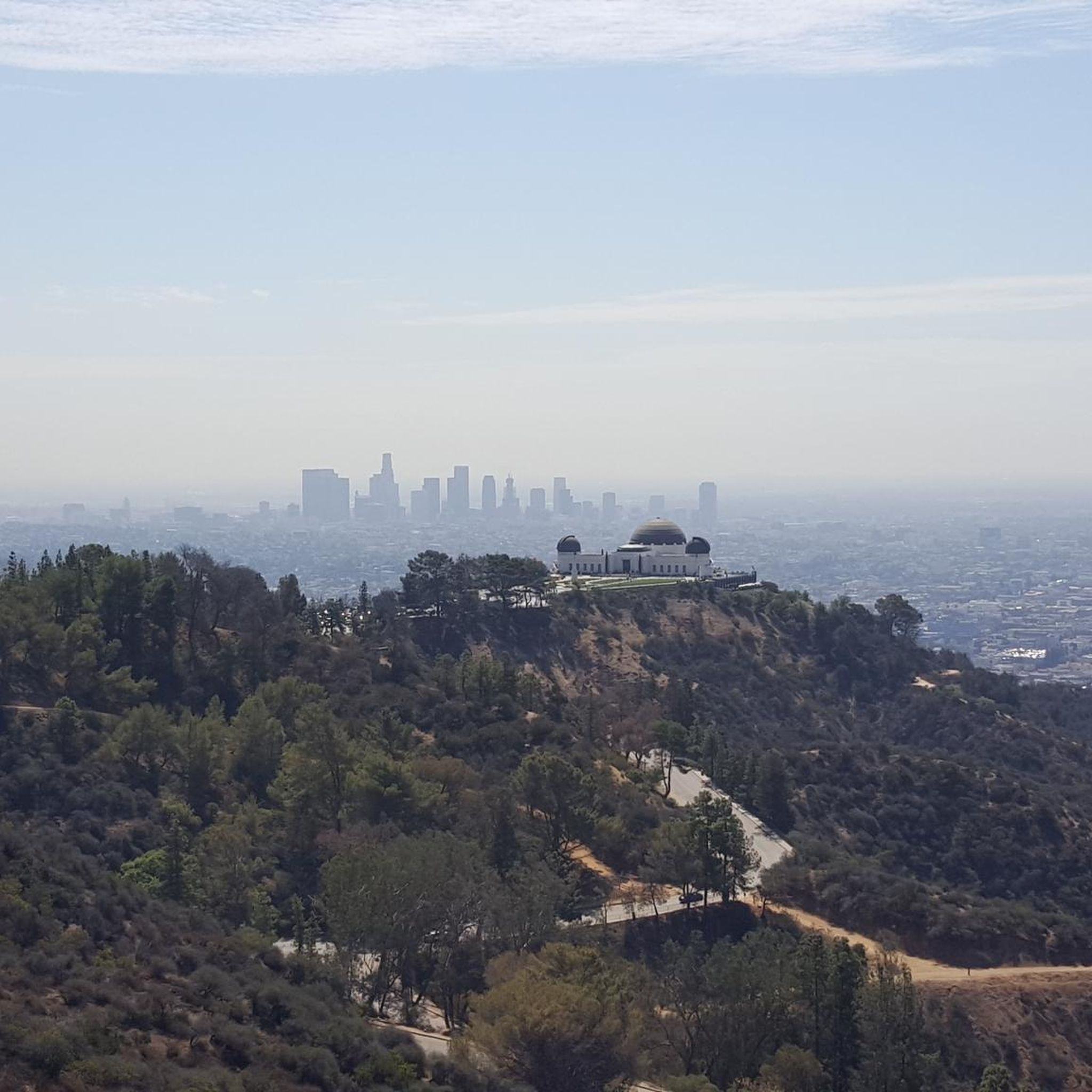
a nice intermediate hike perfect for newbies. Great views of LA.
0
0

You can approach this 3,124-foot peak from several directions, but the multi-use Verdugo Motorway is the most common uphill option.
0
0

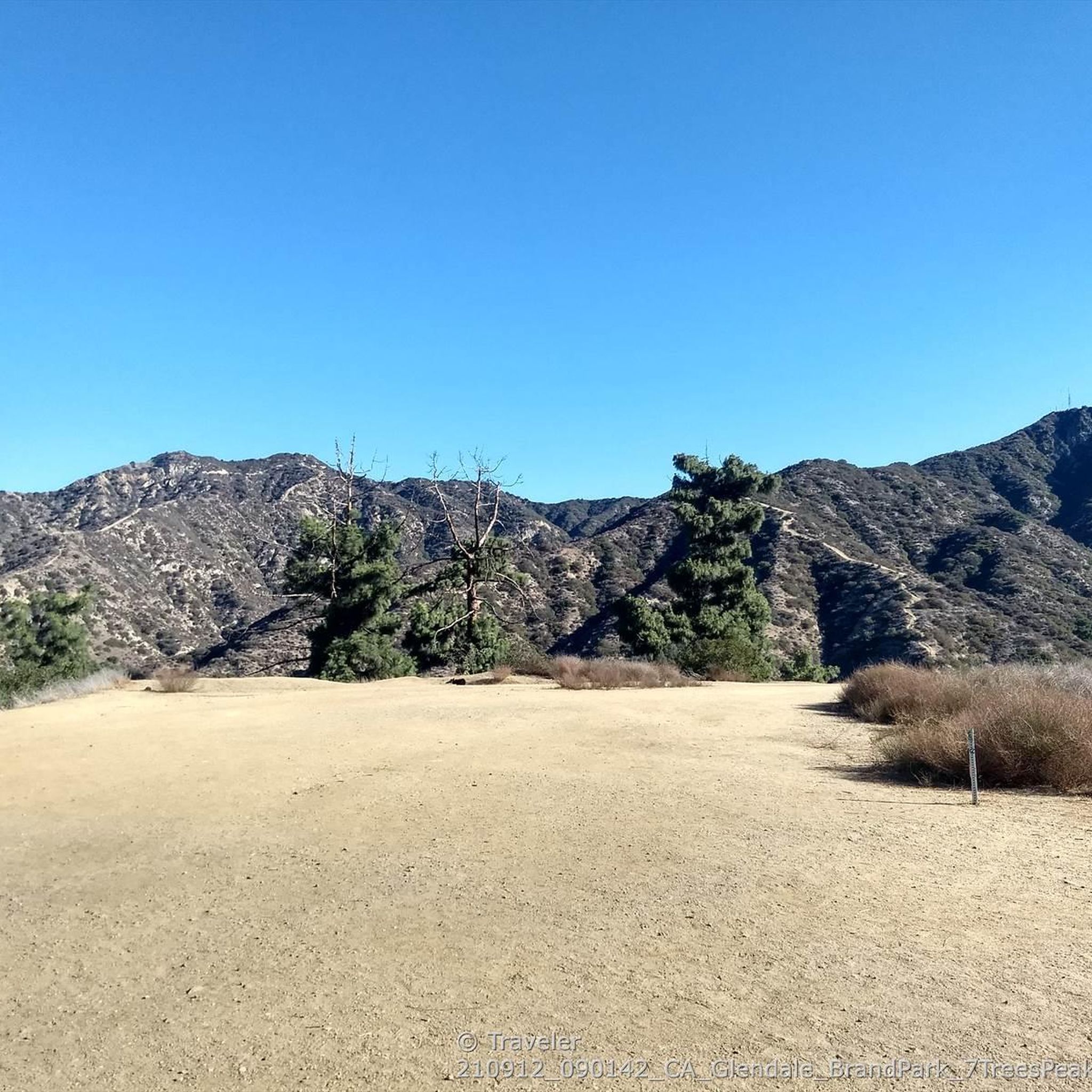
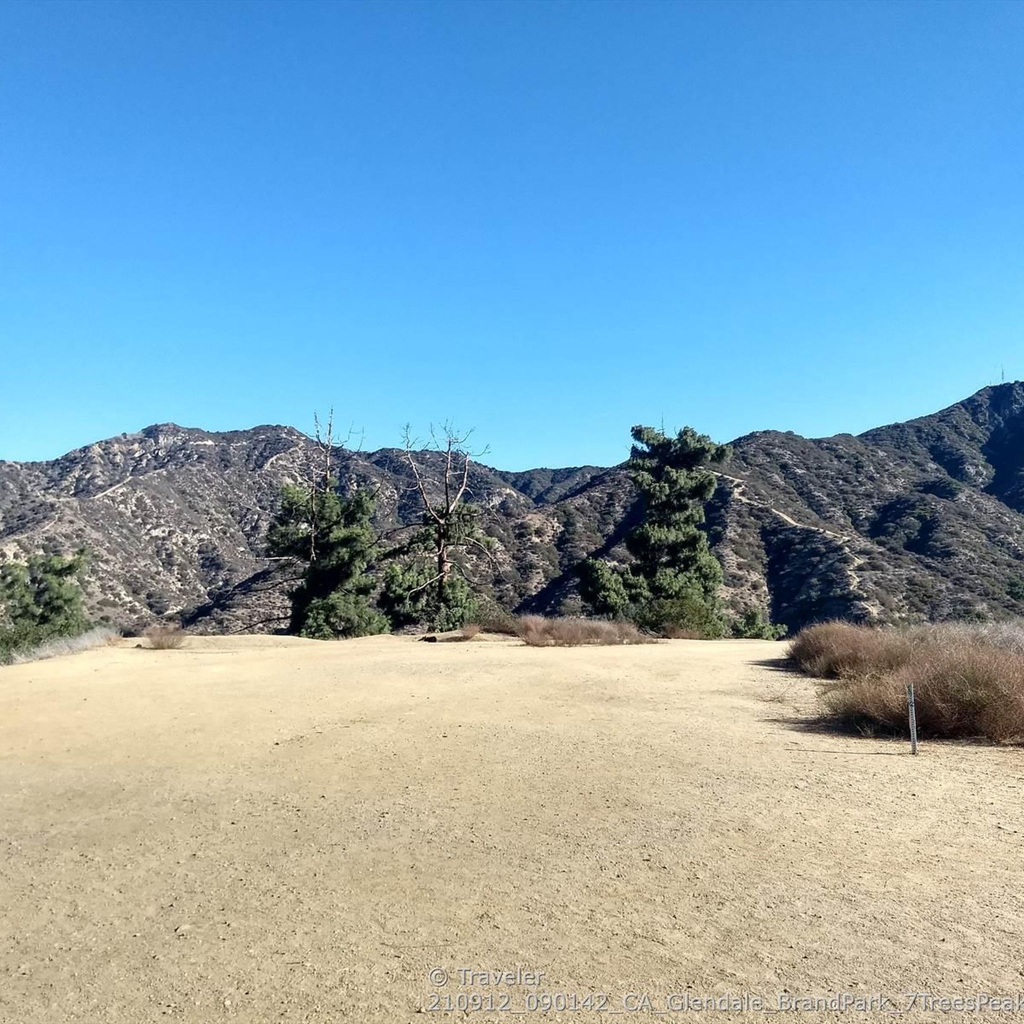
Verdugo Peak stands at 1835 feet and is a remote feeling summit off of the Verdugo Motorway. This sunny summit grants you fantastic views across the Verdugo Mountains and the valley below. In the spring there are often wildflowers along the motorway.
0
0
Mount Thom stands at 2440 feet over the city of Glendale and is a scenic destination for hikers. While often completed with Tongva Peak, Mount Tom is the more popular summit of the two. There are gated radio towers and antennae, which are closed to the public.
0
0
Tongva Peak stands at 2,656 feet and is a popular destination with hikers, trail runners, and mountain bikers and gravel riders. There are radio towers at the top along with a plaque on a rock, marking the summit. This is a great place to snap some photos and enjoy the views after a challenging hike!
0
0

Steep ascent and funny descent to Tongva Peak. Can be crowded with hikers on weekends.
0
0

Careful of protrusions on the trail. Lots of leftover metal mixed with ruts in the beginning.
0
0
Frequently Asked Questions
Are dogs allowed on the trails in the Verdugo Mountains?
Yes, dogs are generally allowed in the Verdugo Mountains Open Space Preserve, but they must be kept on a leash at all times. The wide fire roads, known as motorways, are well-suited for walking with a canine companion. Always bring enough water for both you and your dog, as the trails can be exposed and hot.
Where are the main trailheads and parking areas?
There are several access points to the Verdugo Mountains. Popular trailheads with street parking can be found near Brand Park in Glendale, La Tuna Canyon Park on the north side, and various residential streets in Burbank and Glendale, such as those leading to the Beaudry Motorways. Always check local parking signs and be respectful of residents.
Are there any easy, beginner-friendly hikes available?
While many trails involve a steady climb, there are options suitable for beginners. The lower sections of the motorways, such as the trails starting from Brand Park or Stough Canyon, offer a more gradual introduction to the area. The key is to manage your distance, as even the main fire roads have a consistent incline.
What is a good option for a challenging hike?
For a strenuous workout with significant elevation gain, the Vergudo and Tongva Peaks loop is an excellent choice. This nearly 12-mile (19 km) route connects two of the range's main summits and is considered difficult, demanding good fitness and endurance.
Which trails offer the best views?
Most trails that climb to the main ridgeline offer spectacular panoramic views. The Mount Thom Viewpoint loop from Sparr Heights is specifically known for its rewarding vistas over the city. On a clear day, you can see across the San Fernando Valley, the Los Angeles basin, and towards the San Gabriel Mountains.
Are there good circular hikes in the preserve?
Yes, the preserve is well-suited for loop hikes. Many routes combine different sections of the Beaudry, Verdugo, and Whiting Woods Motorways to create satisfying circuits. A great example is the Tongva Peak via the Beaudry Motorway loop, which provides a comprehensive tour of the ridgeline and its views.
Can I find any waterfalls in the Verdugo Mountains?
The Verdugo Mountains are not known for waterfalls. The climate is relatively dry, and while there are some springs and streams, they do not typically form significant waterfalls, especially during drier months. The main attractions are the rugged trails and expansive views.
What kind of wildlife might I see while hiking?
The Verdugo Mountains are a designated Significant Ecological Area. While hiking, you might encounter mule deer, coyotes, and a variety of birds and reptiles. The area is also home to a rich diversity of native flora, including coast live oaks and sycamores. It's always best to observe wildlife from a safe distance.
Is the Verdugo Mountains Open Space Preserve good for trail running?
Absolutely. The network of wide, graded fire roads (motorways) makes this a popular destination for trail runners. The sustained climbs provide an excellent training ground for building endurance and hill-running strength. The Tongva Peak loop from Sparr Heights is a favorite among local runners.
Are the trails suitable for mountain biking?
Yes, the Verdugo Mountains are very popular with mountain bikers. The main motorways, such as the Verdugo Motorway and Beaudry Motorways, are wide fire roads that are ideal for mountain biking, offering long climbs and fast descents. Bikers should always be cautious of hikers and control their speed.
What do other hikers enjoy most about the Verdugo Mountains?
The area is highly rated by the komoot community, with an average score of 4.6 stars. Reviewers frequently praise the challenging but rewarding climbs, the stunning panoramic city views from the ridges, and the accessibility of a rugged mountain experience so close to the urban center of Los Angeles.
How many hiking trails are in the Verdugo Mountains Open Space Preserve?
There are over 80 different routes to explore within the Verdugo Mountains. These range from short out-and-back climbs to long, challenging loops that traverse the entire ridgeline, offering options for various fitness levels and time commitments.
What is the typical elevation gain on these hikes?
Most hikes in the Verdugo Mountains involve a significant and sustained climb. Moderate routes like the Mount Thom Viewpoint loop from Emerald Isle have around 1,130 feet (345 m) of elevation gain, while more difficult, longer hikes can easily exceed 2,300 feet (700 m).
Most popular routes in Verdugo Mountains Open Space Preserve

Get inspired with the komoot mobile app


Explore more
Browse the best Hikes in other regions.
