The best running trails in Leo Carrillo State Park
5.0
(2)
543
runners
19
runs
Jogging in Leo Carrillo State Park offers a diverse landscape, combining scenic coastal routes with challenging inland trails. The park features 1.5 miles of beach, providing a unique surface for running, alongside varied terrains extending into the Santa Monica Mountains. Runners can explore ecosystems ranging from chaparral and coastal sage scrub to oak and riparian woodlands, with trails offering significant elevation changes. This variety ensures options for different fitness levels amidst natural beauty.
Best jogging routes in Leo Carrillo State…
Last updated: June 29, 2026
7
runners
11.6km
01:48
610m
610m
Hard run. Very good fitness required. Mostly paved surfaces. Suitable for all skill levels.
2
runners
5.92km
00:44
160m
160m
This 3.7-mile moderate jogging loop in Charmlee Wilderness Park offers ocean views and diverse ecosystems with 530 feet of elevation gain.

Sign up for free
1
runners
4.30km
00:30
120m
120m
Jog the Grotto Trail in Santa Monica Mountains, a moderate 2.7-mile route with 380 feet of elevation gain, leading to a unique rock grotto.
28
runners
Hard run. Very good fitness required. Mostly paved surfaces. Suitable for all skill levels.
11
runners
Hard run. Very good fitness required. Mostly paved surfaces. Suitable for all skill levels.
Get access to more routes and recommendations from other explorers.
Sign up for free
Already have an account?
Our route recommendations are based on thousands of hikes, rides, and runs completed by other people on komoot.
Start today with a free account
Your next adventure awaits.
Login or Signup

Other adventures in Leo Carrillo State Park

Tips from the Community

This trail connects to several spur trails throughout the Park. Potrero Road is to the west, where you will find ruins of an old ranch house. The extensive ruins offer an excellent overview of the Park. You will come across many boulders and views of the Pacific Ocean across the meadows filled with fantastic oak trees and wildflowers.
0
0

Circle X Ranch features a few different trailheads off of Yerba Buena Road that offer access to different spots on the property. This particular access point serves as the trailhead for the Grotto Trail.
1
0

The Grotto can be reached via Grotto Trail from Circle X Ranch Campground. Inside the Grotto, you will find a waterfall.
0
0
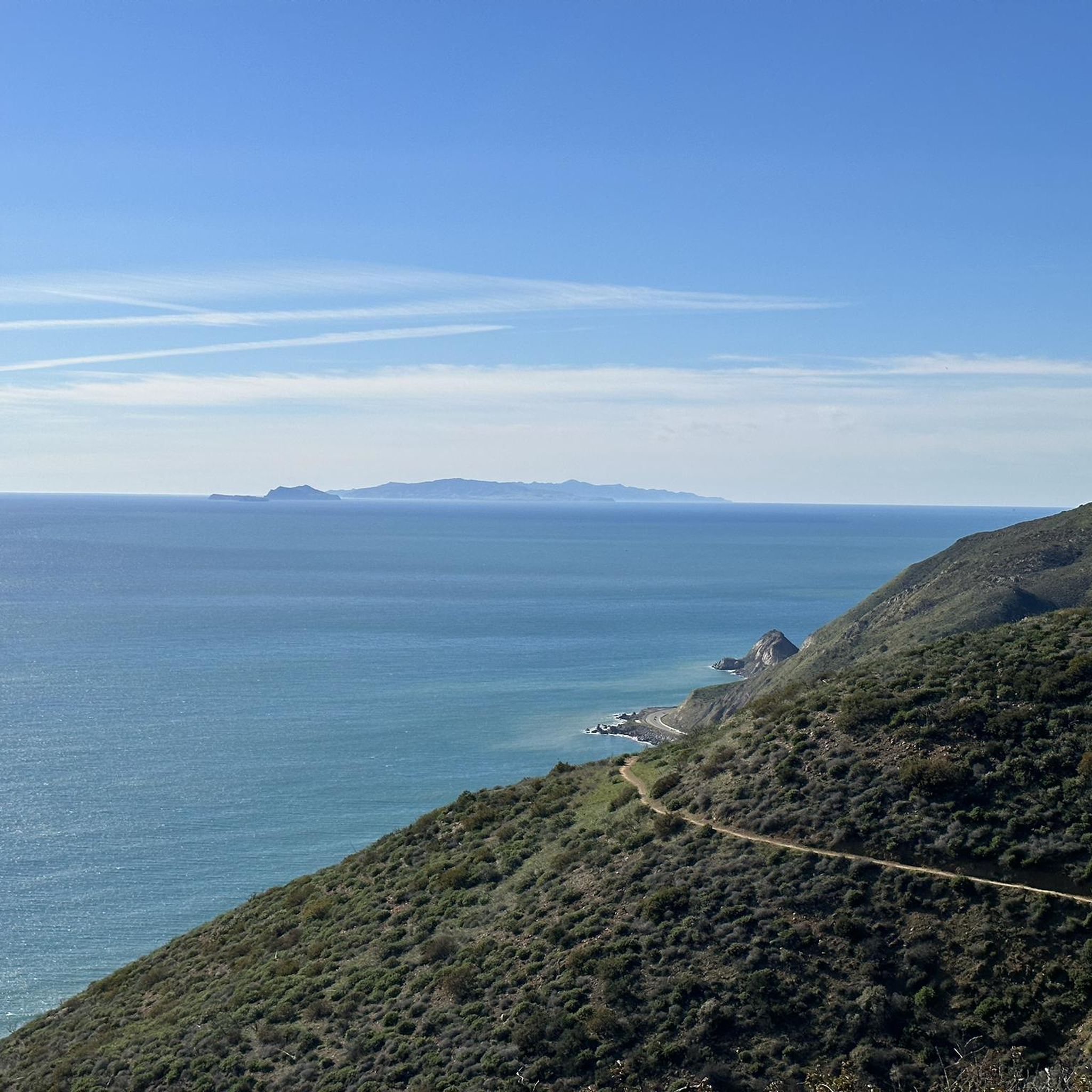
Nestled in the canyons above Malibu, Circle X Ranch is a hidden gem that offers breathtaking views of the Channel Islands and the Topatopa Mountains. This former Boy Scout camp is a haven for exploration, with many trails that wind through its unique coastal Mediterranean ecosystem. The sprawling ranch is home to a variety of fascinating creatures, including blue-bellied lizards and scrub jays. If you're lucky enough to be here during twilight, keep your eyes peeled for a glimpse of the elusive gray fox, which can sometimes be spotted roaming the grounds.
0
0
This stunning landscape east of Circle X Ranch is a paradise for mountain bikers, boasting chaparral-covered hills and magnificent oak woodlands. On the west side, the picturesque Etz Meloy Motorway (Backbone Trail) invites riders to enjoy the magnificence of this area's untouched scenery.
0
0

Stretching 67 miles (ca. 108 km) between Point Mugu and Will Rogers, the Backbone Trail epitomizes perseverance. The last piece of the trail is the Etz Meloy Motorway. Cut in the 1920s and named for early homesteaders, the fire road connects Mulholland Highway and Yerba Buena Road, crossing a number of privately owned tracts. Explore diverse ecosystems and embrace the trail's history.
0
0

Keep in mind, biking is not permitted on the Grotto Trail. You'll have to push your bike for 0.6 miles in order to reach the beautiful waterfall.
0
0
Explore the heights of mountain biking at Tri Peaks, standing tall among the Santa Monica Mountains. Revel in panoramic vistas from one of the region's highest peaks, including a breathtaking 360-degree view of diverse hiking trails and the scenic landscape.
0
0
Frequently Asked Questions
What types of running routes can I find in Leo Carrillo State Park?
Leo Carrillo State Park offers a diverse range of running routes, from scenic coastal paths along the beach to more challenging inland trails within the Santa Monica Mountains. You'll find options suitable for various fitness levels, including moderate loops and difficult runs with significant elevation changes. The park features over 20 dedicated running routes.
Are there any easy or moderate jogging trails for beginners or casual runners?
Yes, the park has several moderate options. For a balanced experience through varied park terrain, consider the Clyde Canyon, Lower Loop & Charmichael Road Trail loop, which is about 3.7 miles. Another moderate choice is the Grotto Trail, a 2.7-mile route leading to a unique rock grotto.
What are the more challenging running routes in Leo Carrillo State Park?
For a more strenuous run, the park offers several difficult trails. The Nicolas Flat Trail – Santa Monica Mountains National Recreation Area is a popular difficult route, spanning 7.2 miles with significant elevation gain. Another challenging option is the Mishe Mokwa to Tri-Peaks and Sandstone Peak – Santa Monica Mountains National Recreation Area, an 11.18 km route with substantial climbs.
Can I run with my dog on the trails in Leo Carrillo State Park?
Dogs are generally permitted on trails within Leo Carrillo State Park, but they must be kept on a leash no longer than six feet at all times. Please be aware that dogs are typically not allowed on the sandy beach areas or inside park buildings. Always check specific trail regulations upon arrival or consult the official park website for the most current rules regarding pets.
Are there any family-friendly running options in the park?
While many trails offer varied terrain, the park's diverse landscape means there are options for families. Shorter, less strenuous sections or the wide, flat beach itself can be great for family runs. For specific trail recommendations, consider routes like the Grotto Trail, which is moderate and relatively short, offering an interesting destination.
What natural features or landmarks can I expect to see while running?
Leo Carrillo State Park is rich in natural beauty. Along coastal routes, you can explore unique features like tide pools, coastal caves, and rock arches, especially around Sequit Point. Inland trails wind through diverse ecosystems including chaparral, coastal sage scrub, oak woodland, and riparian woodland. You might encounter giant sycamore trees and enjoy panoramic ocean views from trails like the Yellow Hill Fire Trail. Don't miss the Nicholas Flat Trail which leads to a seasonal pond, or the unique rock grotto on the Grotto Trail.
Are there any running routes that offer ocean views?
Absolutely! The park is famous for its stunning coastal scenery. The Leo Carrillo Bluff Trail provides continuous views of the Pacific Ocean, tide pools, and offshore rock outcroppings, with the Channel Islands often visible on clear days. Jogging directly along the 1.5 miles of Leo Carrillo State Park Beach also offers a unique soft-surface workout with refreshing ocean breezes.
What do other runners enjoy most about jogging in Leo Carrillo State Park?
The running routes in Leo Carrillo State Park are highly rated by the komoot community, with an average score of 5.0 stars. Runners often praise the park's incredible diversity, from the refreshing ocean air on coastal paths to the challenging climbs and panoramic views found on inland trails. The variety of ecosystems and natural landmarks also contribute to a highly engaging and scenic experience.
Is there parking available for accessing the running trails?
Yes, Leo Carrillo State Park provides parking facilities. There are day-use parking areas available within the park, typically near the beach access points and trailheads. Fees may apply for parking, so it's advisable to check the official California State Parks website for current rates and information before your visit: parks.ca.gov/leocarrillo.
What is the best time of year to go running in Leo Carrillo State Park?
Leo Carrillo State Park is generally pleasant for running year-round, thanks to Southern California's mild climate. However, spring (March to May) is particularly beautiful, with wildflowers blooming along inland trails. Fall (September to November) also offers comfortable temperatures. Summer can be warm, especially on inland trails, so early morning or late afternoon runs are recommended. Winter provides cooler temperatures, but trails can be muddy after rain.
Are there any loop running trails in the park?
Yes, the park features several loop options that are great for running. For example, the Clyde Canyon, Lower Loop & Charmichael Road Trail loop is a popular moderate route that allows you to experience varied terrain without retracing your steps. Another challenging loop is the MRCA Open Space – Long-distance hiking trail loop from Backbone Trail - Encinal to Mulholland, which is a longer, difficult option.
What kind of terrain should I expect on the running routes?
The terrain in Leo Carrillo State Park is quite varied. Coastal routes offer soft sand on the beach and firmer packed earth on bluff trails. Inland, you'll encounter a mix of dirt paths, fire roads, and some rocky sections, especially on more challenging trails with significant elevation changes. The diverse ecosystems mean you'll run through chaparral, coastal sage scrub, oak woodland, and riparian areas.
Most popular routes in Leo Carrillo State Park
Most popular attractions in Leo Carrillo State Park

Get inspired with the komoot mobile app


Explore more
Browse the best Running Trails & Routes in other regions.
