The best cycling routes in Leo Carrillo State Park
4.8
(6)
506
riders
18
rides
Touring cycling routes in Leo Carrillo State Park traverse a diverse landscape that includes 1.5 miles of scenic coastline and extends into the Santa Monica Mountains. The park features a blend of beachfront and mountainous terrain, offering varied cycling experiences. Cyclists can navigate coastal roads with ocean views or explore inland trails winding through chaparral-covered hillsides and oak woodlands. The area includes both paved surfaces and unpaved sections, such as gravel fire roads, connecting the Santa Monica Mountain Range crest…
Last updated: June 29, 2026
5.0
(1)
4
riders
32.7km
02:43
500m
500m
Hard bike ride. Very good fitness required. Mostly paved surfaces. Suitable for all skill levels.
15
riders
50.8km
03:27
410m
410m
Moderate bike ride. Good fitness required. Mostly paved surfaces. Suitable for all skill levels.

Sign up for free
8
riders
32.7km
02:19
620m
620m
Hard bike ride. Very good fitness required. Mostly paved surfaces. Suitable for all skill levels.
6
riders
30.7km
02:35
910m
910m
Hard bike ride. Very good fitness required. Mostly paved surfaces. Suitable for all skill levels.
3
riders
Hard bike ride. Very good fitness required. Mostly paved surfaces. Suitable for all skill levels.
Get access to more routes and recommendations from other explorers.
Sign up for free
Already have an account?
Our route recommendations are based on thousands of hikes, rides, and runs completed by other people on komoot.
Start today with a free account
Your next adventure awaits.
Login or Signup

Other adventures in Leo Carrillo State Park

Tips from the Community

Sycamore Canyon is really beautiful this time of year (January). There were 7 creek crossings to navigate, so expect wet shoes and socks if you do the entire length of the trail.
0
0

The Wood Canyon Vista and Backbone Trailhead has a picnic table and water source. There are no reliable water sources along the trails, so make sure you are prepared before starting.
0
0

Circle X Ranch features a few different trailheads off of Yerba Buena Road that offer access to different spots on the property. This particular access point serves as the trailhead for the Grotto Trail.
1
0

The La Jolla Canyon Trail from PCH has been closed for several years. No bikes allowed on the Ray Miller or Chumash trails. You can access the upper areas via Sycamore Canyon's western ridge (the eastern ridge of La Jolla Canyon)
0
0

North-Eastern entrance to this amazing park, dropping from the Santa Monica Mountain Range Crest via the smooth Sycamore Canyon Road - and with its continuation as a gravel fire road - to the Pacific coast.
0
0

This is a common turnaround point for bikers in search of great views from the slopes of Barney Knob. You can make it part of a loop ride, too, but in that case you'll be looking at road-bike distances.
0
0

Neptunes nest is an infamous seafood restaurant with excellent views of the Pacific and beach. Its a perfect spot to take a break and enjoy the views whilst having a bite to eat.
0
0

Encinal Canyon Road has great views of the coast and the ocean.
0
0
Frequently Asked Questions
What kind of terrain can I expect on touring cycling routes in Leo Carrillo State Park?
Touring cycling in Leo Carrillo State Park offers a diverse experience, blending coastal roads with ocean views and inland trails. You'll find both paved surfaces, such as sections of the Pacific Coast Highway, and unpaved gravel fire roads that wind through chaparral-covered hillsides and oak woodlands. Some routes, like the Neptune's Net – Big Sycamore Canyon Summit loop from Old Malibu, transition from smooth paved roads to gravel, connecting the mountains to the coast.
Are there family-friendly touring cycling routes in Leo Carrillo State Park?
Yes, while many routes in the park are moderate to difficult, there is at least one easy touring cycling route available. For families, it's best to look for routes with paved sections and minimal elevation gain. The park's coastal areas offer smoother rides, though specific family-friendly routes should be checked for current conditions and suitability.
What natural features or landmarks can I see while cycling in Leo Carrillo State Park?
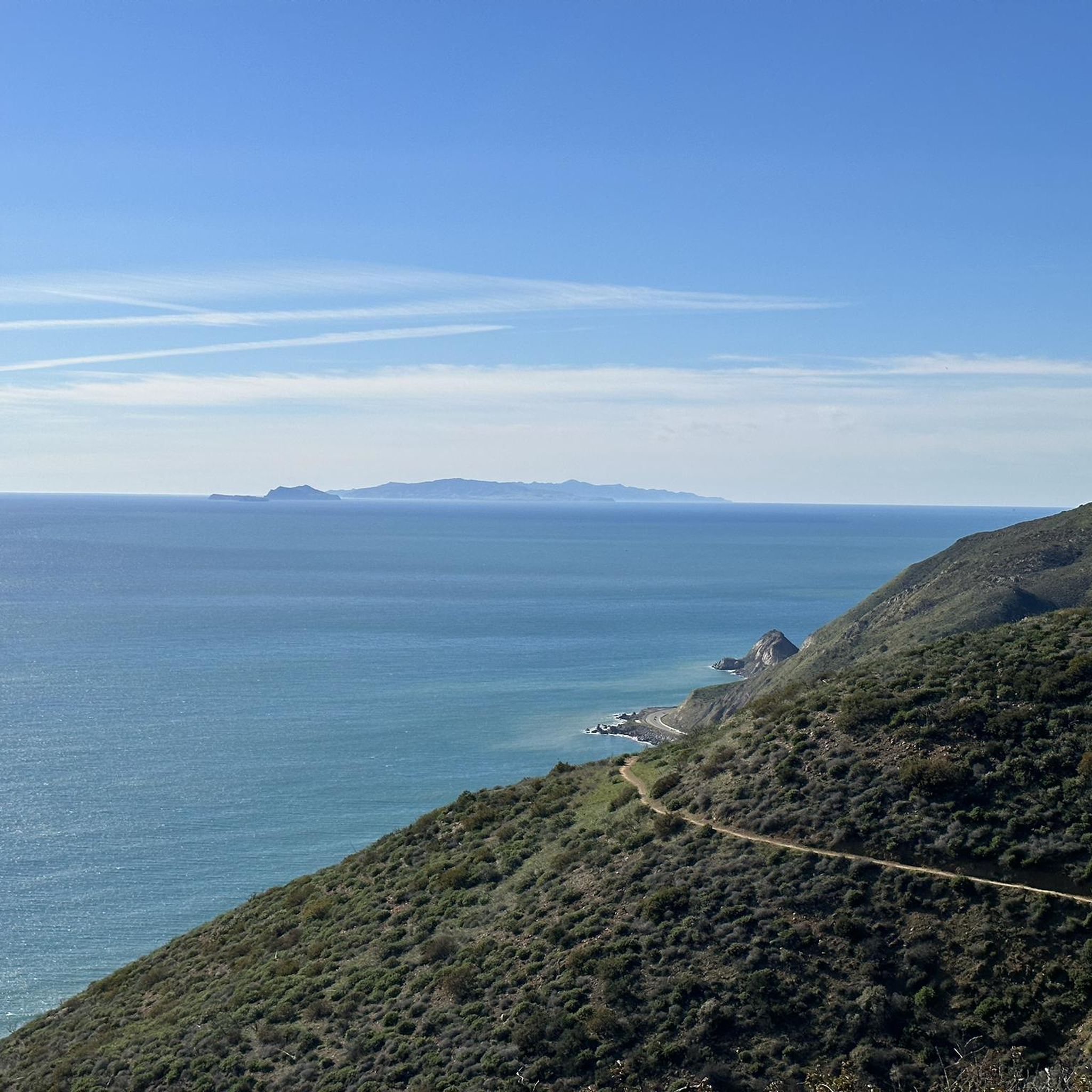
The park is rich in natural beauty and landmarks. Along the coast, you can enjoy views of the Pacific Ocean, explore tide pools teeming with marine life, and discover picturesque coastal caves and rock arches, especially around Leo Carrillo State Park Beach and South Beach. Inland, trails like the Nicholas Flat Trail offer panoramic views of the beach and distant Channel Islands, leading to a pond that showcases the park's diverse ecosystems. Don't miss the opportunity to stop at Neptune's Net, a popular landmark and eatery.
When is the best time of year to go touring cycling in Leo Carrillo State Park?
Leo Carrillo State Park is generally pleasant for cycling year-round due to Southern California's mild climate. However, for the most comfortable experience, spring and fall offer ideal temperatures. Summer can be warm, and sections of Highway 1 can become quite busy with traffic, especially on weekends, which might make parts of the ride less enjoyable. Always check weather forecasts before heading out.
Is parking available for cyclists, and how accessible is the park by public transport?
Leo Carrillo State Park provides parking facilities, including areas near the visitor center and campgrounds, which are convenient for cyclists starting their tours. While the park is primarily accessed by car, public transport options to the immediate vicinity are limited. It's advisable to plan your journey by car or check local transit authority websites for any specific bus routes that might serve the area, though direct access to trailheads via public transport is uncommon.
Are there places to eat or stay near the touring cycling routes?
Yes, there are options for both food and accommodation. The park itself features campgrounds shaded by giant sycamore trees, offering facilities like restrooms and token-operated showers, which are convenient for multi-day touring cyclists. For dining, Neptune's Net is a well-known eatery located near the coast and is even part of a popular cycling route, providing a great stop for refreshments.
What is the typical length and duration of touring cycling routes in the park?
The touring cycling routes in Leo Carrillo State Park vary significantly in length and duration. For instance, the Backbone Trail Loop is about 20.3 miles (32.7 km) and typically takes around 2 hours 42 minutes. A longer option, the Neptune's Net – Big Sycamore Canyon Summit loop from Old Malibu, spans 31.6 miles (50.8 km). Routes range from approximately 15 to over 30 miles, with durations from 2 to 4 hours or more, depending on your pace and the route's difficulty.
Are there any circular touring cycling routes available in Leo Carrillo State Park?
Yes, many of the touring cycling routes in Leo Carrillo State Park are designed as loops, offering a convenient way to explore without retracing your steps. Examples include the challenging Backbone Trail Loop and the South Beach – Leo Carillo State Park loop from Old Malibu, which takes you through both coastal and inland areas.
What do other touring cyclists enjoy the most about touring cycling in Leo Carrillo State Park?
The area is highly rated by the komoot community, with an average score of 5.0 stars from over 8 reviews. Reviewers often praise the diverse landscapes, from scenic coastline views to the challenging yet rewarding trails winding through the Santa Monica Mountains. The blend of paved and unpaved sections, along with the opportunity to connect mountain and coastal experiences, is frequently highlighted as a major draw.
Can I bring my dog on touring cycling routes in Leo Carrillo State Park?
Leo Carrillo State Park has specific regulations regarding dogs. While dogs are generally permitted in campgrounds, picnic areas, and on paved roads, they are typically not allowed on unpaved trails or beaches. It's always best to check the official park website for the most current pet policies before planning your ride, especially if you intend to explore inland trails. You can find more information on the park's official website: ca.gov.
What are the difficulty levels of touring cycling routes in Leo Carrillo State Park?
The touring cycling routes in Leo Carrillo State Park cater to various fitness levels. You'll find a mix of difficulties, with 1 easy route, 10 moderate routes, and 13 difficult routes. Routes like the Sandstone Peak Trailhead – Circle X Ranch loop from Old Malibu are considered difficult due to significant elevation changes and potentially challenging terrain, while others offer a more moderate experience, such as the Neptune's Net – Big Sycamore Canyon Summit loop from Old Malibu.
Are there any specific safety considerations for cycling in Leo Carrillo State Park?
When cycling in Leo Carrillo State Park, it's important to be aware of varied terrain, which can include both paved roads and unpaved fire roads. Sections of Highway 1 can be busy, especially on weekends, so exercise caution and be visible to traffic. Inland trails may have steep sections and loose gravel. Always wear a helmet, carry sufficient water, and be prepared for changing weather conditions. It's also wise to inform someone of your route and expected return time.
Most popular routes in Leo Carrillo State Park
Most popular attractions in Leo Carrillo State Park

Get inspired with the komoot mobile app


Explore more
Browse the best Cycling routes in other regions.
