The best running trails in Antonovich Open Space Preserve
4.3
(3)
187
runners
45
runs
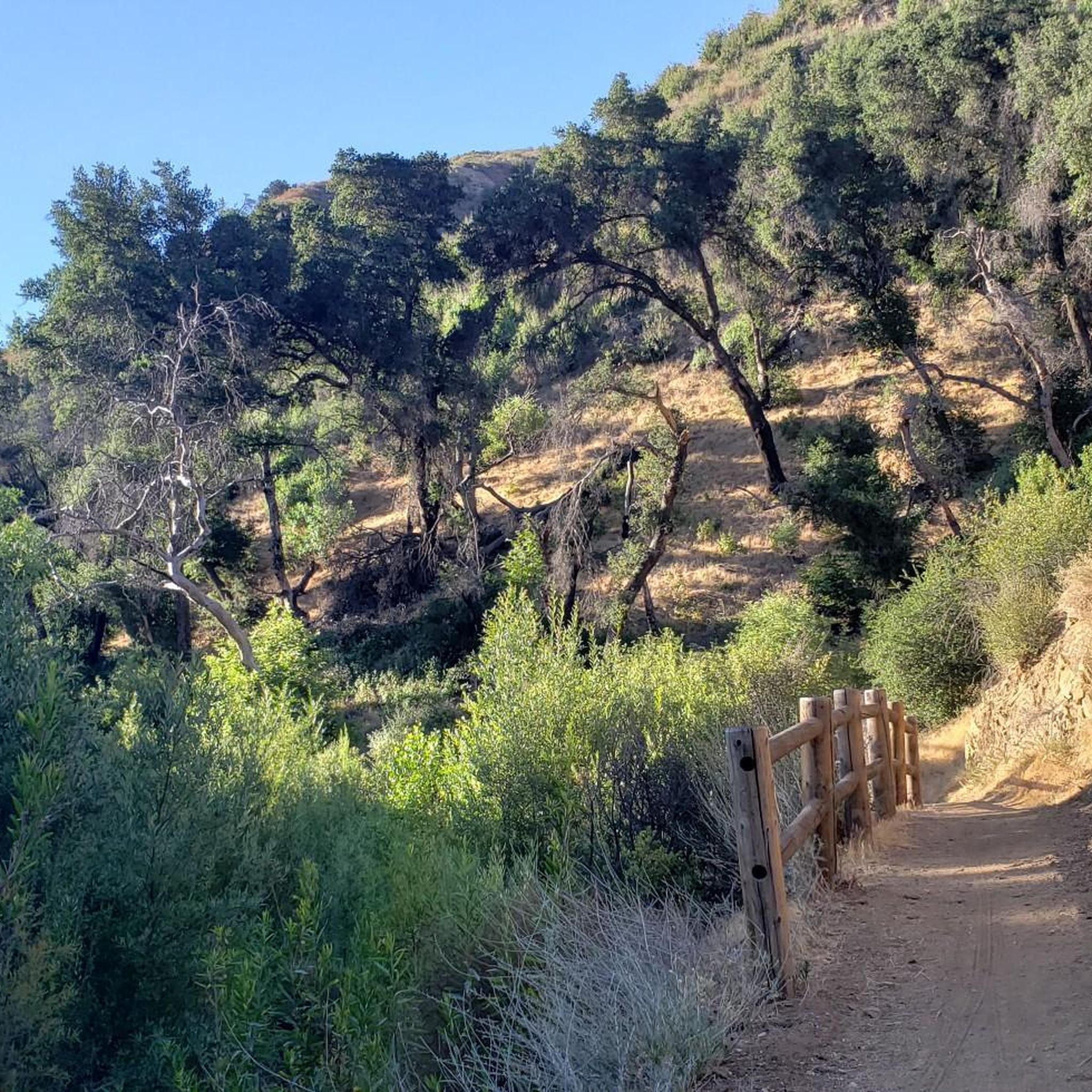
Jogging in Antonovich Open Space Preserve offers diverse terrain across canyons, rolling hills, and areas of natural chaparral vegetation. The preserve features mixed woodlands with species like bigcone Douglas-fir and coast live oak, providing a dynamic environment for runners. Elevation changes are common, particularly in the headwaters of Devil, Ybarra, and Browns Canyons, which include extensive oak and walnut woodlands. This varied landscape provides a range of running experiences for different fitness levels.
Best jogging routes in Antonovich Open Space…
Last updated: June 27, 2026
3
runners
13.6km
01:52
470m
470m
This difficult 8.5-mile jogging route via East Canyon Trail offers panoramic views of Los Angeles County from Mission Point.
4.44km
00:37
150m
150m
Jog the moderate 2.8-mile Rice Canyon Trail Loop in Santa Clarita Woodlands Park, gaining 485 feet in 36 minutes.

Sign up for free
5
runners
8.09km
01:02
340m
340m
Hard run. Very good fitness required. Mostly paved surfaces. Suitable for all skill levels.
4.0
(1)
19
runners
9.74km
01:23
410m
410m
Prepare for a challenging jogging experience on the Don Mullally Trail, a difficult route covering 6.1 miles (9.7 km). You will encounter a significant elevation gain of 1356 feet (413…
5
runners
8.24km
01:10
400m
400m
Start your difficult jogging adventure on the O'Melveny Park to Mission Point Loop, a challenging route spanning 5.1 miles (8.2 km). You'll begin amidst the pleasant green lawns and shaded…
Get access to more routes and recommendations from other explorers.
Sign up for free
Already have an account?
Our route recommendations are based on thousands of hikes, rides, and runs completed by other people on komoot.
Start today with a free account
Your next adventure awaits.
Login or Signup
Popular around Antonovich Open Space Preserve
Tips from the Community

Mission Point is a popular destination for hikers and mountain bikers. The views from the top are spectacular and you can see most of the San Fernando Valley and on a clear day the ocean.
0
0

Rice Canyon Trail is a popular short path in Santa Clarita Woodlands Park that branches off of the more popular East Canyon Trail. The path is singletrack and mainly travels through the forest with a couple of open views. There are a couple water crossings that can be fun or annoying depending on the time of year.
0
0
Mission Point Trail is the most popular trail for tackling Mission Point. The trail is smooth, gradual singletrack that moves across some of the ridges and meadows of the foothills. This is a pretty popular trail for mountain bikes, so be aware of other trail users.
0
0
The De Campos Trail is really popular for mountain biking, hiking, and trail running and is a pretty direct route up to Mission Point. The trail is wide and pretty smooth. It's uphill the whole way out, but you can really move on this smooth, gradual downhill.
0
0
Sunshine Canyon Motorway connects to the East Canyon Trail at Jones Junction. This "Motorway" is more of an old forest road that is perfect for running and mountain biking. You get views like you are on a tight ridgeline even though you're just on a double-track road.
0
0
The East Canyon Trail follows the double-tracks of an old forest road. Sometimes, you have to jump on a short spur trail to get around some forest fencing, but you never have to trespass or anything. This is an awesome trail for running, but it's definitely a gradual uphill the entire way to Jones Junction and beyond until you turn back for the car.
0
0
Mission Point serves as a lookout and memorial site for Dr. Mario A De Campos. There are great, open views from the top, which can be reached from a couple different directions. The views are of the mountains in one direction and the city in the other.
0
0
Towsley Canyon Loop Trail is one of the most (if not the most) popular trails in Santa Clarita Woodlands Park. The loop trail is a touch over 5 miles in total and spends some time on the forest floor in the trees, up high with the shrubs and open views, and even some time nestled up next to some canyon walls. There is a multitude of loop and route options at Santa Clarita Woodlands Park, and the Towsley Canyon Loop Trail is one of the most popular choices for good reason.
0
0
Frequently Asked Questions
How many running routes are available in Antonovich Open Space Preserve?
Antonovich Open Space Preserve offers a wide selection of running routes, with over 40 distinct trails to explore. These routes cater to various fitness levels, including 7 easy, 25 moderate, and 13 difficult options.
What kind of terrain can I expect when jogging in Antonovich Open Space Preserve?
Joggers can expect a diverse range of terrain, including canyons, rolling hills, and areas of natural chaparral vegetation. The preserve features mixed woodlands with species like bigcone Douglas-fir, coast live oak, and California black walnut. You'll also find elevation changes, particularly in the headwaters of Devil, Ybarra, and Browns Canyons, which boast extensive oak and walnut woodlands and riparian corridors.
Are there any family-friendly running routes in the preserve?
Yes, there are several routes suitable for families. For an easier option, consider the East Canyon Trail loop, which is about 3.7 miles (6.0 km) and offers a gentle introduction to the preserve's natural features. While specific 'family-friendly' designations aren't always explicit, routes with lower difficulty ratings are generally more suitable.
Can I bring my dog on the trails in Antonovich Open Space Preserve?
While the region research doesn't explicitly state dog-friendly policies for Antonovich Open Space Preserve, many open space preserves in California allow dogs on leash. It's always best to check the official park website for the most current regulations regarding pets before your visit. You can find more information on the MRCA website.
Are there any circular running routes available?
Yes, Antonovich Open Space Preserve features several excellent loop trails. A popular choice is the Rice Canyon Trail Loop, a moderate 2.8 miles (4.4 km) path that takes you through diverse canyon scenery. Another option mentioned in regional research is the East and Rice Canyon Loop, offering diverse canyon scenery over 3.7 miles (5.94 km).
What are some scenic viewpoints or natural features to look out for?
The preserve offers stunning panoramic views of the San Fernando Valley, the Santa Monica, Totopa, and Santa Susana Mountains, and the Simi Hills. You'll also encounter extensive oak and walnut woodlands, riparian corridors with year-round surface water, and seasonal wildflowers in spring. The Mission Point via East Canyon Trail route is known for its panoramic views from Mission Point.
What is the best time of year to go running in Antonovich Open Space Preserve?
The preserve can be enjoyed year-round, but spring is particularly beautiful due to seasonal wildflowers. Fall and winter offer cooler temperatures, which can be ideal for longer runs. Summers can be hot, so early morning or late afternoon runs are recommended during those months.
Where can I park when visiting Antonovich Open Space Preserve for a run?
Trail access is available from several points, including the East Canyon Trailhead, Newhall Pass Trailhead, and O'Melveny Park. These locations typically offer parking facilities. It's advisable to check specific trailhead information for parking availability and any potential fees.
Is public transport available to reach the running trails?
While the preserve is primarily accessed by car, some trailheads, like O'Melveny Park, might be reachable via local public transport routes. However, direct public transport access to all trailheads within the Antonovich Open Space Preserve can be limited. Planning your route in advance using a local transit planner is recommended.
What do other runners enjoy most about jogging in Antonovich Open Space Preserve?
The running routes in Antonovich Open Space Preserve are highly rated by the komoot community, with an average score of 4.5 stars. Runners often praise the diverse terrain, from canyons and rolling hills to mixed woodlands, and the rewarding panoramic views. The variety of trail lengths and difficulties also makes it a favorite for many.
Are there any longer or more challenging running options?
Absolutely. For a more challenging experience, consider the Mission Point via East Canyon Trail, which is 8.5 miles (13.6 km) and features significant elevation gain. Another challenging option is the Don Mullally Trail, a 6.1 miles (9.7 km) route through rolling hills. The region also mentions a 12.2-mile (19.6 km) East Canyon Trail to O'Melveny Park option for those seeking a longer adventure.
Can I see wildlife while running in the preserve?
Yes, Antonovich Open Space Preserve offers opportunities for wildlife viewing. Keep an eye out for local bird species and small mammals that inhabit the diverse woodlands and chaparral areas. Early mornings or late afternoons are often the best times for wildlife sightings.
Are there any easy running routes for beginners?
Yes, beginners can find suitable routes. The East Canyon Trail loop, approximately 3.7 miles (6.0 km), is described as an easy route, offering a gentle introduction to the preserve's natural beauty. Look for routes marked as 'easy' in the komoot guide for more options.
Most popular routes in Antonovich Open Space Preserve

Get inspired with the komoot mobile app


Explore more
Browse the best Running Trails & Routes in other regions.
