The best running trails in Garin Regional Park
4.4
(14)
960
runners
81
runs
Jogging routes in Garin Regional Park traverse a diverse landscape of rolling hills, open grasslands, and wooded canyons in Hayward, California. The park offers a variety of trails, from mostly paved surfaces to more rugged paths, catering to different fitness levels. Panoramic views of the San Francisco Bay and surrounding areas are accessible from higher elevations, while tranquil spots like Jordan Pond provide peaceful environments. The terrain includes both gentle gradients and significant elevation gains, making it suitable for various running experiences.
Best jogging routes in Garin Regional Park
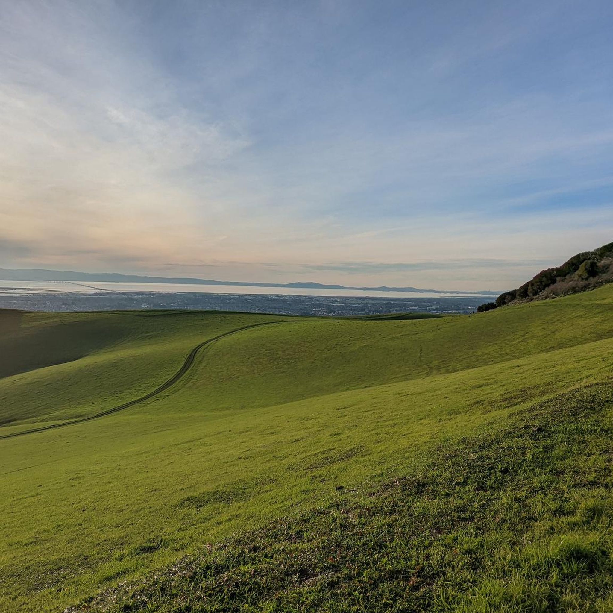
- The most popular jogging route is Vista Peak Loop Trail, a 4.7 miles (7.5 km) trail that takes about 58 minutes to complete. This route offers panoramic Bay Area views from its higher points.
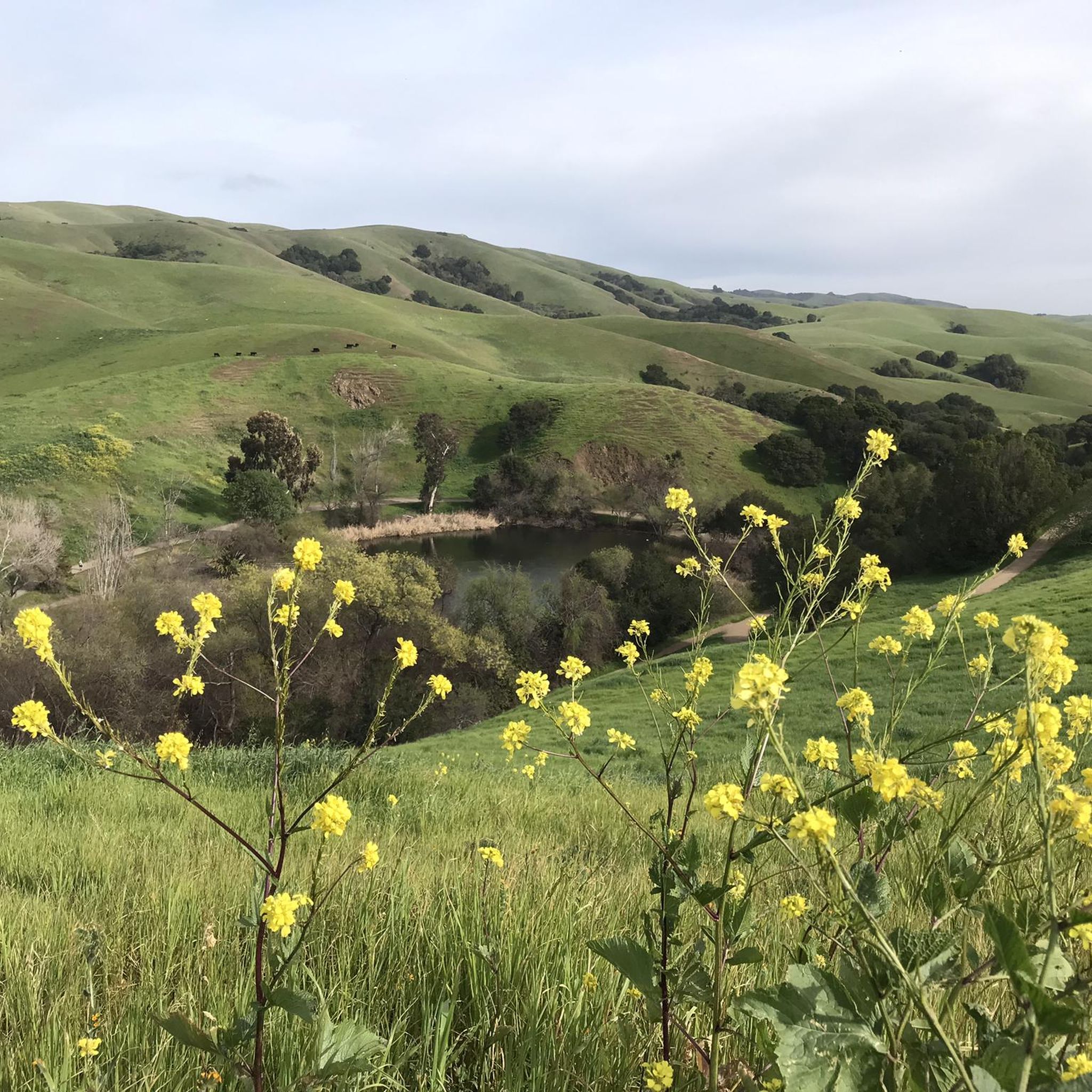
- Another top favourite among local runners is High Ridge Loop Trail – Jordan Pond loop from Garin Regional Park, an easy 2.9 miles (4.7 km) path. This route features the serene Jordan Pond and sections along the high ridge.
- Local runners also love the Jordan Pond – High Ridge Loop Trail loop from Garin Regional Park, a 4.9 miles (7.8 km) trail leading through Jordan Pond and along the High Ridge, often completed in about 1 hour.
- Jogging in Garin Regional Park is defined by rolling hills, open grasslands, and panoramic viewpoints. The network offers options for different ability levels, from easy strolls to challenging runs with significant elevation.
- The routes in Garin Regional Park are highly rated by the komoot community with an average score of 4.0 stars from more than 6 reviews. More than 700 runners have used komoot to explore Garin Regional Park's varied terrain.
Last updated: August 31, 2026
5
runners
7.54km
00:58
190m
190m
The Vista Peak Loop Trail offers a dynamic jogging experience through Garin Regional Park, transitioning from open, rolling grasslands dotted with grazing cattle to a more sheltered, wooded canyon. You'll navigate a mix of paved road, loose dirt, and singletrack paths, with the highlight being the panoramic Bay Area views from the Vista Peak Loop Trail Viewpoint on clear days. This moderate 4.7-mile (7.5 km) loop, with 632 feet (193 metres) of elevation gain, is a great option for a roughly 57-minute run that feels like a true journey.
Before you head out, be aware that the trail can get very muddy after rain, particularly in the first half, so waterproof shoes are recommended during wet seasons. During summer, expect to see brown stubble and cow manure in the heavily grazed pastures. Checking current trail conditions is always a good idea, as erosion and closures can occur. The best time to visit for lush green scenery is between January and April.
This route is a fantastic way to experience the diverse ecosystems of Garin Regional Park, from its open pastures to its wooded sections. While the views are impressive, they are generally considered less dramatic than those on the nearby High Ridge Loop. The trail also connects with other paths like the Zeile Creek Trail, offering opportunities to extend your run if you're looking for more mileage.
5
runners
7.85km
00:59
210m
210m
Moderate run. Good fitness required. Mostly paved surfaces. Suitable for all skill levels.

Sign up for free
8.97km
01:03
220m
220m
The Whispering Creek, Shady Canyon, and Ridgetop Loop offers a dynamic jogging experience, guiding you through varied terrain from chaparral ecosystems with manzanita shrubs to tranquil oak groves. This moderate 5.6-mile (9.0 km) route includes 738 feet (225 metres) of elevation gain, typically taking about 1 hour and 3 minutes to complete. You'll be treated to panoramic views from higher elevations, including a designated viewpoint, making it a rewarding choice for those who appreciate diverse scenery.
Planning your visit is straightforward, with convenient parking available at the main entrance of the Don Castro Regional Recreation Area. Dogs are welcome on the trail, provided they remain on a leash. Due to some exposed sections, consider jogging in the early mornings or late afternoons, especially during warmer seasons, to make the most of your run.
What makes this route stand out is its blend of natural immersion and moderate challenge, perfect for a good workout with scenic rewards. Keep an eye out for local wildlife like brush rabbits and red-tailed hawks as you navigate the diverse surfaces, which include paths, footpaths, and hiking paths. It's a well-regarded option for a moderately challenging run with plenty of natural beauty.
5
runners
7.00km
00:43
20m
20m
Moderate run. Good fitness required. Mostly paved surfaces. Suitable for all skill levels.
2.0
(1)
3
runners
4.16km
00:26
10m
10m
Easy run. Great for any fitness level. Mostly paved surfaces. Suitable for all skill levels.
Get access to more routes and recommendations from other explorers.
Sign up for free
Already have an account?
Our route recommendations are based on thousands of hikes, rides, and runs completed by other people on komoot.
Start today with a free account
Your next adventure awaits.
Login or Signup

Other adventures in Garin Regional Park

Tips from the Community

Wonderful hilly trail making up part of the Dry Creek Pioneer Regional Park.
0
0

The Vista Peak Loop Trails goes up the hillside without any trees blocking your line of sight, so once you climb enough, there are great views onto the Bay Area.
0
0

Don Castro Regional Park is a 101-acre park between Hayward and Castro Valley. It offers swimming in the lagoon, fishing, picnicking, as well as five miles of trails.
0
0
Jordan Pond is a small, picturesque lake in the Dry Creek Pioneer Regional Park, surrounded by lush greenery and wildlife.
0
0
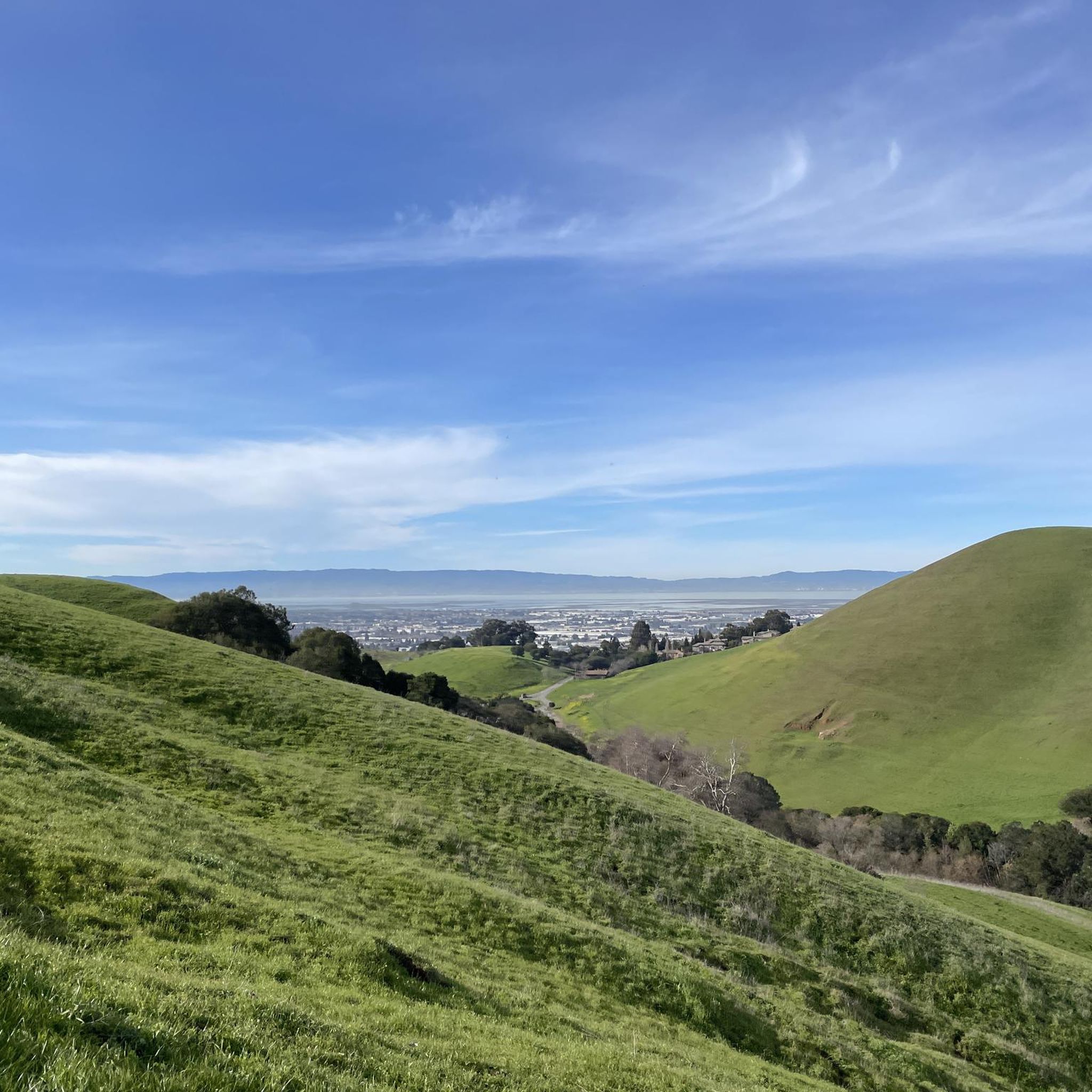
Beautiful views of rolling green hills and the Bay Area. If you're planning on attempting this hike after rain, make sure you're wearing waterproof hiking boots, as the terrain can get quite muddy.
1
0

Don Castro Regional Park is a 101-acre urban oasis on the boundary between Hayward and Castro Valley. The clear blue waters of the swim lagoon are a popular place to cool off. The lagoon and adjacent lake were created in 1964 when the Alameda Flood Control and Water Conservation District dammed San Lorenzo Creek. https://www.ebparks.org/parks/don-castro
0
0
Frequently Asked Questions
What types of running trails can I expect in Garin Regional Park?
Garin Regional Park offers a diverse range of running trails, from mostly paved surfaces suitable for easier runs to more rugged paths for those seeking a challenge. You'll find picturesque rolling hills, open grasslands, and attractive wooded canyons, providing varied terrain for all fitness levels.
Are there easy jogging routes for beginners or those looking for a relaxed run?
Yes, Garin Regional Park has several easy options. For instance, the High Ridge Loop Trail – Jordan Pond loop from Garin Regional Park is an easy 4.7 km (2.9 miles) path featuring the serene Jordan Pond. Another gentle option is the Running loop from South Hayward, which is 4.1 km (2.5 miles) with minimal elevation gain.
Which running routes offer the best panoramic views of the Bay Area?
For breathtaking panoramic views, consider the Vista Peak Loop Trail. This moderate 7.5 km (4.7 miles) route ascends to higher elevations, including Vista Peak, providing sweeping vistas of the San Francisco Bay and surrounding cities.
Are there any loop running routes in Garin Regional Park?
Yes, many of the park's trails are designed as loops, offering a continuous running experience. Besides the Vista Peak Loop, you can explore the Jordan Pond – High Ridge Loop Trail loop from Garin Regional Park, a moderate 7.8 km (4.9 miles) route that combines natural beauty with a good workout.
What historical or natural attractions can I see while running in the park?
Garin Regional Park is rich in both natural beauty and history. You can run past the tranquil Jordan Pond, a peaceful spot for birdwatching. The park also features the Garin Barn Visitor Center, displaying artifacts from the region's ranching past, and a historic apple orchard. In springtime, meadows burst with vibrant wildflowers.
Are there shaded running trails in Garin Regional Park?
While much of the park is open, some trails do offer welcome shade. Look for sections that pass through wooded canyons or oak forests. For example, parts of the Whispering Creek, Shady Canyon, and Ridgetop Loop may provide shaded relief, especially during warmer months.
What is the best time of year to go jogging in Garin Regional Park?
The park offers a pleasant running experience year-round, but conditions vary. In winter and spring, the hills are lush and green, often adorned with wildflowers. Summers can be warm and dry, turning the grasslands golden-brown. Spring and fall generally offer mild temperatures, making them ideal for longer runs.
What do other runners enjoy most about the trails in Garin Regional Park?
The running routes in Garin Regional Park are highly rated by the komoot community, with an average score of 4.0 stars. Reviewers often praise the diverse terrain, from rolling hills to wooded areas, and the stunning panoramic views of the Bay Area from higher elevations. The variety of trail difficulties also makes it popular for different fitness levels.
Can I expect to see wildlife while running in Garin Regional Park?
Yes, the park's diverse ecosystems support a wide array of wildlife. Joggers might spot indigenous animals like deer, hawks, and wild turkeys. Jordan Pond is also home to various waterfowl, making it a great spot for birdwatching during your run.
Are there challenging running routes with significant elevation gain?
Absolutely. Garin Regional Park is known for its hilly terrain, which is even used as a high-school cross-country course. Routes like the Vista Peak Loop Trail feature significant elevation gains, providing a robust workout and rewarding runners with expansive views from the summits.
How many running routes are available in Garin Regional Park?
Komoot features over 60 running routes within Garin Regional Park, catering to a wide range of preferences and fitness levels. This extensive network ensures you'll always find a new path to explore, from easy strolls to challenging runs.
Most popular routes in Garin Regional Park

Get inspired with the komoot mobile app


Explore more
Browse the best Running Trails & Routes in other regions.
