The best walks and hikes in Garin Regional Park
4.7
(74)
1,130
hikers
87
hikes
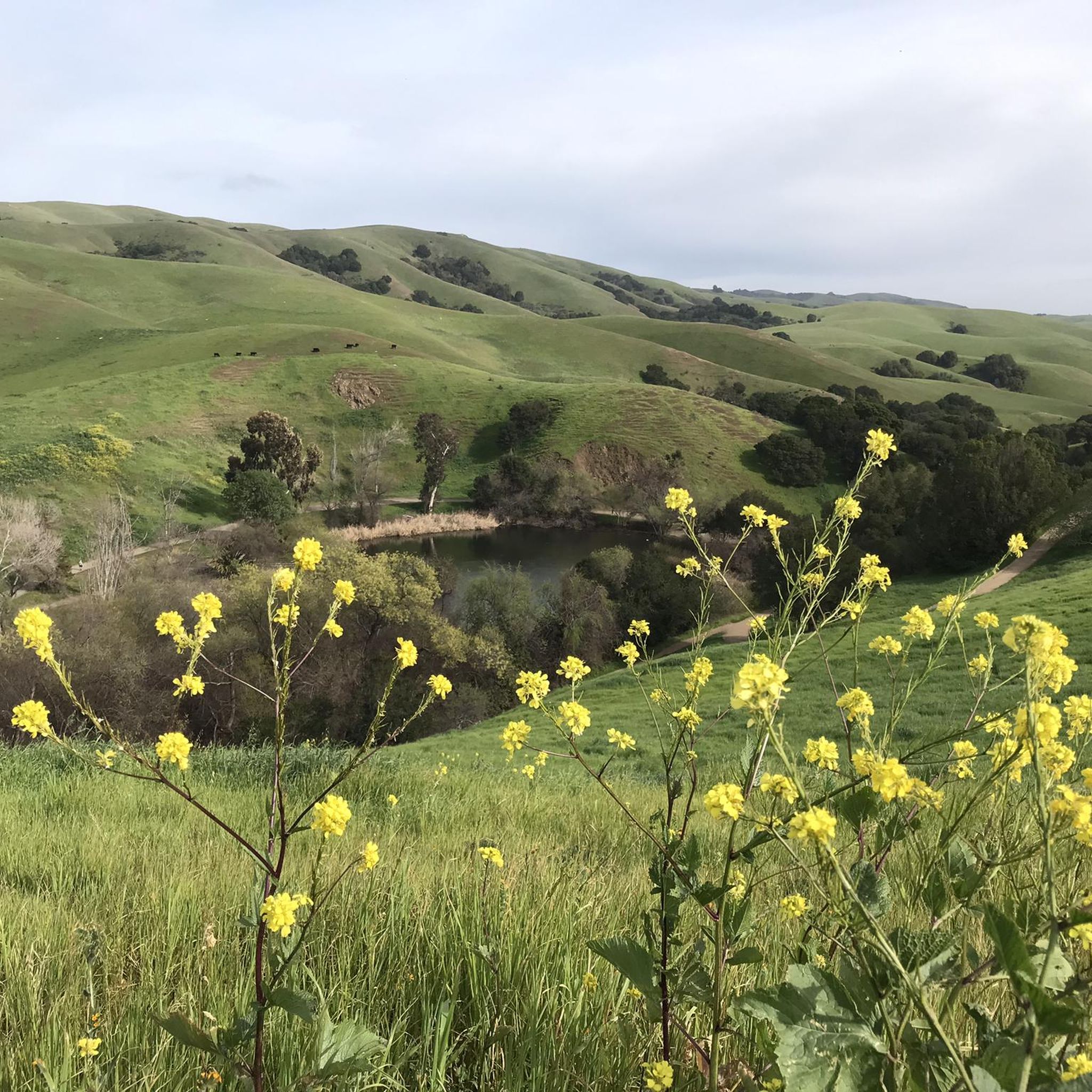
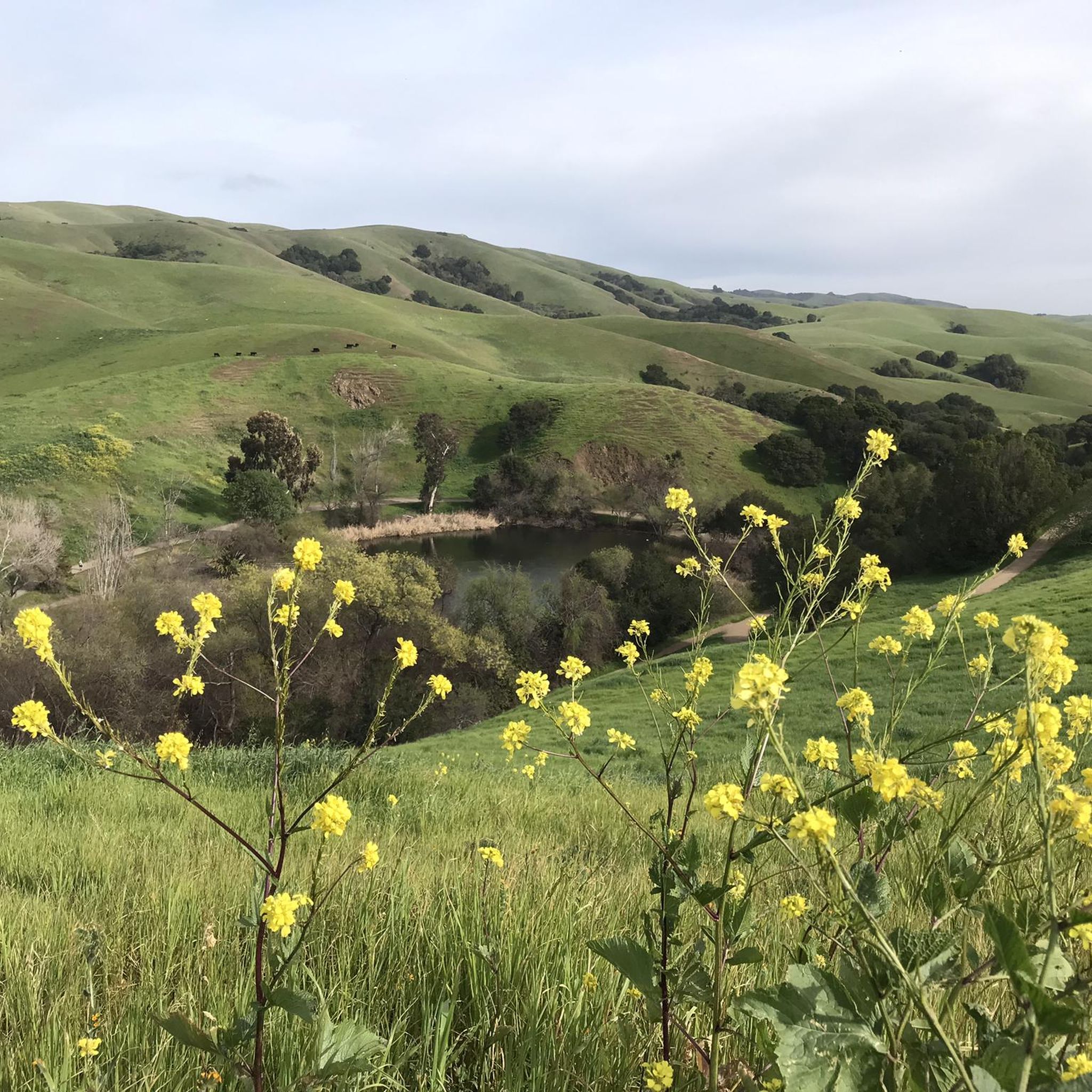
Hiking in Garin Regional Park offers routes through diverse landscapes, including rolling hills, open grasslands, and wooded canyons. The park features summits like Vista Peak and Tolman Peak, which provide expansive views of the San Francisco Bay and the city of Hayward. Hikers can encounter ancient oak trees and varied terrain, with elevations reaching up to 1,500 feet. This East Bay Regional Park provides a range of experiences for different fitness levels.
Best hiking trails in Garin Regional Park
- The most popular hiking route is Vista Peak and Garin Woods Loop, a 4.7 miles (7.5 km) trail that takes 2 hours 11 minutes to complete. This moderate path winds through the park's low rolling hills and a wooded canyon.
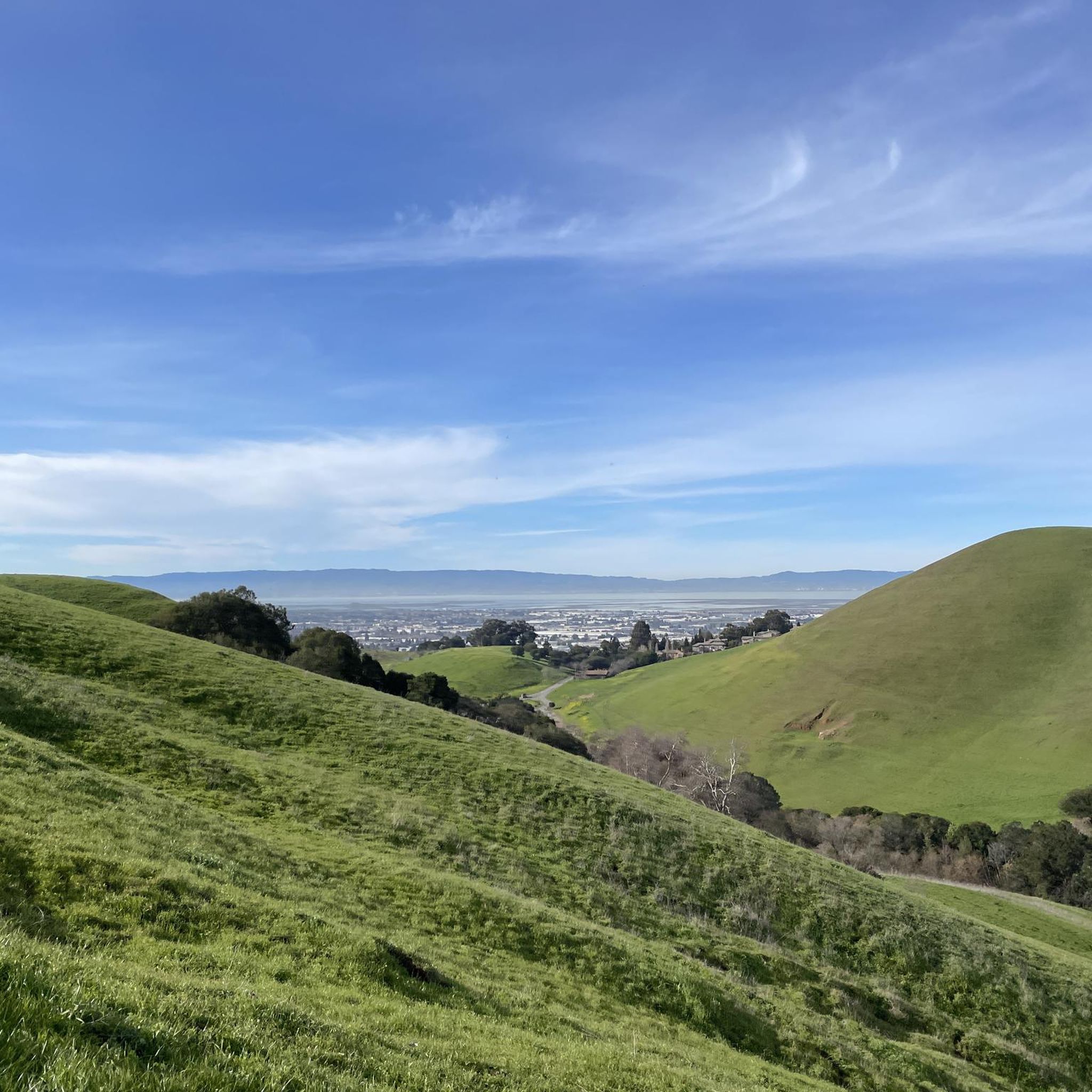
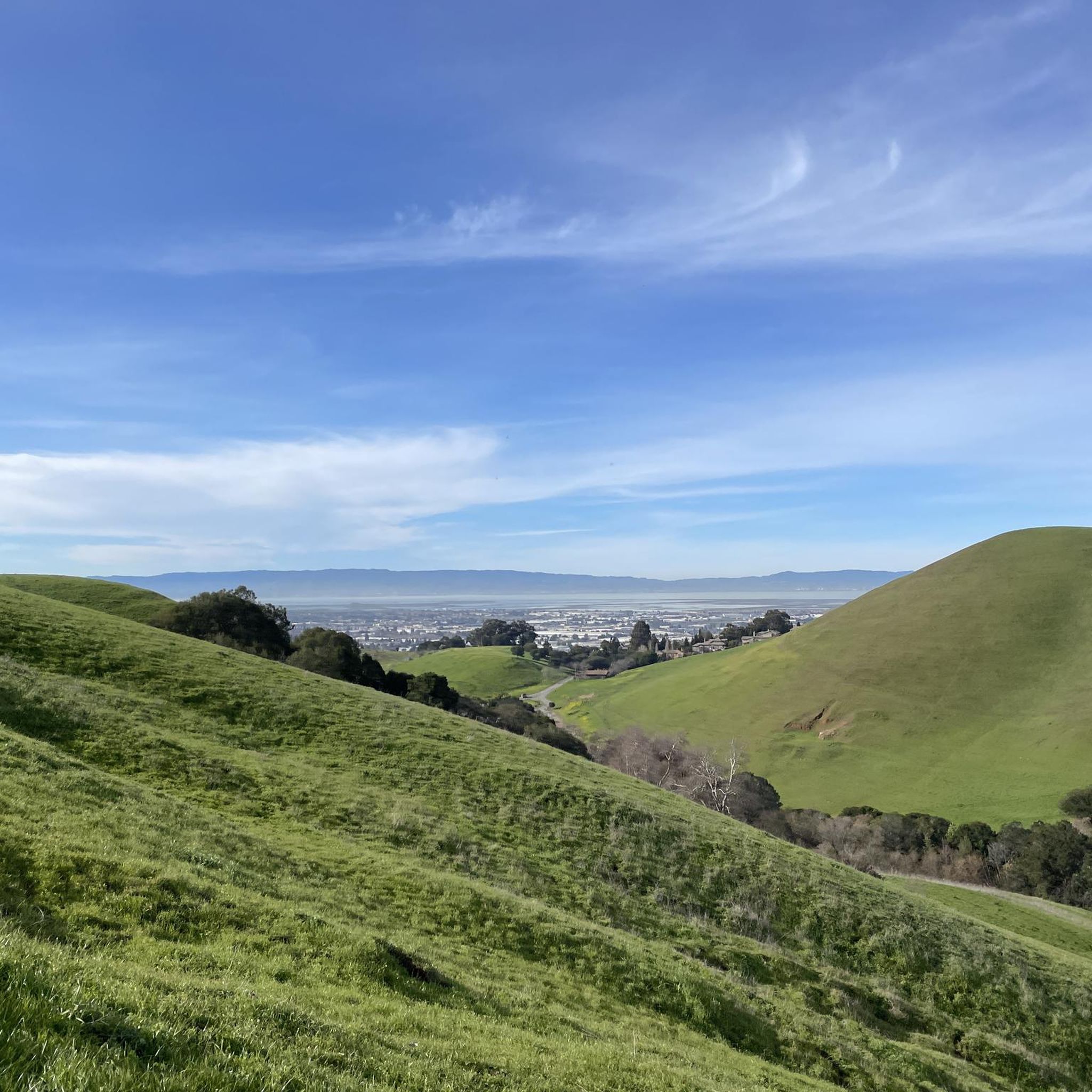
- Another top favourite among local hikers is High Ridge, Meyers Ranch and Dry Creek Trail, an easy 3.4 miles (5.5 km) path. This route offers views over Hayward and the San Francisco Bay.
- Local hikers also love the Tolman Peak Trail to High Ridge Loop Trail, a 10.6 miles (17.0 km) trail leading through varied terrain with significant elevation gain, often completed in about 5 hours 4 minutes.
- Hiking in Garin Regional Park is defined by rolling hills, open grasslands, and wooded canyons. The network offers options for easy strolls to more challenging treks.
- The routes in Garin Regional Park are highly rated by the komoot community with an average score of 4.7 stars from over 60 reviews. More than 900 hikers have used komoot to explore Garin Regional Park's varied terrain.
Last updated: August 30, 2026
6
hikers
5.48km
01:43
210m
210m
The High Ridge, Meyers Ranch and Dry Creek Trail offers a refreshing escape into nature, guiding you through a varied landscape that hints at open ridges, pastoral ranch lands, and the quiet beauty of dry creek beds. This easy 3.4-mile (5.5 km) loop provides a gentle yet engaging experience, perfect for stretching your legs and enjoying the outdoors. With 675 feet (206 metres) of elevation gain spread over its course, it's a comfortable hike that takes approximately 1 hour and 42 minutes.
Planning your visit to the High Ridge, Meyers Ranch and Dry Creek Trail is simple, as trailhead access is generally easy to find. Parking is typically available, making it convenient for a spontaneous outing. This trail is family friendly and dog friendly, making it a great choice for a relaxed day out with loved ones. Consider an early morning start to enjoy the tranquility and cooler temperatures.
This trail stands out in Alameda County for its accessibility and diverse scenery, offering a taste of the region's natural beauty without demanding a full day's commitment. It's an excellent option for beginner hiking or for those looking for a quick, rewarding loop. The combination of ridge views and creek-side paths provides a pleasant contrast, making it a local favorite.
4
hikers
17.0km
05:05
480m
550m
The Tolman Peak Trail to High Ridge Loop Trail offers a demanding yet rewarding hiking experience, taking you through varied terrain with significant elevation changes. You'll navigate towards Tolman Peak, where you can anticipate sweeping vistas, before continuing on to the serene Jordan Pond, a perfect spot for a brief respite. This difficult 10.6-mile (17.0 km) loop, with its 1584 feet (483 metres) of climbing, is designed for hikers seeking a substantial day out, typically requiring about 5 hours and 4 minutes to complete.
Planning your visit means preparing for a full day on the trail; an early start is always recommended to allow plenty of time and to find parking at the trailhead. Given the length and difficulty, ensure you carry sufficient water and snacks, and check the weather forecast to dress appropriately for conditions in Alameda County.
This loop stands out as a significant challenge within the region, connecting prominent natural features like Tolman Peak and Jordan Pond. It provides a robust workout and a chance to immerse yourself in the natural environment, making it a notable option for experienced hikers looking for a comprehensive outdoor adventure.

Sign up for free
5.0
(1)
2
hikers
15.9km
04:44
500m
420m
Embark on a moderate hike along the Independent School to Five Canyons and Newt Pond Trail, a route that offers a rewarding workout over 9.9 miles (15.9 km). You will experience a diverse landscape, moving from open fields into lush wooded canyons and across expansive grassy plateaus. As you climb, expect to gain 1626 feet (496 metres) in elevation, a journey that typically takes around 4 hours and 43 minutes to complete. Keep an eye out for panoramic ridge-top views of the Bay Area, stretching from Hayward to San Francisco, particularly from the Five Canyons viewpoint. The trail also leads you to the notable Newt Pond, an area known for its lushness.
Planning your visit is straightforward, with parking generally available near the trailhead for convenient access. The trail system features a mix of paved and unpaved surfaces, including some steep sections and gravel roads, so prepare for varied terrain. Be aware that some parts of the Newt Pond Trail can be unclear, and certain areas might be rough or overgrown, requiring careful footing. Always check local conditions before you head out.
This trail is located within the Don Castro Regional Recreation Area, offering a unique opportunity to explore a dynamic ecosystem. The Newt Pond is especially interesting after winter rains, when you might spot California newts in their natural habitat. The route provides a comprehensive tour of the area's natural beauty, making it a standout option for those seeking both exercise and scenic exploration in the Bay Area.
1.32km
00:21
0m
30m
The Dry Creek Trail offers a wonderfully accessible escape into nature, perfect for when you need a quick dose of fresh air without committing to a long trek. This easy 0.8-mile (1.3 km) hiking route is remarkably flat, with 0 feet (0 metres) of elevation gain, making it suitable for nearly everyone. You can comfortably complete the entire journey in about 20 minutes, enjoying a peaceful environment.
Planning your trip to the Dry Creek Trail is straightforward. Given its short length and easy difficulty, it's a great option for an impromptu outing. While specific parking details aren't provided, arriving earlier in the day is always a good strategy to secure a spot, especially if you're visiting on a popular weekend. No special permits or fees are mentioned, simplifying your visit.
This trail stands out as a family-friendly and beginner-friendly option in the Alameda County area, providing a gentle introduction to hiking. Its flat terrain and short duration make it ideal for those with young children or anyone looking for a relaxed walk. The presence of Jordan Pond nearby suggests a tranquil setting, offering a serene backdrop for your brief outdoor adventure.
10
hikers
7.54km
02:11
190m
190m
Hike the moderate 4.7-mile Vista Peak and Garin Woods Loop in Garin Regional Park, offering Bay Area views and a mix of open hills and woode
Get access to more routes and recommendations from other explorers.
Sign up for free
Already have an account?
Our route recommendations are based on thousands of hikes, rides, and runs completed by other people on komoot.
Start today with a free account
Your next adventure awaits.
Login or Signup

Other adventures in Garin Regional Park

Tips from the Community

The Vista Peak Loop Trails goes up the hillside without any trees blocking your line of sight, so once you climb enough, there are great views onto the Bay Area.
0
0

Don Castro Regional Park is a 101-acre park between Hayward and Castro Valley. It offers swimming in the lagoon, fishing, picnicking, as well as five miles of trails.
0
0
Don Castro Regional Park is a 101-acre park between Hayward and Castro Valley. It offers swimming in the lagoon, fishing, picnicking, as well as five miles of trails.
0
0
Don Castro Regional Park is a 101-acre park between Hayward and Castro Valley. It offers swimming in the lagoon, fishing, picnicking, as well as five miles of trails.
0
1

At 997 feet, Tolman Peak offers incredible views of the surrounding area looking over Union City with views of the park's woodland, and dreamy rolling hills. Benches are also here if you're keen to take a break and take in the scenery!
1
0
Jordan Pond is a small, picturesque lake in the Dry Creek Pioneer Regional Park, surrounded by lush greenery and wildlife.
0
0
Beautiful views of rolling green hills and the Bay Area. If you're planning on attempting this hike after rain, make sure you're wearing waterproof hiking boots, as the terrain can get quite muddy.
1
0
Frequently Asked Questions
How many hiking trails are available in Garin Regional Park?
Garin Regional Park offers a wide selection of routes, with over 50 hiking trails to explore. These range from easy strolls to more challenging treks, catering to various fitness levels.
What are the different difficulty levels for hiking trails in Garin Regional Park?
The park features trails across all difficulty levels. You'll find approximately 34 easy routes, 22 moderate paths, and 3 more difficult trails, ensuring options for every hiker.
Are there family-friendly hiking options in Garin Regional Park?
Yes, Garin Regional Park is very family-friendly, with many easy trails suitable for casual strollers and families. An excellent option is the High Ridge Loop Trail – Jordan Pond loop from Russell City, which is an easy 2.3-mile path offering scenic views.
Can I bring my dog on the trails in Garin Regional Park?
While the provided information does not explicitly state the dog policy, many regional parks in California allow dogs on leash. It's always best to check the official East Bay Regional Park District website for the most current regulations regarding pets in Garin Regional Park before your visit.
What kind of terrain and natural features can I expect to see while hiking?
Garin Regional Park is characterized by picturesque rolling hills, open grasslands, and attractive wooded canyons. You'll encounter ancient oak trees and varied terrain, with summits reaching up to 1,500 feet that provide expansive views of the San Francisco Bay and Hayward. In springtime, the hills are vibrant with wildflowers.
Are there any notable landmarks or attractions within Garin Regional Park?
Beyond the trails, the park features several attractions. You can visit the serene Dry Creek Garden, fish at Jordan Pond, or explore the historic Apple Orchard, which hosts an annual festival. The Garin Barn Visitor Center and the 'Ukraina Honcharenko' historical landmark also add to the park's charm.
What do other hikers enjoy most about Garin Regional Park?
The area is highly rated by the komoot community, with an average score of 4.7 stars from over 50 reviews. Hikers often praise the diverse landscapes, the rewarding views from the hilltops, and the variety of trails that cater to different skill levels.
Are there any challenging hikes for experienced trekkers?
Yes, for those seeking a more strenuous workout, Garin Regional Park offers challenging routes. The Jordan Pond – Tolman Peak loop from Garin Regional Park is a difficult 12.5-mile trail with significant elevation gain, typically taking over 6 hours to complete.
Are there good options for circular walks in the park?
Many trails in Garin Regional Park are designed as loops, offering excellent circular walking opportunities. The Vista Peak Loop Trail— Garin Regional Park is a popular moderate 4.7-mile loop that winds through rolling hills and a wooded canyon.
Is there parking available at Garin Regional Park?
Yes, Garin Regional Park provides parking facilities. The park is known for its accessibility, and there are designated parking areas and trailheads to accommodate visitors.
What is the best time of year to visit Garin Regional Park for hiking?
Garin Regional Park is enjoyable year-round, but spring is particularly beautiful when the hills are vibrant green and adorned with wildflowers. The varied terrain also makes it a great destination for cooler weather hikes, offering a peaceful escape.
Can I reach Garin Regional Park using public transport?
While the park feels secluded, it is generally accessible. For specific public transport routes and schedules to Garin Regional Park, it is recommended to check local transit authority websites, as direct routes can vary.
Are there picnic areas or facilities for gatherings in the park?
Yes, Garin Regional Park is well-equipped for gatherings. It offers numerous shaded picnic tables and built-in barbecue pits, making it an ideal spot for a post-hike meal or a family outing.
Most popular routes in Garin Regional Park

Get inspired with the komoot mobile app


Explore more
Browse the best Hikes in other regions.
