The best running trails in Handies Peak Wilderness Study Area
24
runners
8
runs
Jogging in Handies Peak Wilderness Study Area offers routes through diverse alpine landscapes, characterized by towering peaks, vast tundra, and deep river canyons. The region features Handies Peak, one of Colorado's most accessible 14,000-foot mountains, alongside numerous other high-elevation summits. Runners can explore steep forested hillsides, rugged rock formations, and glacial cirques, with several alpine lakes and creeks adding to the scenic variety. This area provides a challenging and rewarding environment for trail running amidst significant natural features.
Best jogging…
Last updated: May 27, 2026
8
runners
19.5km
03:16
1,330m
1,330m
Hard run. Very good fitness required. Mostly paved surfaces. Suitable for all skill levels.
5
runners
12.7km
02:24
1,080m
1,080m
Hard run. Very good fitness required. Mostly paved surfaces. Suitable for all skill levels.

Sign up for free
3
runners
8.73km
01:33
670m
670m
Hard run. Very good fitness required. Mostly paved surfaces. Suitable for all skill levels.
5.77km
00:57
370m
370m
Hard run. Very good fitness required. Mostly paved surfaces. Suitable for all skill levels.
8
runners
17.3km
03:02
1,310m
1,310m
Hard run. Very good fitness required. Mostly paved surfaces. Suitable for all skill levels.
Get access to more routes and recommendations from other explorers.
Sign up for free
Already have an account?
Our route recommendations are based on thousands of hikes, rides, and runs completed by other people on komoot.
Start today with a free account
Your next adventure awaits.
Login or Signup
Popular around Handies Peak Wilderness Study Area
Tips from the Community


Two information boards and a medium sized parking lot are located at the American Basin Trailhead. This is a great starting point to summit Handies Peak since you are already pretty high up in elevation. To get here though, you should have a car with high-clearance and 4x4.
3
0
The American Basin is a popular spot along the Alpine Loop. There are some dispersed campsites, a reliable stream and the trailhead to summit Handies Peak that towers over the basin.
3
0
With an elevation of 14,058 feet, Handies Peak is one of the Colorado 14,000ers. You can access the summit either from the American Basin, passing beautiful Sloan Lake or via Grizzly Gulch from Cinnamon Pass Road on the other side of the mountain. The view from the top is spectacular! Keep in mind, that the weather can change quickly and expect thunderstorms especially during the summer months. So start your hike early and descent in the early afternoon at the latest.
3
0
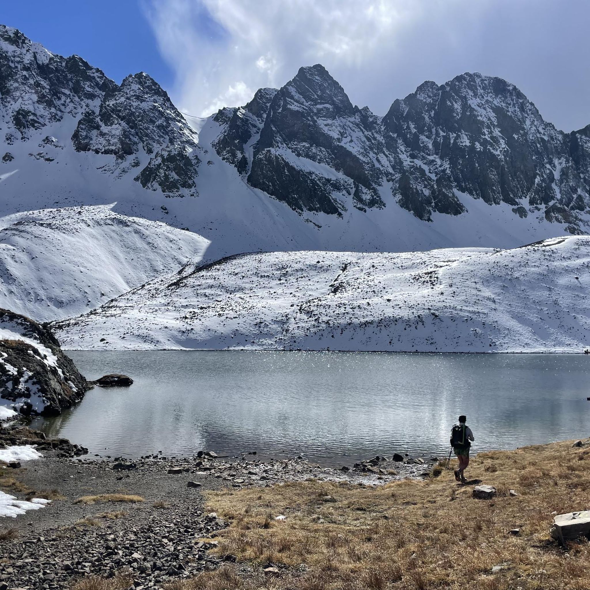
Sloan Lake is nestled into a small basin and accessible via a short side trail. There are some nice flat spots if you want to spend the night in this alpine paradise. The lake with its crystal-clear water is home to cutthroat trouts.
3
0
The climb out of the American Basin up to American Pass is steep and strenuous. Your reward is a great view over Turkey Thief Lake and the surrounding San Juan Mountains including Handies Peak, one of the 14,000ers.
2
0
Turkey Thief Lake is a beautiful small alpine lake nestled at the foot of Handies Peak, Jones Mountain and American Peak. A great spot to take a break and enjoy the scenery.
2
0
This section between Grouse Gulch and Handies Peak is part of the Hardrock 100 Route, a challenging mountain race that leads into some of the most stunning mountain areas in the world. The climb is steep, but gets even more scenic the more elevation you gain. Along this narrow path, you can see relics of the area’s mining past and keep your eyes peeled for interesting rocks.
3
0
Frequently Asked Questions
What kind of terrain can I expect on running routes in Handies Peak Wilderness Study Area?
The Handies Peak Wilderness Study Area offers diverse terrain for runners. You'll encounter steep forested hillsides, river canyons, and as you gain elevation, vast alpine tundra with rugged rock formations and glacial cirques. The routes often feature significant elevation gain, providing a challenging and rewarding experience amidst majestic peaks and sweeping vistas.
Are there any easy or beginner-friendly running trails in the Handies Peak Wilderness Study Area?
While many routes in the Handies Peak Wilderness Study Area are rated as difficult due to significant elevation gain and alpine terrain, the area does offer options that can be more approachable for experienced trail runners. For instance, the initial portion of the Handies Peak Trail, which is part of the Handies Peak via American Basin Trail, passes through wildflower-filled meadows and by Sloan Lake, offering a visually rewarding run that is less technically demanding than summiting the peak itself.
What are some notable natural features or landmarks I might see while jogging here?
The Handies Peak Wilderness Study Area is rich in natural beauty. You can expect to see majestic peaks, including Handies Peak itself, which is the tallest peak managed by the BLM in the continental U.S. There are also several alpine lakes like Sloan Lake and American Lake, and various creeks such as Lake Fork Creek and Cinnamon Creek. During late July and early August, the American Basin Trail is particularly known for its spectacular displays of wildflowers. You might also encounter the American Pass or Turkey Thief Lake.
Are there any circular running routes available?
Yes, for those looking for a loop experience, the Turkey Thief Lake – Sloan Lake loop from Cinnamon Creek offers a challenging circular route. This 17.3 km (10.7 miles) trail includes significant elevation gain and takes you through varied alpine landscapes, passing by two beautiful alpine lakes.
What is the best time of year for trail running in the Handies Peak Wilderness Study Area?
The best time for trail running in the Handies Peak Wilderness Study Area is generally from late spring to early autumn, typically late June through September. During this period, trails are usually free of snow, and the weather is more favorable. Late July and early August are particularly stunning due to the vibrant wildflower displays, especially along the American Basin Trail. Always check current weather and trail conditions before heading out, as alpine weather can change rapidly.
Are dogs allowed on the running trails in Handies Peak Wilderness Study Area?
The Handies Peak Wilderness Study Area is managed by the Bureau of Land Management (BLM). Generally, dogs are permitted on trails within BLM-managed wilderness study areas, but they must be kept under control, often on a leash, to protect wildlife and ensure a positive experience for all users. Always practice Leave No Trace principles, including packing out pet waste. It's advisable to check the latest regulations on the official BLM website for any specific rules or restrictions for this particular WSA: blm.gov.
What are the parking options for accessing running trails?
Access to trails in the Handies Peak Wilderness Study Area typically involves driving on unpaved roads, which may require high-clearance or 4x4 vehicles. Trailheads like the American Basin Trailhead, which is a starting point for the American Basin Trail, usually have designated parking areas. However, these can fill up quickly during peak season. Always plan to arrive early, especially on weekends, and be prepared for potentially rough road conditions.
Are there any permits required for running or accessing the Handies Peak Wilderness Study Area?
Currently, permits are generally not required for day-use activities like running or hiking in the Handies Peak Wilderness Study Area. However, it's always recommended to verify the most up-to-date regulations with the Bureau of Land Management (BLM) or the local ranger district, as rules can change. Backcountry camping might have different regulations. You can find more information on the official BLM website: blm.gov.
What do other runners enjoy most about the Handies Peak Wilderness Study Area?
Runners frequently praise the Handies Peak Wilderness Study Area for its stunning alpine scenery, challenging routes, and the sense of untouched wilderness. The opportunity to summit a 14,000-foot peak like Handies Peak, as offered by routes such as Handies Peak from Silver Creek/Grizzly Gulch, is a major draw. The panoramic views from higher elevations, with no man-made structures visible, are often highlighted as a unique and rewarding aspect of running here.
Are there any long-distance running options for experienced trail runners?
Yes, for experienced trail runners seeking a significant challenge, the Handies Peak Wilderness Study Area offers several long-distance routes. The Redcloud & Sunshine Peaks route is a demanding 19.5 km (12.1 miles) trail that traverses two prominent 14,000-foot peaks, providing extensive views and a substantial workout. These routes are ideal for those looking for significant elevation gain and extended time in high alpine terrain.
Can I find accommodation or amenities near the Handies Peak Wilderness Study Area?
The Handies Peak Wilderness Study Area is a remote alpine region. The nearest town with amenities and accommodation options is Lake City, Colorado. While there are no cafes or pubs directly within the WSA, Lake City offers various services for visitors, including lodging, dining, and supplies. It's advisable to plan your trip and book accommodation in advance, especially during peak season.
Most popular routes in Handies Peak Wilderness Study Area
Most popular attractions in Handies Peak Wilderness Study Area

Get inspired with the komoot mobile app


Explore more
Browse the best Running Trails & Routes in other regions.
