The best walks and hikes in Handies Peak Wilderness Study Area
85
hikers
15
hikes
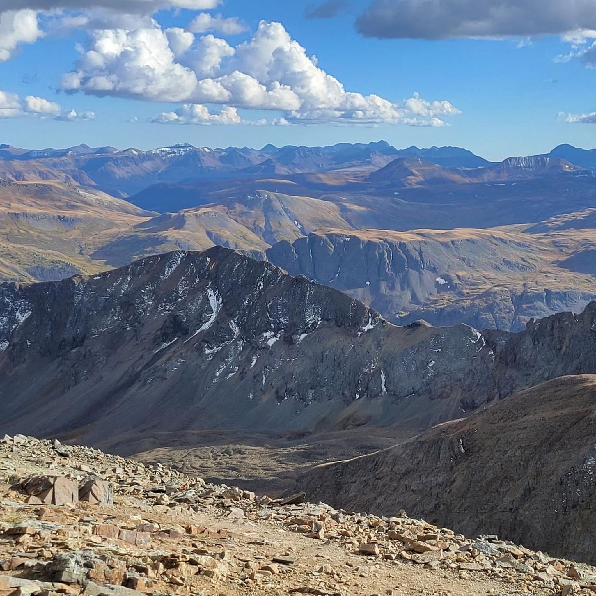
Hiking in Handies Peak Wilderness Study Area offers access to high-altitude trails in Colorado's San Juan Mountains. The region is characterized by its volcanic and glacial geology, which has formed a landscape of U-shaped canyons, alpine basins, and prominent peaks. The area includes Handies Peak, a 14,048-foot (4,282 m) summit, and several alpine lakes, such as Sloan Lake.
Best hiking trails in Handies Peak Wilderness Study Area
- The most popular hiking route is Handies Peak via American Basin Trail —…
Last updated: May 12, 2026
3
hikers
6.39km
03:01
1,080m
0m
Hike Handies Peak from Silver Creek/Grizzly Gulch Trailhead, a difficult 4.0-mile route with 3529 feet of gain and panoramic San Juan views.
1
hikers
7.52km
03:13
1,070m
0m
Hike Redcloud Peak, a challenging 4.7-mile (7.5 km) 14er in the San Juan Mountains, offering panoramic views and a distinct red-hued terrain

Sign up for free
1.70km
00:46
260m
0m
The American Basin Trail offers an easy high-alpine hike, covering 1.1 miles (1.7 km) with an elevation gain of 867 feet (264 metres). You can expect to complete this route…
2.73km
00:59
280m
0m
The Silver Creek Trail offers an easy hiking experience through the rugged Colorado mountains. You'll cover 1.7 miles (2.7 km) with a notable elevation gain of 909 feet (277 metres),…
3.87km
01:35
490m
10m
Hike the moderate 2.4-mile Cataract Gulch Trail near Lake City, Colorado, gaining 1617 feet to discover waterfalls and alpine scenery.
Get access to more routes and recommendations from other explorers.
Sign up for free
Already have an account?
Our route recommendations are based on thousands of hikes, rides, and runs completed by other people on komoot.
Start today with a free account
Your next adventure awaits.
Login or Signup
Popular around Handies Peak Wilderness Study Area
Tips from the Community


Two information boards and a medium sized parking lot are located at the American Basin Trailhead. This is a great starting point to summit Handies Peak since you are already pretty high up in elevation. To get here though, you should have a car with high-clearance and 4x4.
3
0
With an elevation of 14,058 feet, Handies Peak is one of the Colorado 14,000ers. You can access the summit either from the American Basin, passing beautiful Sloan Lake or via Grizzly Gulch from Cinnamon Pass Road on the other side of the mountain. The view from the top is spectacular! Keep in mind, that the weather can change quickly and expect thunderstorms especially during the summer months. So start your hike early and descent in the early afternoon at the latest.
3
0

There is parking on both sides of the road near the old mining ruins. Public restrooms are available and dispersed camping is allowed near the trailhead. From here you can run up Redcloud to the east, or Handies to the west; both are long nontechnical creek trails of comparable difficulty. It is best to get here super early in the summer or camp overnight to summit before afternoon storms.
0
0

Redcloud Peak is on the 14er list in the San Juan range, just barely making the rank at an elevation of 14,037 feet, or 356.5 meters. It is recommended that the peak only be reached in the summer months, like July or August, so you can avoid encountering snow. Even so, during the summer months, it is best to get an early start and plan to be off of Redcloud Peak by 1:00 PM to avoid afternoon storms and the dangers of lightning strikes.
0
0
The trail up to Handies is relatively easy, making this a popular 14'er for beginners. That said, running up is still quite the challenge! The weather can change quickly and you don't want to be caught in a thunderstorm above treeline, so it is best to run up early in the morning and keep an eye on the weather.
0
0
The upper trailhead requires a capable vehicle to access, usually a high clearance 4WD vehicle but you may make it in an SUV if the conditions are good. From here you can hike up stunning American Basin to Handies Peak and the Hardrock 100 route.
0
0
Redcloud Peak is on the 14er list in the San Juan range, just barley making the rank at an elevation of 14,037 feet, or 356.5 meters. It is recommended that the peak only be reached in the summer months, like July or August, so hikers can avoid encountering snow. Even so, during the summer months, it is best to get an early start and plan to be off of Redcloud Peak by 1:00 PM to avoid afternoon storms and the dangers of lightning strikes.
0
0
Frequently Asked Questions
Where are the main trailheads for hiking in the Handies Peak Wilderness?
There are two primary access points. The Silver Creek/Grizzly Gulch Trailhead is accessible by most passenger cars and serves as the starting point for trails to Redcloud and Sunshine Peaks. The other major trailhead is in American Basin, providing the most direct access to Handies Peak. Reaching the American Basin trailhead typically requires a high-clearance, 4-wheel-drive vehicle.
When is the best time to hike in the Handies Peak Wilderness?
The prime hiking season is in the summer, generally from July through early September, when the high-elevation trails are mostly free of snow. For the most spectacular wildflower displays, especially in American Basin, plan your visit from mid-July to early August.
Are dogs allowed on the trails?
Yes, dogs are generally permitted in the Handies Peak Wilderness Study Area, but they must be under your control at all times to protect wildlife and other hikers. Given the fragile alpine environment and presence of wildlife like marmots and pikas, it's best practice to keep them on a leash.
What are the camping regulations in the area?
Dispersed camping is allowed, but you must follow Leave No Trace principles. Campsites should be at least 200 feet away from lakes, streams, and trails. There are no designated campgrounds within the wilderness area itself, so you must be self-sufficient. Always check for current fire restrictions before your trip. For the most up-to-date rules, consult the official Bureau of Land Management (BLM) regulations.
Are there any easier or moderate hikes available?
Yes, while the area is known for its challenging 14ers, there are more moderate options. The American Basin – Sloan Lake loop from Ouray is a beautiful moderate hike that takes you to a stunning alpine lake without the extreme elevation gain of a summit climb. The American Basin itself also offers opportunities for shorter, less strenuous walks amidst incredible scenery.
What kind of wildlife might I see?
The Handies Peak Wilderness is rich with wildlife. In the rocky, high-alpine areas, you are very likely to see and hear pikas and marmots. The area also provides habitat for larger mammals, so keep an eye out for elk, mule deer, and bighorn sheep, especially in the basins and on the surrounding slopes.
Are there any long-distance or backpacking loop options?
The terrain is well-suited for backpacking. A challenging and rewarding option is the Sloan Lake – American Basin loop from Silver Creek Trailhead. This difficult, 11.2-mile (18 km) route connects several basins and passes, offering a fantastic multi-day adventure for experienced backpackers.
How difficult are the trails in this region?
Most trails in the Handies Peak Wilderness are rated as difficult due to the high altitude, significant elevation gain, and rugged terrain. Even trails that are not technically complex require a high level of fitness. There are a couple of moderate routes, but no officially designated easy trails. Always be prepared for sudden weather changes and the challenges of hiking above 10,000 feet (3,000 m).
Are there any trails that are not focused on summiting a 14er?
Absolutely. If you're looking for a long hike through varied terrain without a major peak ascent, the Maggie Gulch OHV Trail — Middleton offers a 10.2-mile (16.5 km) journey through one of the area's scenic gulches. It provides a different perspective on the region's landscape.
What makes the landscape of the Handies Peak Wilderness special?
The scenery is defined by its dramatic glacial and volcanic history. You'll hike through classic U-shaped canyons, scalloped glacial cirques, and high alpine basins. The mountains themselves feature multi-colored rock strata from the Lake City caldera, creating a uniquely beautiful and rugged environment.
Most popular routes in Handies Peak Wilderness Study Area
Most popular attractions in Handies Peak Wilderness Study Area

Get inspired with the komoot mobile app


Explore more
Browse the best Hikes in other regions.
