The best running trails in Underhill State Park
42
runners
13
runs
Jogging in Underhill State Park offers routes through varied terrain on the western slope of Mount Mansfield. The park features mixed hardwood and spruce-fir forests, exposed rock faces, and significant elevation gains leading to Vermont's highest peak. Near the summit, a rare alpine tundra ecosystem is present. The landscape provides challenging trail running experiences with panoramic views of the Champlain Valley.
Best jogging routes in Underhill State Park
- The most popular jogging route is Sunset Ridge Trail – Mount Mansfield…
Last updated: August 9, 2026
4
runners
6.58km
00:43
140m
140m
Moderate run. Good fitness required. Mostly paved surfaces. Suitable for all skill levels.
4
runners
6.01km
00:40
90m
90m
Moderate run. Good fitness required. Mostly paved surfaces. Suitable for all skill levels.

Sign up for free
6
runners
6.71km
00:48
200m
200m
Moderate run. Good fitness required. Mostly paved surfaces. Suitable for all skill levels.
7
runners
Hard run. Very good fitness required. Mostly paved surfaces. Suitable for all skill levels.
3
runners
5.35km
00:35
100m
100m
Moderate run. Good fitness required. Mostly paved surfaces. Suitable for all skill levels.
Get access to more routes and recommendations from other explorers.
Sign up for free
Already have an account?
Our route recommendations are based on thousands of hikes, rides, and runs completed by other people on komoot.
Start today with a free account
Your next adventure awaits.
Login or Signup



Tips from the Community

Great view from the road of the surrounding area. Smugglers' Notch is between Vermont's highest peak (Mount Mansfield), Spruce Peak and Sterling Ridge.
1
0

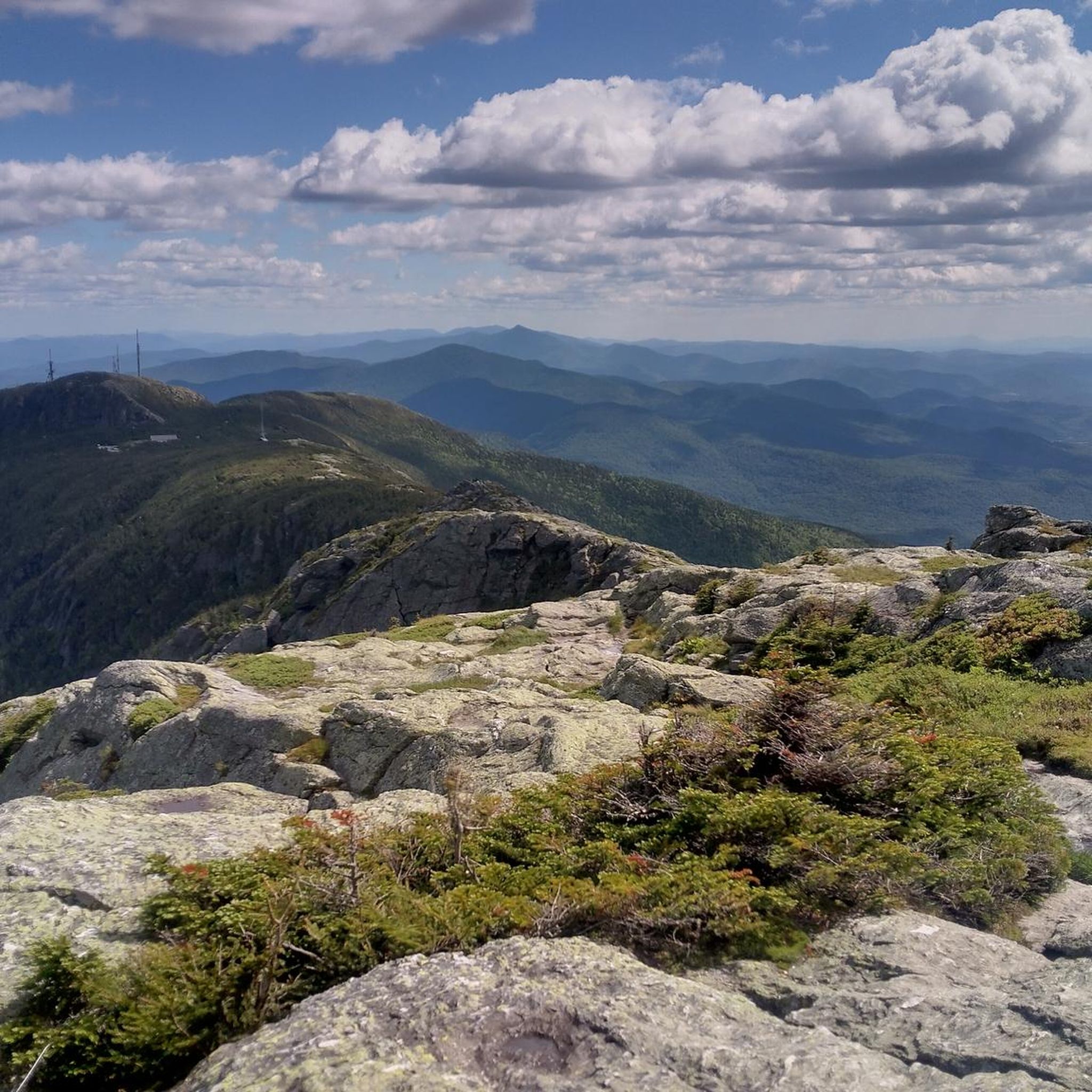
Supposedly, the long, exposed ridge line of Mt. Mansfield, the tallest mountain in Vermont, looks like the profile of a man's face. This particular feature is known as Mansfield's Lower Lip. From the Lower Lip you get great views down the long, exposed ridge line that comprises Mt. Mansfield.
0
0
The small sub peaks and bumps off of Mt. Mansfield are all named for different facial features; supposedly, the long ridge line of Mansfield looks like the profile of a man's face lying down. This particular feature is known as Mansfield's Upper Lip, or simply, the Upper Lip. This rocky band of cliffs is quite prominent on the exposed ridge line and is a great feature to snap some photos of as you continue your hike in the alpine tundra.
0
0
Mt. Mansfield looms over the small ski town of Stowe, Vermont, at 4,393 feet. As the tallest mountain in Vermont, Mansfield is a very popular and rewarding summit for any New Englander. Because of its popularity (there are almost 40,000 visitors every year), the delicate ecosystem has been severely affected. Mt. Mansfield is one of two places in Vermont where Arctic Tundra exists, so please try to stick on designated trails when visiting this summit. When relaxing on the summit, you get fantastic panoramic views across Vermont, and on clear days you can even see to the Presidentials in New Hampshire!
0
1

This is one of the finest views in Vermont, if not New England. Well worth a visit for any hiker with experience
0
0
Frequently Asked Questions
How many running routes are available in Underhill State Park?
Underhill State Park offers a total of 18 running routes. These include 8 moderate paths and 10 difficult trails, providing options for various skill levels, though many are geared towards challenging trail running.
Are there any easy jogging routes suitable for beginners in Underhill State Park?
While many routes in Underhill State Park are challenging, there are 8 moderate running paths. The CCC Road, for instance, provides a more moderate climb with even footing, which could be suitable for a less strenuous jogging experience. An example of a moderate route is the Running loop from Underhill.
What natural features and viewpoints can I expect to see while running in Underhill State Park?
Runners in Underhill State Park can experience stunning natural features and panoramic views. Ascending trails like the Sunset Ridge Trail reward you with phenomenal vistas of the Champlain Valley, the vast Mansfield ridgeline, and even Lake Champlain. Near the summit of Mount Mansfield, you'll find a rare alpine tundra ecosystem. A distinct geological formation, Cantilever Rock, is also accessible via a spur trail.
When is the best time of year to go running in Underhill State Park?
Underhill State Park is officially open from Memorial Day weekend through Columbus Day weekend, which is generally the best time for running. During this period, trails are clear of snow and ice, offering optimal conditions for exploring the diverse terrain.
Are dogs allowed on the running trails in Underhill State Park?
Yes, dogs are generally allowed on trails in Vermont State Parks, including Underhill State Park, but they must be kept on a leash at all times. Please ensure you clean up after your pet to help maintain the park's natural beauty.
Are there any circular running routes in Underhill State Park?
Yes, many of the running routes in Underhill State Park are circular, allowing you to start and end at the same point. Examples include the popular Sunset Ridge Trail – Mount Mansfield Summit loop and the Mount Mansfield – Underhill State Park loop.
What kind of terrain should I expect on the running trails?
The terrain in Underhill State Park is diverse and often challenging, leaning towards trail running. You'll encounter mixed hardwood and spruce-fir forests, exposed rock faces, and sections with significant elevation gain as you ascend towards Mount Mansfield. The CCC Road offers a more even, moderate surface.
Is there parking available for runners at Underhill State Park?
Yes, Underhill State Park provides parking facilities for visitors. During the official operating season (Memorial Day weekend through Columbus Day weekend), fees are charged for access to the park, which includes parking.
What do other runners enjoy most about the trails in Underhill State Park?
Runners frequently praise the challenging ascents to Mount Mansfield, the extensive panoramic views of the Champlain Valley, and the unique experience of running through sections of alpine tundra. The diverse forest environments and varied terrain also contribute to a highly rewarding trail running experience.
Are there any facilities or amenities available at Underhill State Park?
Underhill State Park offers facilities such as tent sites, lean-tos, restrooms, and a picnic pavilion, making it suitable for longer visits or post-run relaxation. For more details on camping and facilities, you can visit the Vermont State Parks website.
Can I reach Underhill State Park using public transport for running?
Public transport options directly to Underhill State Park are limited. It is generally recommended to access the park by car, especially given its location on the western slope of Mount Mansfield within a state forest.
Are there any routes that lead to the summit of Mount Mansfield?
Yes, several challenging routes from Underhill State Park lead directly to the summit ridge of Mount Mansfield, Vermont's highest peak. The Sunset Ridge Trail – Mount Mansfield Summit loop is a prime example, offering extensive panoramic views from the top.
Most popular routes in Underhill State Park

Get inspired with the komoot mobile app


Explore more
Browse the best Running Trails & Routes in other regions.
