The best cycling routes in Gunpowder Falls State Park Springdale Area
4.8
(38)
448
riders
19
rides
Gunpowder Falls State Park Springdale Area bike trails overview reveals a landscape characterized by diverse multi-use trails, river valleys, and wooded areas. The park features extensive rail-trails, including the Torrey C. Brown Rail Trail, which offers a paved surface for touring cyclists. Trails often follow the Big and Little Gunpowder Falls, providing scenic views and a tranquil environment. The varied topography includes dense forests, rolling hills, and historic sites, catering to a range of cycling preferences.
Best touring cycling routes…
Last updated: June 28, 2026
5.0
(13)
96
riders
41.9km
02:48
410m
410m
Moderate bike ride. Good fitness required. Mostly paved surfaces. Suitable for all skill levels.
4.7
(7)
97
riders
32.7km
02:07
200m
200m
Moderate bike ride. Good fitness required. Mostly paved surfaces. Suitable for all skill levels.

Sign up for free
5.0
(2)
29
riders
Easy bike ride. Great for any fitness level. Mostly paved surfaces. Suitable for all skill levels.
4.3
(3)
17
riders
41.1km
02:35
470m
470m
Hard bike ride. Very good fitness required. Mostly paved surfaces. Suitable for all skill levels.
4.3
(6)
82
riders
21.7km
01:25
140m
140m
Easy bike ride. Great for any fitness level. Mostly paved surfaces. Suitable for all skill levels.
Get access to more routes and recommendations from other explorers.
Sign up for free
Already have an account?
Our route recommendations are based on thousands of hikes, rides, and runs completed by other people on komoot.
Start today with a free account
Your next adventure awaits.
Login or Signup
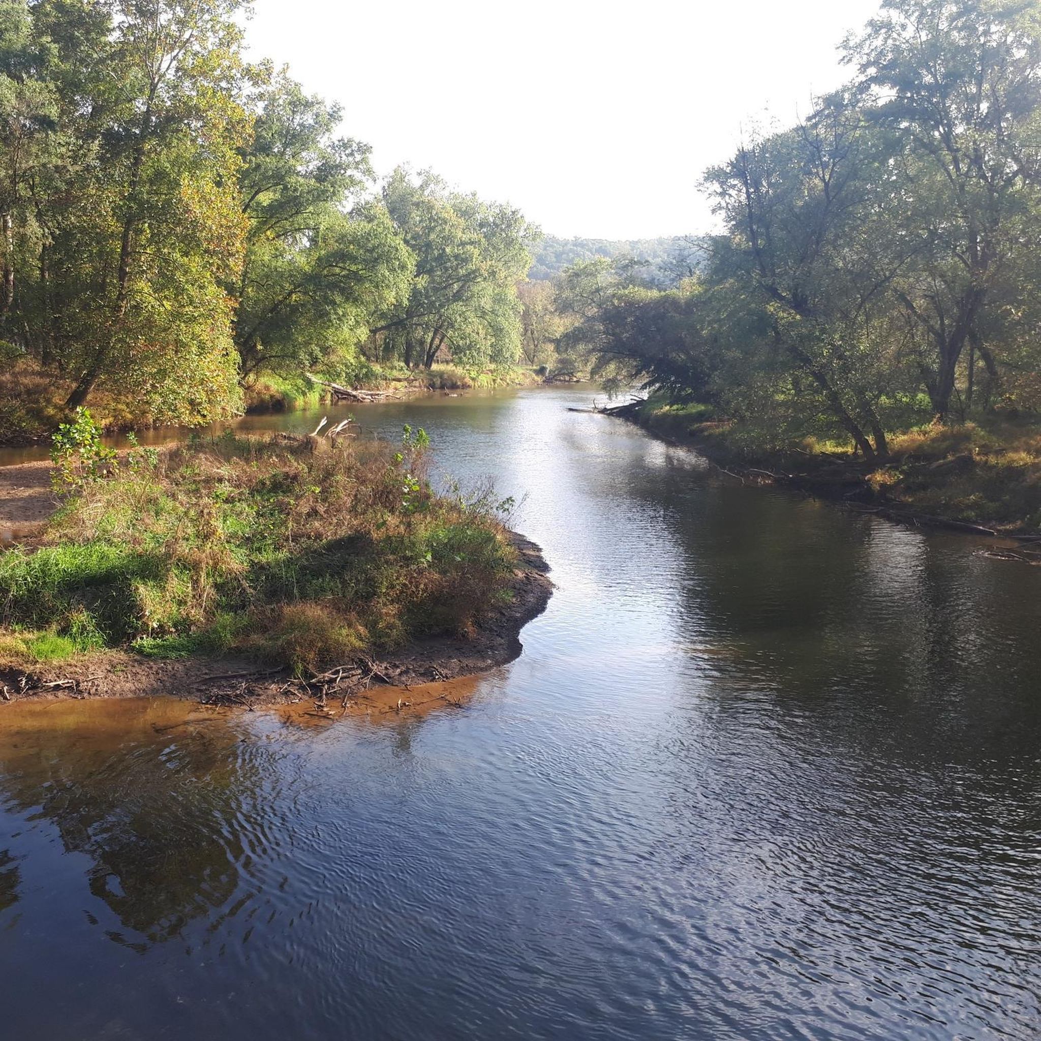


Tips from the Community

love this trail, one of my favorite trails to do a lo g ride.
0
0

Great park access to many trails along the rail trail. Beautiful views of the falls and more if you venture out. Road bikes will probably not be the best though if you want to venture into the park.
0
0
Mostly fine gravel trail with limited road crossings heading up to and beyond the PA state line. Very popular on the weekends and mostly shaded by overhead trees. Multiple places on the trail will provide access to water and bathrooms.
0
0
Convenient parking area with access to the rail trail. Water fountains, tube rentals and other river oriented recreation is available here.
0
0

Small bridge that helps you cross Gunpowder Falls. Even though this section of the East Coast Greenway (ECG) is not paved, it's still a pretty comfortable ride as the compacted dirt and crushed gravel keep the trail smooth.
0
0

The Torrey C. Brown Rail Trail is a 20-mile trail that follows the former Northern Central Railway and stretches from Northern Baltimore to the Pennsylvania state line. It's a great trail for runners, hikers, cyclists, and horseback riders.
0
0

As you cross over Jones Falls you get a great view of the Lake Roland Dam. The dam was completed in 1861 to meet the needs of Baltimore's growing population and today stands as a historical landmark.
0
0

This section of the Torrey C. Brown Rail Trail passes the town of Phoenix. The multi-use gravel trail leads through green nature, woodlands, and offers great views of the nearby Gunpowder Falls River.
0
0
Frequently Asked Questions
How many touring cycling routes are available in Gunpowder Falls State Park Springdale Area?
There are over 20 touring cycling routes available in the Gunpowder Falls State Park Springdale Area. These routes cater to various skill levels, from easy, paved rail-trails to more challenging paths through diverse landscapes.
What kind of terrain can I expect on the touring cycling routes?
The terrain varies significantly. You'll find extensive multi-use trails, including the nearly 20-mile paved Torrey C. Brown Rail Trail, which is ideal for leisurely rides. Other routes traverse dense forests, rolling hills, and follow riverbanks, offering a mix of packed dirt and potentially more rugged sections, especially in the Central Area.
Are there any family-friendly touring cycling routes in the area?
Yes, the paved Torrey C. Brown Rail Trail is an excellent option for families due to its gentle grade and smooth surface. Many of the easy-rated routes, such as the Monkton Train Station – Gunpowder Falls Bridge loop from Phoenix, are also suitable for a family outing.
What are some notable landmarks or natural features to see while cycling?
Cyclists can enjoy picturesque views of the Big and Little Gunpowder Falls, which carve scenic valleys. Historic sites like Jerusalem Mill Village, an 18th and 19th-century Quaker settlement, and the iconic Jericho Covered Bridge (built in 1865) are charming stops. You might also encounter unique natural formations like the Pot Rocks along the Gunpowder River.
Are dogs allowed on the bike trails in Gunpowder Falls State Park Springdale Area?
Gunpowder Falls State Park is generally dog-friendly, but specific rules may apply to certain trails or areas. It's always best to keep dogs on a leash and ensure you clean up after them. For detailed regulations, it's advisable to check the official park website or signage upon arrival.
Where can I park my car when visiting for a bike ride?
Parking is available at various access points throughout the park. For routes like the Monkton Train Station – Gunpowder Falls Bridge loop from Phoenix, parking is often available near the Monkton Train Station. The Jerusalem Mill Village also serves as a visitor center and typically has parking facilities.
Is public transport an option to reach the cycling routes?
While direct public transport options specifically for accessing the bike trails within the Springdale Area of Gunpowder Falls State Park might be limited, some regional bus services may operate in nearby towns. However, for convenient access to trailheads, driving is generally recommended. Always check local transit authority websites for the most current information.
What is the best time of year to go touring cycling in this area?
The park offers enjoyable cycling experiences throughout much of the year. Spring and fall are particularly pleasant, with mild temperatures and beautiful foliage. Summer can be warm, but the shaded forest trails provide relief. Winter cycling is possible, but some trails may be affected by snow or ice, so checking current conditions is advised.
Are there any circular touring cycling routes?
Yes, several routes offer a circular experience, allowing you to start and end at the same point. Examples include the Monkton Train Station – Gunpowder Falls Bridge loop from Phoenix and the Monkton Train Station – Monkton Station loop from Hunt Valley, which are popular choices for touring cyclists.
What do other touring cyclists enjoy most about cycling in Gunpowder Falls State Park Springdale Area?
The area is highly rated by the komoot community, with an average score of 4.9 stars from over 60 reviews. Cyclists frequently praise the tranquil environment, the scenic river views, and the variety of trails, especially the well-maintained Torrey C. Brown Rail Trail, which offers a smooth and enjoyable ride.
Are there any cafes or amenities near the bike trails?
While the park itself is primarily natural, the historic Jerusalem Mill Village within the Central Area serves as a visitor center and may offer some basic amenities. For more extensive options like cafes and restaurants, you would typically find them in the nearby towns and communities that border the state park.
Do I need a permit to cycle on the trails?
Generally, no special permit is required for recreational cycling on the multi-use trails within Gunpowder Falls State Park. However, it's always a good practice to check the official Maryland Department of Natural Resources website for any specific regulations or updates regarding park usage, especially for larger groups or organized events.
Most popular routes in Gunpowder Falls State Park Springdale Area

Get inspired with the komoot mobile app


Explore more
Browse the best Cycling routes in other regions.
