The best running trails in Sumas Mountain Regional Park
4.6
(13)
177
runners
17
runs
Jogging routes in Sumas Mountain Regional Park feature an extensive network of trails across 1,471 hectares. The region is characterized by diverse landscapes, including mature cedar and hemlock forests, which provide a shaded environment. Trails often present challenging elevation changes, leading to panoramic viewpoints overlooking the Fraser Valley, Sumas Prairie, and the Fraser River. The varied terrain accommodates different fitness levels, from accessible paths to rugged routes.
Best jogging routes in Sumas Mountain Regional Park
- The most popular jogging route…
Last updated: July 2, 2026
25
runners
30.5km
04:16
1,160m
1,160m
Hard run. Very good fitness required. Sure-footedness, sturdy shoes and alpine experience required.
8
runners
10.2km
01:30
440m
440m
Hard run. Very good fitness required. Mostly accessible paths. Some sure footedness required.

Sign up for free
7
runners
8.91km
01:14
410m
410m
Hard run. Very good fitness required. Mostly paved surfaces. Suitable for all skill levels.
5
runners
13.7km
01:59
560m
560m
Hard run. Very good fitness required. Sure-footedness, sturdy shoes and alpine experience required.
3
runners
10.2km
01:19
310m
310m
Hard run. Very good fitness required. Mostly paved surfaces. Suitable for all skill levels.
Get access to more routes and recommendations from other explorers.
Sign up for free
Already have an account?
Our route recommendations are based on thousands of hikes, rides, and runs completed by other people on komoot.
Start today with a free account
Your next adventure awaits.
Login or Signup


Tips from the Community

This trail is made from an old logging road and is one of the more straightforward routes to McKee Peak. There are dozens of trail in the area and it is quite easy to get turned around and end of on the wrong path, so be sure to download your maps and double check your routing any time you come to an intersection.
0
0
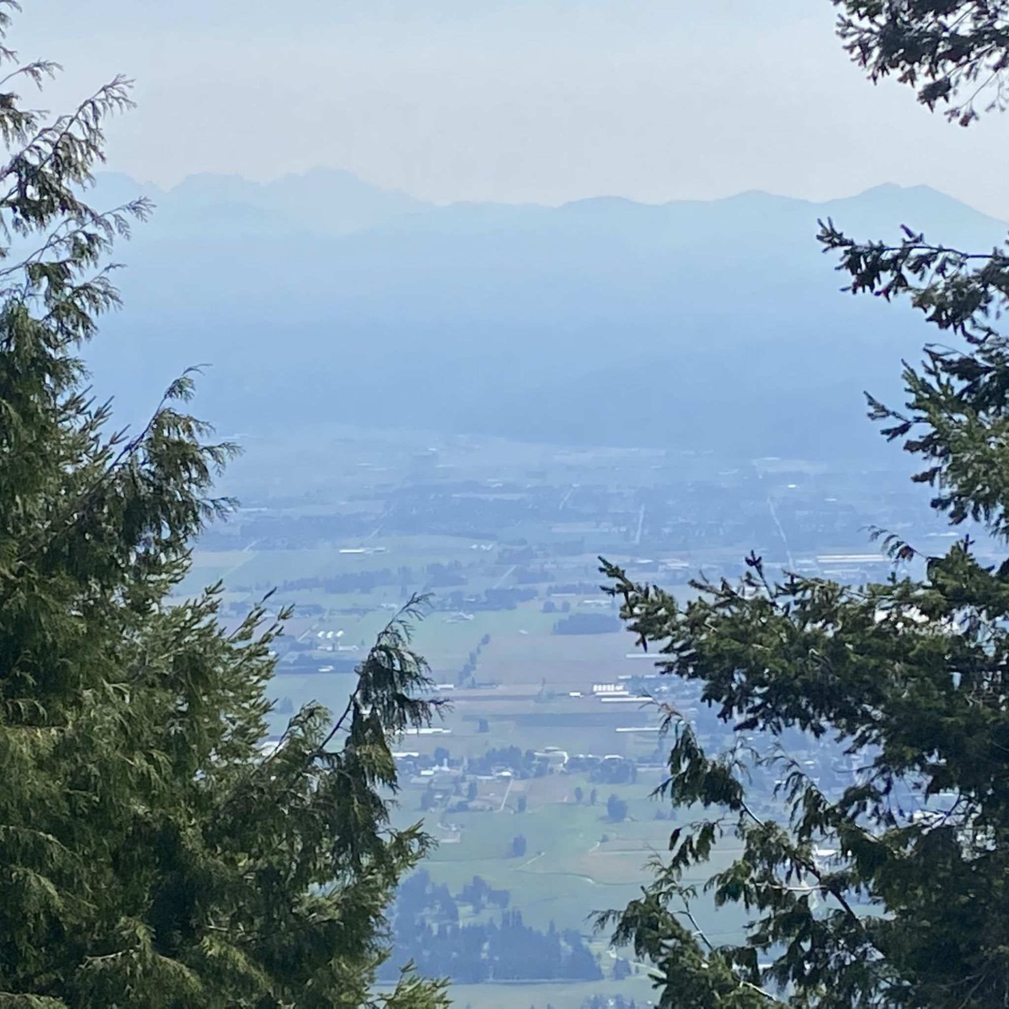
As the high point of McKee Park, McKee Peak offers great views over Abbotsford, the Fraser Valley, and surrounding mountains such as Mt. Robie & Mt. Judge Howay. There's a large communication tower to use as a landmark since the many trails around the summit can be confusing.
0
0
Frequently Asked Questions
What kind of terrain can I expect on the running routes in Sumas Mountain Regional Park?
Sumas Mountain Regional Park offers a diverse range of terrain for runners. You'll find extensive trail networks, including mature cedar and hemlock forests that provide a shaded and cool environment. Many routes feature challenging elevation changes, while others, like the Matsqui Trail Regional Park – Trail Bridge loop from Ridgedale, follow a river with minimal elevation changes, offering a different experience.
Are there any easy or moderate running trails for beginners in Sumas Mountain Regional Park?
While many of the routes in Sumas Mountain Regional Park are rated as difficult due to significant elevation gains, there are options for various fitness levels. The park's extensive network includes accessible paths, though specific 'easy' routes are less common. For a less strenuous experience, consider routes that follow riverbeds, which typically have flatter profiles.
What natural features or viewpoints can I see while jogging in Sumas Mountain Regional Park?
Sumas Mountain Regional Park is known for its spectacular lookout points and diverse natural beauty. You can enjoy panoramic views of the Fraser Valley, Sumas Prairie, Vedder Mountain, and the Fraser River from various spots. Notable features include Chadsey Lake, accessible via trails, and Baker Rock, which offers stunning vistas. Routes like the Sumas Mountain Viewpoint loop from Sumas Mountain Staging Area specifically lead to viewpoints.
Are there any circular running routes available in the park?
Yes, Sumas Mountain Regional Park features several excellent circular running routes. For instance, the Sumas Mountain Viewpoint – Sumas Mountain Regional Park loop from Camp Sumas is a challenging 19.8-mile loop. Another popular option is the Sumas Mountain Viewpoint loop from Sumas Mountain Staging Area, which is a 6.4-mile loop through dense forests.
Is Sumas Mountain Regional Park suitable for family jogging or running with children?
The park offers varied terrain, so suitability for families depends on the specific trail and the children's fitness levels. While some trails have challenging elevation changes, the extensive network includes more accessible paths. For a relaxed outing, the loop trail around Chadsey Lake is often a peaceful choice. Always check the route details for distance and elevation before heading out with family.
Can I bring my dog on the running trails in Sumas Mountain Regional Park?
Sumas Mountain Regional Park is generally dog-friendly, making it a great place to run with your canine companion. However, it's always recommended to keep dogs on a leash and to follow all park regulations regarding pets to ensure a pleasant experience for everyone and to protect the local wildlife.
What is the best time of year to go running in Sumas Mountain Regional Park?
The park's mature cedar and hemlock forests provide a shaded, cool, and fresh atmosphere, making it enjoyable for running during warmer months. However, the park is accessible year-round. During winter, be prepared for potentially rougher road conditions and check trail conditions for snow or ice, especially on higher elevations. Spring and fall offer pleasant temperatures and vibrant scenery.
Are there specific parking areas for accessing the running trails?
Yes, there are designated staging areas and parking lots to access the trails. For example, the Sumas Mountain Viewpoint loop from Sumas Mountain Staging Area indicates a common access point. While the road to the park can be rough in sections, parking is generally available at trailheads. It's advisable to check specific route details for the most convenient parking locations.
What do other runners enjoy most about the trails in Sumas Mountain Regional Park?
The running routes in Sumas Mountain Regional Park are highly rated by the komoot community, with an average score of 4.6 stars. Runners often praise the extensive trail networks, the beauty of the mature forests, and the rewarding panoramic views from various lookout points. The challenging elevation changes are also a draw for those seeking a more rigorous workout.
Are there any amenities like cafes or restrooms near the running routes?
Sumas Mountain Regional Park is primarily a natural area, so amenities like cafes are not typically found directly on the trails. It's recommended to bring your own water and snacks. For cafes or restrooms, you would generally need to visit nearby towns or communities before or after your run.
How long are the running trails in Sumas Mountain Regional Park?
The running trails in Sumas Mountain Regional Park vary significantly in length. You can find shorter loops, such as the Sumas Mountain Viewpoint loop from Sumas Mountain Staging Area at 6.4 miles (10.3 km), which takes about 1 hour 31 minutes. Longer and more challenging routes, like the Sumas Mountain Viewpoint – Sumas Mountain Regional Park loop from Camp Sumas, stretch to 19.8 miles (31.8 km) and can take over 4 hours to complete.
What kind of wildlife might I encounter while running in Sumas Mountain Regional Park?
Sumas Mountain Regional Park is home to diverse ecosystems, including mature forests. While specific sightings are never guaranteed, you might encounter various bird species, small mammals, and other forest wildlife. Always be aware of your surroundings and maintain a respectful distance from any animals you encounter.
Most popular routes in Sumas Mountain Regional Park

Get inspired with the komoot mobile app


Explore more
Browse the best Running Trails & Routes in other regions.
