The best walks and hikes in Sumas Mountain Regional Park
4.5
(20)
355
hikers
37
hikes
Hiking in Sumas Mountain Regional Park offers diverse landscapes and an extensive trail network across 1,471 hectares. The park features varied terrain, including mature cedar and hemlock forests, and significant elevation changes. Hikers can explore trails leading to scenic spots like Chadsey Lake and panoramic viewpoints such as Baker Rock, which provide expansive views of Sumas Prairie and the Fraser River. The park's mixed terrain includes steep sections and rugged paths, catering to different experience levels.
Best hiking trails in Sumas Mountain Regional Park
- The most popular hiking route is Abby Grind Trail — Sumas Mountain Regional Park, a 2.0 miles (3.2 km) trail that takes 2 hours 5 minutes to complete. This route features a significant elevation gain, offering a challenging uphill climb.
- Another top favourite among local hikers is Sumas Peak loop from Sumas Mountain Regional Park, a moderate 4.4 miles (7.1 km) path. This trail leads to Sumas Peak, providing expansive views of the surrounding valley and mountains.
- Local hikers also love the Chadsey Lake – Sumas Mountain loop from Poignant, an 8.6 miles (13.8 km) trail leading through diverse forest ecosystems and past Chadsey Lake, often completed in about 4 hours 59 minutes.
- Hiking in Sumas Mountain Regional Park is defined by diverse forest ecosystems, panoramic viewpoints, and varied terrain. The network offers options for easy, moderate, and difficult trails, accommodating different ability levels.
- The routes in Sumas Mountain Regional Park are highly rated by the komoot community with an average score of 4.6 stars from more than 10 reviews. More than 300 hikers have used komoot to explore Sumas Mountain Regional Park's varied terrain.
Last updated: October 5, 2026
4.7
(3)
20
hikers
3.19km
02:05
390m
390m
Moderate hike. Good fitness required. Mostly accessible paths. Sure-footedness required.
4
hikers
4.55km
04:12
860m
860m
Hard hike. Good fitness required. Sure-footedness, sturdy shoes and alpine experience required.

10.3km
04:42
770m
770m
Moderate hike. Good fitness required. Mostly accessible paths. Sure-footedness required.
5.0
(1)
18
hikers
7.93km
02:38
340m
340m
Hard hike. Good fitness required. Sure-footedness, sturdy shoes and alpine experience required.
5.0
(1)
15
hikers
13.8km
04:59
790m
790m
Hard hike. Good fitness required. Sure-footedness, sturdy shoes and alpine experience required.
Get access to more routes and recommendations from other explorers.
Already have an account?
Our route recommendations are based on thousands of hikes, rides, and runs completed by other people on komoot.
Start today with a free account
Your next adventure awaits.


Tips from the Community

At 796 metres, Taggart Peak is a peaceful, forested summit in Sumas Mountain Regional Park, with a pair of communication towers marking the top. The trees keep the views partial, but if you look through the gaps, you’ll catch Mount Robie Reid, Golden Ears Peak, Sumas Peak and the Fraser Valley spread out below. If you’re here on a clear day, be sure to wander around the tower for a look at Mount Baker, a nice reward after the climb.
0
0
Glenn Ryder Trail is a steep ascent through Sumas Mountain Regional Park, beginning with the Abby Grind before continuing along this narrower, less-travelled section toward Taggart Peak. Beyond the Abby Grind lookout, the trail winds through forest and over some flatter ridge sections before reaching an old logging road and the final climb to the summit. The flatter stretches are a great opportunity to give your legs a break before the steep final push to the top.
0
0

Just past the true summit of Sumas Mountain, this lookout gives you a view that is worth the climb. Here you can take in sprawling views of the Fraser Valley below along with farmlands and the Fraser River.
0
0
This is the true summit of Sumas Mountain. From here you stop climbing, but the view is a bit obstructed, so most like to continue along to Baker Rock for a clearer view.
0
0
The Baker's Grind trail is truly a grind in the purest sense of the word. This trail is a straight climb of over 800 metres until eventually reaching Sumas Mountain. There are several viewpoints along the climb worth stopping and admiring, so take it slow and rest as needed on your way up.
0
0
Sumas Mountain Regional Park encompasses over 1,470 hectares in the Fraser Valley, with a fantastic mix of forested trails, challenging climbs, and breathtaking views from the summit. The park is home to Chadsey Lake and connects to longer routes like the Centennial Trail, with access points on both the east and west sides of the mountain. It’s a beautiful location with diverse terrain, moderate elevation gains, and spectacular panoramic views of Sumas Prairie, Vedder Mountain, and the Fraser River.
0
0
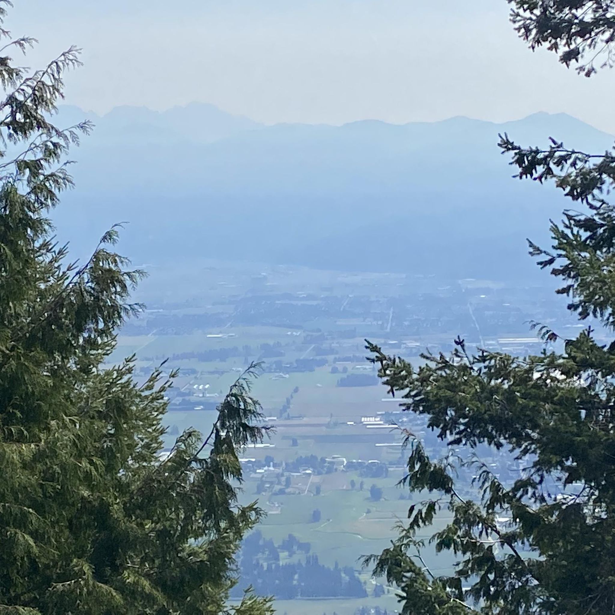
From this vantage point, you get an expansive view of the Fraser Valley surrounded by mountains in the distance. You can see the patchwork of farmlands, rivers, and small towns, with the Fraser River winding through it all like a silver thread. On a clear day, you can see all the way to Mount Baker.
0
0

Don't miss this. It is 5 minutes down from the top heading south.
1
0
Frequently Asked Questions
How many hiking trails are available in Sumas Mountain Regional Park?
Sumas Mountain Regional Park offers a network of around 25 hiking trails. These routes cater to various skill levels, with 15 easy, 8 moderate, and 2 difficult options available for exploration.
What are the best trails for beginners or those looking for an easy hike?
For an easier experience, consider the Hiking loop from McKee. This route is approximately 5.5 km long with a moderate elevation gain, making it suitable for those new to hiking or looking for a less strenuous walk.
Are there any trails with panoramic viewpoints in Sumas Mountain Regional Park?
Yes, Sumas Mountain Regional Park is known for its stunning viewpoints. The summit of Sumas Mountain itself offers expansive views of Sumas Prairie and the Fraser River. Another notable spot is Baker Rock (also known as Baker's Point), which provides spectacular panoramic vistas of the valley. The Eastern Valley Lookout Trail also grants views of Chilliwack and the eastern Fraser Valley.
Can I bring my dog on the trails in Sumas Mountain Regional Park?
Yes, Sumas Mountain Regional Park is generally dog-friendly. Most trails allow dogs, but it's always recommended to keep them on a leash and ensure you clean up after them to preserve the natural environment for all visitors.
Are there any family-friendly hiking options in the park?
Many of the park's easier trails are suitable for families. The peaceful loop trail around Chadsey Lake is a great option for families, offering a scenic walk and the chance to enjoy the lake. Always check the specific trail details for distance and elevation to ensure it matches your family's capabilities.
What kind of terrain can I expect on the trails?
The park features diverse and varied terrain. You'll encounter beautiful stretches of mature cedar and hemlock forests, dense sections rich with moss and ferns, and areas with forests in different stages of growth. Some trails, particularly between Chadsey Lake and Sumas Mountain, can be rugged, rocky, and rooty, adding to the wilderness experience.
What is the best time of year to hike in Sumas Mountain Regional Park?
Sumas Mountain Regional Park is accessible year-round, making it a reliable destination even when higher elevation trails might be snow-covered elsewhere. Spring and fall offer pleasant temperatures and vibrant scenery, while summer is ideal for enjoying Chadsey Lake. Winter hiking is possible, but be prepared for potentially muddy or rugged conditions.
Are there any circular routes available?
Yes, the park offers several circular routes. A popular option is the Chadsey Lake – Sumas Mountain loop from Poignant, which takes you through diverse forest ecosystems and past Chadsey Lake. Another is the Sumas Peak loop from Sumas Mountain Regional Park, offering expansive views.
What natural features can I explore in the park besides trails?
Beyond the trails, you can visit Chadsey Lake, a scenic spot perfect for a peaceful walk, swimming, or fishing. The park also boasts diverse forest ecosystems with mature cedar and hemlock trees, and various viewpoints like Baker Rock and the Eastern Valley Lookout Trail, offering expansive vistas.
What do other hikers enjoy most about Sumas Mountain Regional Park?
The area is highly rated by the komoot community, with an average score of 4.6 stars from over 10 reviews. Hikers often praise the park's diverse landscapes, the challenging yet rewarding climbs to viewpoints, and the peaceful atmosphere around Chadsey Lake.
Is there parking available at Sumas Mountain Regional Park?
Parking is typically available at the park's entrance. However, please note that as of January, the gate to the entrance of Sumas Mountain Regional Park is closed until further notice due to heavy rains causing damage and instability along steeper sections of the road. Repairs are ongoing, so it's advisable to check for current access information before planning your visit.
What kind of wildlife can I expect to see?
Sumas Mountain Regional Park is an excellent location for wildlife viewing, particularly for birding. A variety of warblers, flycatchers, vireos, and various hawk species have been observed within its boundaries. Keep an eye out for other forest creatures as you explore the trails.
Most popular routes in Sumas Mountain Regional Park

Get inspired with the komoot mobile app


Explore more
Browse the best Hikes in other regions.
