The best walks and hikes in Burnaby Lake Regional Park
4.6
(434)
5,055
hikers
127
hikes
Hiking in Burnaby Lake Regional Park offers a natural escape within Metro Vancouver, centered around the scenic Burnaby Lake, which was formed by a glacier. The region is characterized by diverse wetlands, lush forests, and unique peat bog ecosystems, particularly along the southern shore. Well-maintained trails, including boardwalks over wet areas, provide access to these varied landscapes.
Best hiking trails in Burnaby Lake Regional Park
- The most popular hiking route is Burnaby Lake Park Trail loop — Burnaby Lake Regional Park, a 6.8 miles (11.0 km) moderate trail that takes 2 hours 50 minutes to complete. This loop encircles the entire lake, featuring scenic boardwalks.
- Another top favourite among local hikers is Burnaby Lake via South Shore Trail, a moderate 4.8 miles (7.8 km) path. This route offers views of the lake and its diverse wetlands.
- Local hikers also love the Deer Lake Trail Loop, a 2.7 miles (4.4 km) trail leading through forested areas and around Deer Lake, often completed in about 1 hour 10 minutes.
- Hiking in Burnaby Lake Regional Park is defined by the glacial lake, diverse wetlands, and lush forests. The network offers options for easy, moderate, and difficult ability levels.
- The routes in Burnaby Lake Regional Park are highly rated by the komoot community with an average score of 4.6 stars from more than 350 reviews. More than 4000 hikers have used komoot to explore Burnaby Lake Regional Park's varied terrain.
Last updated: August 20, 2026
4.7
(19)
164
hikers
11.0km
02:50
50m
50m
Moderate hike. Good fitness required. Easily-accessible paths. Suitable for all skill levels.
5.0
(2)
64
hikers
4.41km
01:10
40m
40m
Hike the easy 2.7-mile Deer Lake Trail Loop in Burnaby, British Columbia, offering lake views and a family-friendly, flat path.

Sign up for free
34
hikers
6.22km
01:36
30m
30m
Easy hike. Great for any fitness level. Easily-accessible paths. Suitable for all skill levels.
12
hikers
7.75km
02:00
40m
40m
Hike the moderate 4.8-mile Burnaby Lake via South Shore Trail in Burnaby Lake Regional Park, offering lake views and wildlife.
5.0
(1)
10
hikers
3.12km
00:48
10m
10m
Easy hike. Great for any fitness level. Easily-accessible paths. Suitable for all skill levels.
Get access to more routes and recommendations from other explorers.
Sign up for free
Already have an account?
Our route recommendations are based on thousands of hikes, rides, and runs completed by other people on komoot.
Start today with a free account
Your next adventure awaits.
Login or Signup

Tips from the Community

This flat, gravel trail runs between railroad tracks and Burnaby Lake. It's perfect for a family outing with multiple viewpoints along the way. You can take it as an out and back or combine it with other trails for a loop around the lake.
0
0

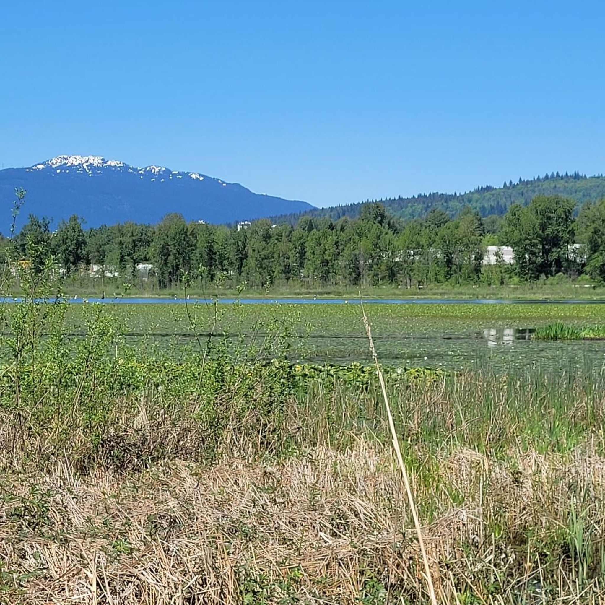
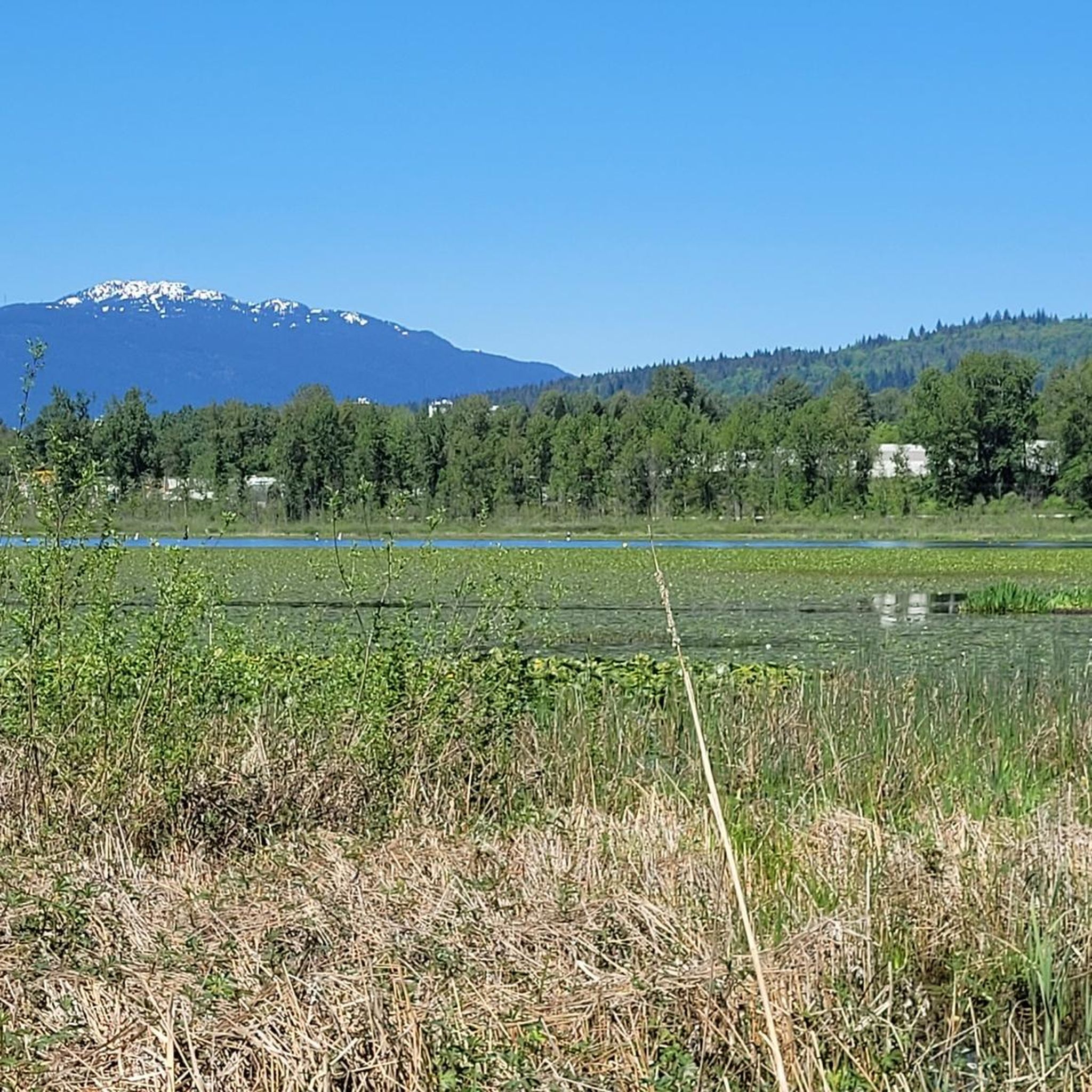
This viewpoint sits at the end of the Phillips Point trail and is marked with a singular bench and great views over Burnaby Lake, which spans about 770 acres and is encompassed by wetlands.
0
0
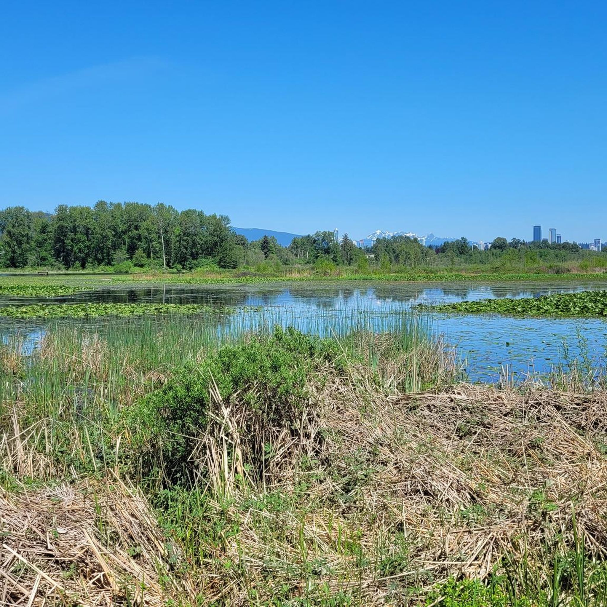
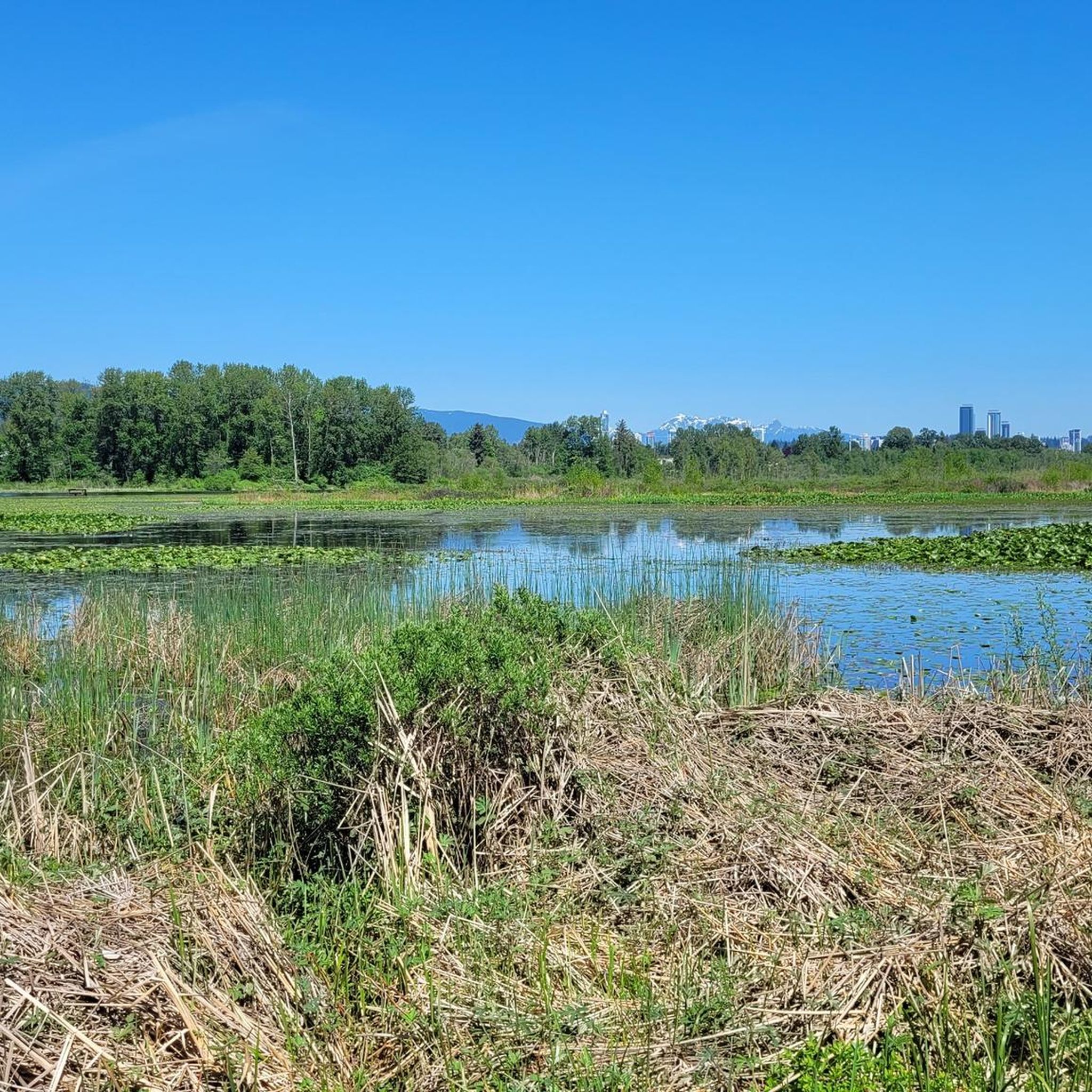
Climb this two-story observation tower for unique views over Burnaby Lake Regional Park. The views from the top of the tower, on a clear day, show off the the far-off Vancouver skyline, with skyscrapers poking out from the forest.
0
0

Burnaby Lake is a glacial lake formed around 12,000 years ago and is now the main feature of the Burnaby Lake Regional Park. It is also home to a variety of wildlife, including ducks, geese, beavers, turtles, and several bird species.
0
0

The Deer Lake Park Perimeter Trail circles the shoreline through a mix of forest, marsh, and open meadow. This easy loop offers close-up views of the lake, distant mountain vistas, and plenty of wildlife, from herons to turtles. The route is a combination of boardwalks and gravel paths dotted with benches along the way for a place to rest, making it ideal for walkers and joggers looking for a quiet escape in the heart of Burnaby.
0
0
Deer Lake is a quiet urban oasis surrounded by forest, wetlands, and cultural landmarks. There is a flat trail that loops around the lake, where you’ll see plenty of waterfowl, with beautiful backdrop views of the mountains. With picnic spots dotted around the lake, it’s the perfect place to take a leisurely walk or a enjoy relaxed afternoon in this peaceful setting.
0
0
Burnaby Lake Regional Park is a beautiful 770-acre wetland sanctuary situated in the heart of Burnaby. The 10-kilometer loop around the lake is perfect for walking, running, and wildlife watching year-round, with boardwalks and viewing platforms along the path. Once a gathering place for the Coast Salish people and later a hub for sawmills, this area now protects over 200 species of birds and is regarded as one of Metro Vancouver’s top spots to enjoy nature close to the city.
0
0

Here you can observe many birds.
2
0
Frequently Asked Questions
How many hiking trails are available in Burnaby Lake Regional Park?
Burnaby Lake Regional Park offers a wide variety of hiking options, with over 100 different routes to explore. These range from easy strolls to more moderate hikes, catering to various fitness levels.
What do other hikers enjoy most about the trails in Burnaby Lake Regional Park?
The trails in Burnaby Lake Regional Park are highly regarded by the komoot community, boasting an average rating of 4.6 stars from over 350 reviews. Hikers frequently praise the park's serene natural escape, diverse landscapes, and the abundance of wildlife, particularly the birdwatching opportunities.
When is the best time of year to hike in Burnaby Lake Regional Park?
Burnaby Lake Regional Park is enjoyable year-round, but spring and fall offer pleasant temperatures and vibrant scenery. Spring brings migratory birds and blooming flora, while fall showcases beautiful autumn colors. Summer is also popular, though trails can be busier. Winter hiking is possible, but some sections might be wet.
Are there family-friendly or easy trails in Burnaby Lake Regional Park?
Yes, the park features numerous easy trails suitable for families and those seeking a relaxed walk. For instance, the Deer Lake Trail Loop is an easy 4.4 km path through forested areas. Additionally, the park offers several accessible trails with minimal slopes, such as the Cottonwood Trail, which are suitable for strollers.
What kind of terrain can I expect on the trails in Burnaby Lake Regional Park?
You can expect diverse terrain, including well-maintained gravel paths, lush forest trails, and unique peat bog ecosystems, especially along the southern part of the lake. Boardwalks are common over wet areas, providing easy passage and unique perspectives. The main loop around the lake is relatively flat.
What natural features or wildlife can I expect to see while hiking?
Burnaby Lake Regional Park is a significant wildlife sanctuary. You can expect to see over 200 bird species, including great blue herons, bald eagles, and osprey. Beavers and turtles, such as the endangered western painted turtles, are also frequently spotted, particularly at dawn or dusk. The park's central feature is the scenic Burnaby Lake itself, surrounded by diverse wetlands and lush forests.
Are there any circular hiking routes in Burnaby Lake Regional Park?
Yes, circular routes are a highlight of the park. The most prominent is the 10 to 13-kilometer gravel trail that encircles the entire lake, which can take about two to three hours to complete. A popular option is the Burnaby Lake Park Trail loop, which is 11.0 km long and features scenic boardwalks.
Are dogs allowed on the hiking trails in Burnaby Lake Regional Park?
Generally, dogs are permitted on leash on most trails within Burnaby Lake Regional Park. It's always a good idea to check for specific signage or park regulations regarding pet access in certain sensitive wildlife areas to ensure compliance.
Where can I park when visiting Burnaby Lake Regional Park for hiking?
Burnaby Lake Regional Park offers several parking areas for trail access. Common parking spots are available at various entry points around the lake, including near the Nature House and Cariboo Dam on the north shore. These provide convenient access to the extensive trail network.
Can I reach Burnaby Lake Regional Park using public transport?
Yes, Burnaby Lake Regional Park is accessible by public transport. Several bus routes serve the perimeter of the park, with stops conveniently located near trailheads and park entrances. This makes it easy for visitors without a car to enjoy the hiking opportunities.
Are there any viewpoints or specific spots for wildlife observation?
Absolutely. A notable spot for wildlife observation is the viewing tower located near Piper Spit on the north shore, which provides excellent opportunities for spotting birds and other wildlife from a higher vantage point. Piper Spit itself is also a prime area for birdwatching. Additionally, the boardwalks along the south shore offer unique perspectives on the wetlands and their inhabitants.
What is the typical duration for a full loop around Burnaby Lake?
The full loop around Burnaby Lake, which is approximately 10 to 13 kilometers, typically takes about two to three hours to complete at a moderate hiking pace. This duration allows ample time to enjoy the scenery and observe wildlife.
Most popular routes in Burnaby Lake Regional Park
Most popular attractions in Burnaby Lake Regional Park

Get inspired with the komoot mobile app


Explore more
Browse the best Hikes in other regions.
