The best running trails in Refugio Nacional De Vida Silvestre De Cabo Rojo
5.0
(5)
22
runners
6
runs
Jogging in Refugio Nacional De Vida Silvestre De Cabo Rojo offers diverse landscapes, from the unique hypersaline lagoons of the Cabo Rojo Salt Flats to extensive mangrove forests and subtropical dry forests. The region features rolling hills and coastal areas, providing varied terrain for runners. The dramatic limestone coastline and the Puente Natural enhance its natural beauty. This natural refuge is also a critical habitat for numerous bird species, adding a wildlife observation element to running routes.
Best jogging routes…
Last updated: August 25, 2026
5.0
(1)
4
runners
14.2km
01:31
50m
50m
Moderate run. Good fitness required. Mostly paved surfaces. Suitable for all skill levels.
5.0
(2)
6
runners
5.55km
00:40
10m
10m
Moderate run. Good fitness required. Mostly paved surfaces. Suitable for all skill levels.

Sign up for free
4
runners
5.97km
00:47
150m
150m
Moderate run. Good fitness required. Mostly paved surfaces. Suitable for all skill levels.
5.0
(1)
4
runners
Moderate run. Good fitness required. Mostly paved surfaces. Suitable for all skill levels.
5.0
(1)
4
runners
11.1km
01:09
60m
60m
Moderate run. Good fitness required. Mostly paved surfaces. Suitable for all skill levels.
Our route recommendations are based on thousands of hikes, rides, and runs completed by other people on komoot.
Start today with a free account
Your next adventure awaits.
Login or Signup
Popular around Refugio Nacional De Vida Silvestre De Cabo Rojo
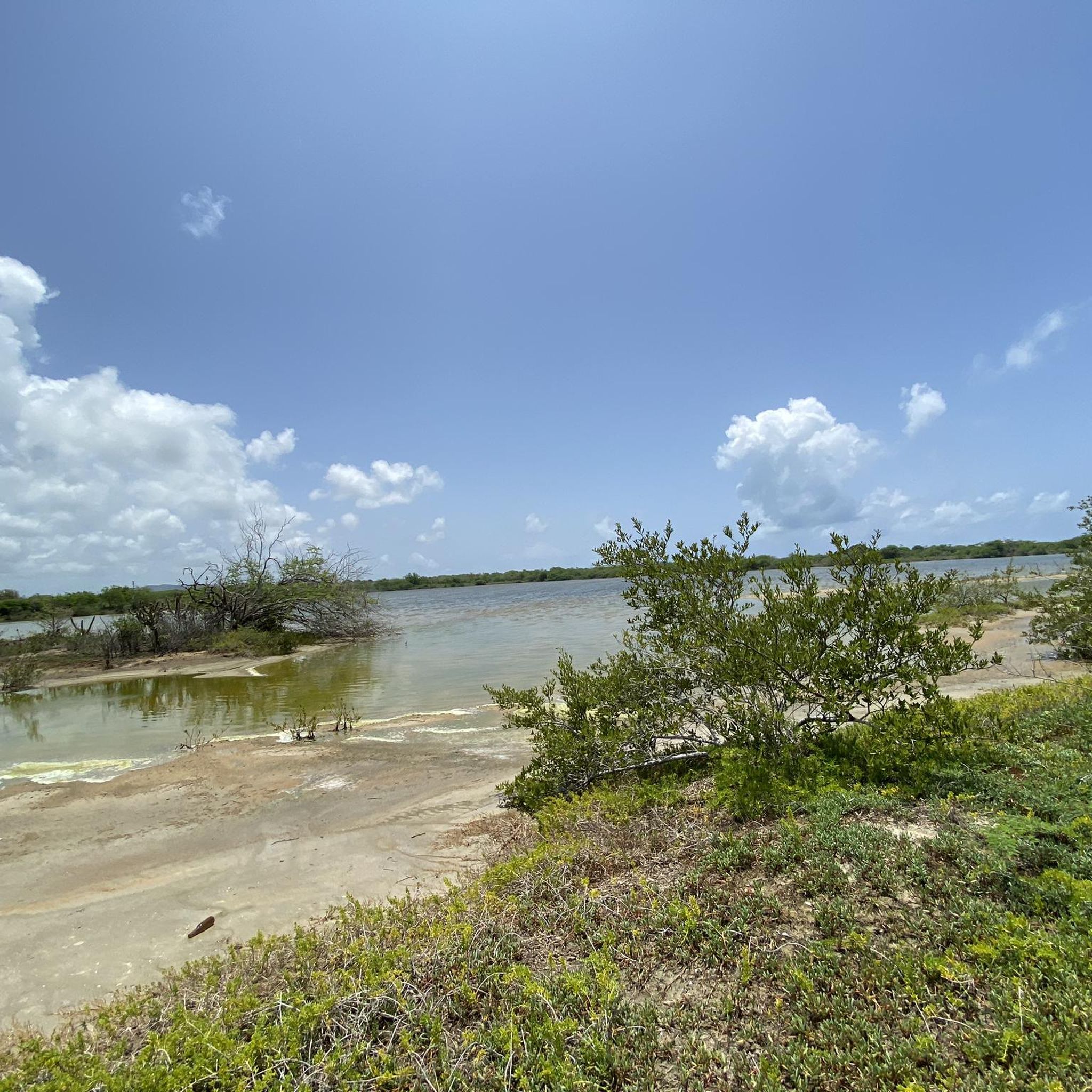
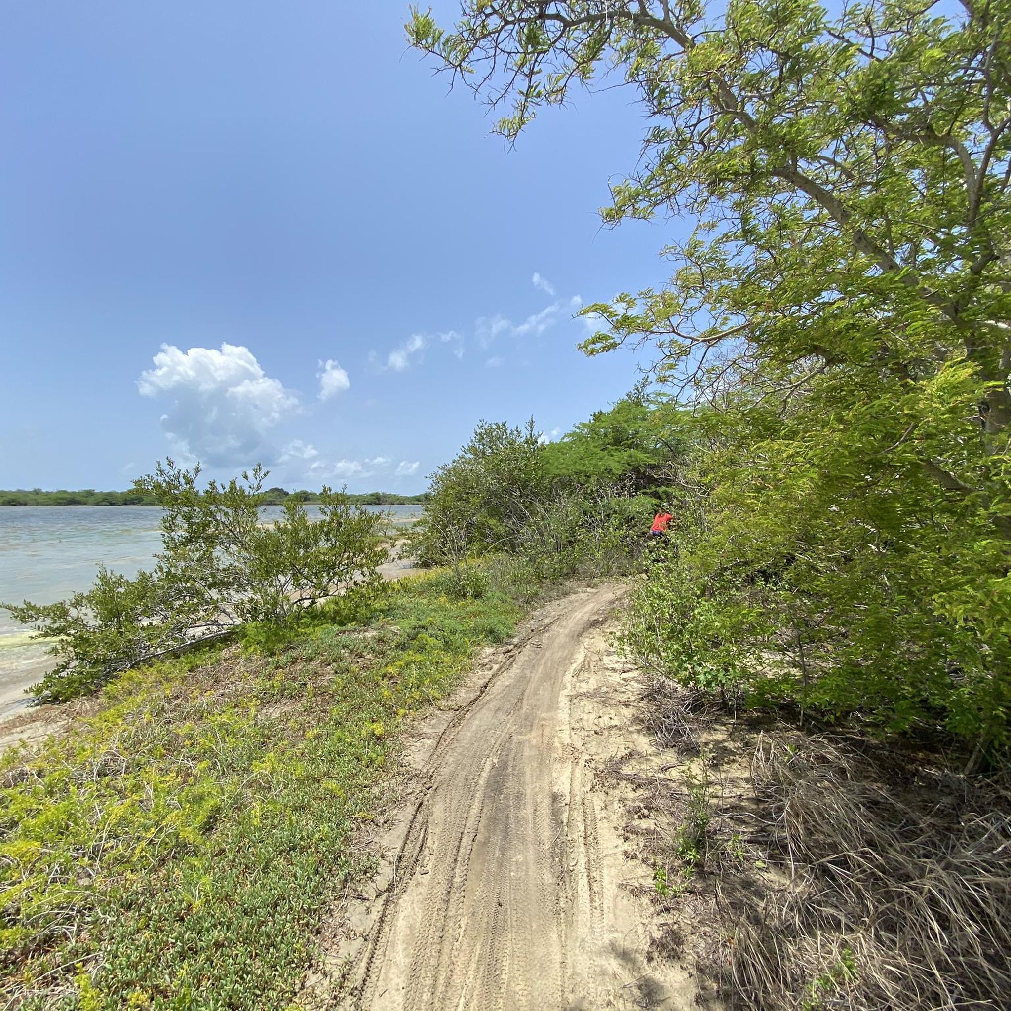

Tips from the Community

The Iris L. Alameda Martínez Wildlife Refuge (RVS Boquerón) is located about 96 km southwest of San Juan, approximately 8 km from the town of Cabo Rojo, between a mangrove forest and a salt meadow. In 1964, the Department of Agriculture of the United States together with that of Puerto Rico, designated 182 hectares as a protected area. Its purpose? The conservation of coastal and marine resources and a recreational space that includes hunting waterfowl, cycling, hiking, among other uses The Refuge has an impressive biodiversity; First, it was made up of a mangrove forest, with an extension of approximately 1.7 km. In it there are two types of wetlands mainly: The Estuary, affected by waves of low intensity and changes in the tides; and the Palustrino, which is mostly freshwater and depends on the ebb and flow of the tides. 50% of the Refuge is made up of three types of mangroves (red mangrove, white mangrove, and black mangrove) that grow within, between, and on the edge of three dikes (West Dike, North Dike, and East Dike) totaling 4km in length. . These support a reservoir that receives water from five sources: three main ones: Valle de Lajas, Laguna de Rincón and runoff from the southern section of the Refuge, and two secondary ones: runoff from the Valle de Lajas irrigation canals and the Boqueron creek.
0
0
Frequently Asked Questions
How many running routes are available in Refugio Nacional De Vida Silvestre De Cabo Rojo?
There are 8 dedicated running routes in Refugio Nacional De Vida Silvestre De Cabo Rojo, offering a variety of experiences for different skill levels.
What kind of terrain can I expect on the running trails?
The running trails in the refuge offer diverse terrain, from flat paths around the unique hypersaline lagoons of the Cabo Rojo Salt Flats to trails winding through subtropical dry forests and rolling hills. You'll find a mix of coastal paths and more inland routes.
Are there any family-friendly running paths in the refuge?
While specific 'family-friendly' routes aren't explicitly categorized, many of the trails are suitable for various activities. The Salt Flats Unit, for example, offers scenic walking and biking trails that could be enjoyed by families. Always check the route's distance and elevation to ensure it matches your family's ability.
Can I bring my dog on the jogging routes?
The Refugio Nacional De Vida Silvestre De Cabo Rojo is a wildlife refuge, and regulations regarding pets can vary. It's best to check the official U.S. Fish & Wildlife Service website for the most current rules on bringing pets to ensure a pleasant and compliant visit. You can find more information at fws.gov/refuge/cabo-rojo.
What are some notable natural features or landmarks I might see while running?
While running, you can experience the iconic Cabo Rojo Salt Flats with their vibrant pink lagoons and white salt mounds, and observe diverse ecosystems including mangrove and dry forests. The refuge is also a critical habitat for numerous bird species, offering excellent birdwatching opportunities. The nearby Faro Los Morrillos (Cabo Rojo Lighthouse) and stunning beaches are also easily accessible from the refuge.
Are there any loop trails for running in the area?
Yes, many of the running routes in Refugio Nacional De Vida Silvestre De Cabo Rojo are loops. For example, you can explore the Playa Moja Casabe loop from Cabo Rojo National Wildlife Refuge or the Playa Los Pozos loop from Vistamar El Combate, both offering scenic coastal views.
Where can I park when visiting the running trails?
Parking is generally available at designated access points for the refuge's trails. For specific parking information related to the Cabo Rojo Salt Flats Unit or other trailheads, it's advisable to consult the official refuge website or signage upon arrival.
What is the best time of year to go running in Refugio Nacional De Vida Silvestre De Cabo Rojo?
The refuge is a great destination year-round, but the cooler, drier months from December to April are often preferred for outdoor activities like running. This avoids the peak heat and humidity of summer, making for a more comfortable experience. Early mornings or late afternoons are generally best to avoid the midday sun.
What do other runners say about the trails in Refugio Nacional De Vida Silvestre De Cabo Rojo?
The running routes in Refugio Nacional De Vida Silvestre De Cabo Rojo are highly rated by the komoot community, with an average score of 5.0 stars. Runners often praise the diverse landscapes, from coastal paths to dry forests, and the opportunity to observe wildlife while exercising.
Are there routes suitable for beginners or easy jogging?
While the guide primarily lists moderate and difficult routes, the refuge's trail system includes paths suitable for various activities. The trails around the Cabo Rojo Salt Flats, for instance, are generally flatter and can be a good option for an easier run or walk. Always check the route details for distance and elevation to match your fitness level.
What kind of wildlife might I encounter while jogging?
Refugio Nacional De Vida Silvestre De Cabo Rojo is a critical habitat for numerous bird species, including migratory birds and the endangered Yellow-shouldered Blackbird. You might also spot various plant species, and other small wildlife typical of mangrove and dry forest ecosystems, making for an engaging experience.
Are there any challenging running routes for experienced runners?
Yes, for experienced runners seeking a challenge, the refuge offers more demanding routes. The Cerro Mariquita loop from Refugio de Vida Silvestre de Boquerón is an 11.0-mile (17.8 km) trail with significant elevation gain, classified as difficult, providing a robust workout through varied terrain.
Is public transport available to access the refuge's running trails?
Public transport options directly to the refuge's trailheads may be limited. It is generally recommended to access the Refugio Nacional De Vida Silvestre De Cabo Rojo by private vehicle. For detailed visitor information, including access, you can refer to the official U.S. Fish & Wildlife Service website.
Most popular routes in Refugio Nacional De Vida Silvestre De Cabo Rojo

Get inspired with the komoot mobile app


Explore more
Browse the best Running Trails & Routes in other regions.
