The best MTB trails in Refugio Nacional De Vida Silvestre De Cabo Rojo
5.0
(14)
429
riders
22
rides
Mountain bike trails in Refugio Nacional De Vida Silvestre De Cabo Rojo traverse a diverse landscape characterized by coastal paths, subtropical dry forests, and rolling hills. The region features unique natural elements such as the Cabo Rojo Salt Flats and dramatic limestone cliffs. Riders can explore extensive trail systems that include singletrack, dirt, and gravel roads. This area offers varied terrain suitable for different skill levels, from easy to more challenging routes.
Best mountain bike trails in Refugio Nacional De Vida Silvestre De Cabo Rojo
- The most popular mountain bike trail is Cabo Rojo Lighthouse loop from Vistamar El Combate, an 11.5 miles (18.4 km) trail that takes about 1 hour 18 minutes to complete. This easy route offers views of the coastline and the historic lighthouse.
- Another top favourite among local mountain bikers is Playa Moja Casabe loop from Cabo Rojo National Wildlife Refuge, an easy 11.6 miles (18.6 km) path. This route winds through varied terrain, including sections near the beach and inland ecosystems.
- Local mountain bikers also love the Playa Moja Casabe loop from Villa Teresa, an 11.2 miles (18.0 km) trail leading through coastal and forested areas, often completed in about 1 hour 24 minutes.
- Mountain biking in Refugio Nacional De Vida Silvestre De Cabo Rojo is defined by coastal paths, mangrove forests, and dry forest trails. The network offers options for different ability levels, from easy loops to moderate climbs.
- The routes in Refugio Nacional De Vida Silvestre De Cabo Rojo are highly rated by the komoot community with an average score of 5.0 stars from 5 reviews. More than 100 mountain bikers have used komoot to explore Refugio Nacional De Vida Silvestre De Cabo Rojo's varied terrain.
Last updated: September 1, 2026
5.0
(5)
81
riders
29.0km
02:33
410m
410m
Moderate mountain bike ride. Good fitness required. Suitable for all skill levels.
8
riders
18.2km
01:18
50m
50m
Easy mountain bike ride. Great for any fitness level. Suitable for all skill levels.

Sign up for free
16
riders
19.1km
01:12
70m
70m
Easy mountain bike ride. Great for any fitness level. Suitable for all skill levels.
72
riders
49.3km
03:43
600m
600m
Moderate mountain bike ride. Good fitness required. Suitable for all skill levels.
17
riders
23.1km
01:43
180m
180m
Easy mountain bike ride. Great for any fitness level. Suitable for all skill levels.
Get access to more routes and recommendations from other explorers.
Sign up for free
Already have an account?
Our route recommendations are based on thousands of hikes, rides, and runs completed by other people on komoot.
Start today with a free account
Your next adventure awaits.
Login or Signup
Popular around Refugio Nacional De Vida Silvestre De Cabo Rojo
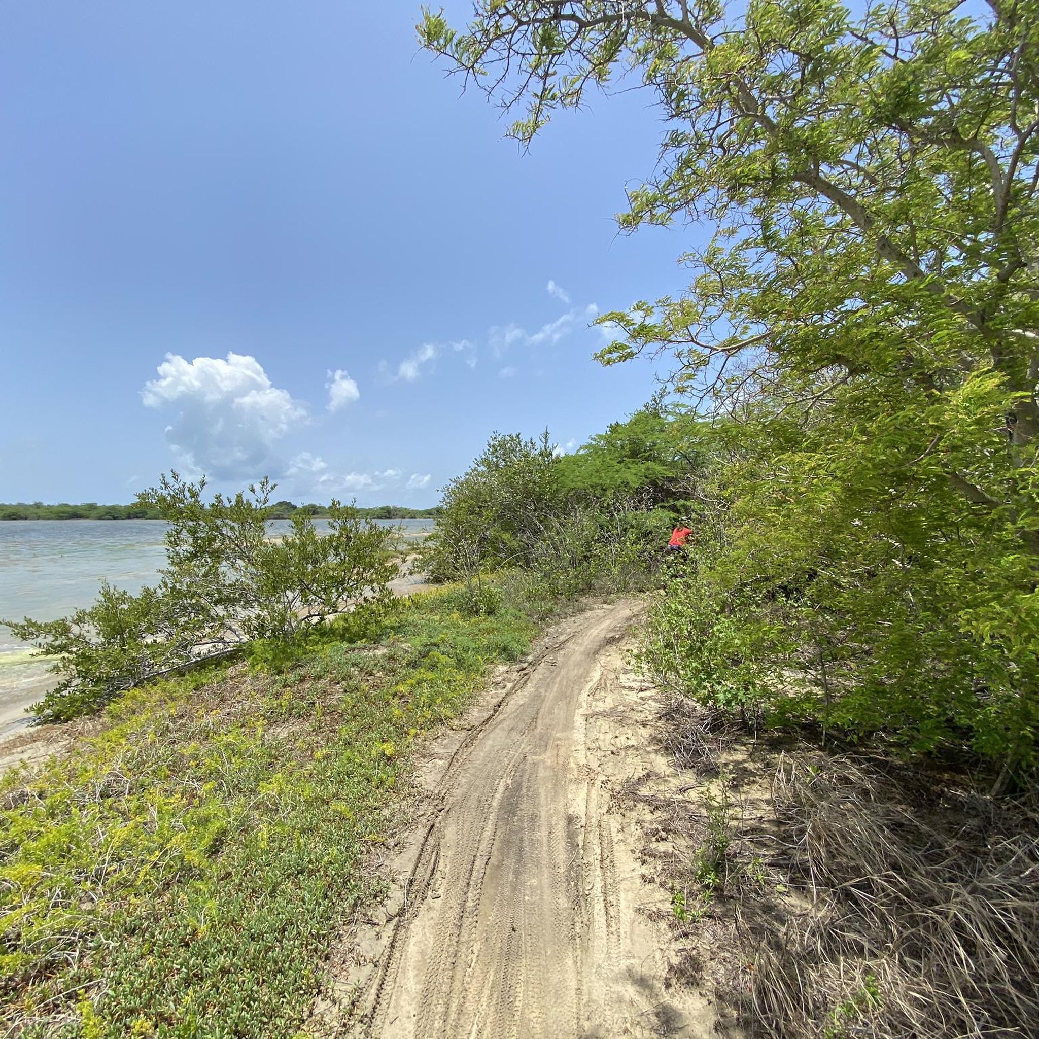

Tips from the Community

The last route to get to the lighthouse is for minimal gravel cycling, but today, when it was sunny and the ground was dry, you can reach the top in a controlled way.
0
0

Great hideaway - mangroves with lots of small crabs
0
0
Pictures Stonecliff in the blue ocean
0
0

The Iris L. Alameda Martínez Wildlife Refuge (RVS Boquerón) is located about 96 km southwest of San Juan, approximately 8 km from the town of Cabo Rojo, between a mangrove forest and a salt meadow. In 1964, the Department of Agriculture of the United States together with that of Puerto Rico, designated 182 hectares as a protected area. Its purpose? The conservation of coastal and marine resources and a recreational space that includes hunting waterfowl, cycling, hiking, among other uses The Refuge has an impressive biodiversity; First, it was made up of a mangrove forest, with an extension of approximately 1.7 km. In it there are two types of wetlands mainly: The Estuary, affected by waves of low intensity and changes in the tides; and the Palustrino, which is mostly freshwater and depends on the ebb and flow of the tides. 50% of the Refuge is made up of three types of mangroves (red mangrove, white mangrove, and black mangrove) that grow within, between, and on the edge of three dikes (West Dike, North Dike, and East Dike) totaling 4km in length. . These support a reservoir that receives water from five sources: three main ones: Valle de Lajas, Laguna de Rincón and runoff from the southern section of the Refuge, and two secondary ones: runoff from the Valle de Lajas irrigation canals and the Boqueron creek.
0
0
Frequently Asked Questions
How many mountain bike trails are available in Refugio Nacional De Vida Silvestre De Cabo Rojo?
There are nearly 20 mountain bike trails in Refugio Nacional De Vida Silvestre De Cabo Rojo. These routes cater to various skill levels, with 8 easy trails and 11 moderate trails, ensuring options for both beginners and more experienced riders.
What kind of terrain can I expect on mountain bike trails in Refugio Nacional De Vida Silvestre De Cabo Rojo?
The trails in Refugio Nacional De Vida Silvestre De Cabo Rojo offer diverse terrain, including slopes, roots, stones, and sharp bends. You'll find sections adjacent to the beach, as well as singletrack, dirt, and gravel roads winding through coastal paths, subtropical dry forests, and rolling hills.
Are there family-friendly mountain bike trails in Refugio Nacional De Vida Silvestre De Cabo Rojo?
Yes, the refuge offers several easy mountain bike trails suitable for families. For instance, the Cabo Rojo Lighthouse loop from Vistamar El Combate is an easy 18.4 km route that provides scenic views without overly challenging terrain.
What natural features and landmarks can I see while mountain biking in the refuge?
You can encounter several notable natural features and landmarks. The iconic Cabo Rojo Lighthouse (Faro Los Morrillos) offers breathtaking views from its perch on limestone cliffs. The unique Cabo Rojo Salt Flats (Salinas de Cabo Rojo) with their vibrant colors and salt mounds are also a prominent sight. Additionally, you might spot the natural stone bridge, Puente Natural, extending into the sea.
Are there any loop trails for mountain biking in Refugio Nacional De Vida Silvestre De Cabo Rojo?
Yes, many of the mountain bike routes in the refuge are loops. For example, the Playa Moja Casabe loop from Cabo Rojo National Wildlife Refuge is an 18.6 km easy loop that takes you through varied terrain, including coastal and inland ecosystems.
What is the best time of year to go mountain biking in Refugio Nacional De Vida Silvestre De Cabo Rojo?
While specific seasonal recommendations aren't provided, it's generally advisable to consider the tropical climate. The dry season (roughly December to April) typically offers more favorable conditions with less rain and humidity, making for more comfortable riding. Always check local weather forecasts before heading out.
What kind of wildlife might I encounter on the trails?
Refugio Nacional De Vida Silvestre De Cabo Rojo is a critical habitat for abundant wildlife. You might spot numerous bird species, including the endangered Yellow-shouldered Blackbird, as well as lizards, frogs, iguanas, and butterflies. Be aware that live cattle may also be present on some trails.
What should I bring for a mountain bike ride in the refuge?
It's advisable to bring plenty of water, snacks, and insect repellent. Given the diverse terrain and potential for sun exposure, appropriate cycling gear, sun protection, and basic repair tools are also recommended.
Are there any longer mountain bike routes for more experienced riders?
Yes, for those seeking a longer ride, the Laguna Fraternidad – Playa Moja Casabe loop from Roca Ola is a moderate 37.6 km route. This trail offers a more extensive exploration of the refuge's diverse landscapes.
What do other mountain bikers enjoy most about the trails in Refugio Nacional De Vida Silvestre De Cabo Rojo?
The area is highly rated by the komoot community, with an average score of 5.0 stars. Reviewers often praise the unique coastal paths, the diverse ecosystems ranging from mangrove forests to dry forests, and the stunning views, particularly around the lighthouse and salt flats.
Is there parking available for mountain bikers at the refuge?
While specific parking locations for mountain bikers are not detailed, the refuge has visitor access points. It's recommended to check the official U.S. Fish & Wildlife Service website for visitor information and designated parking areas, especially near interpretive centers or trailheads. You can find more information at fws.gov/refuge/cabo-rojo/visit-us.
Are there any interpretive centers to learn more about the refuge?
Yes, to enhance visitor understanding, there are interpretive centers at both the Salt Flats Unit and the main refuge headquarters. These centers offer insights into the local ecosystems, endangered species, and the history of the salt mining industry in the region.
Most popular routes in Refugio Nacional De Vida Silvestre De Cabo Rojo

Get inspired with the komoot mobile app


Explore more
Browse the best MTB trails in other regions.
