The best road cycling routes in Untere Allerniederung Bei Boye
4.5
(393)
3,693
riders
189
rides
Road cycling in Untere Allerniederung Bei Boye is characterized by its predominantly flat terrain and well-maintained paths, making it suitable for various fitness levels. The region features the Aller river floodplain, a designated nature reserve with extensive wet meadows, ancient oxbow lakes, and distinctive dune areas. Cyclists can explore diverse landscapes, including softwood and hardwood alluvial forests, transitioning into oak and beech forests. The low elevation gains across the area ensure a consistent riding experience.
Best road cycling routes in…
Last updated: September 30, 2026
4.4
(7)
74
riders
Moderate road ride. Great for any fitness level. Some segments of this route may be unpaved and difficult to ride.
4.4
(21)
135
riders
52.5km
02:18
130m
130m
Moderate road ride. Good fitness required. Mostly well-paved surfaces and easy to ride.

4.6
(14)
126
riders
36.9km
01:34
70m
70m
Easy road ride. Great for any fitness level. Mostly well-paved surfaces and easy to ride.
4.6
(14)
91
riders
34.3km
01:26
40m
40m
Easy road ride. Great for any fitness level. Mostly well-paved surfaces and easy to ride.
4.3
(3)
51
riders
59.0km
02:34
180m
180m
Moderate road ride. Good fitness required. Some segments of this route may be unpaved and difficult to ride.
Get access to more routes and recommendations from other explorers.
Already have an account?
Our route recommendations are based on thousands of hikes, rides, and runs completed by other people on komoot.
Start today with a free account
Your next adventure awaits.

Tips from the Community

Stop in Wolthausen...Restaurant Wildwasser with 1a beer garden
0
0

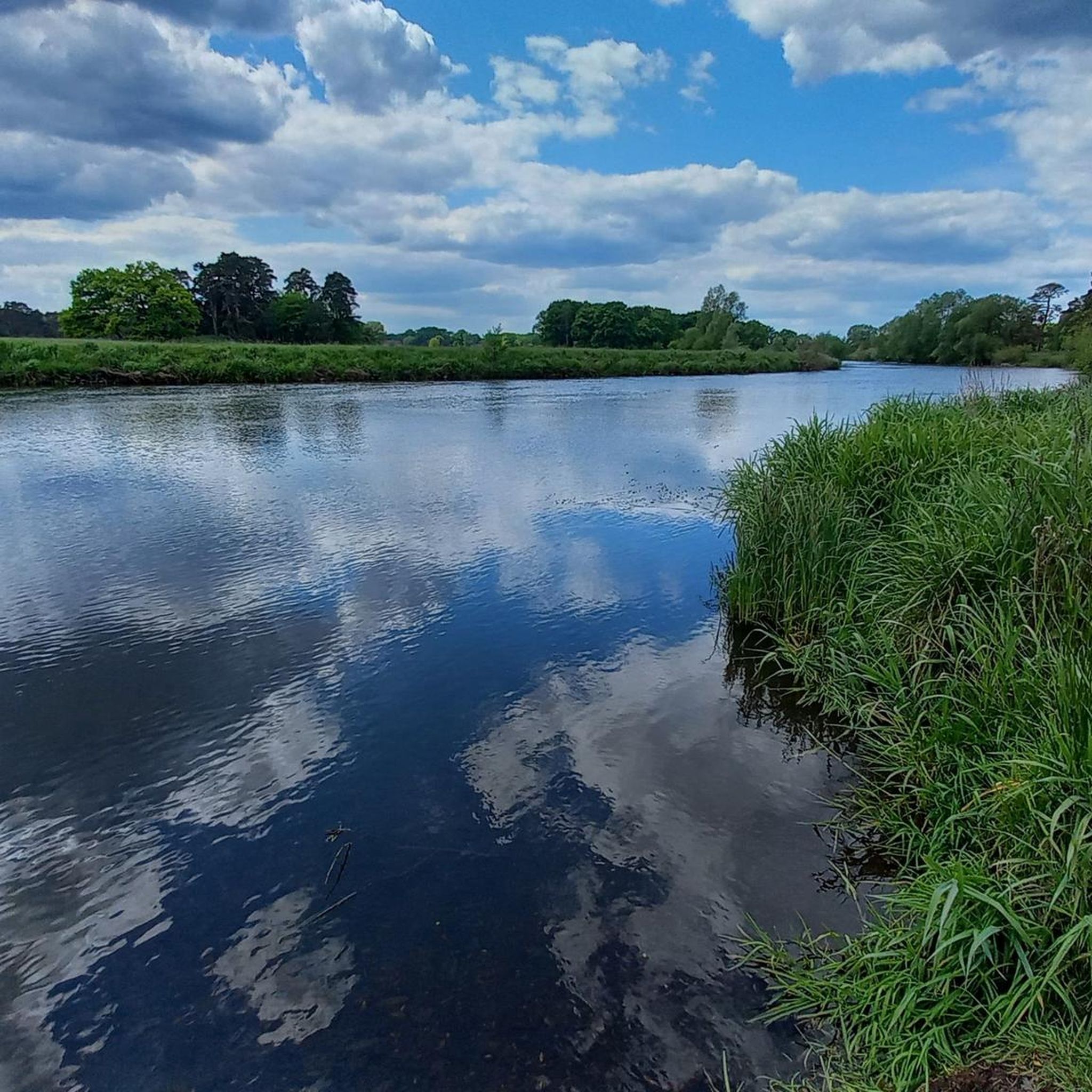
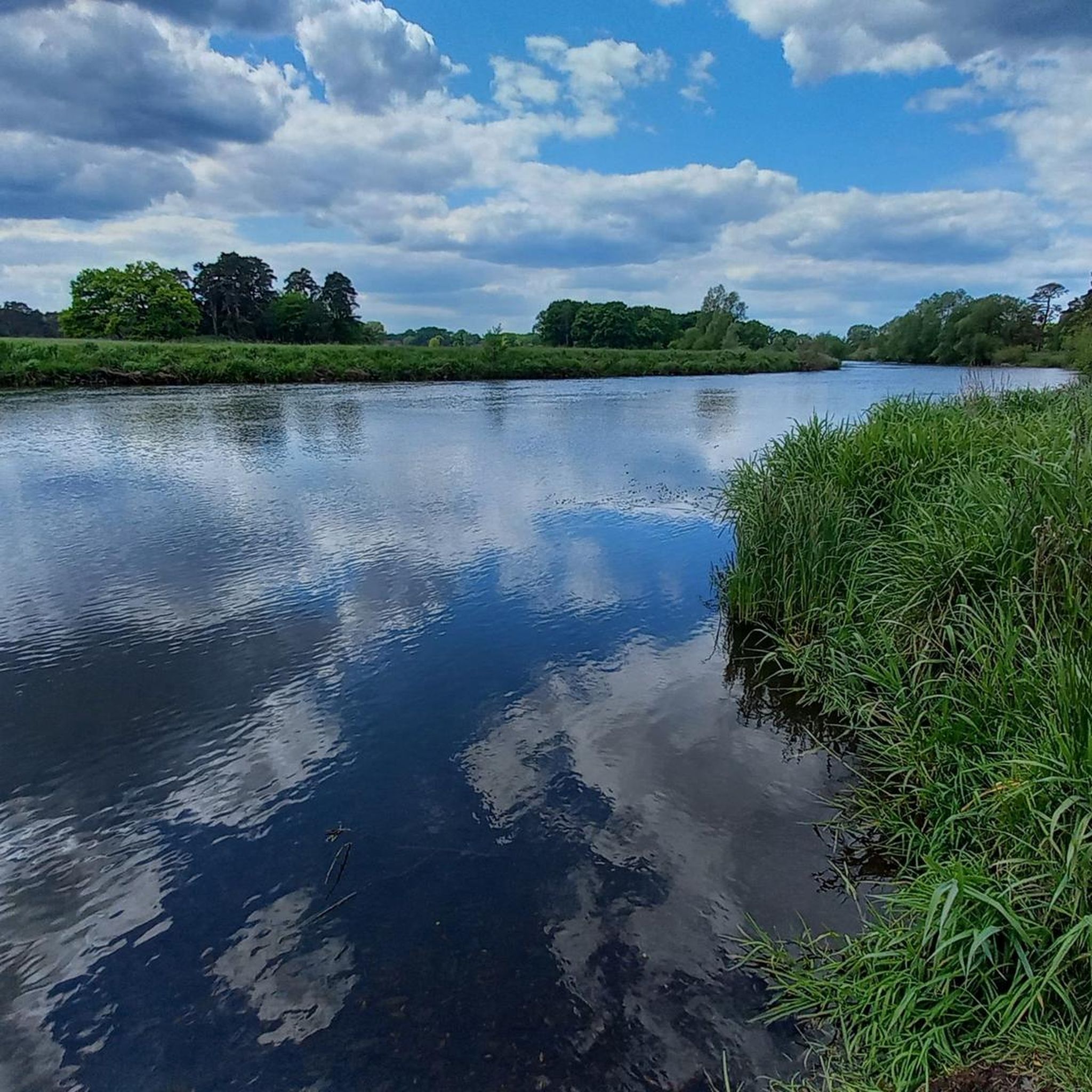
The view of the Örtze shows the natural river landscape of the Südheide with its calm watercourses, bank vegetation, and extensive green spaces. The idyllic surroundings shape the landscape and make the Örtze a characteristic component of the regional nature.
1
0


drive between villages on secondary roads without car traffic
0
0
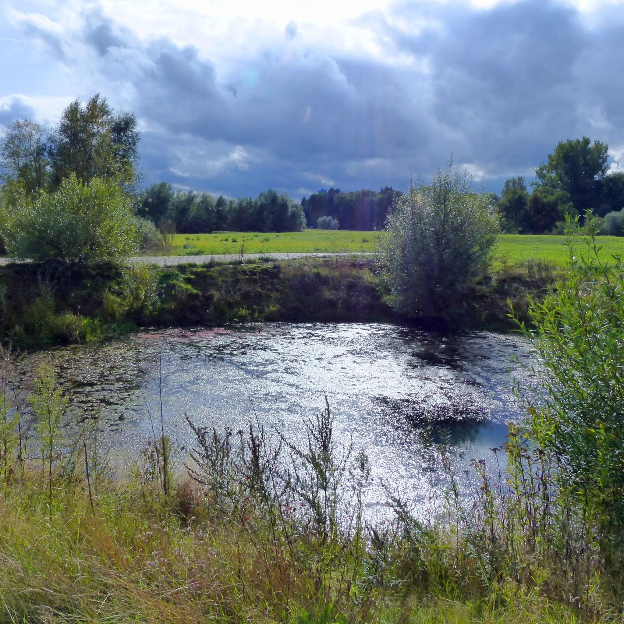
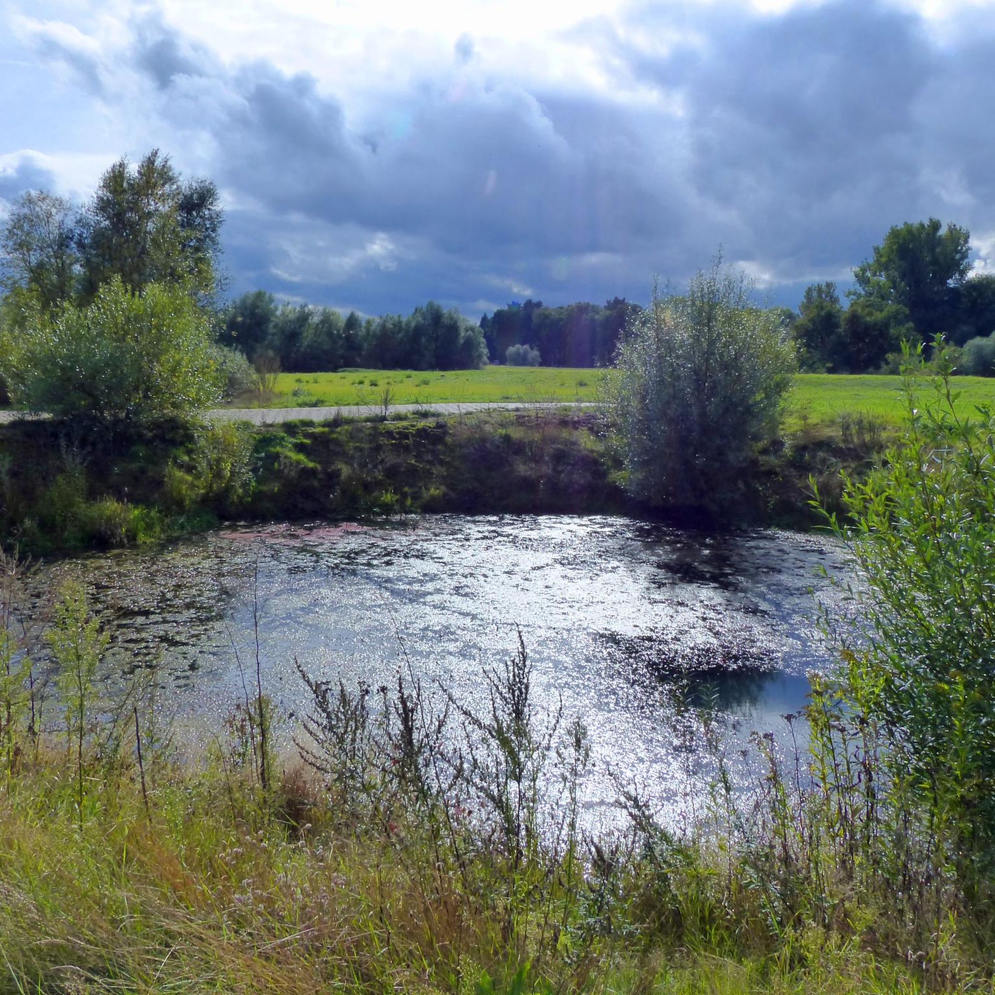
The Oldendorf gravel pits are a scenic area, ideal for cycling and nature observation. Formed by gravel mining, lakes and wetlands have formed here, which today provide habitat for numerous bird species and other animals. The paths around the ponds are easily accessible and invite you to take a relaxing bike ride. The diverse flora and fauna can be enjoyed, especially in spring and autumn.
0
0

good quality
1
0

Thanks to a mega storm we found this beautiful resting place
2
0
This spot not only offers a great view of the Örtze River, but also the opportunity to experience nature up close. Beautiful location!
2
0
Frequently Asked Questions
How many road cycling routes are available in Untere Allerniederung Bei Boye?
There are over 190 road cycling routes in Untere Allerniederung Bei Boye, offering a wide range of options for different preferences and fitness levels. These include 37 easy routes, 153 moderate routes, and 7 more challenging trails.
What is the typical terrain like for road cycling in this region?
The terrain in Untere Allerniederung Bei Boye is predominantly flat, characterized by the picturesque Aller river floodplain. You'll find well-maintained paths, extensive wet meadows, ancient oxbow lakes, and distinctive dune areas. The low elevation gains ensure a consistent and enjoyable riding experience, suitable for various bicycle types.
What is the best time of year for road cycling in Untere Allerniederung Bei Boye?
The region is ideal for road cycling during spring, summer, and early autumn when the weather is mild and the natural landscapes are at their most vibrant. The well-maintained paths are generally accessible throughout these seasons, offering fresh air and serene surroundings.
Are there routes suitable for beginners or families?
Yes, the area is very suitable for beginners and families due to its predominantly flat terrain and well-maintained paths. Many routes, like the Wolthausen Observation Tower – Smooth Road Bike Path loop from Untere Allerniederung bei Boye, are classified as easy with minimal elevation gain, making them perfect for a relaxed ride.
What natural features can I expect to see along the road cycling routes?
You'll encounter diverse natural features, including the Aller river floodplain, extensive wet meadows, and ancient oxbow lakes. The routes also pass through various forest types, such as softwood alluvial forests with black alder and ash, and hardwood forests. A unique sight is a four-hectare section of the Neustädter Holz where Scottish Highland cattle graze, helping to preserve an ancient wood pasture. You can explore highlights like the Wood pasture Lower Aller Lowlands near Boye and the Aller Meadow.
Are there any historical landmarks or points of interest along the routes?
Yes, cyclists can discover several points of interest. The Aller Cycle Path in the Lower Aller Floodplain near Boye itself is a highlight. You can also visit the Aller Lock Bannetze, a historically significant lock from the early 20th century, or take a break at the idyllic Mühlenteich Eversen (Mill Pond in Eversen).
Are there circular road cycling routes available in the region?
Yes, many road cycling routes in Untere Allerniederung Bei Boye are designed as loops, allowing you to start and end at the same point. Examples include the Wolthausen Observation Tower – Smooth Road Bike Path loop from Untere Allerniederung bei Boye and the Wienhausen Abbey – Wienhausen Abbey loop from Celle.
Where can I park my car when starting a road cycling tour?
While specific parking locations are not detailed for every route, the region around Celle and other starting points for tours like the Aller Cycle Path generally offers parking facilities. It's advisable to check local parking options near your chosen starting point, especially in towns like Celle.
Can I reach the cycling routes by public transport?
The region is accessible by public transport, particularly to larger towns like Celle, which serve as common starting points for many routes. From there, you can often connect directly to the cycling network, including sections of the Aller Cycle Path.
Are there places to stop for a break or refreshments along the routes?
Yes, the region offers opportunities for breaks. The Mühlenteich Eversen (Mill Pond in Eversen) is an idyllic spot for a short rest. While specific cafes or pubs are not listed for every route, towns and villages along the Aller Cycle Path often provide options for refreshments and accommodation.
What do other road cyclists enjoy the most about road cycling in Untere Allerniederung Bei Boye?
The area is highly rated by the komoot community, with an average score of 4.6 stars. Reviewers often praise the tranquil natural landscapes, the well-maintained and predominantly flat paths, and the diverse scenery including river floodplains and forests. The serene atmosphere and fresh air are frequently highlighted as key attractions.
Are there any specific regulations for cycling in the nature reserve areas?
The Aller river floodplain is largely a designated nature reserve. While cycling is generally permitted on marked paths, it's important to stay on designated routes to protect the sensitive ecosystem. Respect local signage and be mindful of wildlife, especially in areas like the wood pasture where Scottish Highland cattle graze.
Most popular routes in Untere Allerniederung Bei Boye
Most popular attractions in Untere Allerniederung Bei Boye

Get inspired with the komoot mobile app


Explore more
Browse the best Road cycling routes in other regions.
