The best road cycling routes in Kolsås / Dælivann Landskapsvernområde
4.3
(23)
2,459
riders
51
rides
Road cycling in Kolsås / Dælivann Landskapsvernområde offers diverse terrain within a protected landscape area in Akershus. The region is characterized by forested hills, river valleys, and the presence of Dælivann lake. Road cyclists can expect routes that navigate through varied natural environments, with some offering views towards the Oslofjord. The landscape includes both gentle gradients along waterways and more challenging ascents through the local hills.
Best road cycling routes in Kolsås / Dælivann Landskapsvernområde
- The most popular road cycling…
Last updated: July 5, 2026
58
riders
Moderate road ride. Good fitness required. Mostly well-paved surfaces and easy to ride.
11
riders
76.7km
03:30
750m
750m
Moderate road ride. Good fitness required. Some segments of this route may be unpaved and difficult to ride.

Sign up for free
8
riders
18.9km
00:55
190m
190m
Easy road ride. Great for any fitness level. Mostly well-paved surfaces and easy to ride.
96
riders
190km
08:38
1,910m
1,910m
Hard road ride. Very good fitness required. Mostly well-paved surfaces and easy to ride.
4.0
(4)
77
riders
111km
05:12
1,190m
1,190m
Hard road ride. Very good fitness required. Mostly well-paved surfaces and easy to ride.
Get access to more routes and recommendations from other explorers.
Sign up for free
Already have an account?
Our route recommendations are based on thousands of hikes, rides, and runs completed by other people on komoot.
Start today with a free account
Your next adventure awaits.
Login or Signup
Popular around Kolsås / Dælivann Landskapsvernområde
Tips from the Community

This path enables walkers and cyclists to follow the Hortensveien in and out of Tønsberg. From this path you can enjoy the Bergstein loop, a pleasant 3-kilometer (2-mi) amble featuring woodland and fields.
0
0

A narrow path along the Sandvikselva river. The banks and the riverbed are still in their natural state here.
0
0
The Sandvika small boat harbor („Småbåtshavn“) is a marina used by local residents and visitors for mooring leisure boats and accessing the Oslofjord.
0
0

Nice place, some cafés, a smith, and a Viking ship that is being rebuilt.
2
0

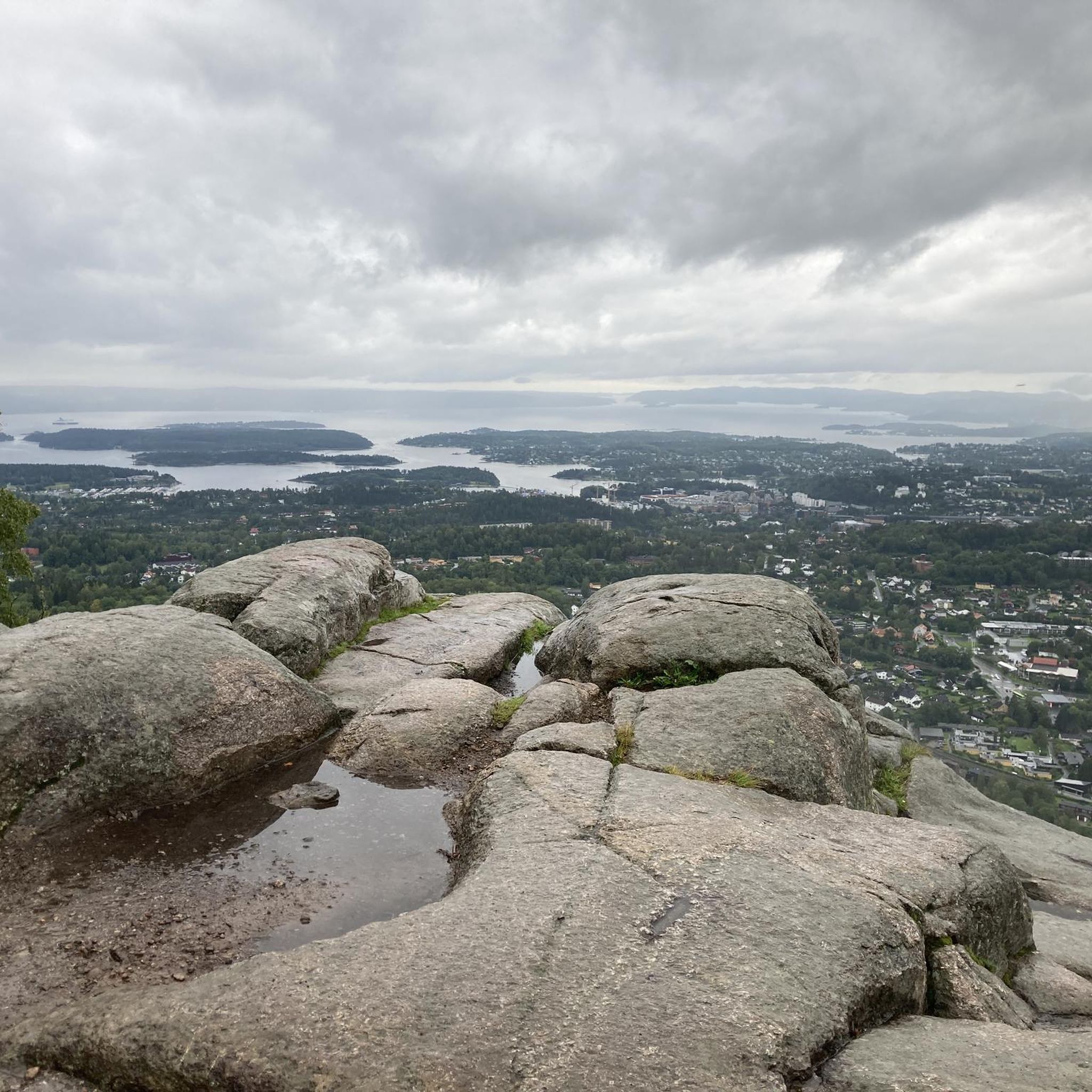
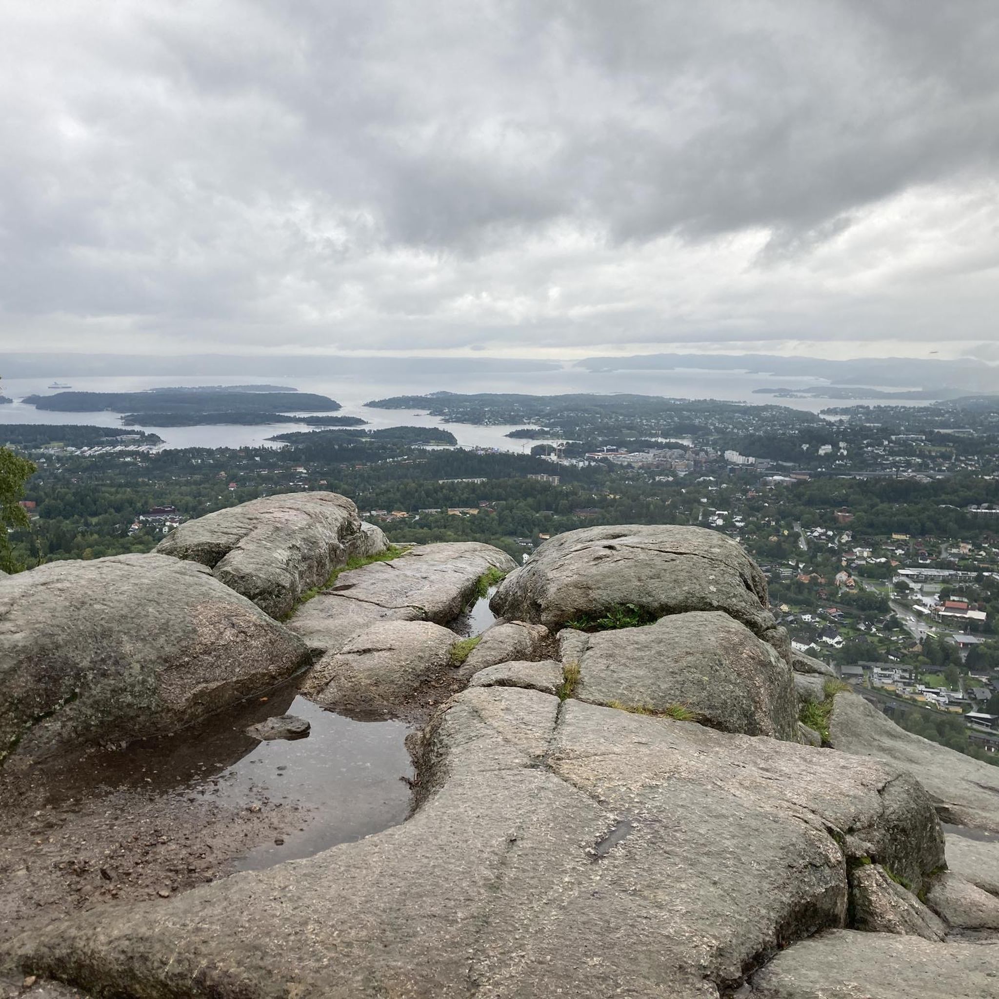
Viewpoint directly on the footpath and cycle path. Beautiful views of Oslo directly from the path, but no rest stop.
1
0


Akershus Fortress dominates Oslo and the harbor. It is always open to the public and can be visited by walking freely between the walls and the garden.
0
0

Striking white church in a very small village. Peaceful surroundings, so a nice spot to stop and take a rest.
0
0
Frequently Asked Questions
What kind of terrain can I expect on road cycling routes in Kolsås / Dælivann Landskapsvernområde?
The region offers a diverse landscape for road cycling, characterized by forested hills, river valleys, and the presence of Dælivann lake. You'll find routes that navigate through varied natural environments, including gentle gradients along waterways and more challenging ascents through the local hills.
Are there road cycling routes suitable for beginners in Kolsås / Dælivann Landskapsvernområde?
Yes, the area provides options for all skill levels. There are 11 easy routes available, perfect for beginners or those looking for a relaxed ride. An example is the Sandvikselva loop from Gjettum, which is 18.5 km long with moderate elevation gain.
What are the options for experienced road cyclists seeking a challenge?
For experienced road cyclists, Kolsås / Dælivann Landskapsvernområde offers 18 difficult routes. These routes feature significant elevation gains and longer distances. Consider the challenging Tønsberg Harbour – Undrumsdal church loop from Kolsås, which spans 188.2 km with over 1800 meters of elevation gain.
Are there any road cycling routes with views of the Oslofjord?
Yes, several routes in the region offer extensive views of the Oslofjord, combining coastal stretches with inland sections. A notable option is the View of Oslofjord – Cycling Route Along Oslofjord loop from Hauger, a 77.6 km moderate path designed to showcase these scenic vistas.
How many road cycling routes are available in Kolsås / Dælivann Landskapsvernområde?
There are over 60 road cycling routes available in Kolsås / Dælivann Landskapsvernområde, catering to various preferences and skill levels. This includes 11 easy, 33 moderate, and 18 difficult routes.
What do other road cyclists say about the routes in this region?
The routes in Kolsås / Dælivann Landskapsvernområde are highly rated by the komoot community, with an average score of 4.2 stars from over 27 reviews. Cyclists often praise the varied terrain, the scenic river valleys, and the beautiful views towards the Oslofjord.
Are there circular road cycling routes available?
Yes, many of the routes in Kolsås / Dælivann Landskapsvernområde are designed as loops, allowing you to start and end at the same point. Examples include the Sandvikselva loop from Avløs and the Sandvikselva loop from Gjettum.
What is the typical distance and elevation gain for road cycling routes here?
Distances vary widely, from shorter rides like the 18.5 km Sandvikselva loop from Gjettum to much longer excursions such as the 188.2 km Tønsberg Harbour – Undrumsdal church loop from Kolsås. Elevation gains range from around 180 meters for easier routes to over 1800 meters for the most challenging ones.
Is it possible to reach the road cycling routes using public transport?
Kolsås / Dælivann Landskapsvernområde is generally accessible by public transport, particularly from Oslo. Many starting points for routes are near bus or metro stations, making it convenient to combine cycling with public transit. It's advisable to check local transport schedules for specific route access points.
Where can I find parking for road cycling routes in Kolsås / Dælivann Landskapsvernområde?
Parking is available at various access points around the protected landscape area. Many routes start from locations with designated parking, such as Avløs or Gjettum, which are common starting points for the Sandvikselva loops. Look for public parking areas near trailheads or local community centers.
What is the best time of year for road cycling in Kolsås / Dælivann Landskapsvernområde?
The best time for road cycling in this region is typically from spring through autumn (May to October). During these months, the weather is generally milder, and the roads are clear of snow and ice, providing optimal conditions for enjoying the diverse landscapes.
Most popular routes in Kolsås / Dælivann Landskapsvernområde

Get inspired with the komoot mobile app


Explore more
Browse the best Road cycling routes in other regions.
