The best walks and hikes in Kolsås / Dælivann Landskapsvernområde
4.6
(921)
7,416
hikers
22
hikes
Hiking routes Kolsås Dælivann Landskapsvernområde traverse a diverse landscape dominated by the Kolsås hill, featuring Nordre Kolsåstopp (387 meters) and Søndre Kolsåstopp (342 meters). The area is characterized by steep cliffs formed from rhomb porphyric lava, offering panoramic views over Oslo, Bærum, and the Oslo Fjord. Between the peaks lies Seterstjern lake, with Dælivann situated below the eastern peak. Mixed forests, including spruce, pine, and oak, cover areas like Fleskumåsen, providing varied terrain for hikers.
Best hiking trails in Kolsås / Dælivann Landskapsvernområde
- The most popular hiking route is View from Nordre Kolsåstopp – View from Søndre Kolsås loop from Toppenhaug, a 4.6 miles (7.4 km) moderate trail that takes about 2 hours 17 minutes to complete. This route connects both prominent peaks, offering expansive views.
- Another top favourite among local hikers is View from Nordre Kolsåstopp – View of Nordre Kolsåstoppen loop from Toppenhaug, an easy 2.8 miles (4.5 km) path. This trail provides access to Nordre Kolsåstopp with a more direct approach.
- Local hikers also love the View from Søndre Kolsås loop from Bærum, a 2.3 miles (3.6 km) trail leading through varied forest and open areas to Søndre Kolsåstopp, often completed in about 1 hour 18 minutes.
- Hiking in Kolsås / Dælivann Landskapsvernområde is defined by prominent hills, steep cliffs, and mixed forests. The network offers options for different ability levels, from easy walks around Dælivann to more challenging ascents to the Kolsås peaks.
- The routes in Kolsås / Dælivann Landskapsvernområde are highly rated by the komoot community with an average score of 4.7 stars from over 300 reviews. More than 2700 hikers have used komoot to explore Kolsås / Dælivann Landskapsvernområde's varied terrain.
Last updated: July 10, 2026
4.6
(19)
165
hikers
7.49km
02:18
260m
260m
Moderate hike. Good fitness required. Easily-accessible paths. Suitable for all skill levels.
4.6
(19)
155
hikers
Moderate hike. Good fitness required. Easily-accessible paths. Suitable for all skill levels.

Sign up for free
5.0
(3)
55
hikers
Easy hike. Great for any fitness level. Easily-accessible paths. Suitable for all skill levels.
26
hikers
3.63km
01:18
200m
200m
Moderate hike. Great for any fitness level. Mostly accessible paths. Sure-footedness required.
5.0
(1)
6
hikers
Moderate hike. Good fitness required. Easily-accessible paths. Suitable for all skill levels.
Get access to more routes and recommendations from other explorers.
Sign up for free
Already have an account?
Our route recommendations are based on thousands of hikes, rides, and runs completed by other people on komoot.
Start today with a free account
Your next adventure awaits.
Login or Signup
Popular around Kolsås / Dælivann Landskapsvernområde
Tips from the Community

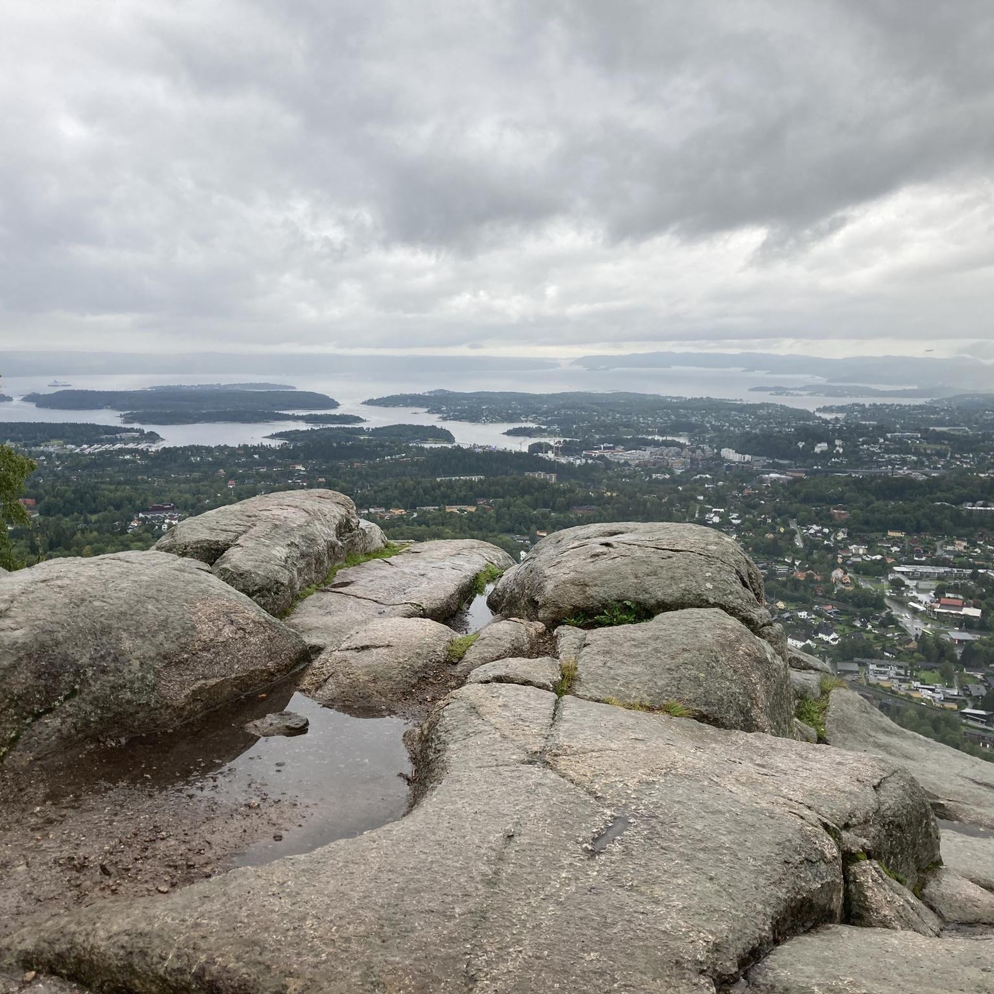
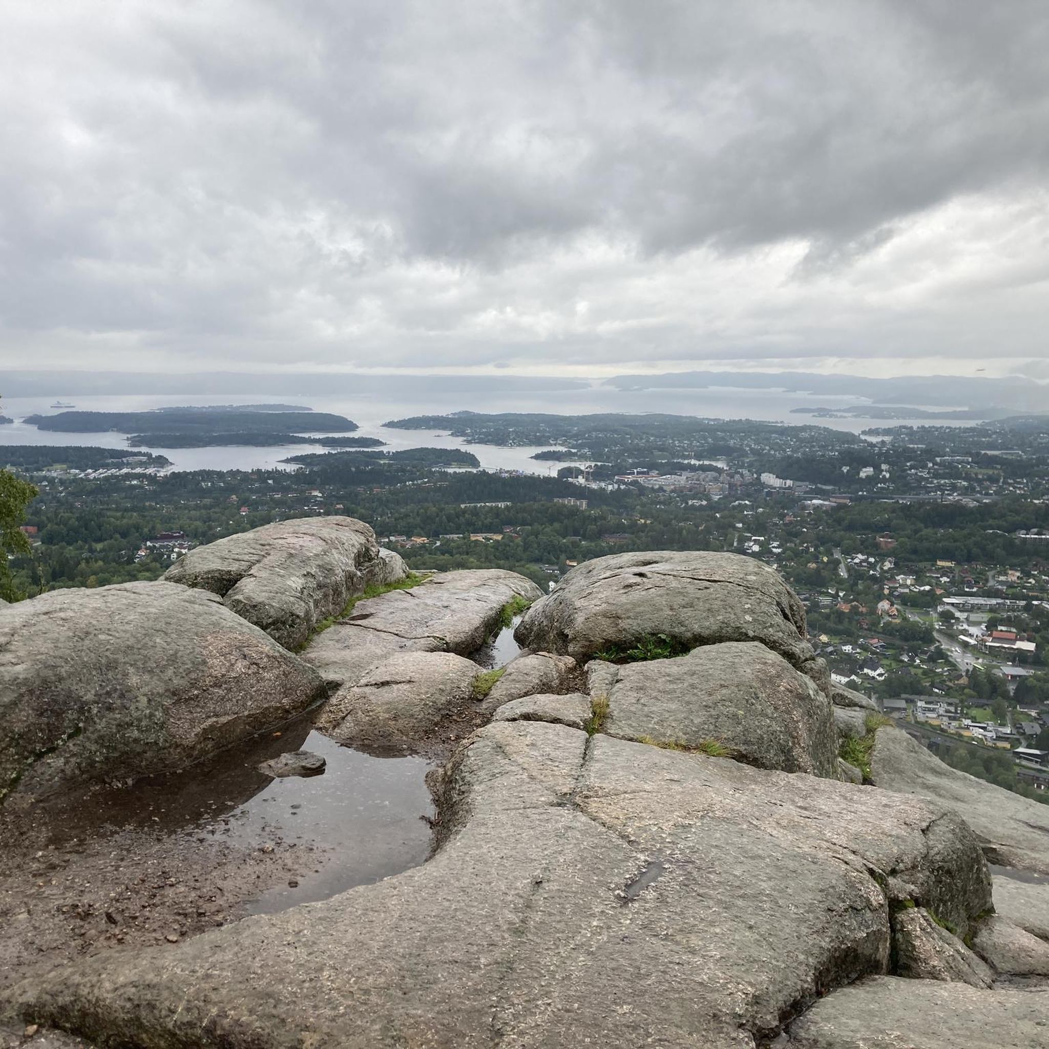
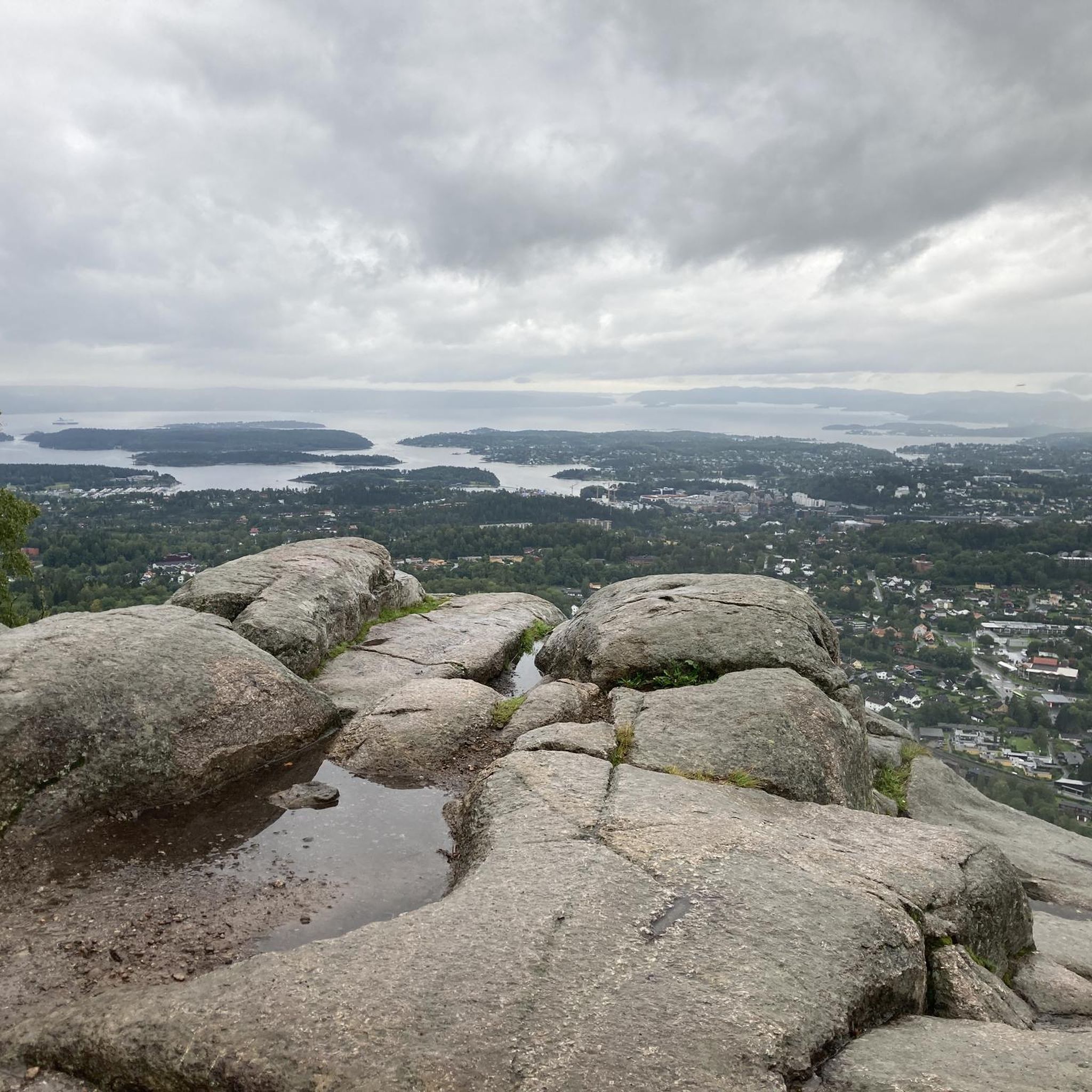
Kolsås is well known as being a hub of rock climbing in the Oslo region, and it has over 200 climbing routes. It is also a great vantage point to look out over the city of Oslo. The views out over the city and fjord are simply beautiful.
0
0
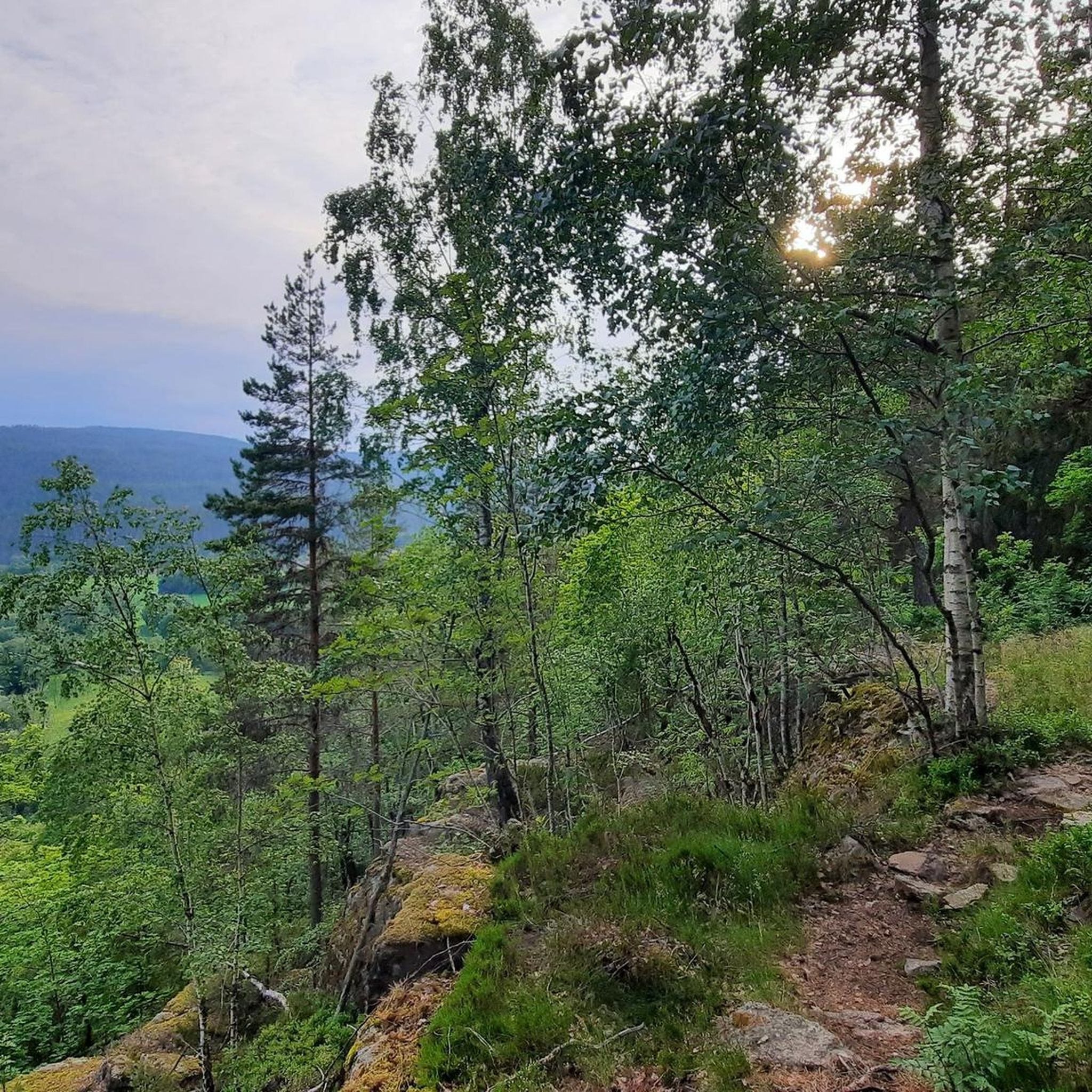
Between Nordre and Southern Kolsåsbanen sits idyllic Lake Seterstjern. This small lake sits in the middle of the forest and is a veritable haven of tranquillity. This is simply a beautiful place to have a rest and enjoy the peace and quiet of nature.
0
0
The views out towards Nordre Kolsåstoppen from here and over Oslo Fjord are simply beautiful. This rocky outcrop set amidst a forest clad mountain top is just another great vantage point you have on this easily accessible hill from Oslo.
0
0
Kolsåstoppen is a well-known peak in Bærum. There are really two peaks: Nordre Kolsåstopp, which is 379 metres high, and Søndre Kolsåstopp, which is a bit lower at 342 metres. The area is known for its beautiful paths and panoramic views overlooking the Oslo fjord.
0
0


Great view of Sandvika and Oslofjord.
1
0

Very nice view of the Oslo fjord
1
0
Frequently Asked Questions
How many hiking trails are available in Kolsås / Dælivann Landskapsvernområde?
There are over 20 hiking routes in Kolsås / Dælivann Landskapsvernområde. These trails offer a variety of experiences, from easy walks to more challenging ascents, catering to different fitness levels.
What kind of terrain can I expect when hiking in Kolsås / Dælivann Landskapsvernområde?
The terrain is diverse, featuring prominent hills like Kolsås with its two peaks, Nordre Kolsåstopp and Søndre Kolsåstopp. You'll encounter steep cliffs formed from rhomb porphyric lava, mixed forests with various tree species, and serene lakes such as Seterstjern and Dælivann. Some steeper sections are equipped with stairs and railings for safety.
Are there challenging hikes for experienced hikers?
Yes, Kolsås / Dælivann Landskapsvernområde offers moderate trails that provide a good challenge. For instance, the View from Nordre Kolsåstopp – View from Søndre Kolsås loop from Toppenhaug covers 7.4 km with significant elevation changes, connecting both prominent peaks for expansive views.
Are there easy trails suitable for beginners or families?
Absolutely. Many paths are suitable for beginners and families. An easy option is the View from Nordre Kolsåstopp – View of Nordre Kolsåstoppen loop from Toppenhaug, a 4.5 km path that provides access to Nordre Kolsåstopp with a more direct approach. The area around Dælivann also offers pleasant, less strenuous walks.
What natural features or viewpoints can I discover while hiking?
Hikers can enjoy spectacular panoramic views over Oslo, Bærum, and the Oslo Fjord from the peaks of Kolsås. You'll also find the idyllic Seterstjern lake between the peaks and the mysterious Dælivann below the eastern peak. The Fleskumåsen area boasts a rich mixed forest, and the region is home to diverse wildlife, including various bird species and animals like squirrels, badgers, and foxes.
Are there any historical sites or cultural attractions in the area?
Yes, the region is rich in history. Near Dælivann, you can find ancient petroglyphs and burial mounds. The Gråmagan area contains remains of an old village castle from the migration period. The area also has a history of lime production, with evidence of old lime quarries and kilns. The landscape even inspired French painter Claude Monet, who created several paintings of Mount Kolsås.
Are there circular hiking routes in Kolsås / Dælivann Landskapsvernområde?
Yes, many routes are designed as loops, allowing you to start and end at the same point. Examples include the popular View from Nordre Kolsåstopp – View from Søndre Kolsås loop from Toppenhaug and the View from Søndre Kolsås loop from Bærum, which leads through varied forest to Søndre Kolsåstopp.
Is parking available near the trailheads?
While specific parking locations are not detailed in the guide, Kolsås / Dælivann Landskapsvernområde is a popular destination, and parking options are generally available near common access points, such as Toppenhaug or Bærum, which serve as starting points for many trails.
Can I reach Kolsås / Dælivann Landskapsvernområde using public transport?
Yes, the area is generally accessible by public transport, making it convenient for hikers without a car. Public transport options typically connect from Oslo and Bærum to various points around the landskapsvernområde, allowing access to different trailheads.
What do other hikers enjoy the most about hiking in Kolsås / Dælivann Landskapsvernområde?
The area is highly rated by the komoot community, with an average score of 4.7 stars from over 300 reviews. Reviewers often praise the stunning panoramic views from the Kolsås peaks, the diverse and well-maintained trails, and the rich natural beauty, including the serene lakes and varied forests.
Are dogs allowed on the hiking trails?
Generally, dogs are welcome on trails in Kolsås / Dælivann Landskapsvernområde, but it's important to keep them on a leash, especially during nesting seasons for birds and to protect local wildlife. Always follow local regulations regarding pets in nature reserves.
What is the best time of year to hike in Kolsås / Dælivann Landskapsvernområde?
The area is beautiful year-round. Spring brings vibrant flora, while summer offers lush greenery and longer daylight hours. Autumn showcases stunning fall colors. Winter hiking is also possible, with snow-covered landscapes, though some trails might require appropriate gear for icy conditions. Always check local weather forecasts before heading out.
Are there any specific safety considerations for hiking in this region?
While many trails are well-maintained, some sections, particularly on the Kolsås peaks, can be steep and rocky. Always wear appropriate footwear, carry enough water, and be prepared for changing weather conditions. In winter, ice can be a factor. It's advisable to inform someone of your hiking plans, especially if exploring less-trafficked routes.
Most popular routes in Kolsås / Dælivann Landskapsvernområde

Get inspired with the komoot mobile app


Explore more
Browse the best Hikes in other regions.
