The best running trails in Maribyrnong Valley Parklands
5.0
(1)
64
runners
14
runs
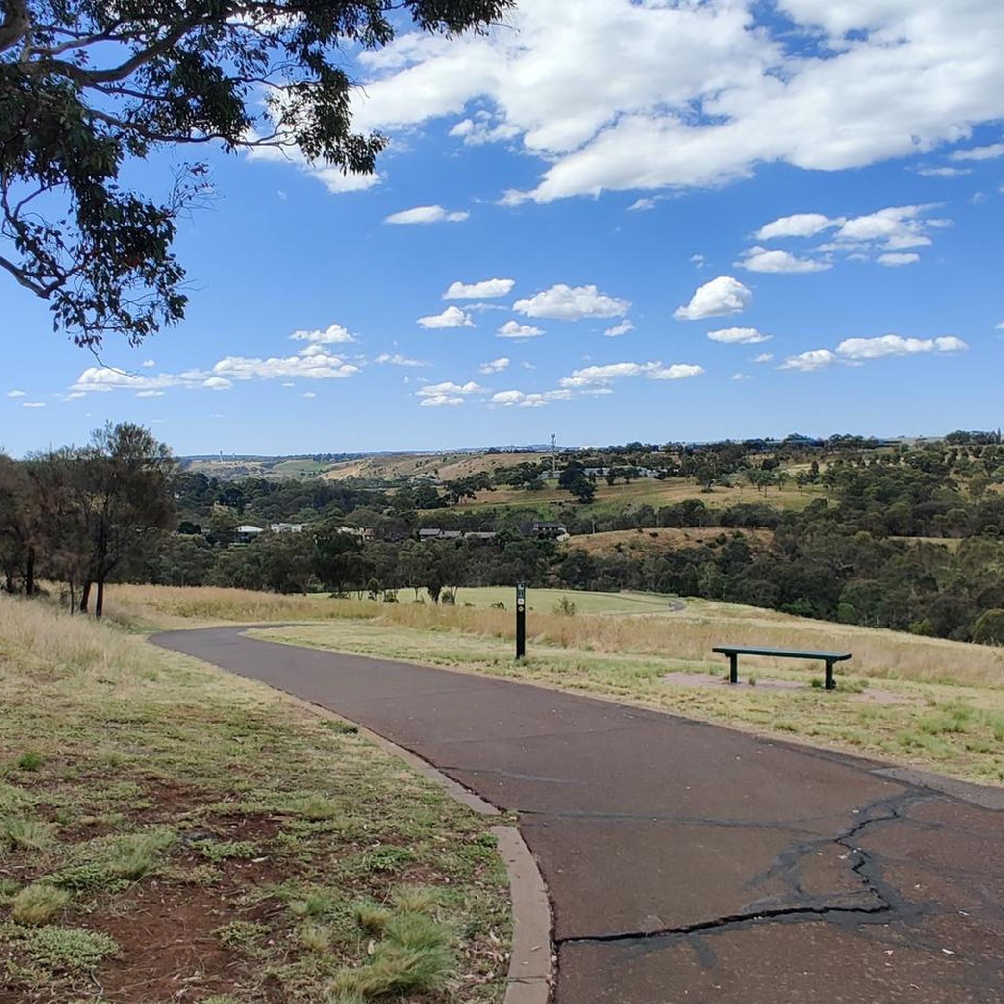
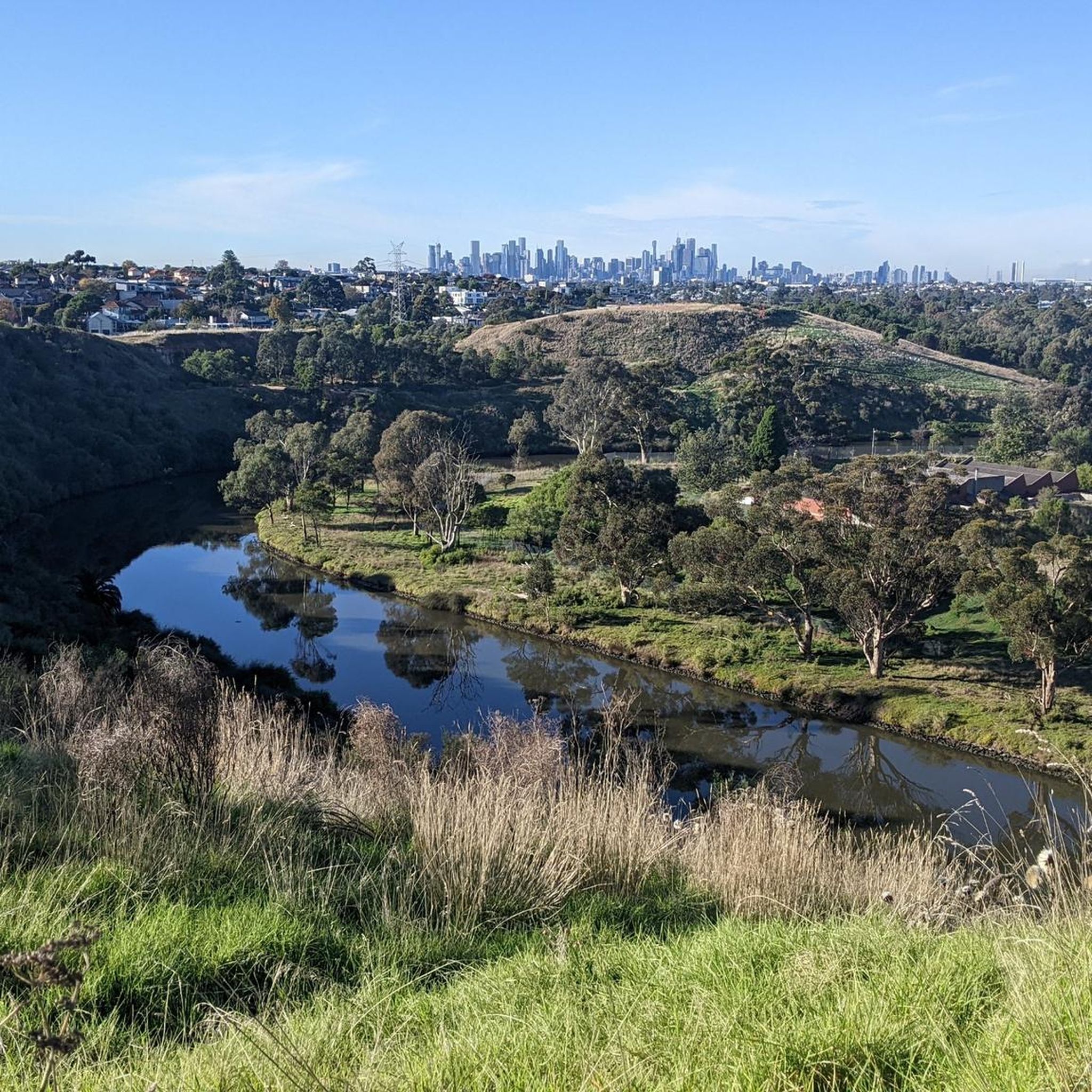
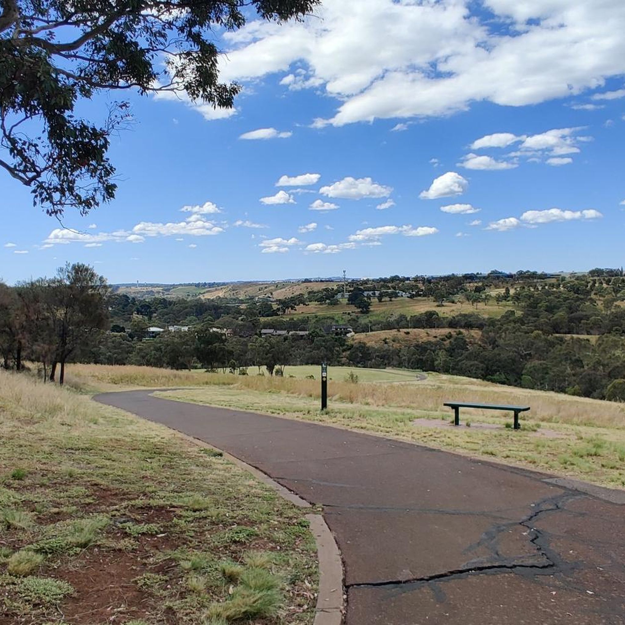
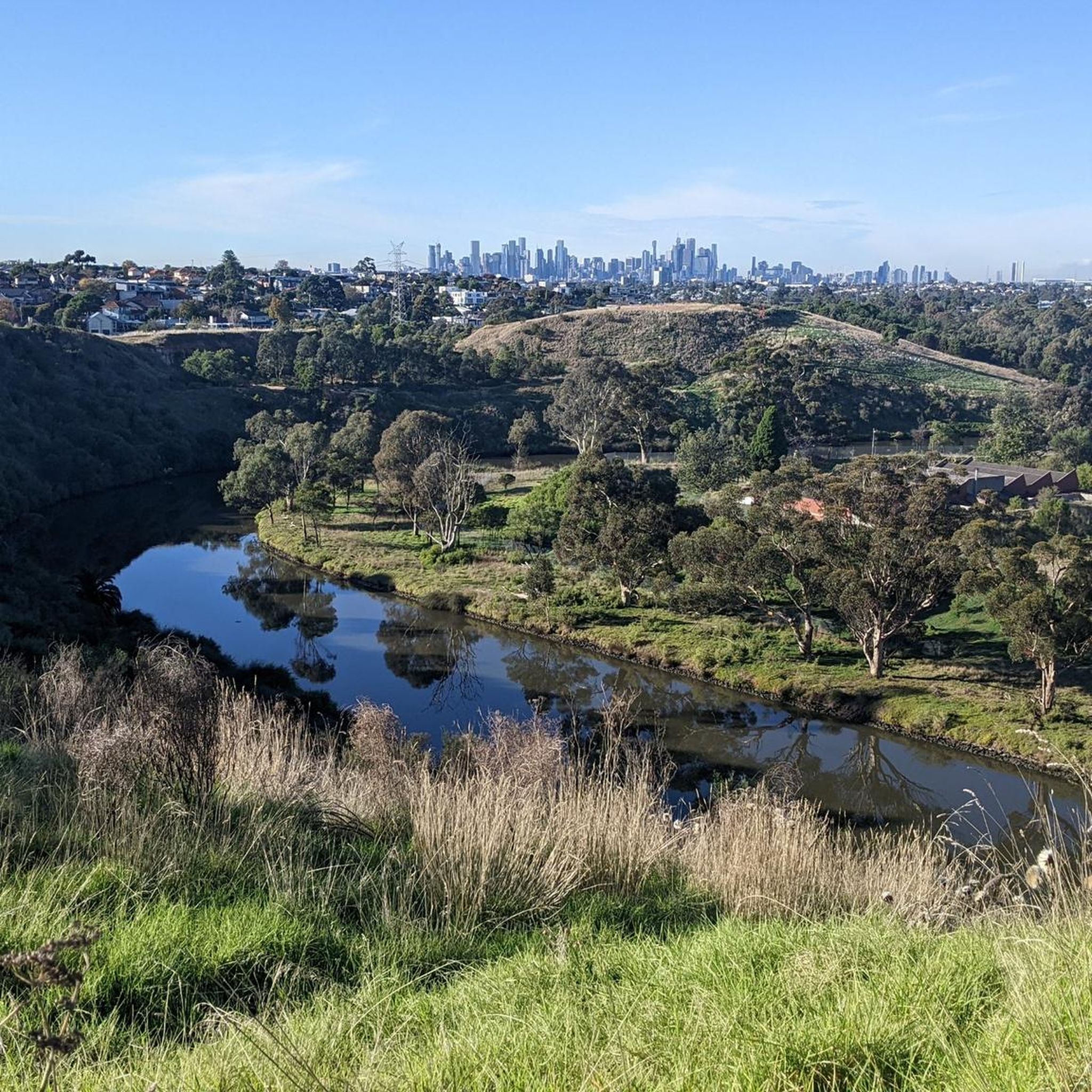
Jogging routes in Maribyrnong Valley Parklands traverse a diverse landscape shaped by the winding Maribyrnong River, which carves a valley through basalt plains. The region features river lands, dramatic escarpments, and expansive native grasslands, providing varied terrain for runners. Majestic River Red Gums line the Maribyrnong River, contributing to the natural setting. This area offers panoramic views from the encircling ridges of the river escarpment, making it suitable for a range of running experiences.
Best jogging routes in Maribyrnong Valley Parklands
- The most popular jogging route is Maribyrnong River – Maribyrnong Valley Parklands loop from Overnewton Anglican Community College Yirramboi Campus, a 7.7 miles (12.4 km) trail that takes 1 hour 18 minutes to complete. This moderate route offers scenic river views and varied running surfaces.
- Another top favourite among local runners is Dodds loop from Ginifer, a difficult 10.5 miles (17.0 km) path. This route features varied terrain, including sections with notable elevation changes.
- Local runners also love the Taylors Lake – Lake Kingfisher loop from Watergardens, a 27.5 miles (44.3 km) trail leading through a diverse landscape including lakes, often completed in about 4 hours 40 minutes.
- Jogging in Maribyrnong Valley Parklands is defined by river lands, escarpments, and native grasslands. The extensive network of trails offers options for various ability levels, from easy loops to challenging long-distance runs.
- The guide includes highly-rated routes that showcase the best of the region's landscape. More than 80 runners have used komoot to explore Maribyrnong Valley Parklands's varied terrain.
Last updated: July 8, 2026
5.0
(1)
10
runners
Moderate run. Good fitness required. Mostly paved surfaces. Suitable for all skill levels.
5
runners
17.0km
01:47
100m
100m
Hard run. Very good fitness required. Mostly paved surfaces. Suitable for all skill levels.

Sign up for free
6
runners
42.5km
04:28
270m
270m
Hard run. Very good fitness required. Mostly paved surfaces. Suitable for all skill levels.
16
runners
Hard run. Very good fitness required. Mostly paved surfaces. Suitable for all skill levels.
7
runners
Moderate run. Good fitness required. Mostly paved surfaces. Suitable for all skill levels.
Get access to more routes and recommendations from other explorers.
Sign up for free
Already have an account?
Our route recommendations are based on thousands of hikes, rides, and runs completed by other people on komoot.
Start today with a free account
Your next adventure awaits.
Login or Signup
Popular around Maribyrnong Valley Parklands
Tips from the Community

The multi-use Maribyrnong River Trail follows its eponymous river for nearly 25 kilometres through northwest Melbourne. Along the way it passes through multiple parks and neighbourhoods where walkers, joggers, and cyclists can stop to enjoy the scenery or meet friends at one of the cafés that lie a short distance from the path.
0
0
This short crossing connects the trails on either side of the Maribyrnong River. It can get flooded when the water is high so don't plan on using it after heavy rain.
0
0

This beautiful park is a revitalised floodplain wetland along the Maribyrnong River, created to improve water quality and foster local biodiversity. There are picnic areas and a network of boardwalks and shared pathways throughout the grounds, where you can explore the area and observe the diverse birdlife and native plant species up close. This peaceful, nature-focused space is connected to the Maribyrnong River Trail, making it the perfect spot for a quiet escape amid the bustling surrounding urban environment.
0
0
Maribyrnong River Trail is a great multi-use path that follows the river for roughly 25 kilometres, connecting the inner suburbs to Melbourne’s northwest. The trail combines sealed paths with riverside scenery, passing parks, wetlands, and historical sites along the way. It’s relatively flat and easy, making it an ideal route for both casual walkers and longer-distance cyclists.
0
0
Heavenly Queen Temple is a large Taoist temple dedicated to Mazu, the Chinese sea goddess, and is considered the largest of its kind in Australia. Set along the Maribyrnong River, the complex features traditional Chinese architecture inspired by Beijing’s Forbidden City, expansive gardens, and a prominent gold-painted statue of Mazu. Easily reached from nearby trails, the temple is open daily from around 9:30 am to 3:30 pm, and with free admission, it's a culturally rich and visually impressive stop along the river corridor.
0
0
Maribyrnong Valley Parklands is a beautiful and large open area just a short distance from the Melbourne CBD. Visitors can a wide variety of facilities ranging from playground and picnic areas to sports fields and a network for multi-use paths. The parklands are split by the Maribyrnong River that winds its way through the grounds on its final approach to its confluence with the Yarra River.
0
0
The Maribyrnong River has its headwaters in the Great Dividing Range Near Mount Macedon where is flows for 40 kilometers before its confluence with the Yarra River. The name stems from the Woiwurrung language of the local Wurundjeri people and it roughly translates to "I can hear the ring-tailed possum". As the river nears its terminus at the Yarra River walkers, runners, and cyclists can follow the Maribyrnong River Trail through the northwestern suburbs of Melbourne through beautiful parklands and quiet neighbourhoods.
0
0
The multi-use Maribyrnong River Trail follows its eponymous river for nearly 25 kilometers through northwest Melbourne. Along the way it passes through multiple parks and neighborhoods where walkers, joggers, and cyclists can stop to enjoy the scenery or meet friends at one of the cafes that lie a short distance from the path.
0
0
Frequently Asked Questions
How many running routes are available in Maribyrnong Valley Parklands?
There are over 15 running routes documented in Maribyrnong Valley Parklands, offering a wide range of experiences for joggers of all levels. The extensive network of trails ensures you'll find a suitable path.
Are there any easy or beginner-friendly running routes in the parklands?
Yes, the parklands offer several easy loops, some of which are paved and suitable for beginners or those looking for a relaxed run. While this guide highlights 1 easy route, many of the moderate trails can also be enjoyed at a comfortable pace.
What kind of terrain can I expect on the jogging trails in Maribyrnong Valley Parklands?
You'll encounter diverse terrain, including river lands, dramatic escarpments, and expansive native grasslands. Trails vary from paved sections to gravel paths, often winding alongside the Maribyrnong River and through areas with majestic River Red Gums.
Are there any circular running routes in Maribyrnong Valley Parklands?
Absolutely. Many of the running paths in the parklands are designed as loops, allowing you to start and finish at the same point. A popular option is the Maribyrnong River – Maribyrnong Valley Parklands loop, which offers scenic river views.
Are there places to park my car when visiting the running trails?
Yes, the Maribyrnong Valley Parklands are well-equipped with amenities, including numerous parking lots conveniently located near trailheads and popular access points. Brimbank Park, for instance, offers ample parking.
Can I find cafes or places to get refreshments near the running routes?
Yes, for your convenience, there are cafes available within the parklands. The Leaping Lizard Café, located at the visitor center in Brimbank Park, is a popular spot for refreshments before or after your run.
What are some notable viewpoints or attractions along the running trails?
The parklands offer panoramic views, especially from the encircling ridges of the river escarpment. The Maribyrnong River itself is a central feature, and you'll pass through various natural settings, including areas with significant native flora and diverse local wildlife. Brimbank Park also provides scenic spots and access to the river.
Are there any longer, more challenging running routes for experienced runners?
Yes, for those seeking a greater challenge, the parklands feature several difficult routes with significant elevation changes and longer distances. An example is the Taylors Lake – Lake Kingfisher loop, which spans over 44 km.
What do other runners enjoy most about jogging in Maribyrnong Valley Parklands?
The diverse landscapes and extensive trail network are highly appreciated by the komoot community. Over 80 runners have explored these routes, often praising the scenic river views, varied surfaces, and the opportunity to experience nature close to the city.
Is there a community running event in the parklands?
Yes, the Maribyrnong parkrun is a free, timed 5km run that takes place along a section of the Maribyrnong River Trail every Saturday morning. It's a great way to join the local running community.
Are there any running routes that pass through woodlands or offer a different natural setting?
Yes, routes like the Gellibrand Hill – Woodlands Historic Park loop take you through different natural settings, including woodlands, offering a varied experience beyond the riverine landscapes.
What is the longest running route featured in this guide?
The longest route highlighted in this guide is the Taylors Lake – Lake Kingfisher loop from Watergardens, covering approximately 44.3 km and typically taking around 4 hours and 40 minutes to complete.
Most popular routes in Maribyrnong Valley Parklands

Get inspired with the komoot mobile app


Explore more
Browse the best Running Trails & Routes in other regions.
