The best road cycling routes in Toohey Forest
4.6
(158)
7,326
riders
79
rides
Road cycling in Toohey Forest offers a network of designated bikeways and shared trails within a significant natural reserve. The area features open eucalypt forests, sandstone and quartzite outcrops, and ridgelines. Many routes are paved or mostly well-paved, providing suitable surfaces for road bikes. The terrain includes slight inclines and varying surfaces, with some paths connecting to urban areas and university campuses.
Best road cycling routes in Toohey Forest
- The most popular road cycling route is Goodwill Bridge – Story Bridge loop from Yeerongpilly, a 65.8 miles (105.9 km) trail that takes 4 hours 57 minutes to complete. This moderate route offers extensive urban and natural views.
- Another top favourite among local road cyclists is Goodwill Bridge – V1 Bikeway Entrance loop from Yeronga, a difficult 114.6 miles (184.4 km) path. This challenging route features significant elevation gain across varied landscapes.
- Local road cyclists also love the Goodwill Bridge loop from Holland Park West, a 10.7 miles (17.2 km) trail leading through urban and parkland areas, often completed in about 56 minutes.
- Road cycling in Toohey Forest is defined by open eucalypt forests, ridgelines, and paved bikeways. The network offers options for easy, moderate, and difficult routes, catering to different ability levels.
- The routes in Toohey Forest are highly rated by the komoot community with an average score of 4.6 stars from over 130 reviews. More than 7,000 road cyclists have used komoot to explore Toohey Forest's varied terrain.
Last updated: July 2, 2026
13
riders
126km
05:47
1,060m
1,060m
Hard road ride. Very good fitness required. Mostly well-paved surfaces and easy to ride.
202
riders
108km
05:02
390m
390m
Hard road ride. Very good fitness required. Mostly well-paved surfaces and easy to ride.

Sign up for free
5.0
(2)
166
riders
184km
08:27
1,160m
1,160m
Hard road ride. Very good fitness required. Mostly well-paved surfaces and easy to ride.
4.3
(3)
87
riders
17.4km
00:58
120m
120m
Easy road ride. Great for any fitness level. Mostly well-paved surfaces and easy to ride.
53
riders
49.3km
02:29
470m
470m
Moderate road ride. Good fitness required. Some segments of this route may be unpaved and difficult to ride.
Get access to more routes and recommendations from other explorers.
Sign up for free
Already have an account?
Our route recommendations are based on thousands of hikes, rides, and runs completed by other people on komoot.
Start today with a free account
Your next adventure awaits.
Login or Signup

Tips from the Community

This lookout sits on one of the highest points on Brisbane’s south side, with wide views across the city and surrounding suburbs. On clear days, the view extends beyond the urban area toward Moreton Bay and distant ranges. The summit is easily accessible by road or walking tracks, with open viewing areas, picnic spaces, and a café nearby. It’s a popular spot, especially around sunset, when visibility and lighting shift across the skyline.
0
0

The South Bank Grand Arbour is a long, beautiful vine-covered walkway running through South Bank Parklands along the Brisbane River. The steel pergola structure stretches for about one kilometre and is draped with bougainvillea, creating a colourful shaded path for walking and cycling. Lined with gardens, seating and nearby cafés, it forms one of the central pedestrian corridors through the South Bank precinct.
0
0

Jindalee's Centenary Bridge is currently undergoing renovations to increase it from four lanes to six. Improving pedestrian and cycle access the bridge is also being done. The project is expected to be completed in 2027.
0
0
The South East Freeway Bikeway is a shared walking and cycling route along the Pacific Motorway corridor. The mostly sealed path provides a direct route between the southern suburbs and the city, popular with both commuters and recreational users. It connects with other paths, such as the Norman Creek Bikeway and local parkland trails along the route, making it ideal for spending the day exploring the area free from traffic.
0
0
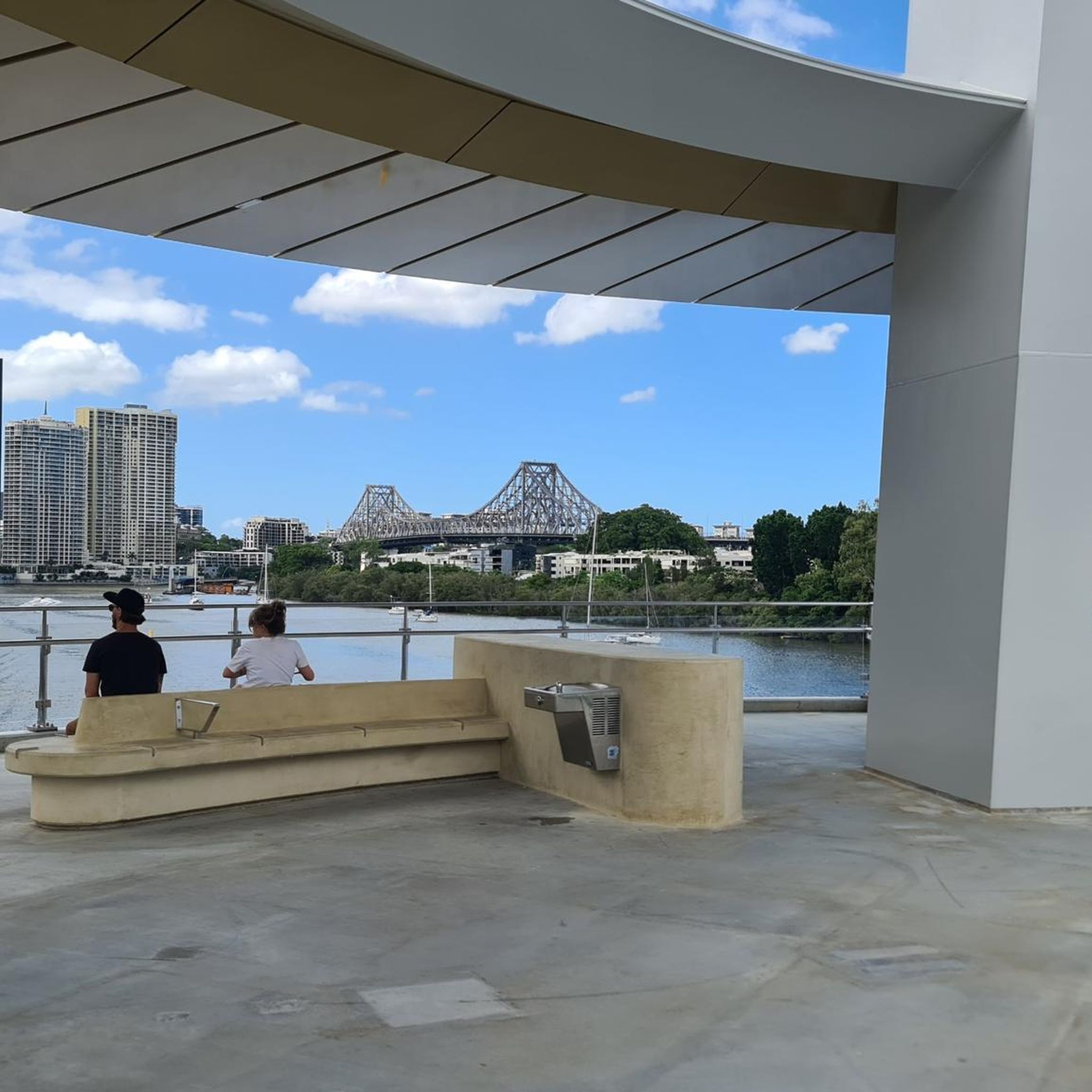
Goodwill Bridge is a pedestrian and cycle bridge spanning the Brisbane River between South Bank and Gardens Point. From the centre of the bridge, you get open views along the river toward the city skyline, with high-rise towers reflecting off the water below. The bridge sits slightly elevated above river level, giving you a clear view of boats passing beneath and the CBD rising beyond. It’s a popular crossing, so keep left and stay aware of cyclists as you pause to take in the view.
0
0
Opened in 2001, the Goodwill Bridge is a pedestrian and cycle crossing over the Brisbane River linking South Bank with the city near the Botanic Gardens. Its sleek, cable-stayed design and gentle curves make it a popular, traffic-free route with expansive river and skyline views. The bridge also hosts small lookout bays and often features public art and lighting displays during city events.
0
0

Enhance Your Outdoor Experience with the Perfect Merlot For those planning to explore this breathtaking region—whether by bike, on foot, or through an invigorating hike—it is essential to come prepared. While the area is renowned for its scenic landscapes and diverse outdoor activities, finding an ideal location to unwind with a glass of wine can be challenging. Bringing your own premium Merlot allows you to elevate your adventure with a well-deserved moment of relaxation. Whether you choose to pause at a panoramic viewpoint or celebrate your journey after an active day, having your favorite wine on hand ensures a seamless blend of exploration and indulgence. Plan ahead, pack accordingly, and turn your outdoor excursion into an unforgettable experience.
0
0

Used to be great place to grab coffee. Not so much anymore.
0
0
Frequently Asked Questions
How many road cycling routes are available in Toohey Forest?
Toohey Forest offers a wide selection of road cycling routes, with over 80 options available. These routes cater to various skill levels, from easy rides to more challenging excursions.
Are there road cycling routes suitable for beginners in Toohey Forest?
Yes, Toohey Forest is home to 28 easy road cycling routes. A great option for beginners is the Goodwill Bridge loop from Holland Park West, an enjoyable 17.2 km ride that typically takes less than an hour to complete.
What kind of terrain can I expect on road cycling routes in Toohey Forest?
The road cycling routes in Toohey Forest feature mostly well-paved surfaces, making them suitable for road bikes. While many paths are easy to ride, some routes may include slight inclines and varying surfaces as they traverse open eucalypt forests and ridgelines.
Are there any challenging road cycling routes for experienced cyclists?
Absolutely. For experienced cyclists seeking a challenge, Toohey Forest offers 17 difficult routes. A notable option is the Goodwill Bridge – V1 Bikeway Entrance loop from Yeronga, a demanding 184.4 km path with significant elevation gain across varied landscapes.
What are the best times of year to go road cycling in Toohey Forest?
Toohey Forest is beautiful year-round, but late winter and spring are particularly vibrant. During these seasons, wildflowers bloom, adding extra beauty to the natural surroundings. Always check the local weather forecast before heading out.
Are there any viewpoints or landmarks along the road cycling routes?
Yes, many routes offer access to scenic spots. The adjacent Mount Gravatt Outlook Reserve features the Mount Gravatt Lookout, providing panoramic views of Brisbane, Moreton Bay islands, and the D'Aguilar Ranges. Some routes also pass through areas with extensive sandstone and quartzite outcrops, and ancient grass trees.
Can I find circular road cycling routes in Toohey Forest?
Yes, many of the road cycling routes in Toohey Forest are designed as loops, allowing you to start and finish at the same point. For example, the Jack Pesch Bridge – Indooroopilly Bridge loop from Yeerongpilly is a moderate 48.8 km circular route.
Are there family-friendly road cycling options in Toohey Forest?
Yes, several routes are suitable for families. The path from Toohey Picnic Area to Griffith University, for instance, is a wide concrete path offering an easy 5 km return ride. Many of the 28 easy routes are also well-suited for family outings.
Where can I park when visiting Toohey Forest for road cycling?
Toohey Forest offers multiple picnic areas such as Mayne Estate, Toohey Picnic Area, Gertrude Petty Place, and Mt Gravatt Outlook picnic area, many of which provide parking facilities. These are convenient starting points for your ride.
Is Toohey Forest accessible by public transport for cyclists?
Yes, Toohey Forest is well-connected. The Griffith University Intercampus Link, a designated bikeway, provides access between Griffith University's Nathan and Mount Gravatt campuses, which are often served by public transport routes. For detailed public transport information, you can consult the Brisbane City Council website.
What do other road cyclists enjoy most about Toohey Forest?
The road cycling experience in Toohey Forest is highly rated by the komoot community, with an average score of 4.6 stars from over 130 reviews. Cyclists often praise the diverse network of designated bikeways and shared trails, the natural beauty of the eucalypt forests, and the variety of routes catering to all skill levels.
Are there facilities like cafes or restrooms along the routes?
Yes, the Mount Gravatt Lookout summit hosts a café and toilet facilities, making it a convenient stop. Additionally, several picnic areas like Toohey Picnic Area and Mt Gravatt Outlook picnic area offer sheltered spots, BBQ facilities, and accessible toilets, ideal for breaks during your ride.
Most popular routes in Toohey Forest

Get inspired with the komoot mobile app


Explore more
Browse the best Road cycling routes in other regions.
