The best running trails in Garigal National Park
4.3
(50)
11,280
runners
349
runs
Jogging in Garigal National Park offers diverse landscapes characterized by impressive sandstone country, dense bushland, and heathlands. The park features a network of trails winding alongside tranquil Middle Harbour Creek and through areas with towering Sydney redgums. Joggers can experience varied terrain, including natural rock formations and occasional waterfalls after rain. This environment provides a range of running experiences, from flat paths to routes with some elevation gain.
Best jogging routes in Garigal National Park
- The most popular jogging route…
Last updated: July 4, 2026
4.5
(2)
80
runners
35.4km
04:31
810m
810m
Hard run. Very good fitness required. Mostly paved surfaces. Suitable for all skill levels.
17
runners
8.29km
01:02
180m
180m
Moderate run. Good fitness required. Mostly paved surfaces. Suitable for all skill levels.

Sign up for free
14
runners
10.4km
01:10
210m
210m
Moderate run. Good fitness required. Mostly paved surfaces. Suitable for all skill levels.
13
runners
Hard run. Very good fitness required. Sure-footedness, sturdy shoes and alpine experience required.
11
runners
18.9km
02:19
400m
400m
Hard run. Very good fitness required. Mostly paved surfaces. Suitable for all skill levels.
Get access to more routes and recommendations from other explorers.
Sign up for free
Already have an account?
Our route recommendations are based on thousands of hikes, rides, and runs completed by other people on komoot.
Start today with a free account
Your next adventure awaits.
Login or Signup
Tips from the Community

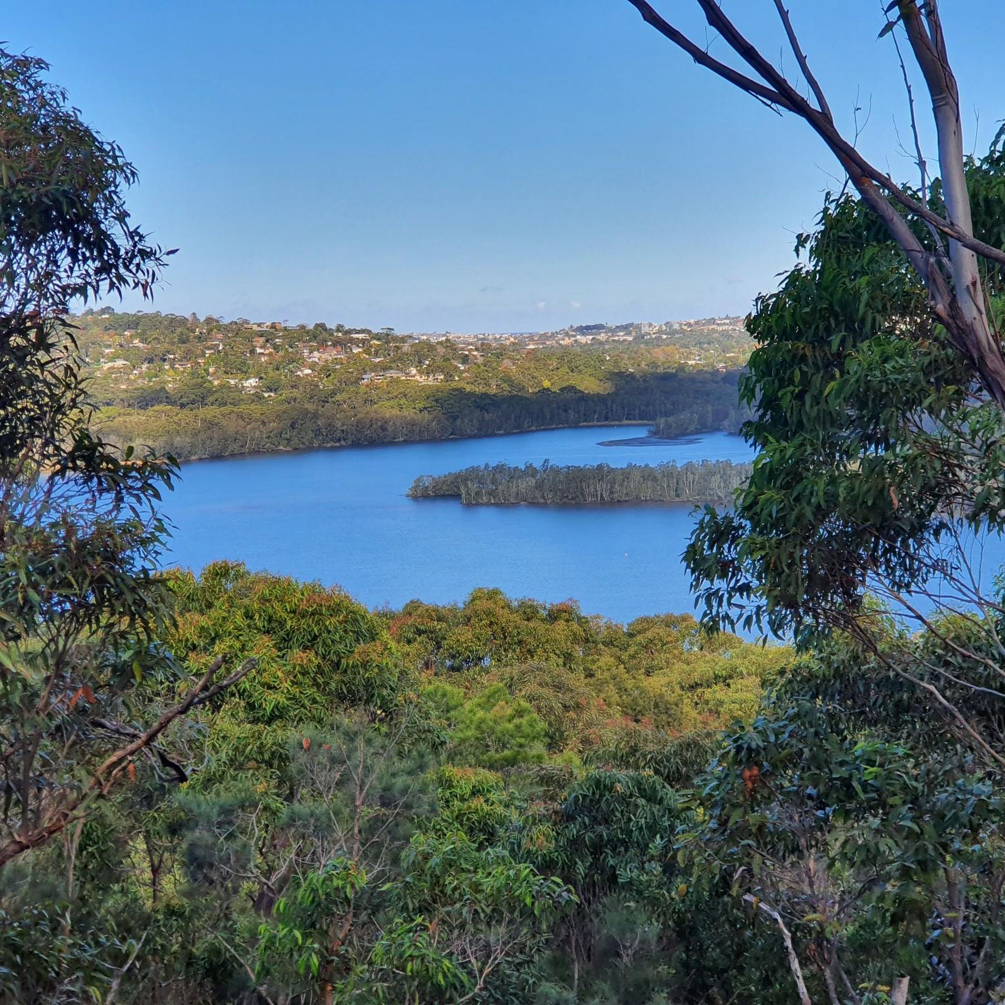
Along this section of the track, Cowan Creek is quiet, with shallow rocky pools, smooth sandstone slabs, and overhanging trees that create a sheltered, intimate setting. The still water reflects the surrounding forest, making it a peaceful contrast to the higher ridge sections of the creek along the walk away from the main foreshore at Bobbin Head.
0
0
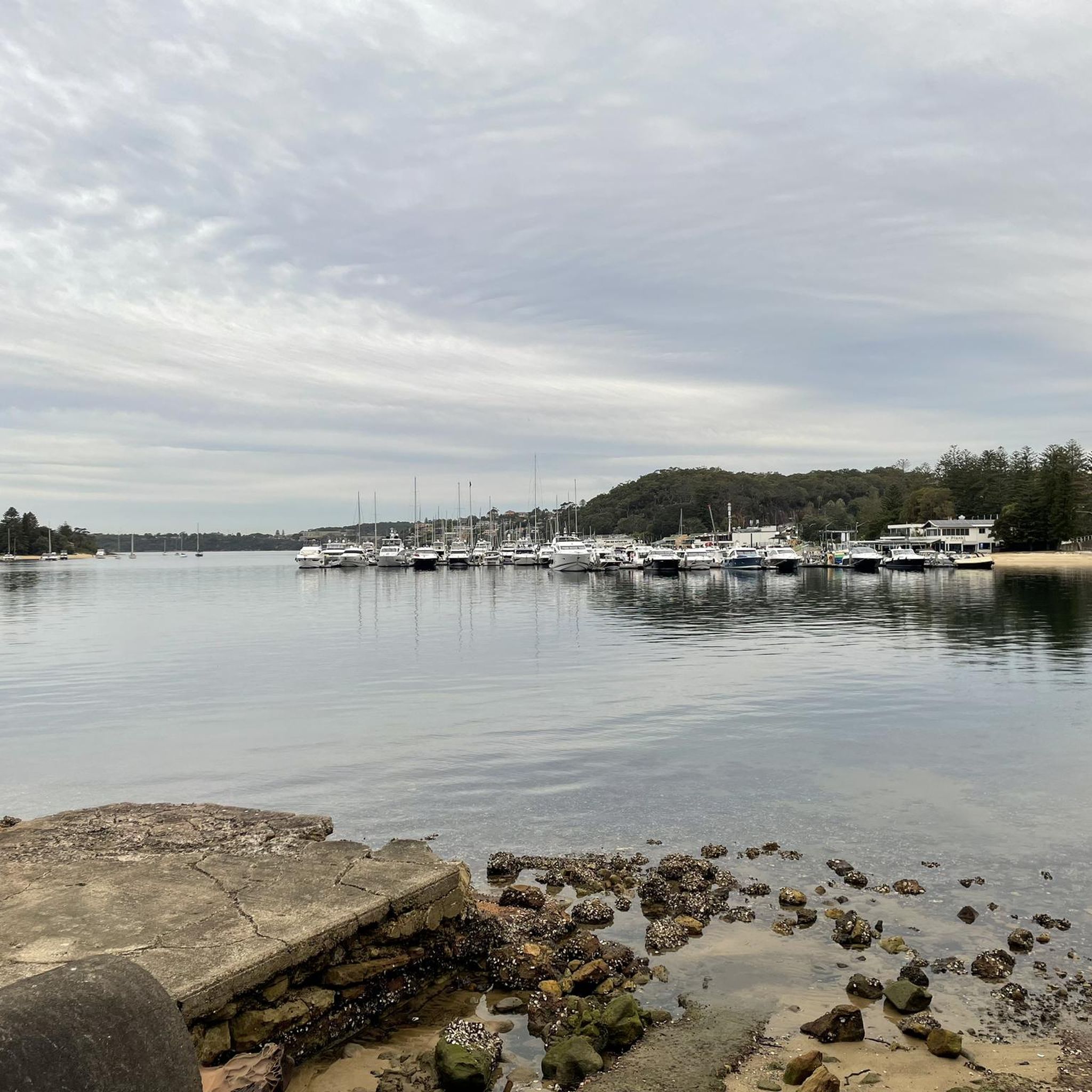
The Warimoo Track climbs steadily through tall forest from Bobbin Head, following a well-formed bush track with a mix of steps and natural surface. As it gains elevation, glimpses through the trees hint at Cowan Creek below before the track returns to the ridge. It provides the return leg of the loop back toward the Sphinx Memorial through classic Ku-ring-gai bushland.
0
0
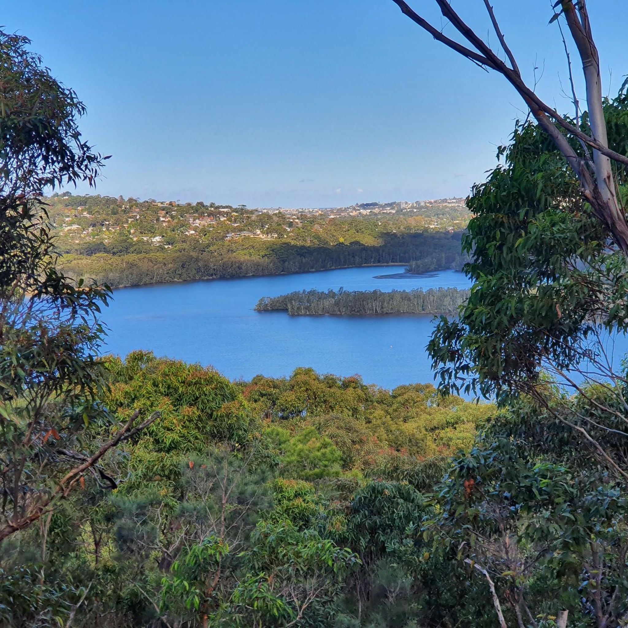
The Sphinx Memorial is a large sandstone monument built in the 1920s to honour Australian soldiers who served in World War I. Carved directly from the rock, it sits beside the track in open bushland, creating a quiet, reflective starting point for the walk. Its distinctive shape and historic significance make it one of the park's best-known landmarks.
0
0

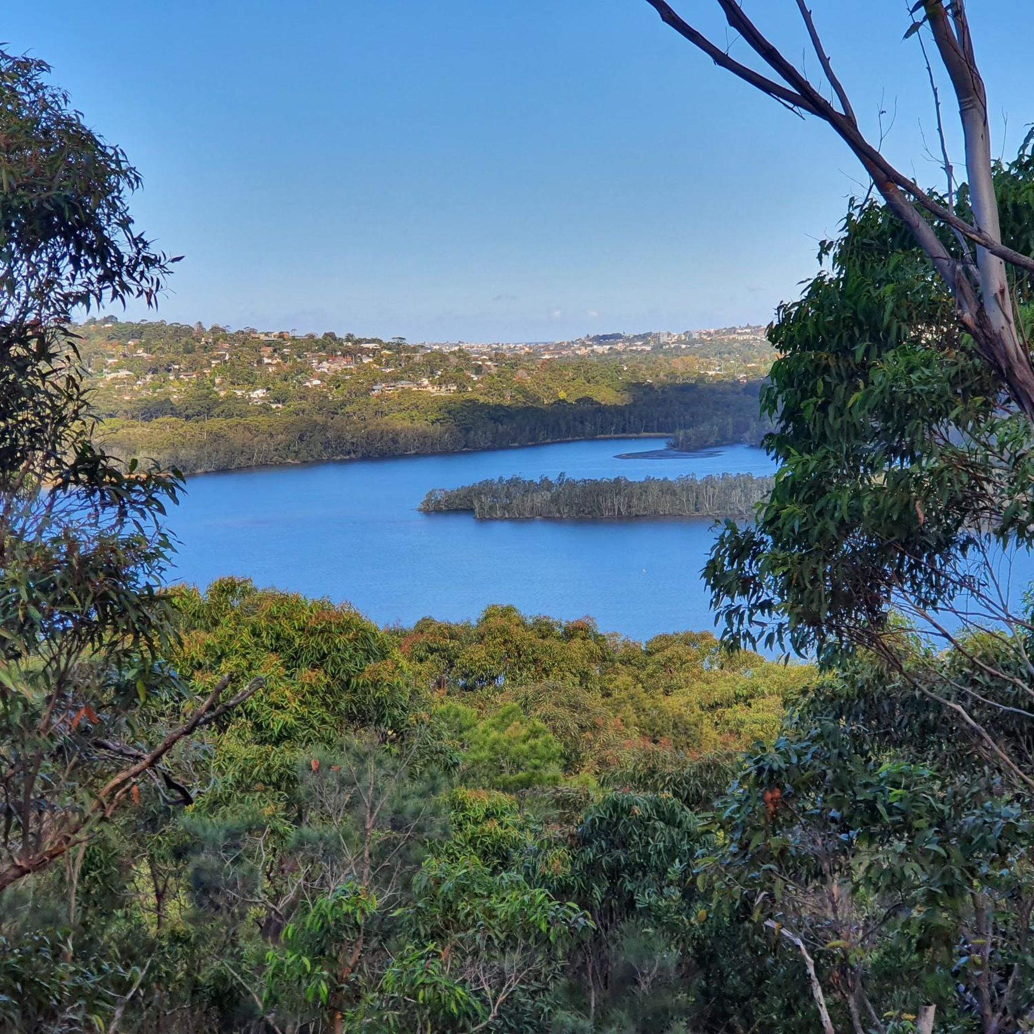
Beautiful spot for a picnic. Easy access from Belrose or part if the McIntish to Davidson Park walk.
0
0
Frequently Asked Questions
How many running routes are available in Garigal National Park?
Garigal National Park offers a vast network of trails for runners. You'll find nearly 400 distinct routes, catering to various fitness levels and preferences. Over 11,000 runners have already explored these paths using komoot.
What kind of terrain can I expect on the jogging trails in Garigal National Park?
The park's trails feature diverse terrain, from impressive sandstone country and dense bushland to heathlands. Many paths follow the tranquil Middle Harbour Creek, offering scenic water views. You'll encounter natural rock formations and, after rain, occasional waterfalls. While some trails are mostly accessible or paved, others require good fitness due to more challenging, varied surfaces.
Are there any easy or beginner-friendly running routes in Garigal National Park?
Yes, Garigal National Park has options for all abilities. There are over 30 easy routes perfect for beginners or those looking for a relaxed run. These trails typically feature less elevation gain and more forgiving surfaces.
Can I find longer, more challenging running routes for advanced runners?
Absolutely. For experienced runners seeking a challenge, the park offers 74 difficult routes. An example is the Bobbin Head Picnic Area – Bobbin Head loop from Brigidine College, a demanding 35.4 km trail that explores extensive bushland and creek views.
What are some scenic highlights or natural features I might see while running?
Garigal National Park is rich in natural beauty. You can expect to see impressive sandstone formations, lush river valleys, and heathlands that burst with wildflowers in spring. Many trails offer scenic views of Middle Harbour Creek. Keep an eye out for native wildlife like swamp wallabies and diverse birdlife. The park also features historical sites and significant Aboriginal heritage.
Are there any circular running routes in Garigal National Park?
Yes, many of the park's trails are designed as loops, offering varied scenery without retracing your steps. A popular moderate option is the Endlicher Point loop from Brigidine College, which provides scenic views over 8.3 km. Another great choice is the Running loop from Belrose, a 10.4 km route through sandstone country and bushland.
What do other runners enjoy most about jogging in Garigal National Park?
The running routes in Garigal National Park are highly rated by the komoot community, with an average score of 4.6 stars from over 50 reviews. Runners often praise the diverse landscapes, the tranquil escape from the city, and the opportunity to experience both bushland and scenic water views along Middle Harbour Creek.
Are there any trails that feature waterfalls in Garigal National Park?
Yes, after good rainfall, several trails in Garigal National Park feature cascades and waterfalls. The Cascades are a popular spot accessible via various trails, and routes like the Flat Rock Beach – Engraving Site loop from Manly Warringah War Memorial State Park can also pass by impressive water features.
Is Garigal National Park suitable for family-friendly running or walks?
While the guide focuses on jogging, many of the easier and moderate trails are suitable for families looking for an outdoor experience. The park's diverse landscapes and wildlife spotting opportunities can make for an engaging outing. Always check the specific route details for distance and difficulty to ensure it's appropriate for your family's fitness level.
What is the best time of year to go running in Garigal National Park?
Garigal National Park is enjoyable year-round, but spring is particularly beautiful when the heathlands burst with vibrant wildflowers. After rain, the waterfalls and creeks are at their most impressive. It's always advisable to check weather conditions before heading out, especially during hotter summer months, and to carry sufficient water.
Are there any trails that offer panoramic views?
Yes, several well-maintained walking and running trails, such as sections of the Heath Track, provide panoramic views of the surrounding landscape, allowing you to appreciate the park's extensive bushland and sandstone country.
Can I access Garigal National Park trails using public transport?
Garigal National Park is located just 20 kilometers north of Sydney's central business district. While direct public transport to all trailheads might be limited, some areas are more accessible than others. It's recommended to research specific access points and public transport options to those locations before planning your run. For more detailed information on park access, you can visit the official NSW National Parks website: nsw.gov.au.
Most popular routes in Garigal National Park

Get inspired with the komoot mobile app


Explore more
Browse the best Running Trails & Routes in other regions.
