The best running trails in Garawarra State Conservation Area
5.0
(1)
312
runners
20
runs
Jogging in Garawarra State Conservation Area offers diverse landscapes for runners, situated between the Royal National Park and the Illawarra Escarpment. The region features a mix of coastal heath, dry and wet sclerophyll forests, and subtropical rainforests. Runners can expect varied terrain including rugged sandstone plateaus, gorges, and creek systems, with some trails providing views of the Pacific Ocean. These natural features create a dynamic environment for running routes.
Best jogging routes in Garawarra State Conservation Area
- The most popular…
Last updated: July 4, 2026
4
runners
6.30km
00:40
70m
70m
Moderate run. Good fitness required. Mostly paved surfaces. Suitable for all skill levels.
52
runners
20.2km
02:06
140m
140m
Hard run. Very good fitness required. Mostly paved surfaces. Suitable for all skill levels.

Sign up for free
39
runners
55.3km
07:30
1,220m
1,220m
Hard run. Very good fitness required. Sure-footedness, sturdy shoes and alpine experience required.
11
runners
26.8km
03:12
380m
380m
Hard run. Very good fitness required. Sure-footedness, sturdy shoes and alpine experience required.
14
runners
11.1km
01:13
200m
200m
Hard run. Good fitness required. Sure-footedness, sturdy shoes and alpine experience required.
Get access to more routes and recommendations from other explorers.
Sign up for free
Already have an account?
Our route recommendations are based on thousands of hikes, rides, and runs completed by other people on komoot.
Start today with a free account
Your next adventure awaits.
Login or Signup
Popular around Garawarra State Conservation Area
Tips from the Community

From June to August, you might be lucky enough to spot whales from the coastal walk as they migrate along the coast.
0
0

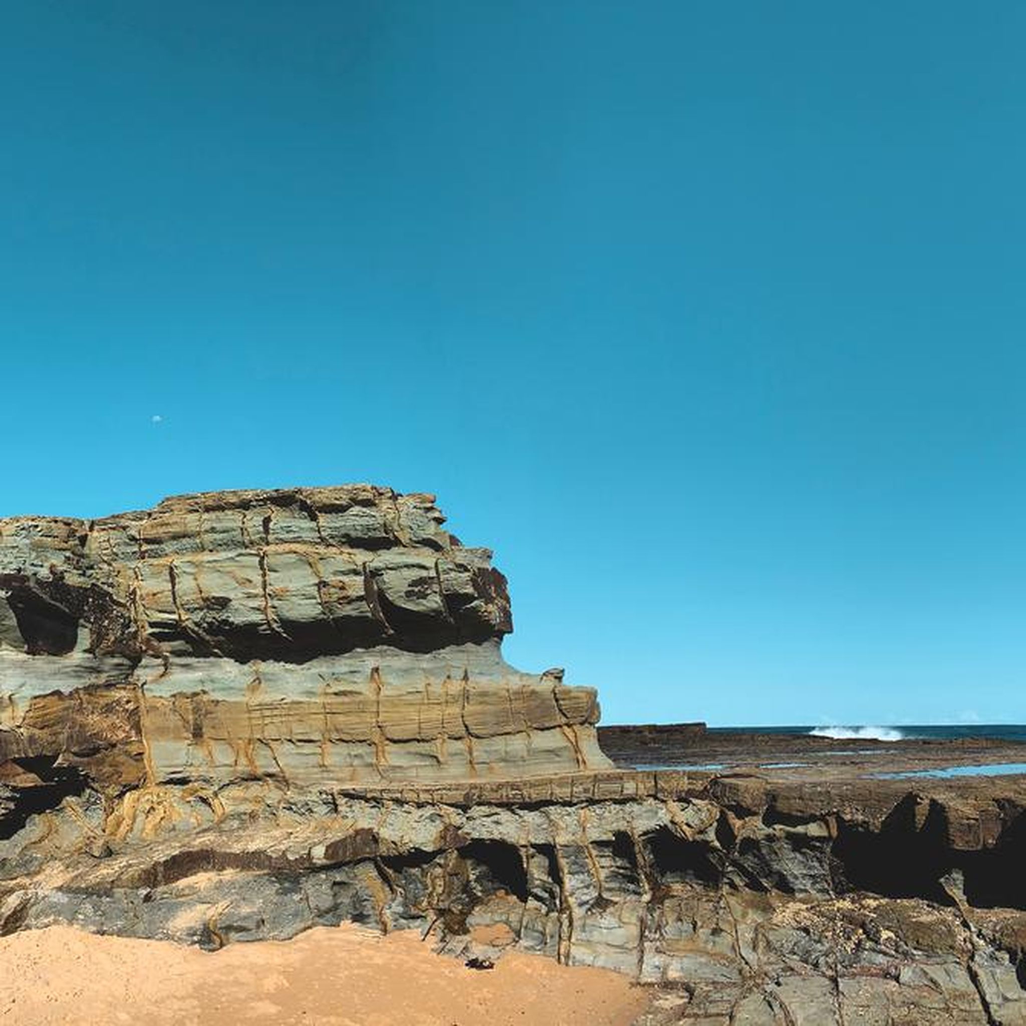
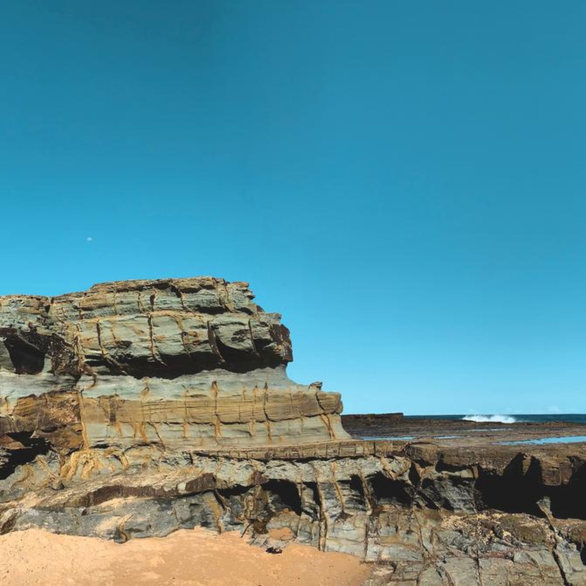
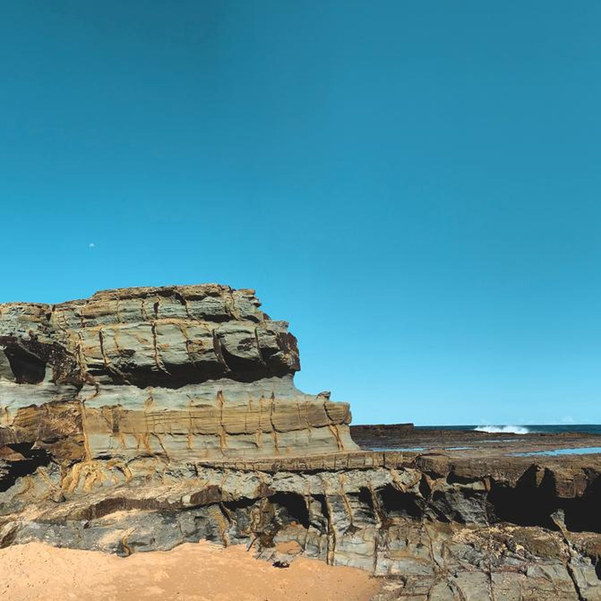
This rocky clifftop viewpoint offers sweeping views over the rugged coastline and the Pacific Ocean, with dramatic sandstone cliffs and bushland stretching along the shore. Set high above the coast, it's a quiet place to pause and take in the scenery before continuing the loop.
0
0

Located at the edge of Bundeena, this is the starting point of the Coastal Track in Royal National Park. The trail begins near the junction of Eric Street and Beachcomber Avenue, where you’ll find a small car park and toilets at the trailhead. Water, cafés, and shops are available in Bundeena before starting, but there is no drinking water available once you leave town and continue along the track.
0
0
The Coast Track is a fantastic coastal route of about 26 kilometres that includes a mix of formed track, boardwalks, and stone steps. It follows the cliff line through coastal heath, with expansive ocean views, passing lookouts and exposed headlands along the way. There are plenty of ups and downs, with some uneven sections, making it better suited to walkers with a reasonable level of fitness who want to enjoy exploring this beautiful path.
0
0

Uloola Falls is a seasonal waterfall with bush camping and viewpoints. The falls drop about 10 meters, not huge, but beautiful. The falls end at a small pool that is popular for swimming. In spring, between September and October, tall red gymea lilies bloom nearby.
0
0
Uloola Falls Trailhead has a massive car park and a set of stairs leading down to the Uloola Falls Trail, marked with a sign and map.
1
0

This part of the Coast Track crosses over the Waterrun, in order to do so without getting your feet wet a series of steps was built down, across, and up the other side of the run. It's a unique feature along this stretch of the trail.
1
0
The Balconies are a series of cliffs that have been undercut by the sea, leaving the top layer of rock jutting out over the water like a balcony. It a popular spot in Royal National Park as it is easily accessible from the nearest parking area.
1
0
Frequently Asked Questions
How many running routes are available in Garawarra State Conservation Area?
There are over 25 running routes available in Garawarra State Conservation Area, offering a wide range of experiences from moderate jogs to more challenging long-distance runs.
Are there easy running routes suitable for beginners in Garawarra State Conservation Area?
Yes, Garawarra State Conservation Area offers several routes suitable for beginners. For instance, the Old Quarry Duck Pond loop from Helensburgh is a moderate 6.3 km trail known for its generally flat and well-formed track, making it a good option for those starting out or looking for a less strenuous run.
What kind of landscapes can I expect to see while running in Garawarra State Conservation Area?
Runners in Garawarra State Conservation Area will experience diverse landscapes, including coastal heath, dry and wet sclerophyll forests, and subtropical rainforests. The area also features rugged sandstone plateaus, gorges, and creek systems, with some trails offering expansive views of the Pacific Ocean and the Illawarra coastline.
Are there any waterfalls or scenic lookouts along the running trails?
Yes, the region is known for its natural beauty. Kellys Falls picnic area offers breathtaking views of cascading waterfalls and a network of walking trails and scenic lookouts. You can also find expansive views of the Pacific Ocean from locations like Bald Hill Lookout and Mount Murray, which may be accessible from certain trails.
What is the typical length and difficulty of running routes in the area?
Running routes in Garawarra State Conservation Area vary significantly in length and difficulty. You can find shorter, moderate trails like the 6.3 km Old Quarry Duck Pond loop from Helensburgh, as well as more challenging, longer options such as the 20.2 km Hacking River loop from The Forest Path or the 19.1 km Otford Lookout – Burgh Ridge Track loop from Otford, which can take several hours to complete.
Can I bring my dog on the running trails in Garawarra State Conservation Area?
Garawarra State Conservation Area is part of the NSW National Parks system. Generally, dogs are not permitted in NSW national parks and reserves, including Garawarra State Conservation Area, to protect native wildlife. It's always best to check the official NSW National Parks website for the most current regulations regarding pets: nsw.gov.au.
Are there circular running routes available?
Yes, many of the running routes in Garawarra State Conservation Area are designed as loops, offering varied scenery without retracing your steps. Examples include the Old Quarry Duck Pond loop from Helensburgh, the Hacking River loop from The Forest Path, and the Otford Lookout – Burgh Ridge Track loop from Otford.
What do other runners enjoy most about jogging in Garawarra State Conservation Area?
The area is highly rated by the komoot community, with an average score of 5.0 stars. Runners often praise the diverse forest ecosystems, the challenging terrain for longer runs, and the opportunity to immerse themselves in peaceful bushland close to urban areas. The well-formed tracks, like Cawleys Road, are also frequently mentioned for their suitability for various activities.
Is public transport available to reach the Garawarra State Conservation Area trails?
Garawarra State Conservation Area is situated between the Royal National Park and the Illawarra Escarpment, making it accessible from both Sydney and Wollongong. While specific public transport links directly to trailheads might be limited, you can research train services to nearby towns like Helensburgh or Otford, and then consider local transport or a short taxi ride to reach specific starting points. Always check local transport schedules in advance.
What kind of wildlife might I encounter while running?
Garawarra State Conservation Area is a haven for wildlife. You might spot native animals such as the powerful owl and long-nosed potoroo. The area is also excellent for birdwatching, with species like wattlebirds and lyrebirds commonly sighted. Remember to observe wildlife from a distance and avoid disturbing their natural habitat.
Are there any historical sites or cultural points of interest in the area?
Yes, the Garawarra Farm Historic Site is a heritage-listed former dairy farm within the conservation area. It provides insights into early European settlement and conservation efforts through interpretive signage, offering a glimpse into the region's past.
When is the best time of year to go running in Garawarra State Conservation Area?
The area is beautiful year-round, but late winter and early spring (typically August to October) are particularly vibrant. During this time, the park comes alive with blooming wildflowers such as banksias, Christmas bells, and wattles, adding an extra layer of beauty to your run.
Most popular routes in Garawarra State Conservation Area

Get inspired with the komoot mobile app


Explore more
Browse the best Running Trails & Routes in other regions.
