The best cycling routes in Blue Mountains National Park
4.7
(3)
388
riders
32
rides
Touring cycling routes in Blue Mountains National Park traverse a landscape characterized by dramatic sandstone cliffs, deep gorges, and expansive eucalypt forests. The region, a UNESCO World Heritage Site, offers a diverse range of terrain for cyclists, including both sealed and unsealed roads. Routes often feature exhilarating descents and climbs through varied ecosystems, from open forests to dense rainforest escarpments. This environment provides a rewarding experience for touring cyclists seeking diverse natural features.
Best touring cycling routes in Blue Mountains…
Last updated: November 17, 2026
91
riders
50.9km
04:02
890m
890m
Hard bike ride. Very good fitness required. Mostly paved surfaces.
63
riders
67.1km
05:09
1,210m
1,210m
Hard bike ride. Very good fitness required. Mostly paved surfaces.

15
riders
31.1km
02:09
480m
480m
Hard bike ride. Very good fitness required. Mostly paved surfaces.
21
riders
101km
08:57
1,930m
1,930m
Hard bike ride. Very good fitness required. Mostly paved surfaces.
23
riders
56.3km
05:22
1,080m
1,080m
Hard bike ride. Very good fitness required. Mostly paved surfaces.
Get access to more routes and recommendations from other explorers.
Already have an account?
Our route recommendations are based on thousands of hikes, rides, and runs completed by other people on komoot.
Start today with a free account
Your next adventure awaits.
Tips from the Community

This crossing is a concrete causeway where Glenbrook Creek flows gently across the trail. Depending on water levels, you may need to walk or ride through a shallow sheet of flowing water, so take extra care as you cross, as the surface can be slippery. After heavy rain, the crossing may become impassable or be closed, so be sure to check recent weather conditions before you plan to explore this part of the trail.
0
0

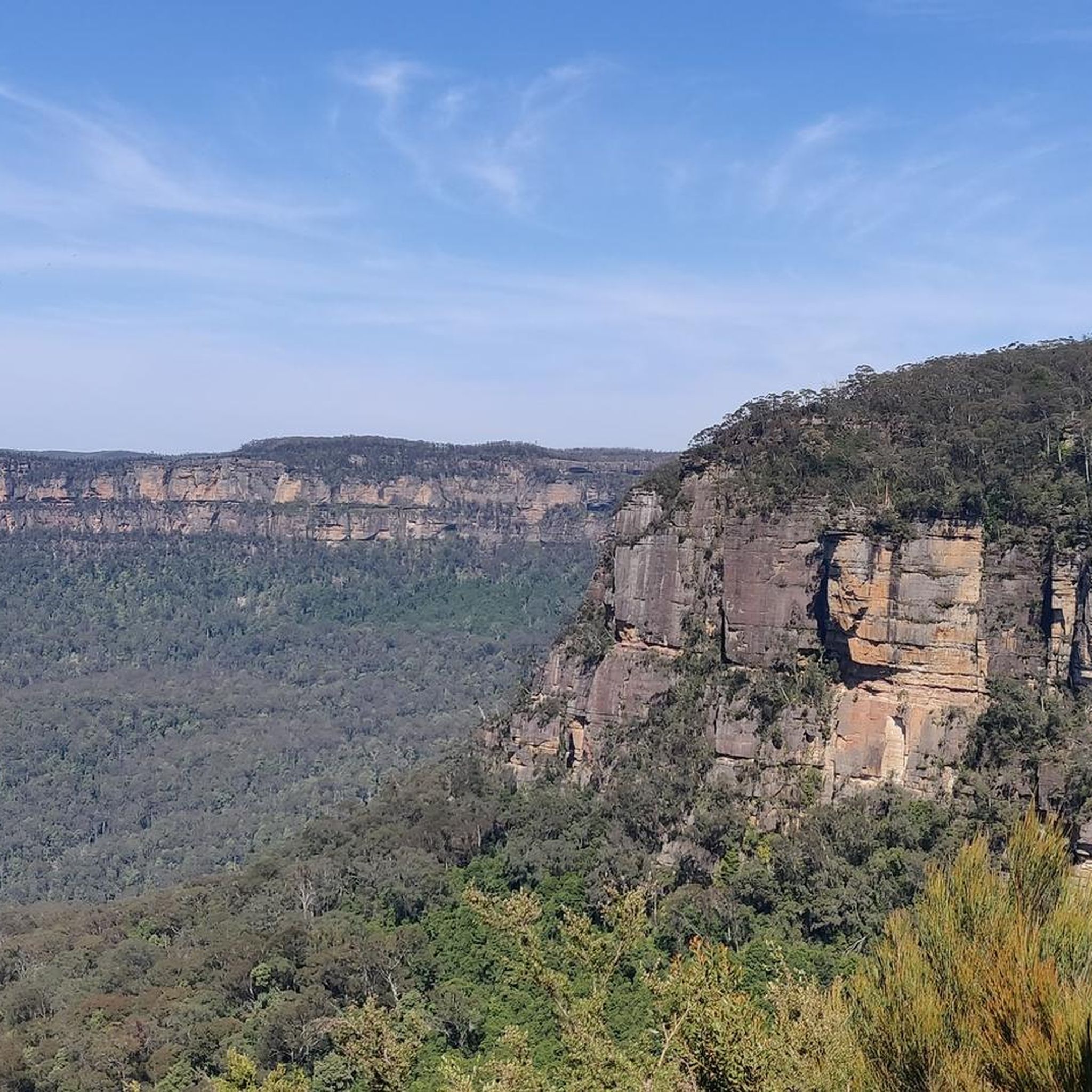
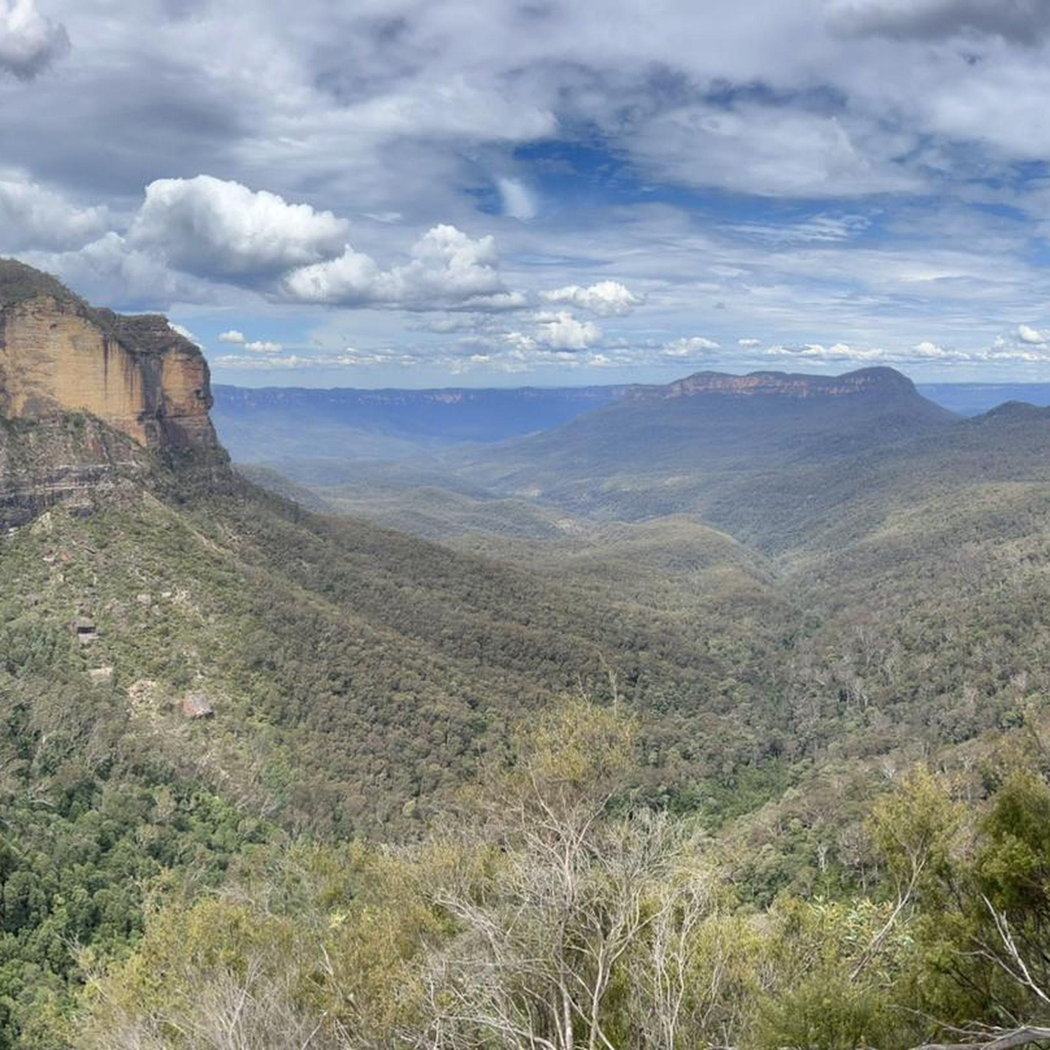
Red Wire Saddle is sometimes referred to as Red Wire Saddle Cliffs, and sticks out above the forests to reveal a nice view of the lower Blue Mountains bushland and rolling hills. The saddle sits alongside sandstone cliffs. The name comes from utility workers and fire workers who put up basic telephone and emergency communication lines, and in order to stand up to harsh elements, bushfires, and rusting, the wires were copper-coated which aged into a distinct rusty red hue.
0
0
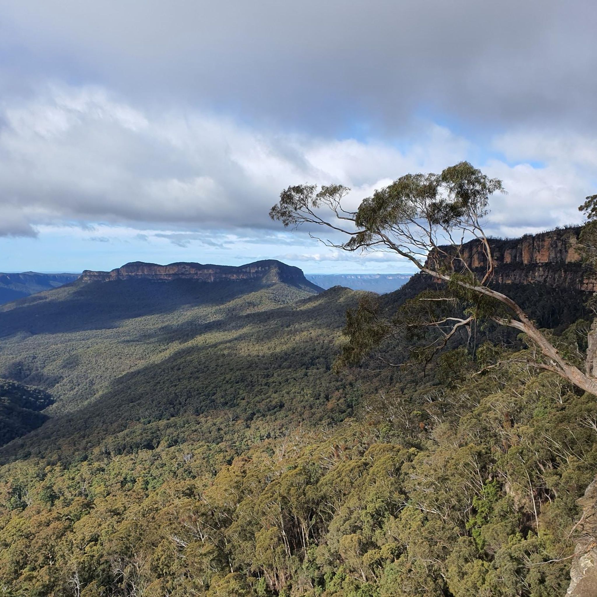
Woodford – Oaks trail is a wide fire management road that passes though eucalyptus forests and past streams, watering holes, reservoirs, campsites, picnic areas, and archaeological sites like Bora Ground. The entire trail stretches from Woodford to Glenbrook spanning almost 28 kilometres in total. The trail can be taken as an out and back or, for ambitious bushwalkers and bikers, an end-to-end adventure. The trail starts and ends very close to Woodford and Glenbrook train stations. This area can get hot in summer. During severe heatwaves, temperatures can occasionally soar past 40° C, so plan accordingly.
0
0
The Woodford – Oaks trail is an unsealed fire management road, not a public driving road. Just south of the Wheel Firefighting Reservoir spur trail, the Woodford – Oaks trail opens up to a large dirt car park for designated vehicles.
0
0
Weeping Rock is a beautiful, small waterfall where Jamison Creek spills gently over a sandstone rock overhang near Wentworth Falls. The cascade is reached by a quieter side track on the Weeping Rock circuit, and is a cool, shady spot with shallow rock pools and lush ferns under the cliff. There are metal stairs next to the falls that continue along the creek, where you might spot freshwater crayfish, often seen here.
0
0

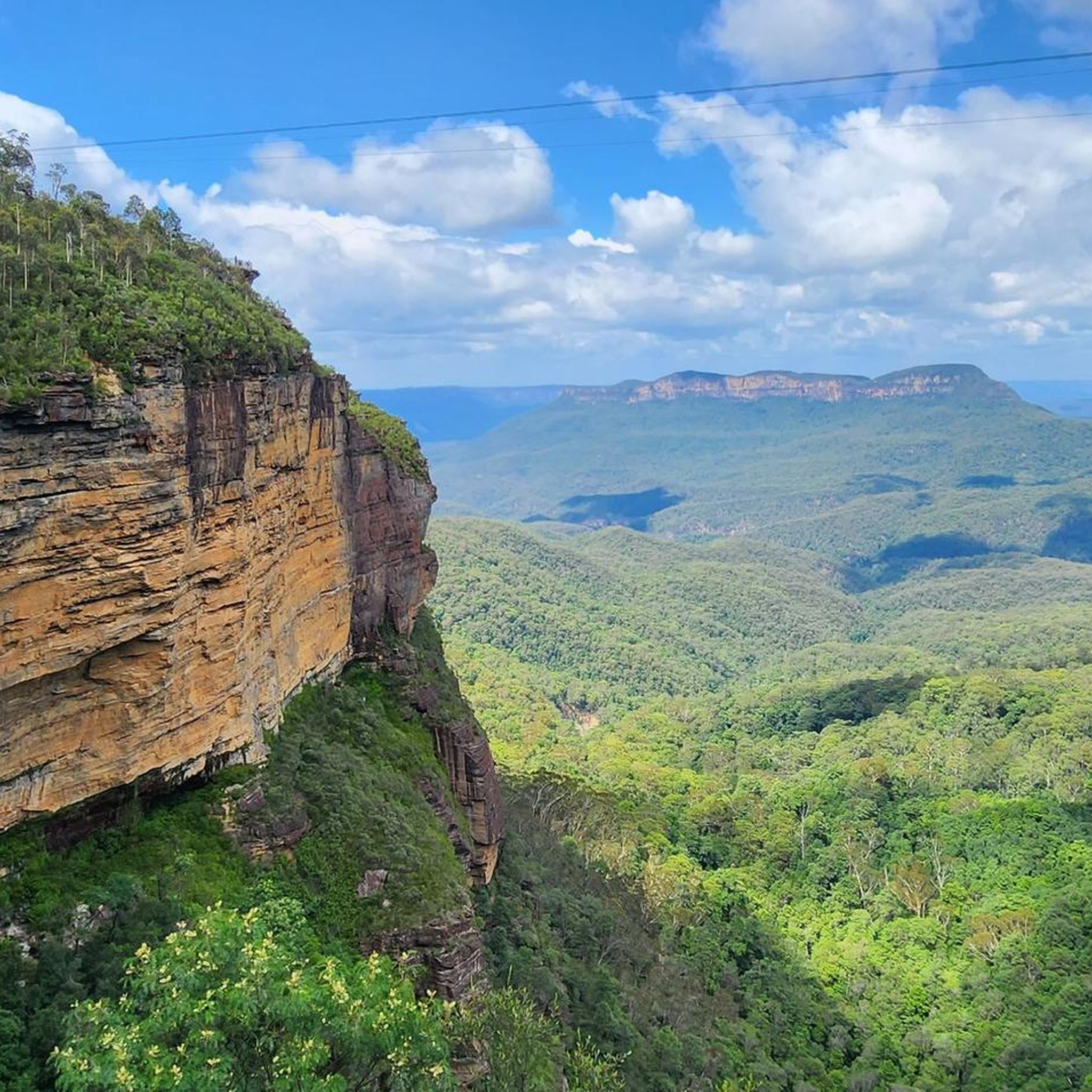
Upper Wentworth Falls is the first major section of the waterfall system, where Jamison Creek spills over broad sandstone shelves before plunging deeper into the Jamison Valley below. From the top of the falls, you get a mix of calm creek pools, exposed cliff edges, and sweeping valley views all in one spot, with the sound of rushing water carrying through the surrounding bushland after rain. The upper cascades are reached via the Wentworth Falls Track, which descends from the picnic area through a series of steep steps and lookouts.
0
0
Cataract Falls is the largest and most intricate waterfall along the circuit, cascading in several tiers down Cataract Creek. A network of trails provides access to various viewpoints, including a lower plunge pool and a mid-level platform where the water flows over beautiful orange-stained rock slabs. The multiple layers and changing perspectives make this stop particularly captivating, as the water splits and reunites as it descends.
0
0
Adelina Falls is a small waterfall on Lawson Creek, dropping about 15 metres into a sheltered, gully lined with ferns. A short side track leads down to its base, where a footbridge crosses the creek, and the exposed clay beneath the falls gives the rock a distinctive orange tint. The setting feels enclosed and shaded, with water slipping over rock ledges into a quiet pool at the bottom.
0
0
Frequently Asked Questions
How many touring cycling routes are available in Blue Mountains National Park?
There are over 45 touring cycling routes documented in Blue Mountains National Park on komoot, offering a wide range of experiences for cyclists. These routes vary in difficulty, with 7 easy, 17 moderate, and 21 difficult options.
What kind of terrain can I expect on touring cycling routes in Blue Mountains National Park?
The Blue Mountains offer a diverse and challenging environment for touring cyclists. You'll encounter both sealed and unsealed roads, with exhilarating descents and climbs through varied ecosystems. Expect everything from open eucalypt forests and heathlands to dense rainforest escarpments and rugged canyons. The region is known for its dramatic sandstone cliffs and deep gorges, providing a rewarding experience for those seeking diverse natural features.
Are there any family-friendly touring cycling routes in Blue Mountains National Park?
While many routes in the Blue Mountains can be challenging, there are options suitable for families looking for an easier ride. The park features a mix of gravel roads and fire trails that can be less demanding. For specific family-friendly options, it's best to check individual route details on komoot, filtering for 'easy' difficulty, which currently lists 7 such routes.
What are some notable landmarks or viewpoints I can visit while cycling in the Blue Mountains?
The Blue Mountains are rich with spectacular viewpoints and natural formations. You can cycle to areas offering panoramic views of the Jamison and Grose Valleys. Iconic spots include Echo Point Lookout – View of the Three Sisters, Evans Lookout, and Rocket Point lookout. Many routes incorporate these stunning vistas, providing excellent opportunities for scenic breaks.
Are there any circular touring cycling routes in Blue Mountains National Park?
Yes, several routes are designed as loops, allowing you to start and finish at the same point. An example of a challenging loop is Upper Leura Cascades loop from Glenbrook, which covers 87.4 km with significant elevation changes. These circular routes are great for comprehensive exploration without needing a shuttle.
What is the best time of year to go touring cycling in the Blue Mountains?
The Blue Mountains offer good cycling conditions for much of the year. Spring (September to November) and Autumn (March to May) are generally considered ideal, with milder temperatures and beautiful scenery, including wildflowers in spring. Summer can be hot, and winter can be cool, especially at higher elevations, but clear days still offer excellent riding. Always check the local weather forecast before heading out.
Can I access touring cycling routes in Blue Mountains National Park using public transport?
Yes, the Blue Mountains are well-serviced by public transport, particularly trains from Sydney, making it convenient to access many trailheads. Towns like Woodford, Glenbrook, and Katoomba, which are starting points for several routes, have train stations. This allows for flexible planning, including one-way rides with a train shuttle back, such as the popular approach for sections of the Oaks Fire Trail.
What do other touring cyclists enjoy most about cycling in Blue Mountains National Park?
The touring cycling routes in Blue Mountains National Park are highly rated by the komoot community, with an average score of 4.5 stars. Cyclists often praise the breathtaking scenic beauty, the diverse terrain that offers both challenge and reward, and the opportunity to explore a UNESCO World Heritage Site. The dramatic gorges, towering sandstone cliffs, and expansive eucalypt forests are frequently highlighted as key attractions.
Are there any routes that feature waterfalls or significant natural monuments?
Absolutely! The Blue Mountains are famous for their stunning waterfalls and natural monuments. You can find routes that pass near or offer views of Wentworth Falls and Katoomba Falls. The Grand Canyon Track area also offers incredible natural beauty, though it's primarily a walking trail, nearby cycling routes can provide access to its vicinity.
Where can I find parking for touring cycling routes in Blue Mountains National Park?
Parking is generally available at various access points and trailheads throughout Blue Mountains National Park. Popular starting points in towns like Woodford, Glenbrook, and near major lookouts often have designated parking areas. It's advisable to check specific route details or local park information for the most convenient parking options for your chosen starting point.
Are there any challenging touring cycling routes for experienced riders?
Yes, the Blue Mountains offer numerous challenging routes for experienced touring cyclists, characterized by significant elevation gain and varied terrain. For example, the The Oaks Trail Water Crossing – Lapstone Hill Tunnel loop from Lapstone is a difficult 35.8 km route with over 500 meters of ascent. Many of the park's 21 difficult routes will provide a rewarding test of endurance and skill.
What kind of views can I expect on the Narrow Neck Trail?
The Narrow Neck Peninsula offers incredible views across the Jamison Valley and Megalong Valley, extending to the Wild Dog Mountains and Kanangra Wilderness. A route like the View of Narrow Neck Trail – Tarros Ladder Lookout loop from Cliff Drive–Moss Street Reserve provides access to these panoramic vistas, making it a popular choice for cyclists seeking spectacular scenery.
Most popular routes in Blue Mountains National Park
Most popular attractions in Blue Mountains National Park

Get inspired with the komoot mobile app


Explore more
Browse the best Cycling routes in other regions.
